Ten Mile Stations of the D&RG
1234567


1234567
Re: Ten Mile Stations of the D&RG
|
Some proposed changes at Cunningham Spur, 1898.
Scanned in two sections. Jimmy 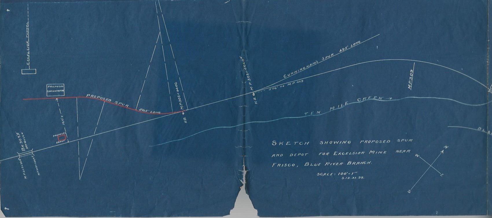 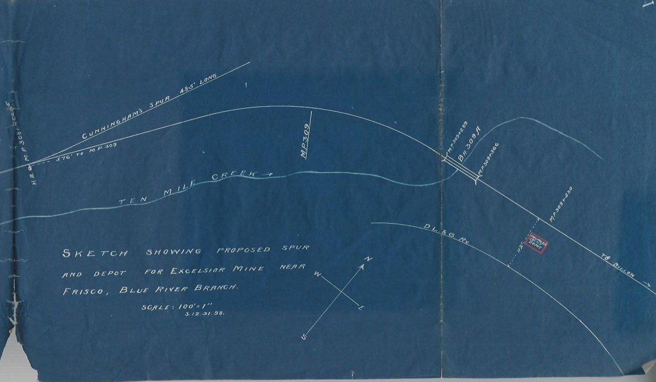
|
Re: Ten Mile Stations of the D&RG
|
The red rectangle in the second map photo says ''joint depot''.
|
Re: Ten Mile Stations of the D&RG
|
Actually it says "Proposed Joint Depot", likely never built; but it would have made a lot of sense. And another "Proposed Depot" at the Excelsior Spur.
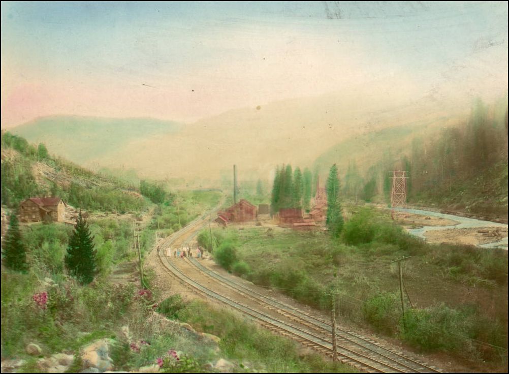
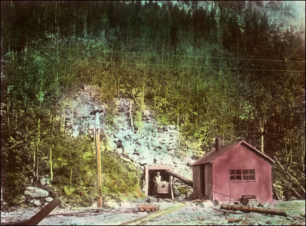
Look how close the "D&LG" mainline is to the D&RG main as the two railroads curve into the mouth of Tenmile Canon -- 112 feet between the mains. Now I know where that photo of the Excelsior Concentrator, that I posted above, fits into the Tenmile scheme of things! Keep the maps coming, Jimmy! Jim
Jim Courtney
Poulsbo, WA |
Re: Ten Mile Stations of the D&RG
|
In reply to this post by Jimmy Blouch
Officers Spur 1907
Bridge 303A does not show a crossing title Bridge 303B appears to cross Officers Creek Jimmy 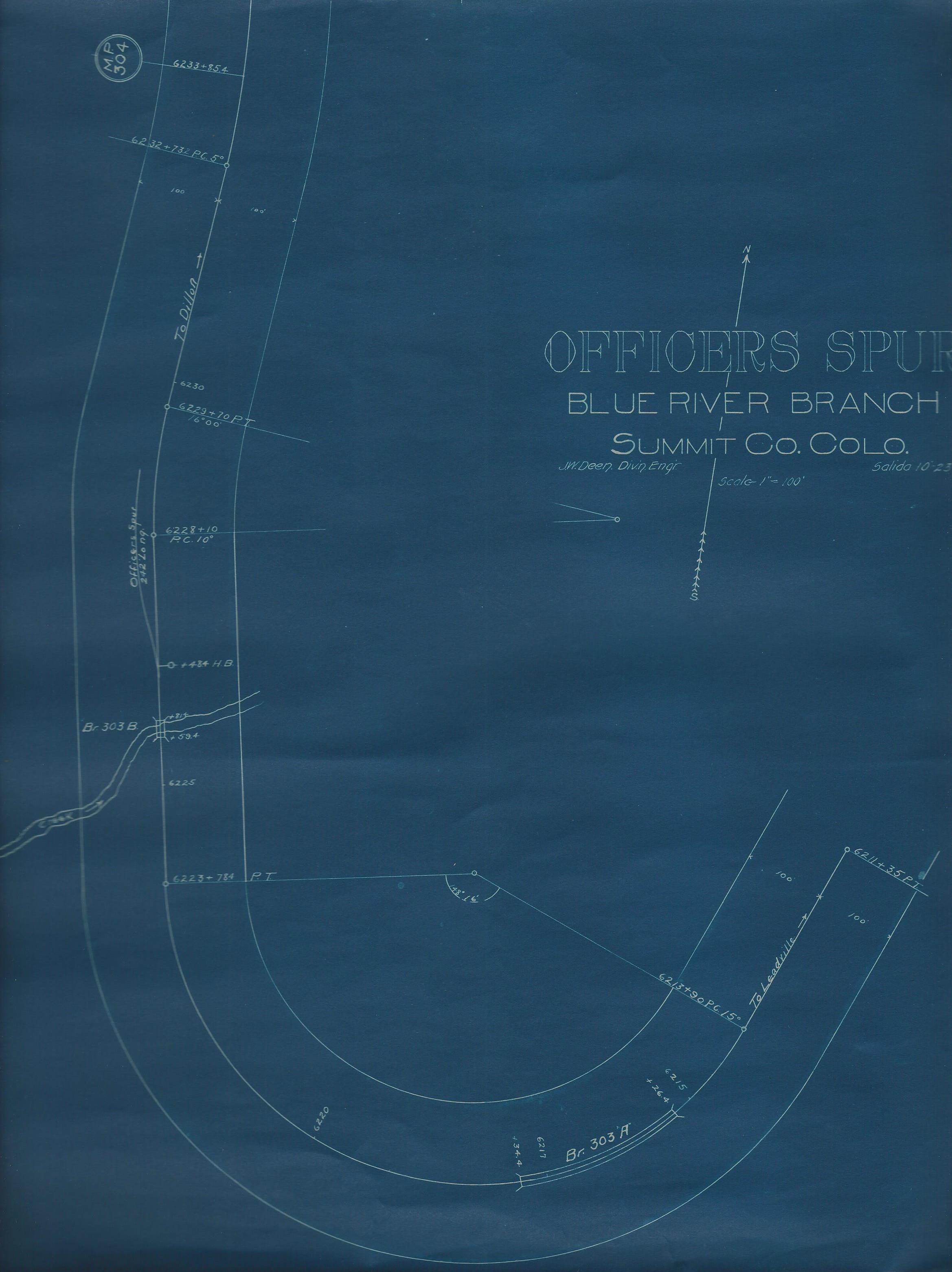 |
Re: Ten Mile Stations of the D&RG
|
This post was updated on .
In reply to this post by Jimmy Blouch
Map for Wheeler 1900
Direction to Dillon to the left. No water tank between Wheeler to, and including, Dillon. D&RG timetable for 1890 shows mixed train 263 departing Wheeler at 11:15AM for Dillon and train 264 returning from Dillon at 1:55 PM It was11.2 miles from Wheeler to Dillon. Jimmy 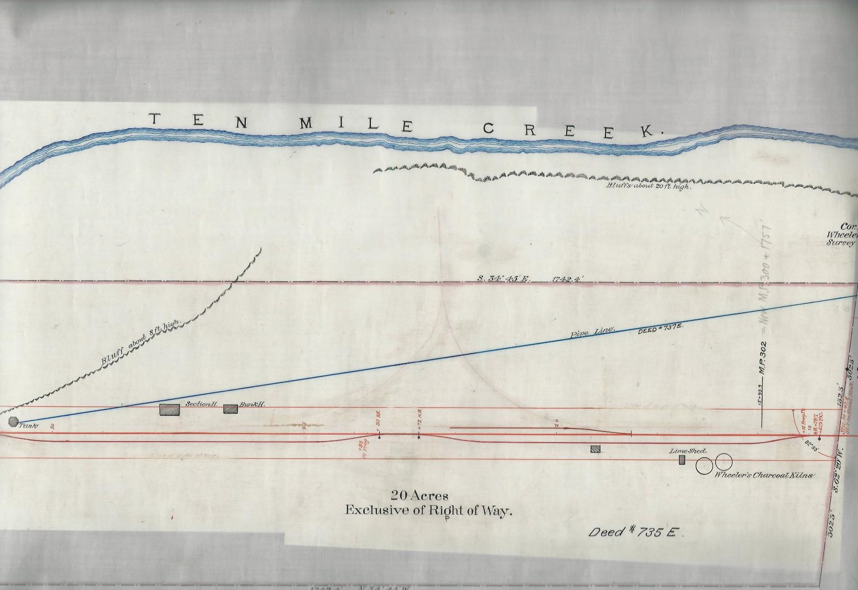
|
Re: Ten Mile Stations of the D&RG -- Wheeler
|
This post was updated on .
Fantastic, Jimmy.
I have always wondered what the D&RG station at Wheeler looked like. What's that faint ghost of a wye about? Was there a wye at one time at Wheeler?? The only photo that I have ever seen of a D&RG train at Wheeler is this Wm H. Jackson view from the Denver Public Library: 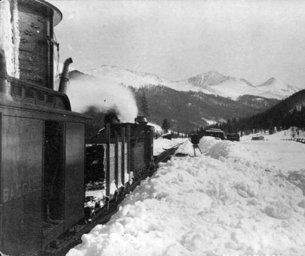 (I couldn't find a digitalized version on DPL, had to scan this from CRA 12, page 56.) The engine is stopped, south bound to Leadville, to take water at Wheeler tank. The first siding with a boxcar spotted next to piles of cut lumber is to the right. I can't make out the section house or bunk house, perhaps this is a very early photo, before they were constructed. On the east side of Tenmile Creek, the South Park had a siding and water tank as well, initially named Wheeler, later renamed Solitude: 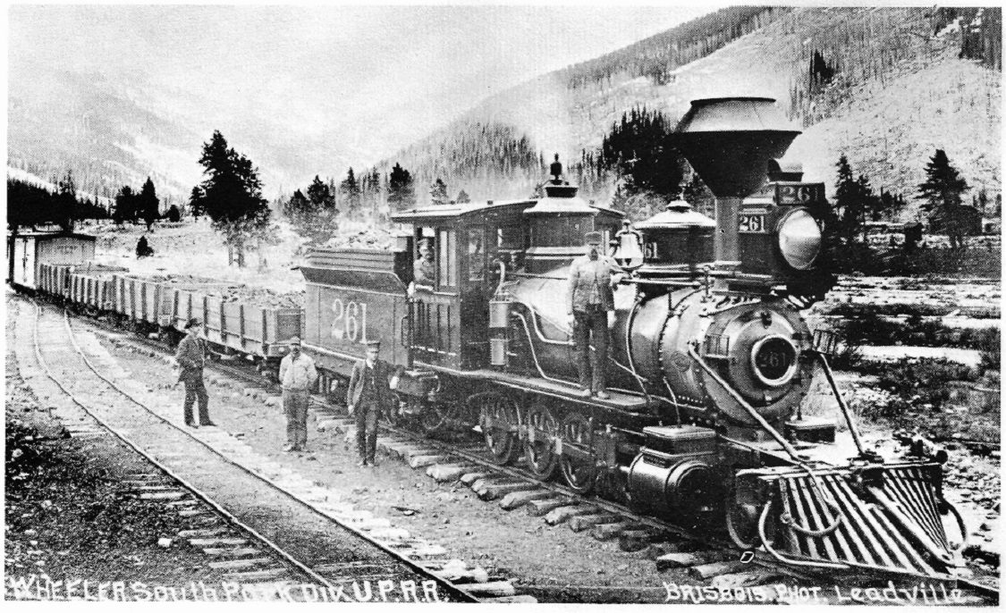 Brisbois Studio photo, Leadville; Rex G. Beistle Collection. The photo has to be late 1880s, as Rhode Island engine 261 is still lettered for the Utah and Northern. To the right frame apears to be the D&RG bunk house (with privy) as located on Jimmy's map. Any maps of other locations between Frisco and Wheeler, Jimmy? Curtain, Uneva Lake Spur? Jim
Jim Courtney
Poulsbo, WA |
Re: Ten Mile Stations of the D&RG -- Wheeler
|
DPL's view isn't much better Jim. There are a number of copies around in various locations that appear to be of a better print. WHJ-537 http://digital.denverlibrary.org/cdm/fullbrowser/collection/p15330coll22/id/37652/rv/singleitem/rec/13 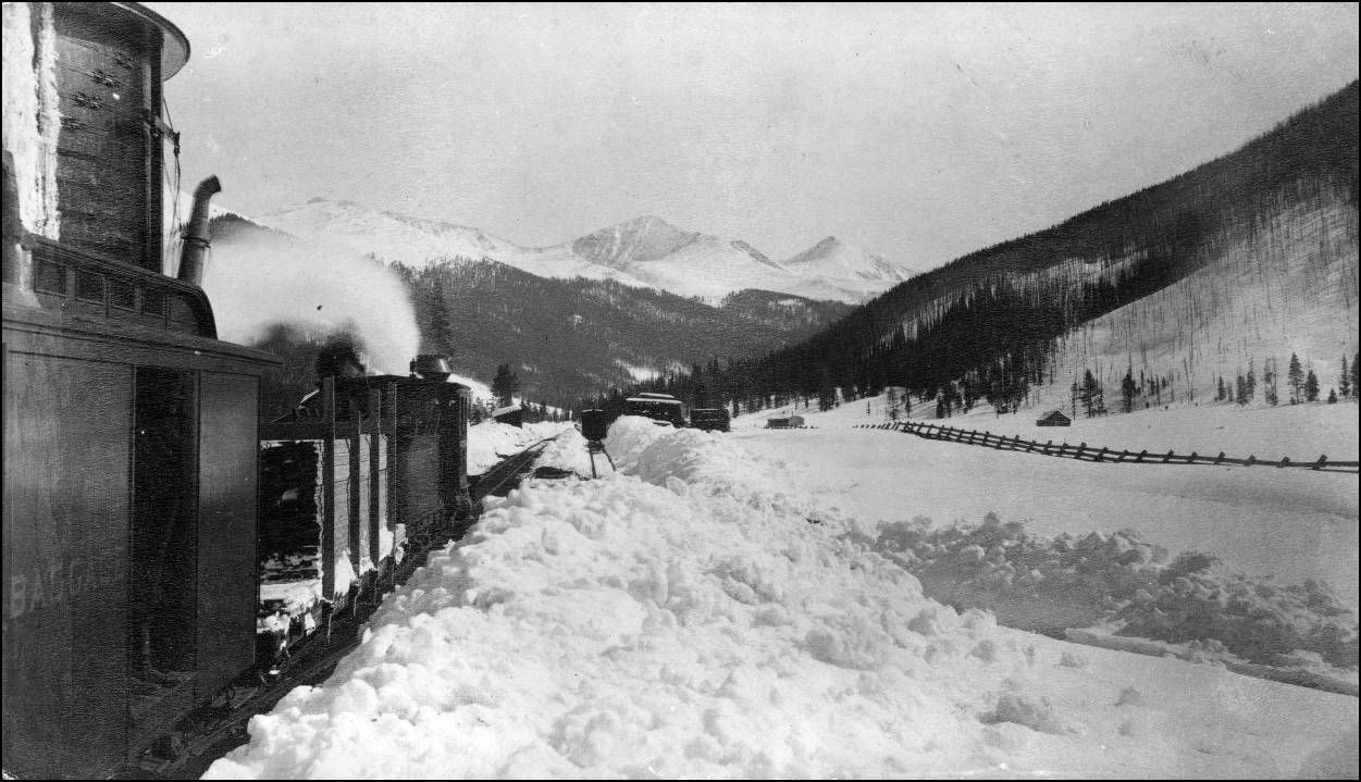 The C&S at Solitude. Z-5661 http://digital.denverlibrary.org/cdm/fullbrowser/collection/p15330coll22/id/72283/rv/singleitem/rec/1 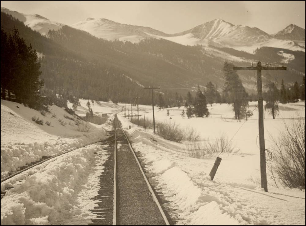 CHS.J921 http://digital.denverlibrary.org/cdm/fullbrowser/collection/p15330coll21/id/7137/rv/singleitem/rec/3 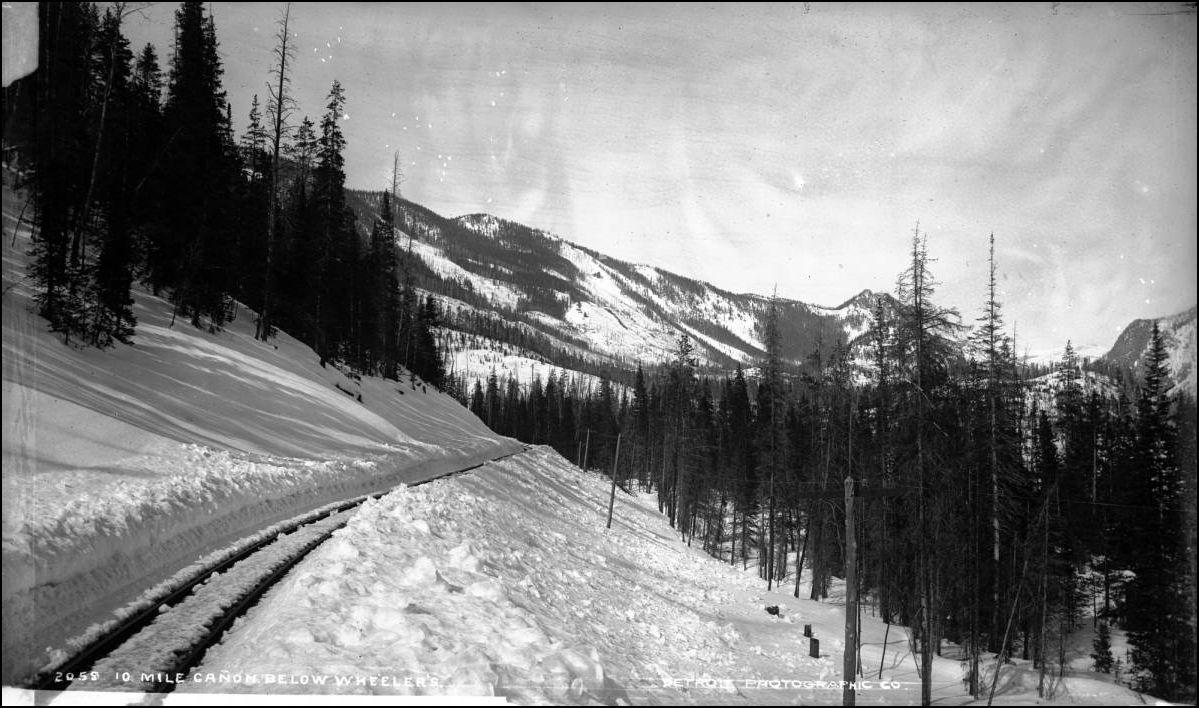
UpSideDownC
in New Zealand |
Re: Ten Mile Stations of the D&RG -- Curtin
Re: Ten Mile Stations of the D&RG -- Curtin
|
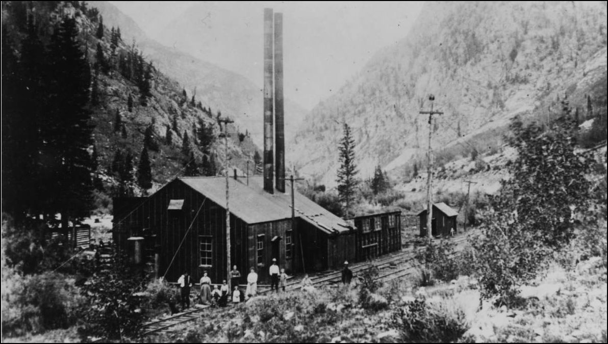
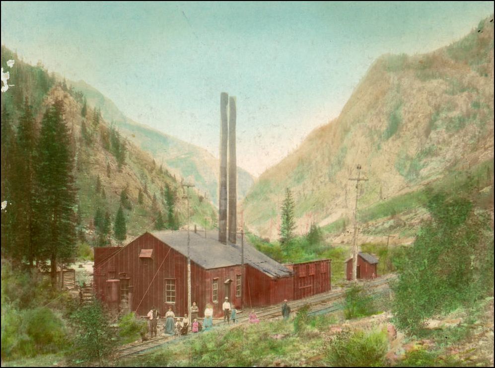
FWIW, I believe that plant in Curtin that is often described as a power plant is in fact a compressed air plant, not a power plant.
Cheers, Jeff. |
Re: Ten Mile Stations of the D&RG -- Curtin
|
Mary Gilliland did say that in her comprehensive book "Summit" on pg139, but that is at odds with the plethora of Power poles and wires both at the Plant and the Drift ventilation shed in the two photos above. Perhaps unknown to the author or source, maybe there was both Compressor and Dynamo housed in that building? However, Gilliland is the only written source I've seen on this particular location, have you seen another?
UpSideDownC
in New Zealand |
Re: Ten Mile Stations of the D&RG -- Curtin
|
Hi Chris,
Gilliland was also my source. I did a quick newspaper search though, and while not conclusive, I did come up with this: 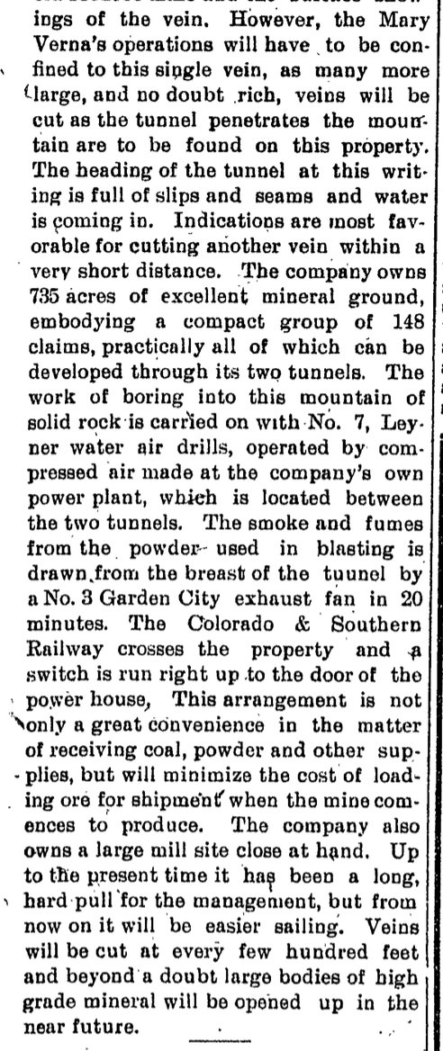 Summit County Journal, Sept 18, 1910 Assuming this is the same plant, I think you could say this supports either the "compressed air" theory or the "compressed air plus electricity" theory, but I'd lean a bit towards air + electricity given the mention of the exhaust fans. Any thoughts? Cheers, Jeff. |
Re: Ten Mile Stations of the D&RG -- Curtin
|
What is known of commercial power production in the area at
that time ? .... was there any ? The lattice steel tower in one photo and the tall poles scream "power", but tell us nothing from which direction it is traveling. Given the time period and remote location, I suspect it is a private generating station and power is outbound to the mine workings. But that is based on almost no knowledge of the power utility supply system of that area at that time.
"Duty above all else except Honor"
|
Re: Ten Mile Stations of the D&RG -- Curtin
|
We “know” from the other thread (see Chris’ link) that the high-tension towers in those views just happen to be passing Curtin on their way from the Georgetown hydro plant, over Argentine Pass, and through Ten Mile Canon to Leadville.
That’s not to say that Curtin didn’t generate electricity… just that it didn’t use that transmission line. Cheers, Jeff.
|
Re: Ten Mile Stations of the D&RG -- Lower Tenmile Canon to Curtin
|
This post was updated on .
In reply to this post by South Park
Chris,
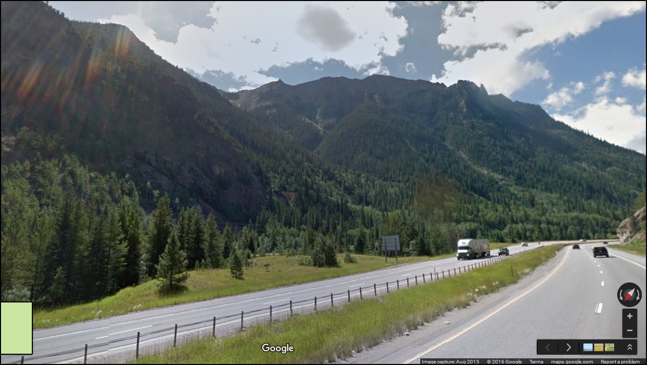
I agree, before the train departs Wheeler for Recen/Kokomo, we should complete our study of the lower Tenmile Canon. For an overview of lower Tenmile Canon, let's consult the 1905 edition of Google Maps:  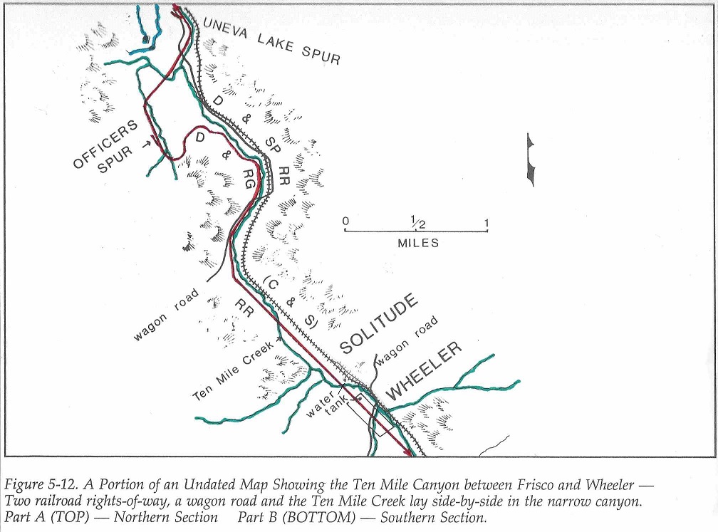 In Roadside Summit, The Human Landscape, Sandra Pritchard prepared this map from an undated topographical map that showed both railroads. Chris posted the first map above. Since things were crowded in the lower canon (creek, wagon road and two railroads), I have colored in the creek and, using the D&RG convention on Jimmy's maps, colored the D&RG as red. I also added some features on the east (C&S) side of the canon per location descriptions in Mary Ellen Gilliland's Summit. (Looks like we all read the same books  ). ).
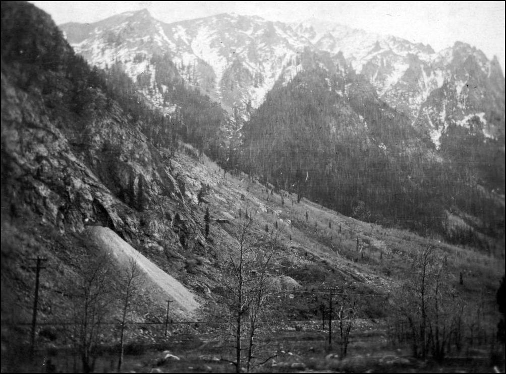
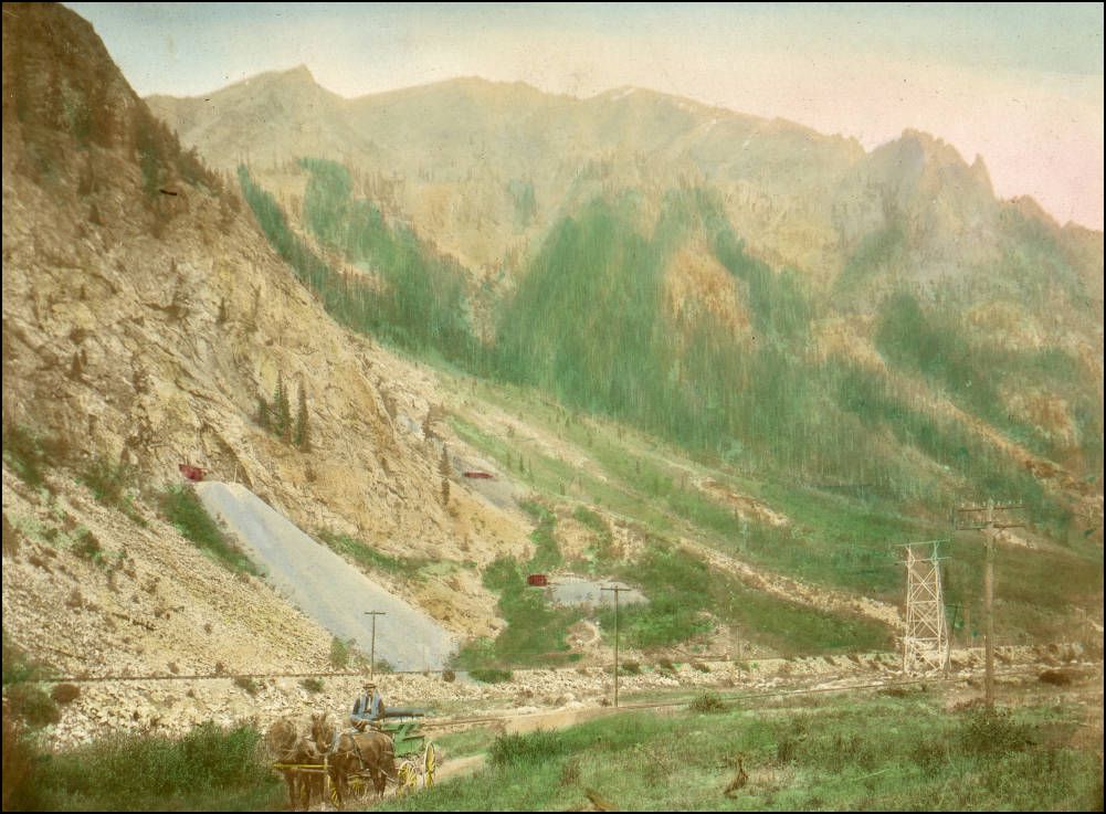
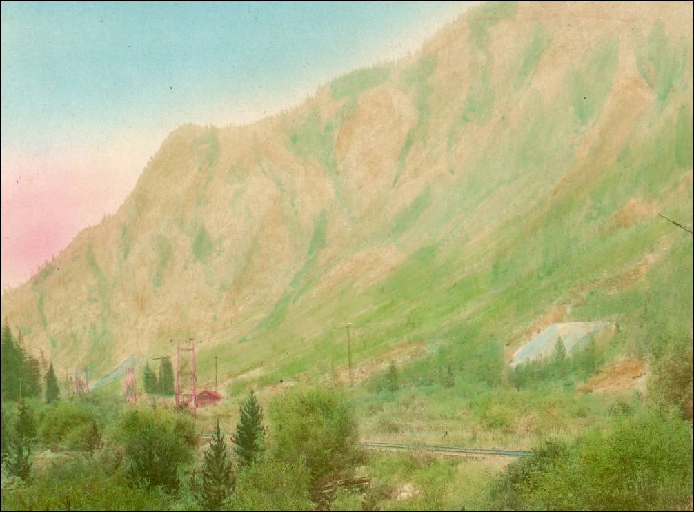
Just inside the canon, on the east side was the King Solomon Tunnel and its boiler house; the C&S had a coal spur to supply the power house: 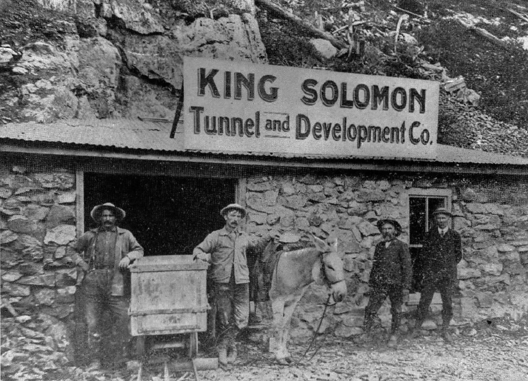 http://digital.denverlibrary.org/cdm/fullbrowser/collection/p15330coll22/id/15100/rv/singleitem/rec/1 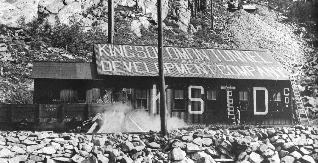 In Grandt's Narrow Gauge Pictorial VIII. The tunnel itself is at the upper right corner. There are not many views of the Leadville-Dillon area showing both lines of the DSP&P and the D&RG in the same frame. The D&RG, the first railroad in the canon, crossed and recrossed Tenmile Creek below Curtain, and ran on the east side of the creek for about half a mile, crowding the C&S against the canon wall to a higher elevation: 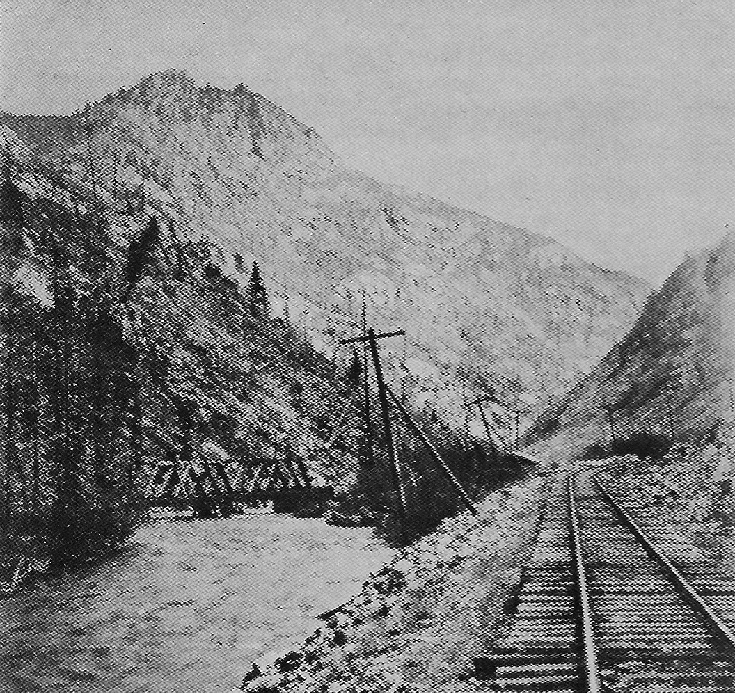 From Digerness, The Mineral Belt, Volume II 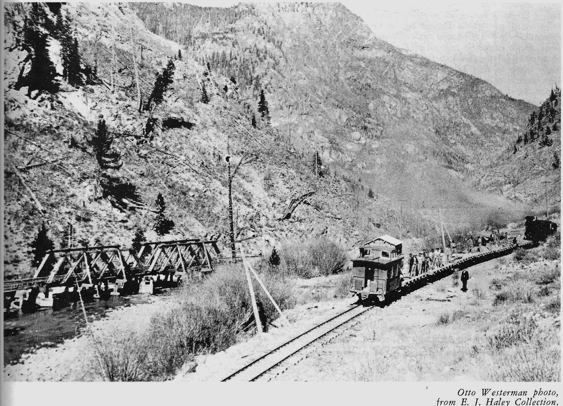 In Mac Poor's DSP&P Memorial Edition The D&RG seemed to like wooden Howe truss bridges of light construction; the bridge looks similar to the D&RG two-span bridge at Dillon. Other views of Curtain siding, in black and white . . . 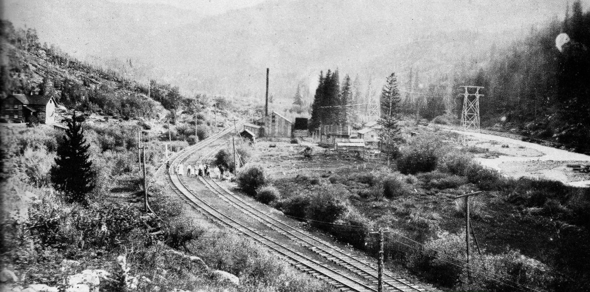 . . . and the C&S log section house: 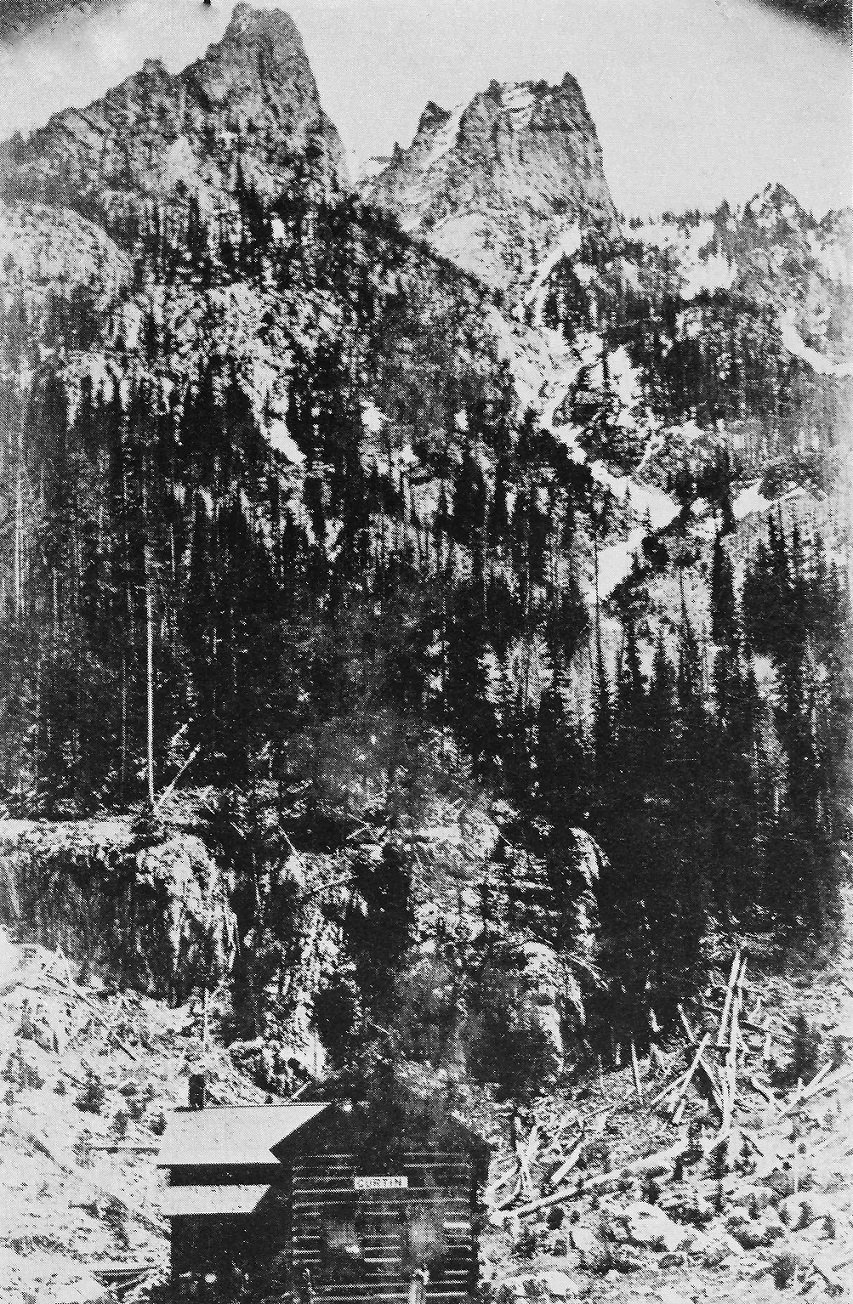 Both photos in Digerness, The Mineral Belt, Volume II The lower map, above, better illustrates the large loop of D&RG track near Officer's spur, and better explains Jimmy's map of that station in relationship to the D&RG line in lower Tenmile Canon. The lower map also shows Uneva Lake Spur. I haven't found a location of that name on C&S timetables, nor in Mac Poor's station list. Perhaps it was a D&RG spur. Uneva Lake was a resort area, with at least one hotel. Jim
Jim Courtney
Poulsbo, WA |
Re: Ten Mile Stations of the D&RG -- Curtin
|
Chapter 4 of DSP&P Pictorial has several pictures taken around Curtin and Solitude of the Rotary and snow shovelers clearing the "Uneva Lake Slide".They are on pp129 thru 135 in the original and most are credited to Andy Anderson.
|
Re: Ten Mile Stations of the D&RG -- C&S Damaged Rotary
|
This post was updated on .
As an aside, Robert, this photo has always puzzled me:
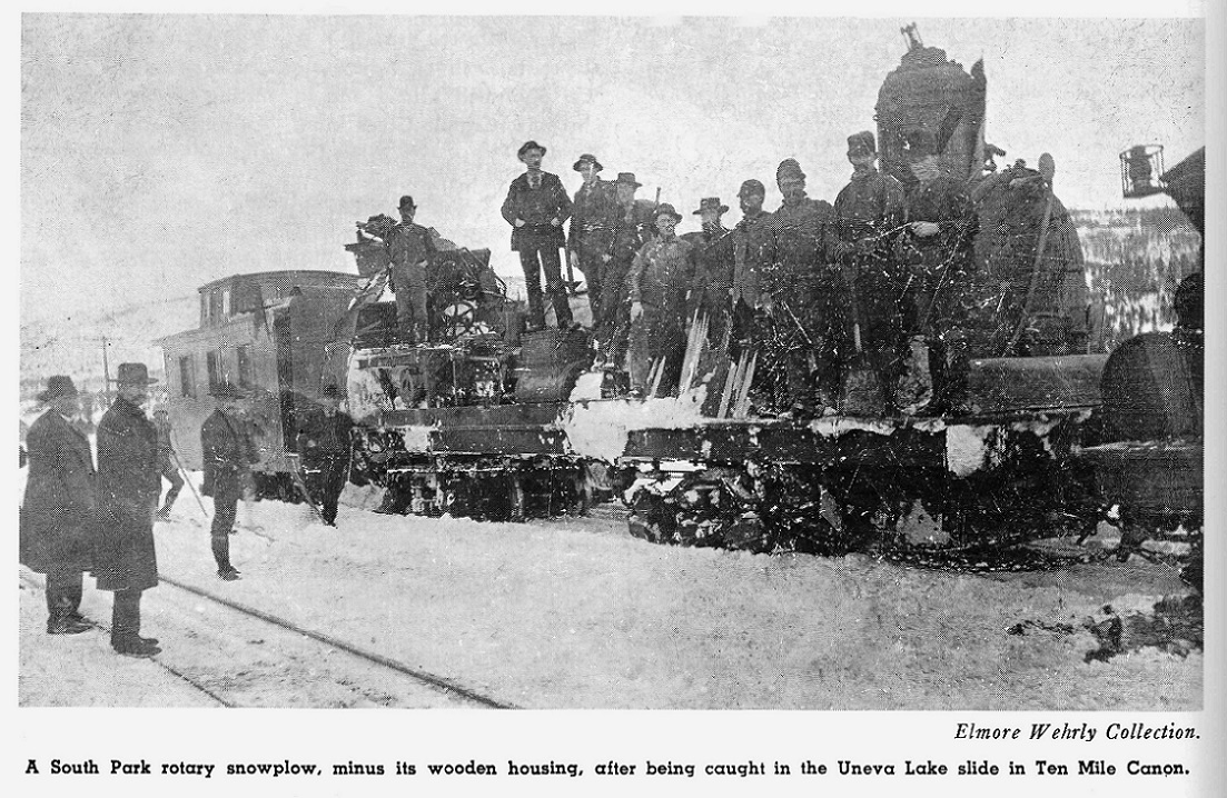 The photo is in Mac Poor's DSP&P Memorial Edition. It is not clear that the damaged rotary is at the Uneva Lake siding, it could be back down at Dickey. The caboose at the left sure looks to me like an original D&RG three-window, four wheel caboose. The scant view of the rear of the locomotive tender is obviously a DL&G or C&S locomotive, what with the "basket" marker light holder. It has always made me wonder whether the C&S and D&RG collaborated in winter to keep their two lines open. Does anyone know if the D&RG sometimes used the C&S rotary or vice-versa? The D&RG certainly used its own rotaries on the Blue River branch: 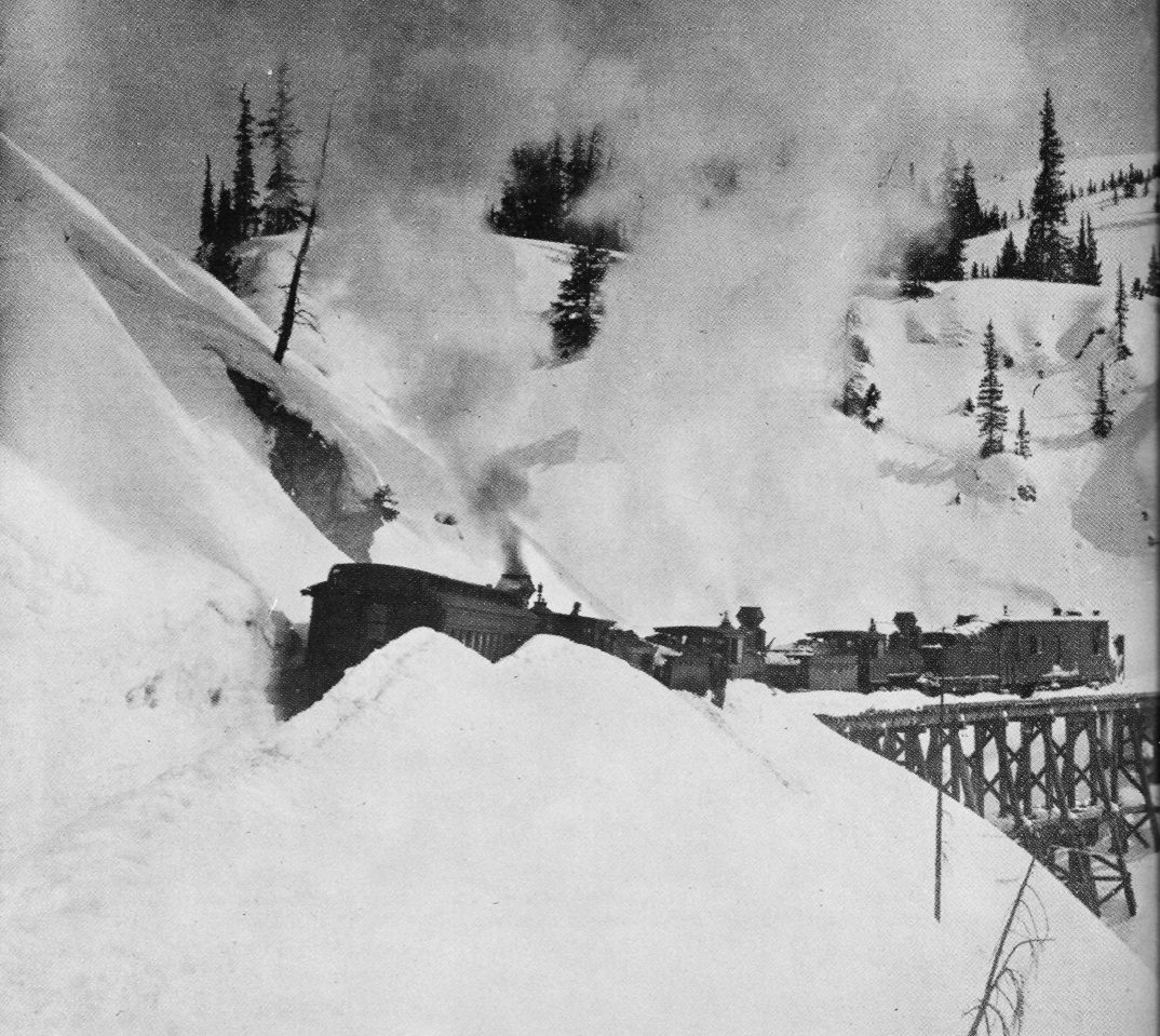 In Digerness, The Mineral Belt, Volume II. A northbound D&RG rotary train climbs the east side of Fremont Pass, below Climax, c1905. Jim
Jim Courtney
Poulsbo, WA |
Re: Ten Mile Stations of the D&RG -- C&S trains at Wheeler / Solitude
|
This post was updated on .
In reply to this post by Chris Walker
These are the only two photos that I know of that actually include C&S trains at Solitude:
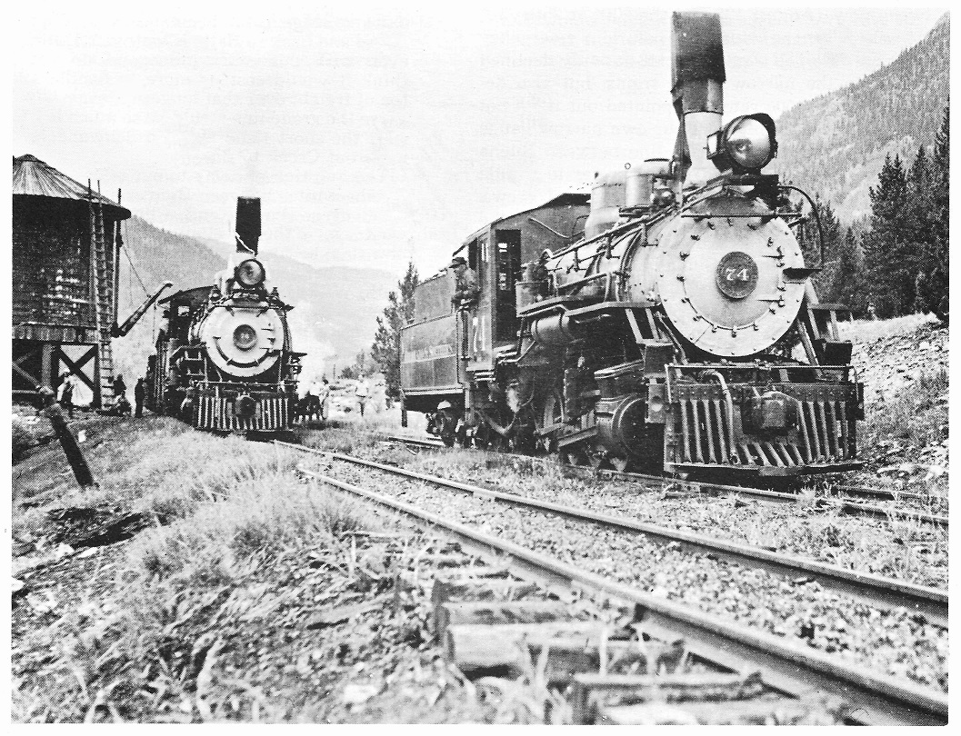 Otto Perschbacker photo, Lad Arend collection, in Colorado Rail Annual 12. This July 1937 photo shows a Leadville bound train with helper, stopping for water at Solitude tank. This was the last C&S freight train operated east of Climax. Then there is this wonderful photo: 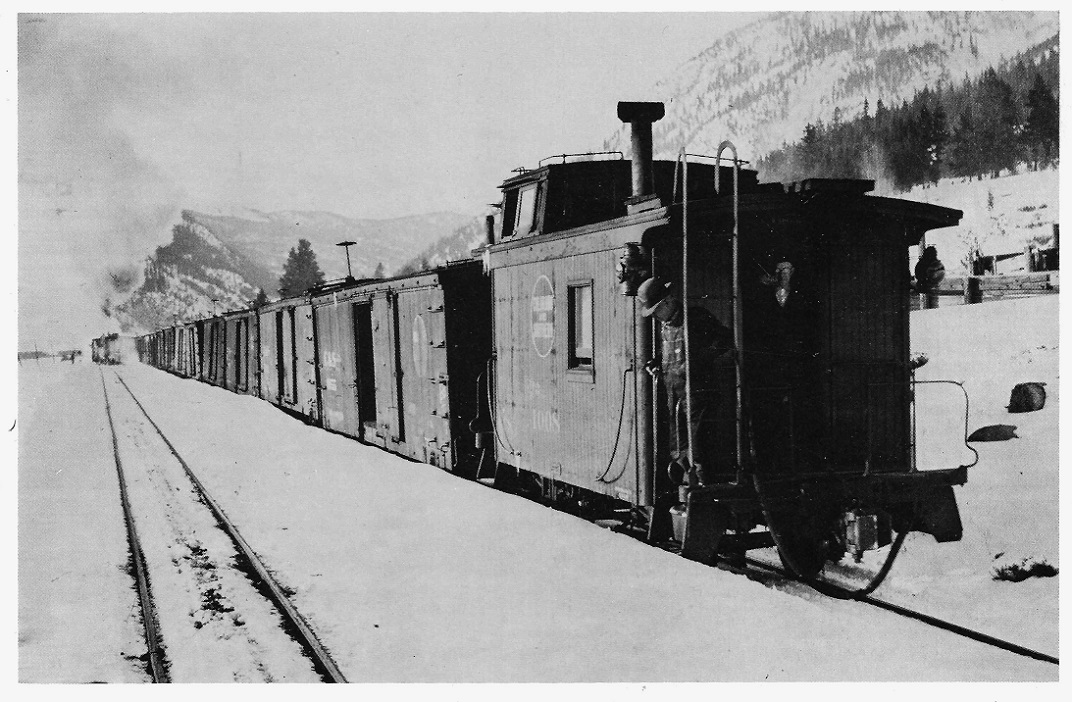 William Gibson photo, in Digerness, The Mineral Belt Volume II. An east bound freight slowly pulls out of Solitude siding after a meet, in March of 1937. The boxcars in the departing freight seem to be "a rock-in an a-rolling" on the rough track of the siding. I would suspect that Mr. Gibson is standing on the rear platform of the west bound passenger train, now stopped for water at Solitude Tank, behind the left shoulder of the photographer.
Jim Courtney
Poulsbo, WA |
Re: Ten Mile Stations of the D&RG -- C&S Damaged Rotary
|
In reply to this post by Jim Courtney
Other than the Como Roundhouse fire,did 99200 ever lose its housing?Which might be answered by a story that was circulated recently in the DSP&PHS about a Rotary wreck in which one of the crew(which was a relative of the person who told the story)was killed.Could this photo be of that wreck?
|
Re: Ten Mile Stations of the D&RG -- Wheeler
|
In reply to this post by Jim Courtney
Fantastic, Jimmy.
"I have always wondered what the D&RG station at Wheeler looked like. What's that faint ghost of a wye about? Was there a wye at one time at Wheeler??" Yes, a wye was located at Wheeler. It was in place June 1890, however by the end of 1890 it was no longer in service. "Any maps of other locations between Frisco and Wheeler, Jimmy? Curtain, Uneva Lake Spur?" I do not have individual maps for Curtain or Uneva Lake Spur. I do have a map of the entire line from Leadville to Dillon showing both D&RG and C&S, side by side. I'll start at Dillon and work down to Wheeler. Jimmy |
Re: Ten Mile Stations of the D&RG -- Curtin Powerlines.
|
This post was updated on .
In reply to this post by South Park
SP,
you have previously championed us to provide you with more reading material....  here's some homework in answer to your question. here's some homework in answer to your question.
EDIT:updated links http://c-sng-discussion-forum.254.s1.nabble.com/Rural-electrification-tp4229.html http://c-sng-discussion-forum.254.s1.nabble.com/Pipes-on-Flats-tp2980p3005.html
UpSideDownC
in New Zealand |
«
Return to C&Sng Discussion Forum
|
1 view|%1 views
| Free forum by Nabble | Edit this page |


