Maude Munroe Mine
|
I think I asked this before if I did excuse the mind or mine!!
Where did the Maude ship its Ore to what Mill for processing? Hope you all are having a great day!  Jerry Jerry "And in the end, it’s not the years in your life that count. It's the life in your years." A. Lincoln |
|
This post was updated on .
Hi Jerry,
Actually that is the Donna Juanita mine. Here is a brief overview, the wider picture was presented in http://c-sng-discussion-forum.41377.n7.nabble.com/Stanley-Mills-Part-Two-Salisbury-Mill-and-Donna-Juanita-Mine-td3483.html The Maude Monroe Adit 8 was a level drift (tunnel) opposite the Donna J. 17 Donna Juanita Shaft 18 Donna Juanita Adit 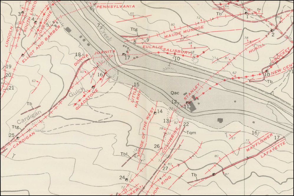 from the USGS 1917 The Donna Juanita in C&S later years. I doubt very much that this Headframe was anymore than a developing shaft not production as evidenced by the later more substantial "Orange" Headframe. If any paying ore was produced it was most likely shipped by Truck, the orebin appears not being large enough to fill one carload and given at this time the Headframe was adjacent the C&S Mainline. Note there was no US6&40 Highway there at the time of the C&S either. 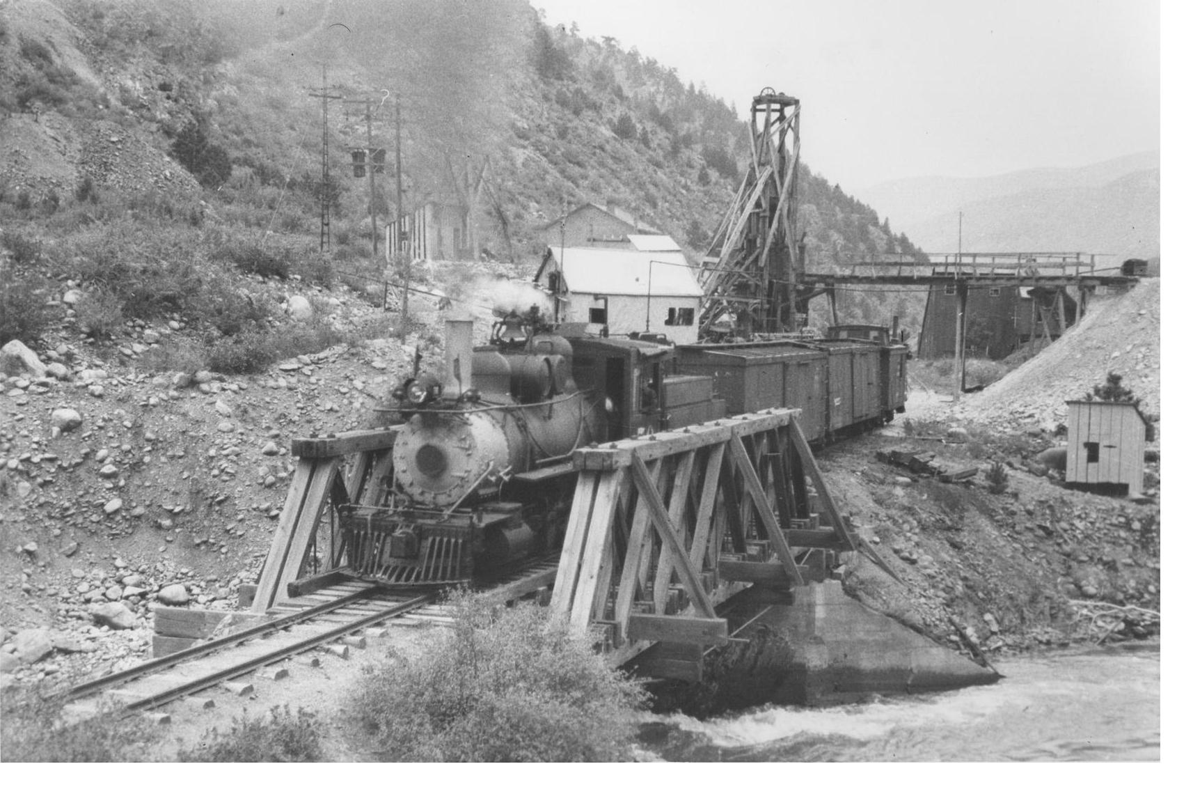 Courtesy of the Collection of Mallory Hope Ferrell: Richard B. Jackson photo. The Donna J. post C&S abandonment. 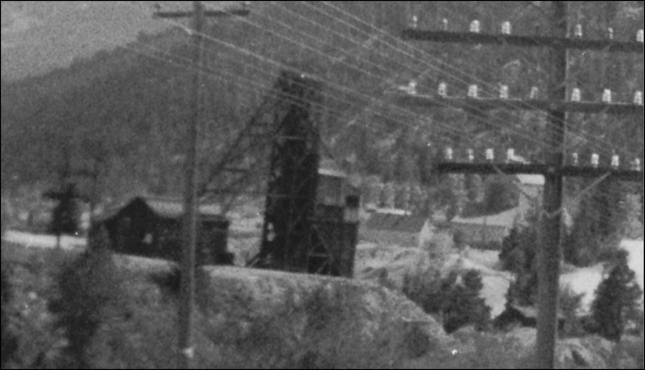 http://cdm16079.contentdm.oclc.org/cdm/fullbrowser/collection/p15330coll22/id/6198/rv/singleitem/rec/4 Harry Brunk in the Jan/Feb 1994 Gazette changed from calling it the Hukill instead to the Maude Monroe but in the May/June 1995 Gazette, Harry came to the (correct)conclusion that the Orange Headframe was of later years and that Headframe was also from after the C&S abandonment. Harry never wrote about discovering the true name of this mine Headframe in the NG&SL Gazette series. There never really was a Hukill mine per se in the years of the Colorado&Southern. EDIT: Clarification. The Hukill name was given to the Donna Juanita "Orange" Headframe in print by David S. Digerness in Mineral Belt Vol-3, 1982, perpetuated in Model form by Harry Brunk in the NG&SL July/Aug 1985 Gazette and later changed to the Maude Monroe. The actual Hukill Shaft on the Hukill Vein was opposite the current Stanley Consolidated buildings that still stand today but higher above the C.C./C&S line, Salisbury Mine and Crockett Mine workings on the Northside of Clear Creek. Smelting Ore from the Hukill was sent to Blackhawk in 1875, most likely via the C.C. from the Floyd Hill terminus. The Hukill was incorporated into the Stanley Consolidated in 1878 and most likely worked via the Old Stanley Shaft (Plutus Headframe on Sanborn Maps). How Digerness came to identify the Donna J. as the Hukill I can't say but the proximity to Hukill Gulch may have had a bearing on this. I've haven't yet seen where the Donna J. trucked their ore to but at this late date in Idaho Springs options were limited to 4 locations. 1) the nearby Alma-Lincoln Mill, 2) the "New " Smith Mill opposite Moscript&Hassell Lumber Yard 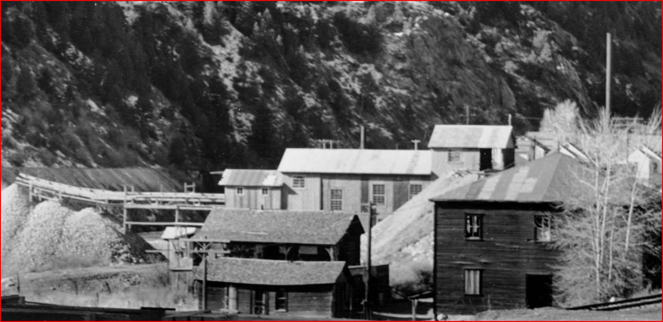 http://cdm16079.contentdm.oclc.org/cdm/fullbrowser/collection/p15330coll22/id/38790/rv/singleitem/rec/3 3) the rebuilt Kilton Mill on Miner/12th Ave. 4) the Argo Mill perhaps but I've never seen Road transport unloading facilities there. I guess this info doesn't really help with your Model railroad traffic routing plans. 
UpSideDownC
in New Zealand |
|
Chris so there never was a MM Mine it really was the Donna Juanita mine.
Even the color photo is really the Donna Juanita? So all the kits that have come out are really not the MM Mine. And the plans I have aren't really of the MM Mine either. So my next question is if you look at the mine I'm building didn't they have tailings? Or did they just dump the ore in to cars and ship it to a mill? And so I'm looking for a mill it would have shipped to without having to make a fake stamp mill. Any help will be appreciated. Regards, Jerry Jerry "And in the end, it’s not the years in your life that count. It's the life in your years." A. Lincoln |
|
This post was updated on .
This is a complex subject and not all the Mines were worked at the same time as others and often were re-opened after an idle period or as in the case of the Donna J. a completely new identity sprang up in a very over-worked area. See the USGS map in my previous reply. This info is the result of my interpretation of various sources available and if anyone has any other or contrary information please feel free to include it here.
>>so there never was a MM Mine it really was the Donna Juanita mine. Well Gerry, technically yes there was but not the "Orange" Headframe made famous by the talented Harry Brunk. The Maude Monroe was in existance before the Donna J. In this picture the later incarnation of the Maude Monroe went across the new 6&40 Hwy. The Salisbury Mill is gone, the waste dump visible behind the Power Transformers, the exploratory small Headframe Donna Juanita on the right, and its waste dump is visible lower right behind trees. I have some doubt that the C&S is still running at this date as the new Hwy took the C&S Grade out of Idaho Springs to this location. 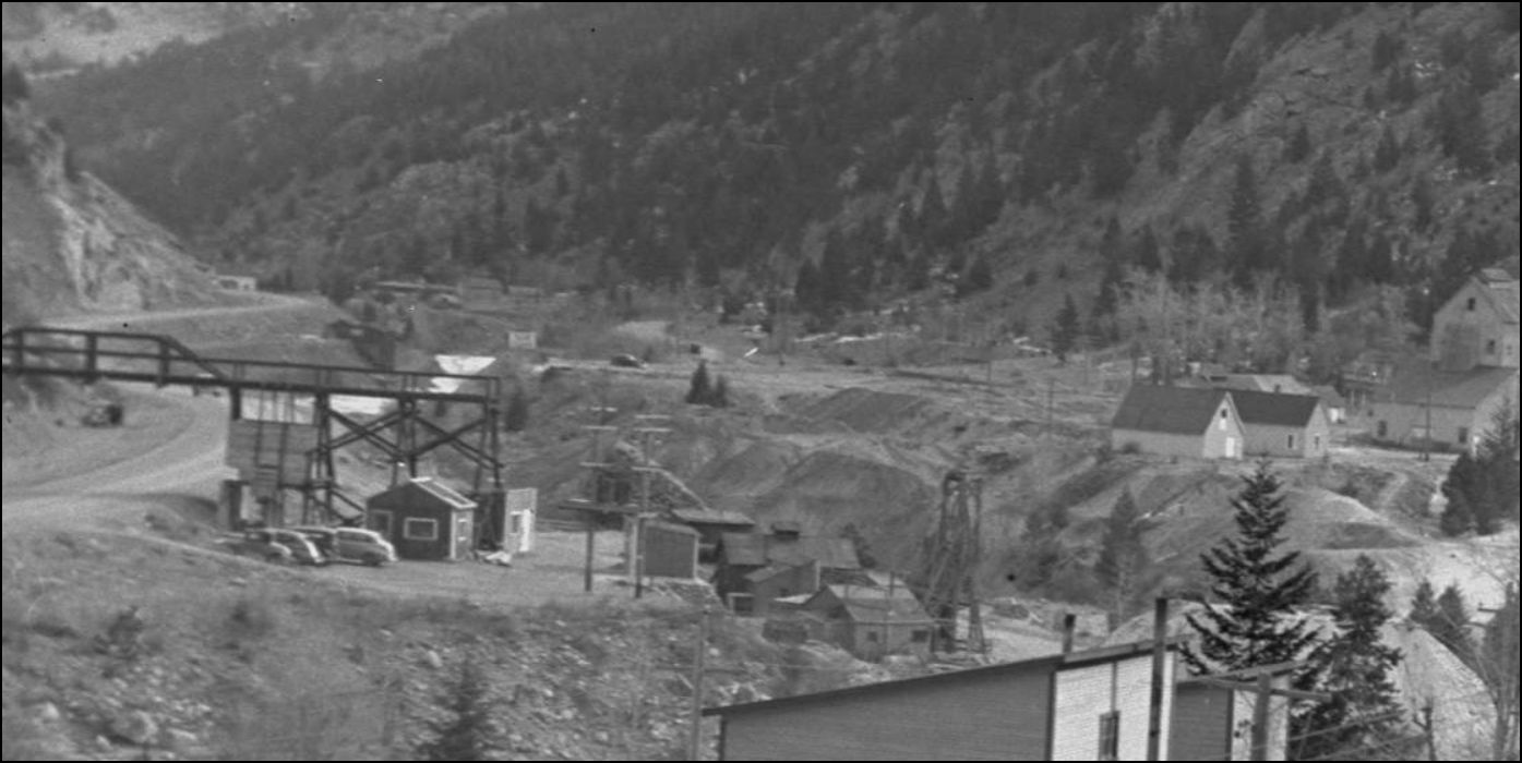 http://digital.denverlibrary.org/cdm/fullbrowser/collection/p15330coll21/id/11494/rv/singleitem/rec/270 >>Even the color photo is really the Donna Juanita? So all the kits that have come out are really not the MM Mine. And the plans I have aren't really of the MM Mine either. I'm afraid so, just based on the published works of Harry Brunk which would be very hard to correct. Not that this new information has any bearing on your modelling and what you choose to call it on your model either. >>So my next question is if you look at the mine I'm building didn't they have tailings? The proper term is Waste Rock Dump or Low-Grade Ore Dumps: Again in Mal Ferrell's picture of the C&S#70, to the right across the Railway can be seen the Waste Dump. That was still there in later photos of the "Orange" Headframe but not accessed from that new Headframe. A lot of Mines actually put waste rock back into older disused workings called Gobbing, more modern-era mines use the waste sand/fines from the milling process as sand fill in Stopes. Tailings are Slimes produced by a Mill process and usually are dumped into Clear Creek in the Idaho Springs case or into Settling Ponds like those atop Fremont Pass from the Climax Mill. 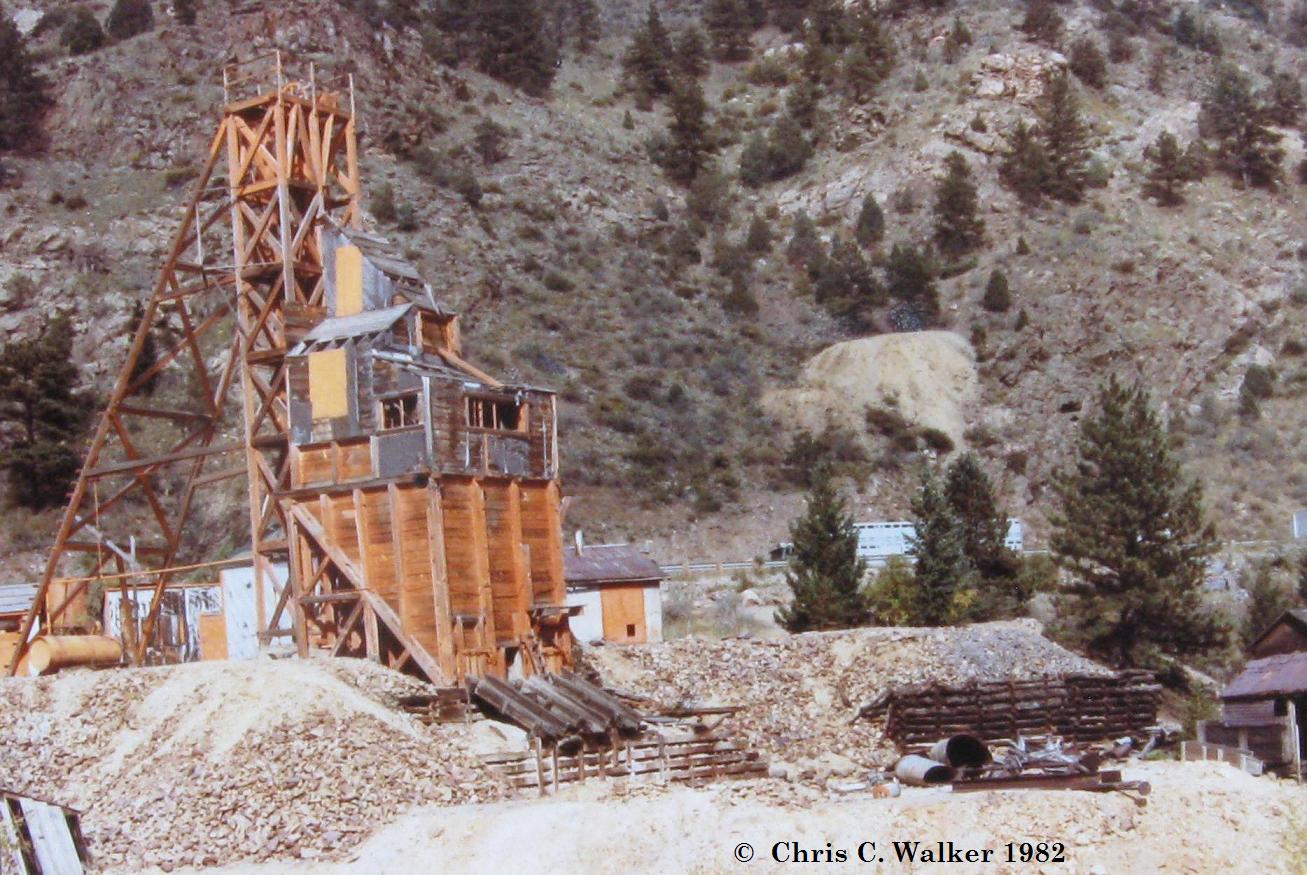 From this shot I took, it can be seen very clearly where the Waste Rock went around the Headframe and outbuildings. This area is now a lot higher than the roadbed of the C&S when compared to the other in-service pictures. >>Or did they just dump the ore in to cars and ship it to a mill? Assuming the C&S was there in the period of the "Orange" Headframe then I think there would have been a case for a siding for sure. >>And so I'm looking for a mill it would have shipped to without having to make a fake stamp mill. The nearby Salisbury Mill seemed a good choice and was in existance when the Development Headframe verion of the Donna J. existed, see the Photo in my first reply but was torn down before the C&S was pulled out. There is no visual evidence in any of these photographs that show any link between the new Donna Juanita and the Salisbury Mill which was shown as closed in later years. Other producing Mines around Idaho Springs did indeed do just that, again a review of the installments of the various Mills of I.S. yeilds information on such. See this listing here http://c-sng-discussion-forum.41377.n7.nabble.com/Track-Plan-tp5176p5181.html
UpSideDownC
in New Zealand |
Re: Donna Juanita Mine Workings.
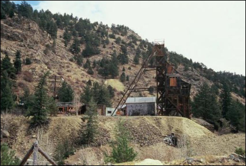 Idaho Springs Historical Soc. 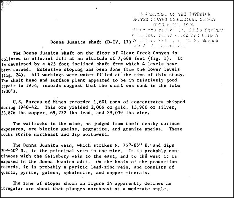 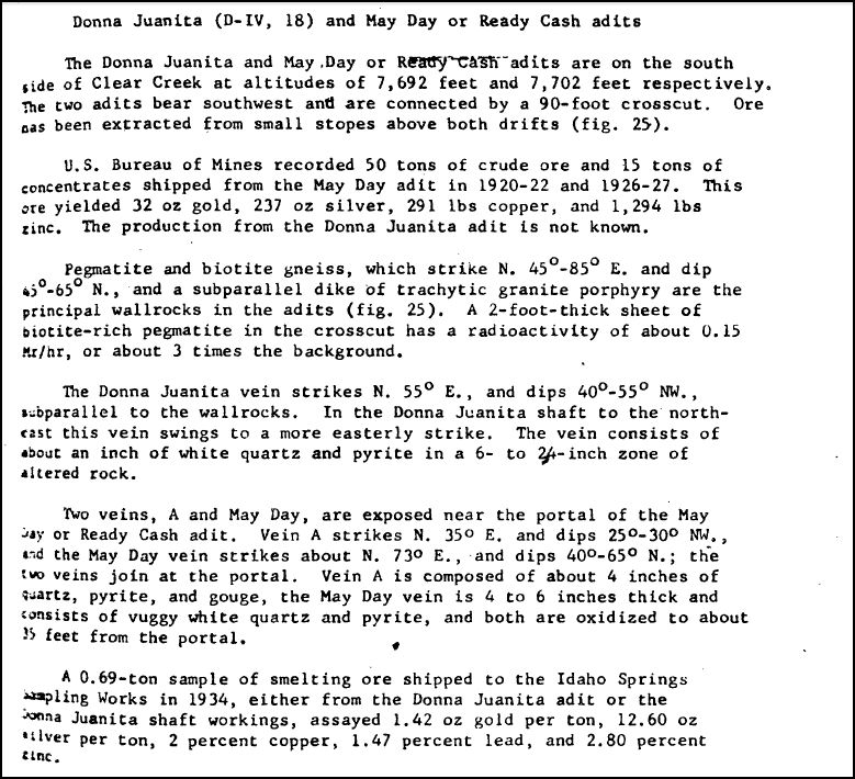 From the Mines And Prospects, Idaho Springs. USGS 1966 The Ore sample destination of the Idaho Springs Sampling Works mentioned was covered here in http://c-sng-discussion-forum.41377.n7.nabble.com/Idaho-Springs-Mid-Town-Ore-Processing-Part-3-tp2512.html The above references the "records suggest that the Shaft was sunk in the late 1930's." and "U.S. Bureau of Mines recorded 1,601 tons of concentrates shipped during 1940-42." This confirms the my speculation that the original Headframe was for development (Richard B. Jackson photo 1936) and the scrapping of the C&S Silver Plume to Idaho Springs line completed in early 1939 predated the "Orange" Headframe. At this time of writing. The Donna Juanita Shaft: Map of Workings is missing from the USGS collection, the Donna Juanita Adit is available but of no relevance here. However for a comparison, here is the adjacent "real" Maude Monroe mine workings located just across the road. 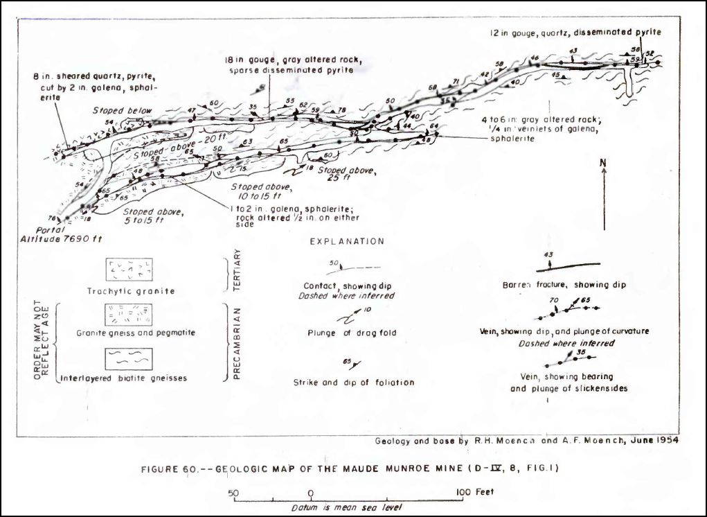
UpSideDownC
in New Zealand |
Re: Donna Juanita Mine Workings.
|
Mine map of the Donna Juanita.
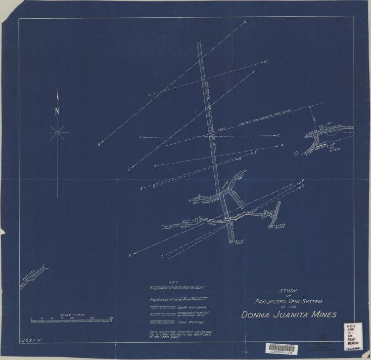 As you can see from this enlargement, the actual workings didn't amount to much down there.  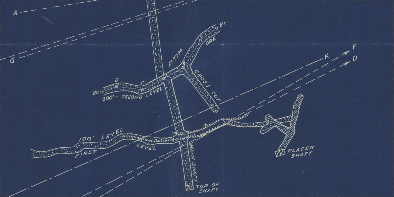
UpSideDownC
in New Zealand |
Re: Donna Juanita - Maude Monroe Veins info.
|
Another little tid-bit for interested parties.
 This entry in the USGS 1917 P.P. 94 pub. clarifys the Maude Monroe vein as a Drift tunnel, and not a Shaft operation. 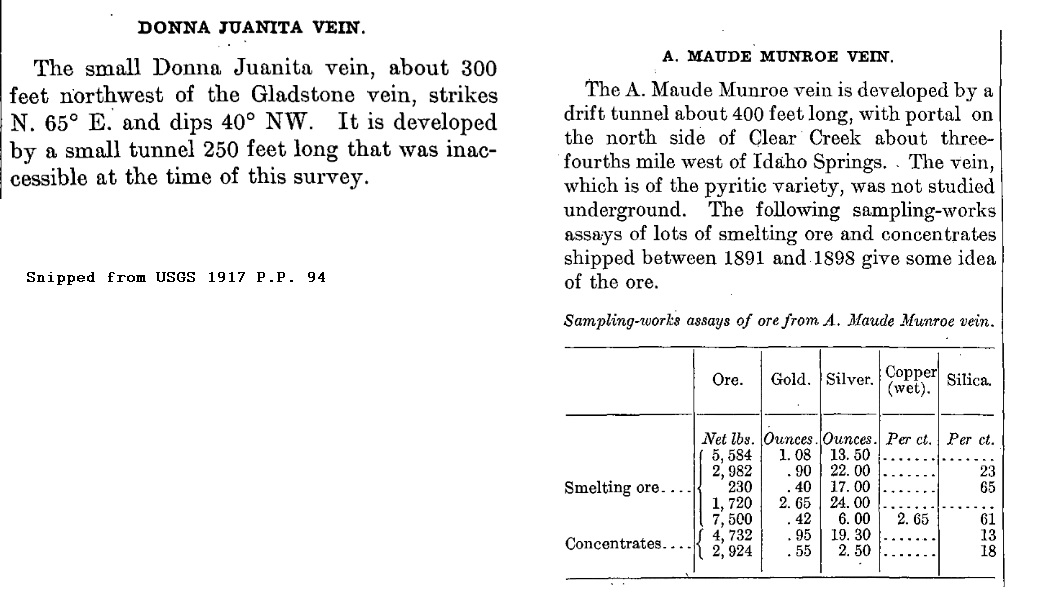
UpSideDownC
in New Zealand |
|
Thanks for the update Chris.
Jerry Jerry "And in the end, it’s not the years in your life that count. It's the life in your years." A. Lincoln |
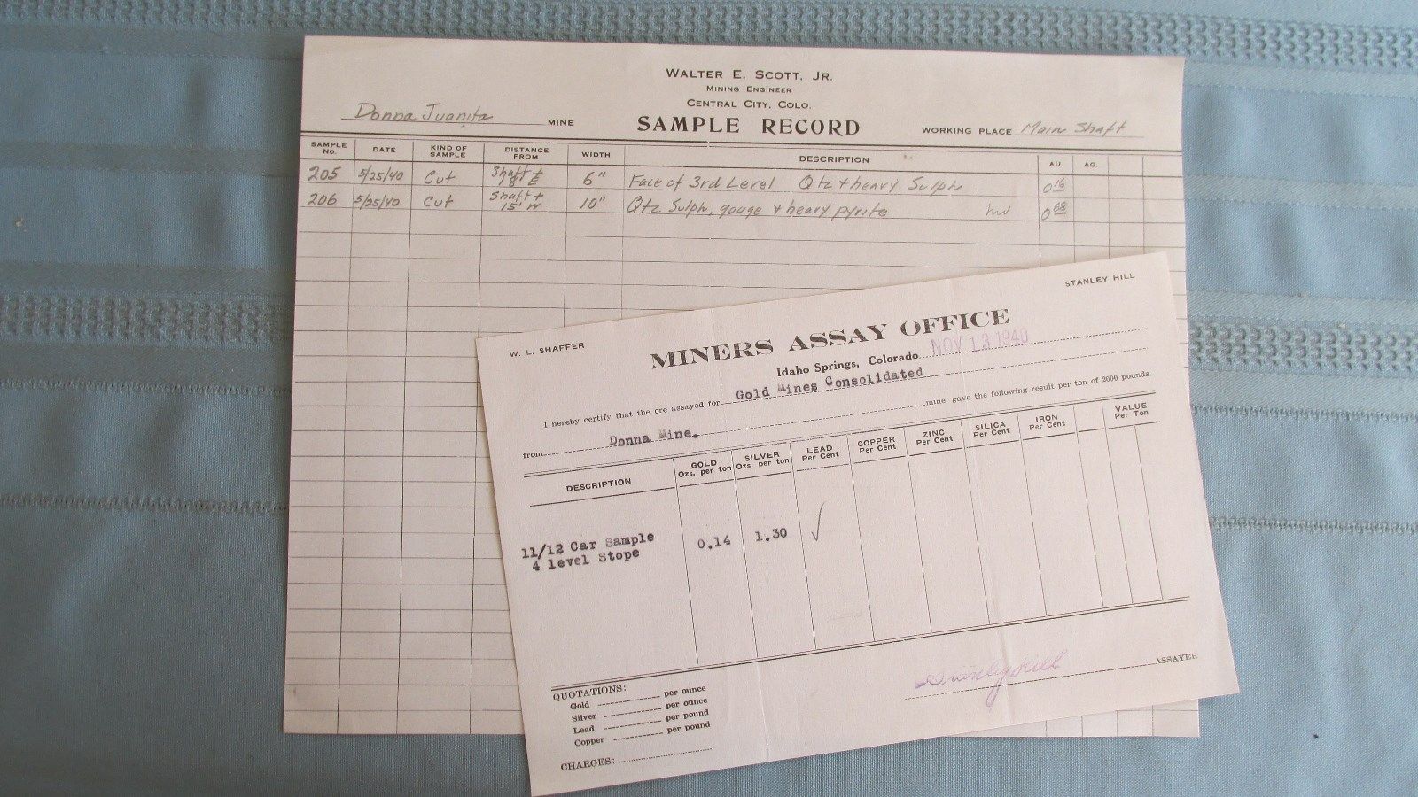
UpSideDownC
in New Zealand |
Re: Donna Juanita - Maude Monroe Veins info.
|
In reply to this post by Gerard
FWIW dept.
This snippet is what I think was what the esteemed Harry Brunk found during his research and drew his conclusion that his Hukill Mine model was actually the Maude Monroe. 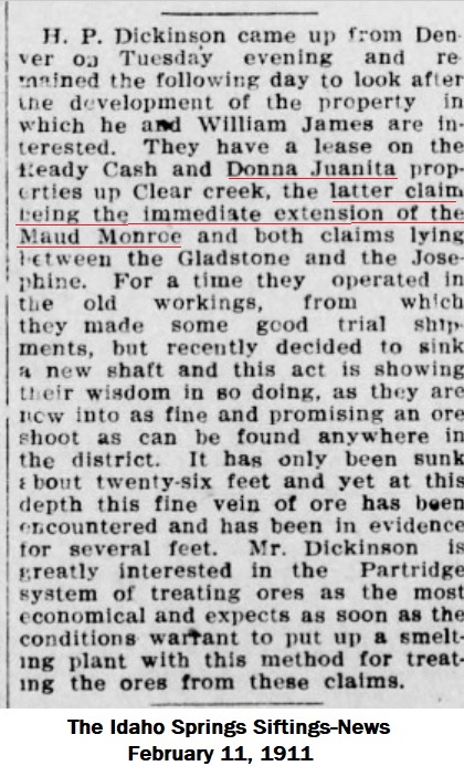 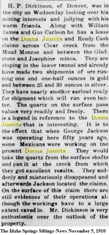 There was also this 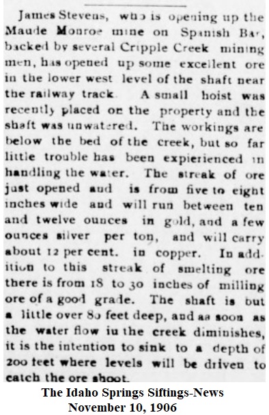 Well, that's my take on it after exhaustive research on this Mine, and like all good Miners everywhere.... .... I'm calling it "deep enough". 
UpSideDownC
in New Zealand |
«
Return to C&Sng Discussion Forum
|
1 view|%1 views
| Free forum by Nabble | Edit this page |

