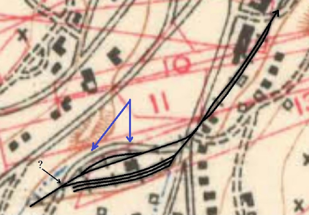
Pre-C&S Central City map
1234


1234
|
This post was updated on .
Jim, I see where you're coming from in placing that siding on the north side of the depot but if you look at earlier photos, that earth filled flat space doesn't appear to be there, either in the Lake photo or the early photo looking end-on at the station that Rick posted. It appears to be a further addition. This point has me wanting to find time to sort photos into a more chronological order to better plot the appearance, disappearance, and change against the information we have from the dated maps and other documentation. It seems that there's something that happens around 1904 that doesn't quite follow logically in the yard's evolution. We're running with scanty information; the reason may be revealed when the photos are arranged chronologically. I'm not holding my breath.
The Lake photo likely dates from between 1896 to 1899, so not that long before the new brick station was installed, though it could be as early as 1891. These dates are based on changes shown on the Sanborn maps. This photo is the one known document we have of the entire yard in the late UPD&G or initial C&S year and we all agree it is fuzzy. This photo may show a spur or siding and the main on the north side of the freight house, but it may not--do we know conclusively if there was not a platform on the north side of the freight shed? If we believe the records, there was approximately 370 square feet of platform at this building--which could translate to a single platform 11' deep on the south side, or platforms 5'-6' deep on both long sides. If on both sides, it could limit space available on the north side to one track. There was some form of oil facility by the late 1890s that was reworked in the 1899 yard remodel. The shed dug into the hillside at the end of the yard in the Lake photo seems a likely candidate but a tank is hard to find in the photo. Alternately, was that warehouse on stilts the oil facility? (Edit) Is it possible the early oil facility only received product in barrels, not in bulk in tank cars, explaining the possible lack of storage tanks in the Lake photo? The corral also is seen in the photo--as it is in a Lake photo (DPL L-18) showing the early St Charles coal cars, which unfortunately doesn't show if the new brick depot is in yet but could be an 1898 photo before the remodel. In 1899 the newspapers have items on the yard being remodeled--cut deeper into the hillside, tracks possibly lengthened, oil facility moved and there was talk of a road connection to the Nevadaville road. And the new station is built. Next up is a C&S inventory of yard tracks from November 1900, after the yard was remodeled and the brick station installed. Listed is a house track (this ran on the south side of the freight house), a cinder pit track (next to the house track) and a wagon track (next to the cinder track) in addition to the main on the north side of the depot. No mention of any other siding is given. The 1906 Special map and the 1905 Gilpin map offer a couple other interesting spur and siding interpretations. Both are based off notes or surveys done in 1904, 4 years after the yard remodel and new brick station. The first shows the short siding, the second doesn't. These maps represent the house and team spurs or sidings differently between them and differently than seen on later maps and the 1900 inventory. Neither show the small warehouse, which likely was removed when the yard was reworked in 1899. The building footprint at the site of the UPD&G freight shed/C&S new depot appears small in the Special map but some other structures in the area are also misrepresented. The validity of the USGS trackage has had some comments made that open it to question: track not being a primary focus to the surveyor, information being misunderstood between the surveyor and cartographer or maybe the surveyor having misread a feature (wagon tracks seen as trackage). We don't know if any of these apply, but their mention is food for thought on taking the arrangement as 100% accurate. The 1912 Mileage Guide map brings us back to the configuration hinted at in the 1900 Inventory--main, house, cinder, team. The small siding from the 1906 Special map is not shown. The oil facility is at the end of the single team spur. Finally, there's the ICC Valuation map, which shows the main on the north side of the depot and on the other side the house siding, the cinder siding, and the team spur tracks. I matches the 1912 layout and the small siding is not shown. The team spur pinches in as it approaches the oil facility which is tucked at the tail of the team track at this time. Lots of room for theories and speculation, lots of gaps, so much open to question. Off to start sorting photos...
Dave Eggleston
Seattle, WA |
Re: Colorado Central RR Central City Map
|
This post was updated on .
In reply to this post by Rick Steele
Rick, regarding the lumber spur (spur #1 on the ICC Valuation map) and chute. I did some further digging to find my reasoning on this. The spur may have been used by the mine but it was put in for the lumber company as far as I can tell from the newspapers.
First, another correction it WAS named Quigley, not Quance. Construction on the spur (shown as #1 on the ICC Valuation map) was reported to have begun in the March 5 1905 Gilpin Observer and reported completed complete in the April 27 1905 Gilpin Observer 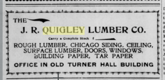 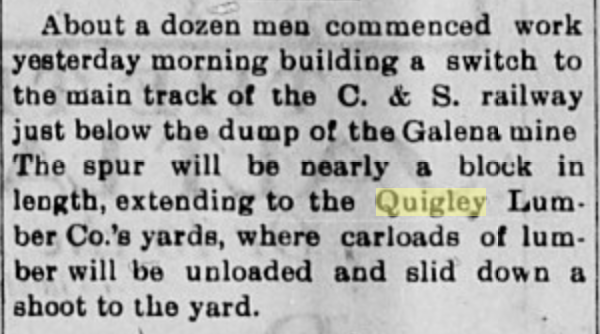 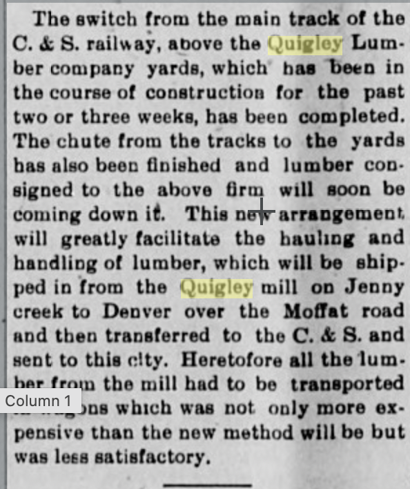 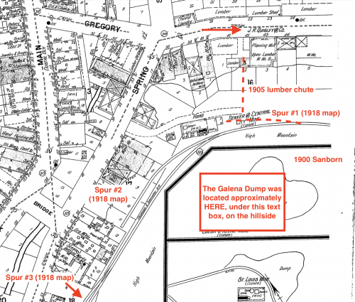
Dave Eggleston
Seattle, WA |
|
In reply to this post by Jim Courtney
Chris, I think that Jim Courtney has a good conjecture about a short siding serving whatever that small building was north of the Freight House, and either the wagon road or the remnants of the ties, which I cannot see in the later photos, could be what the USGS person saw.
BUT!!! I don't trust the USGS when it comes to yards. They just put in a bunch of parallel tracks where the Yard is supposed to be. I have an original of the USGS map that Chris posted. Black Hawk is not depicted with any turntable at all, but they did remember to curve the yard a bit to fit the locale. 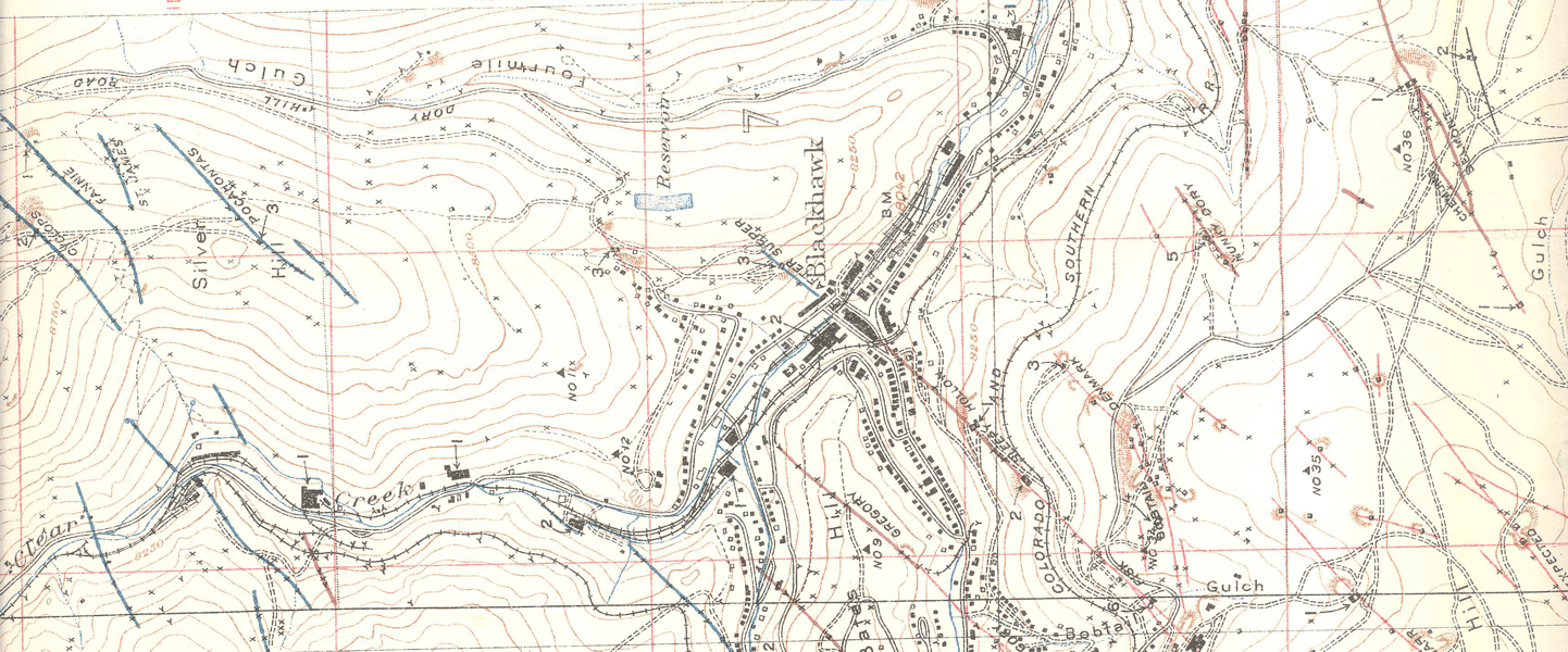 They do pretty well on the spurs but as for the yard, pffftttt... This is from USGS Professional Paper 94: Economic Geology of GIlpin County and Adjacent Parts of Clear Creek and Boulder Counties, Colorado By Edson S. Bastin and James M. Hill Washington Government Printing Office 1917 Plate IV The maps show the Geology, the claims and in this map, the direction of the ore veins. The USGS Survey date shows 1904. Veins mapped in 1911-1912 For those of you who remember the Central City Train, there was a mine across Packard Gulch Called "The Next President" mine. Here is what they said about that: 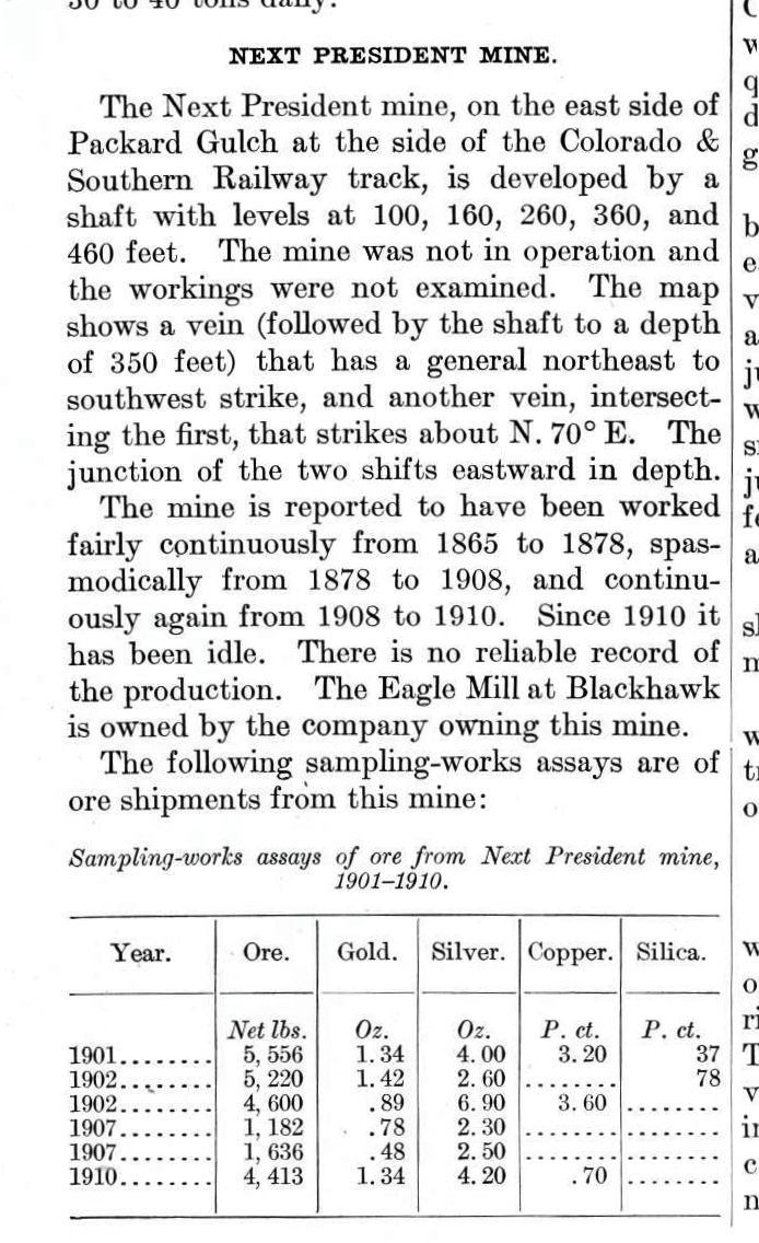 I couldn't find the Central City Mine, perhaps closed by the time of Publication. |
|
In reply to this post by Jim Courtney
Apparently Jim, Sundance and the authors of the Gilpin Railroad Era thought so too. I never thought to look in the back for a Map pocket.   This trackage that the USGS "saw" sure does match the H.Lake picture and also his "Brand New Depot" shot. I'm thinking the Tank is for Gasoline, there was a shift to Gas powered Hoist operation around 1900, one of several snippets I had found a while ago reading the Mining pages. The_Gilpin_Observer,_Volume_14,_Number_5,_May_10,_1900 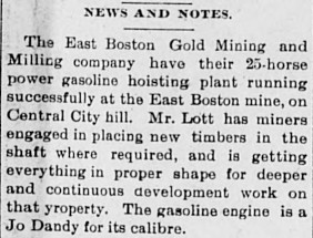
UpSideDownC
in New Zealand |
|
In reply to this post by Dave Eggleston
That Boxcar is sitting too high to be on the house track Dave, the switch you see is the track that connects the freight house to the Passenger arrival road, if it was the No.4/No.5 connecting switch then it would have to be sited closer to the Depot directly in the shadow of that Boxcar. I think at this time period of the brand new Depot, that the tracks 5 & 6 were still DL&G-era stub-end, and I see that in the layout of the original Freighthouse (H.Lake) picture. Which would match the USGS map. And I say that, because there looks to be a ****pile at the right end of the Boxcar; seen a lot of those in my time, never put a loco or car over one either. Did you Mr Steele?  Dave also mentioned the "Coal Cars", that was at the time of the original Freighthouse, no parapets or chimneys visible. 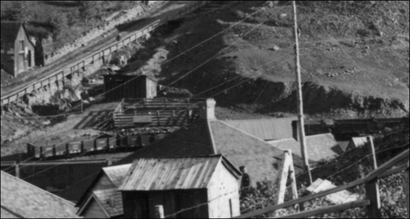
Lots to study, and lots to think on.......
UpSideDownC
in New Zealand |
|
This post was updated on .
Ah, I misunderstood which car you meant, thought you were talking about the boxcar on the main.
I've been sorting the photos I have of Central City--from books, DPL, this forum--into a rough chronological timeline to better understand the yard's visual evolution alongside other documentation. On the initial pass, in the C&S era, four broad periods appear. The first period is the year prior to the new station, 1898-99; the second is 1899 to ca 1905 with the new station, no scale house seen, no corral, the oil facility more limited and the baseball field grandstands their original size; the third is ca 1905 to ca WWI when the scale shed appears, Neef's is built, the coal shed is built, a mine next to the ball field disappears, the oil depot may expand and the baseball grandstands double in size; the fourth period is ca WWI to abandonment. I've just begun the exercise and it has revealed one thing. The photo being discussed, L-207, appears to fit in the second period. For this period I have seven candidate photos all looking up Spring Gulch towards the baseball field and yard from the opposite side of town. L-207 is unique in that a house just up the hill from where the corral had been is missing--it hasn't been built yet. In all other photos it's there. This means it is one of the earliest photos of the yard after the new station was built, as seen from this angle. This house appears in photos until the end of operations, with changing details. In the next photo, x-2542, we see the house. As I looked at other photos I noticed the house in x-2542 lacks a few details seen in all other photos--it is remarkably plain. Is it newly built? From this I'll theorize this as the next oldest photo, as seen from this angle, after L-207, for this period. And could we be seeing Quigley Lumber's initial offloading point, the boards offloaded in front of the outhouse, before the spur for them was built in 1905? This doesn't support or not support any track configuration suggested, but it may put the photo into a better timeframe context for consideration. Lots to chew on. Perspectival foreshortening, fuzzy photos, undated photos, USGS map issues and a lack of supporting documentation remain in play. Good fun! 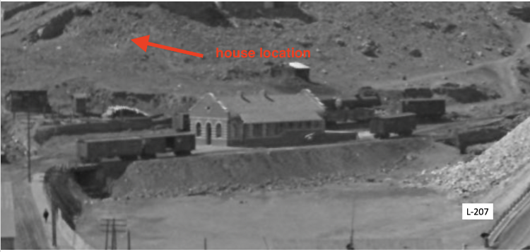 
Dave Eggleston
Seattle, WA |
|
The only photo I've seen that shows the new Lumber Siding. The D&CC Shafthouse burned in mid-late January 1920.
L-240 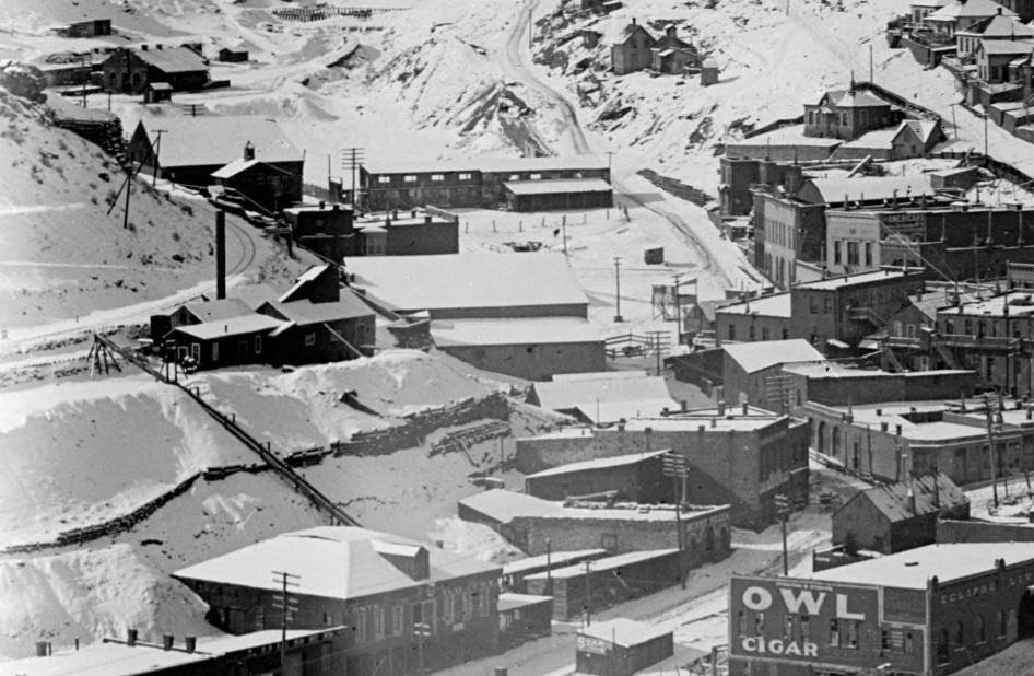
UpSideDownC
in New Zealand |
Re: Central City Pierce Mine Shafthouse.
|
This post was updated on .
The Pierce Shafthouse burned sometime after 1910, I haven't yet been able to find mention in the newspapers(yet).
X-11645 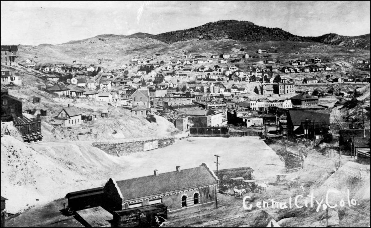 X-2529 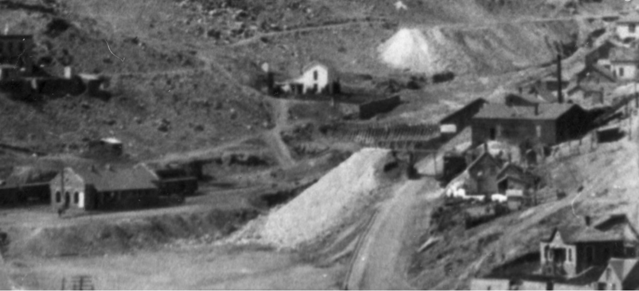 Note the White Noticeboard on the Depot at this time. When the Depot was first photographed, there was no Powerpole at the left (edge) of the Platform. L-207 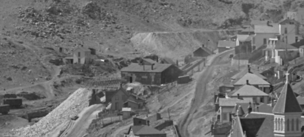 Note the Coal delivery chutes on the street. X-2542 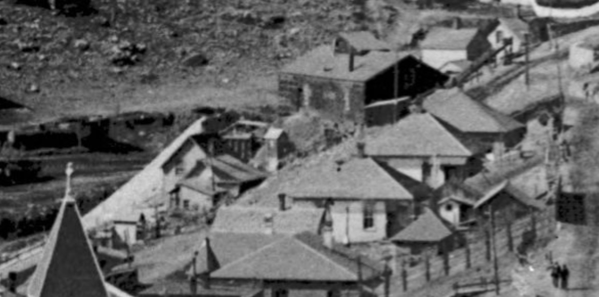
UpSideDownC
in New Zealand |
|
In reply to this post by Chris Walker
Thanks, Chris on the burning of the mine. The first photo of the Pierce shows the pre-June 1907 grandstand arrangement.
That's the only photo of the lumber chutes I've seen, too. Note the grandstands at the baseball field. The original grandstand was erected around 1889 and was half the size of what we see, placed on the right half of the structure. I just found the articles discussing the repair and expansion of the grandstand to double the size--June 20 1907 and June 27 1907 Gilpin Observer. So this winter shot seems to be, at the earliest, dated to winter 1907-08 but maybe ca 1910?
Dave Eggleston
Seattle, WA |
I recall discussions on my various trips with Joe Crea, John Robinson and Bob Stull on the "Big Snow" pictures, he was of the opinion back then it was 1913. But Joe added a reminder that there were numerous big snows over the years. I never got to talk with Dan Abbott about that, we were frothin' around the Gilpin topic mostly, it was all out of my research areas 'til now. One more thing on carbon dating these pictures is to correlate the Foresters Hall billboard changes along with the lettering on rolling stock in the various photos. It alone is worthy of a photo essay.
UpSideDownC
in New Zealand |
Yep, I did a survey of the Foresters Hall billboards about 3 years ago and have a timeline. Same with changes to buildings all over Central City, such as the Armory Hall's roof. Lettering, trees, Spring Gulch bridge, buildings up Spring and Nevada Gulches...working on any detail I can get a toehold on to help. I've now put four yard photos into a chronological order from the 1900-1905 period, and have moved one more photo from a later period into that period.
Dave Eggleston
Seattle, WA |
|
This post was updated on .
In reply to this post by Chris Walker
I know they did--they ran with the best information at their disposal and published the best books possible. Really good books I regularly read through. The map they used appears to be the 1906 Special, as you point out. The book's map covers a big period, 1886-1917, and trackage evolved over that time in both Black Hawk and Central City before and after 1904 when the map was surveyed. A lot of moving pieces difficult to capture on a single map. And new details have surfaced since publication giving us a lot more insight than we had back then. Looking at the map I note some things. The siding for Hawley, Zang's and Neef's is missing. They've labeled the Central City section house as the 1878 depot. We now know that the 1878 depot was actually housed in the Montana Mill structure, which sat where the yard was later developed. The "1878 depot" likely was built in 1880 as the second depot. Looking at Black Hawk the two track yard across from the station is missing. The turntable is not shown in any of its three locations. There are some other details that can be questioned. I'm not sure they had the information on any of these at the time of publication. The map is a great discussion point but I still argue, given the questions it also raises, that caution needs to be exercised in interpreting the map.
Dave Eggleston
Seattle, WA |
|
In reply to this post by Dave Eggleston
Dave, I've been meaning to ask where you read of this, always like to improve my "background" knowledge on this place. here's the Building in 1874, a few years prior to the grading of the Highline. X-2609 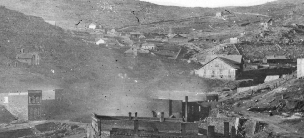
UpSideDownC
in New Zealand |
|
This post was updated on .
Chris, yeah, no problem. I should really put caveats on this because I know there will be skeptics, and I may have been overly confident at this point in my statements. But I've not just read about it, I have a photo that adds strength to the theory and I'm becoming a stronger believer in it.
I first read about the Central City depot burning in Jan 1880 in Dan Edwards' book covering the 19th century Clear Creek lines. Flipping back a few pages and I saw another transcribed article from May 22, 1878 that mentions the depot is in the old Montana mill. I dug through the papers, found another opening day article calling out the mill as the station. I also found another article about the 1880 fire, mentioning the station, mill and freight burned. From the article in Edwards' book we also know #6 was inside and burned, as did freight and company records. So I had 4 compelling articles from two timeframes. I had no idea what the Montana Mill was but found DPL x-11450, an engraving from 1860 (inserted below). Right where the railroad yard would be, smack center frame, is a mill. I know an engraving can't be trusted for exactitude but it was a start. Hunting further, I found DPL holds two bird's eye maps, one from 1866, one from 1873 and both show the same mill structure at this location. I also found the photo you shared, and two others of the mill just before and just after the fire--x-4665 and c-342. With these I can more confidently trace the future grade to the forward wing of the Montana as you did with x-2609. I started looking for any image that might show more of the area, with cars or tracks. All the opening day photos seem to concentrate on the area around Hawley's, but I went back to x-2982-- if you continue the grade from above Hawley's through the crowd on the Main Street building rooftops you hit paydirt. I've posted it below as nabble isn't formatting pictures with text nicely right now. The Montana, two engines and a passenger car are hiding in plain sight just right of the crowd. To me it looks like there are at least two tracks, based on one engine appearing to slightly obscure the tender of the other, and that those tracks could run through the mill. Conclusive? Maybe not, but definitely compelling. Does this mean the mill was the station? Not by itself, but placed with the articles, what we know of where the CCRR ran at this point from other pictures and even that there was a precedent of doing this type of structure reuse in Black Hawk by the CCRR, the theory starts to gain pretty good traction. Good enough that I'm warming a lot to the idea that the mill was used as the initial station structure, just as they had done, and were still doing until September 1878, with the mill in Black Hawk. What the Central City track arrangement was is open to wild speculation at this time. I expect pushback and that's ok. For now this thing has enough legs to keep it in play and, I think, to argue positively for it. At this point I'm being open minded but lean to believing the theory is true. I'm looking for further info that would support or trash this theory. Further on x-2982 you can make out the brick section house but if the little brick station structure is there, it is obstructed by the crowds. This leads me to the question: was that building built after the fire or was it an existing building repurposed into a depot in 1880? Either way, it points to a good possibility that that brick structure was the second station. That's the paper trail I have so far. I do think the evidence is pretty good, given the variety of sources and dates. I've been chasing this for about 6 months and wonder if there might be another image out there that can take this thread further. Odds don't seem great. Here are x-11450 of 1860 and a crop of the pertinent area of x-2982 of May 22 1878, with a zoom in to the upper right corner. 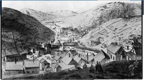 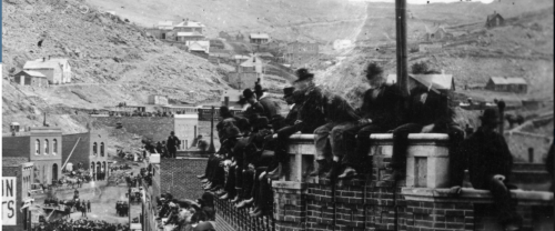 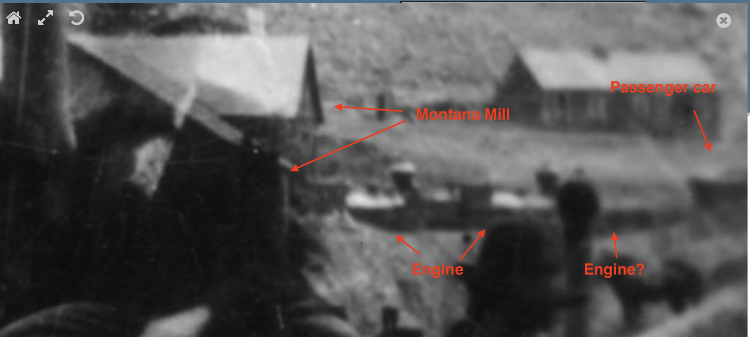
Dave Eggleston
Seattle, WA |
|
Dave,
I was looking thru the Abbott/McCoy Gilpin Railroad Era, noticed a panorama of Central City on pages 342-343. The photo is dated 1887, photographer not cited, in the Ronzio Collection. The old freight house and yard are visible in the distance. This is the best enlargement I can do, of a photo scanned from a book: 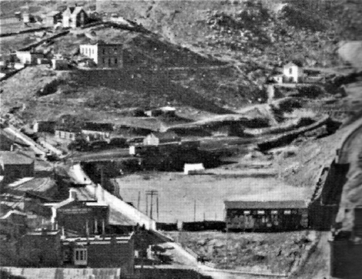 The three boxcars are spotted on a track that hugs the very edge of the fill above the ball park, just like the Harry Lake photo upthread. To my eye, there is a turnout just to the left of the brightly illuminated boxcar end. That would suggest that there are two tracks on the city side of the freight house, as in Chris's interpretation of the topo map.
Jim Courtney
Poulsbo, WA |
|
This post was updated on .
Yes, Jim, this photo is at least earlier than 1895--the Hawley warehouse is missing its later peaked roof but the Sauer-McShane warehouse may have it's peak installed.
As to the photo interpretation, in all that fuzz it's hard to say--yours is very plausible given what little solid information we have.
Dave Eggleston
Seattle, WA |
|
But Dave, pontificating about fuzzy, blurred photos is what we do here!

Jim Courtney
Poulsbo, WA |
|
This post was updated on .
I know.
 It's what keeps most of us coming back. It's what keeps most of us coming back.
Dave Eggleston
Seattle, WA |
|
In reply to this post by Jim Courtney
Nah, I'm sticking with one track in front.
The thing that fascinated me, though is what looks like the presence of a platform next to the Section House. Perhaps for Passengers to wait on, embark, disembark rather than waiting on the Street side of the Ticket Office? Rick |
|
Rick,
I think that's the idea with the platform. It's a long one and I think was put in place because the area where it's located was originally lower than the grade, dropping down to the cellar behind the section house.
Dave Eggleston
Seattle, WA |
«
Return to C&Sng Discussion Forum
|
1 view|%1 views
| Free forum by Nabble | Edit this page |


