Pre-C&S Central City map
1234


1234
|
What I've been doing in my experimentation with 3D printing is working up from HO in terms of minimum wall thicknesses. I do the CAD drawing in full-scale units, and then scale the exported STL files when I import them into the slicing software. Every slicing program I've seen handles STL scaling quite well.
The supports are added in the slicer layout, and can be varied by scale. I've been able to do 'early' tenders that print well in HO, and have scaled them to S and O without issues. All the stuff I've done is with a SLA resin printer, but a friend has been able to do filament prints of my STL files with only minor adjustments in the slicing stage to accommodate different support needs. The main limit of the SLA printers is the build plate size, which in turn is driven by the size/resolution of the UV light matrix. Most of the structure kits would appear to need to have the STL files edited to break the long walls into multiple components for resin prints, whereas the filament printers tend to have fewer size constraints. Steve |
|
In reply to this post by Chris Walker
getting back on track....
 Here's version another of the CenCty 1906 Special Topo, this time without the Claim info. 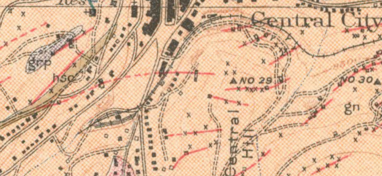 My view is this map would have most likely been correct in the track details, at the time of recording. The differentiating between a track switch be it individual, lapped or a 3-way would not be noted as such, it's a Topographical and Mining map, not a Railroad map, and cartographers aren't usually obsessive about such details. Usually the scale of such maps preclude Passing tracks and Sidings as existing, a Main track deemed sufficient. We are just lucky that the larger scale maps exist for CenCty and Idaho Sprs. Note Structures are represented by a square, or oblong with occasional elbow square symbol. The square symbol for the building between tracks appears to represent in size the early Freighthouse, not the much longer new Depot.
UpSideDownC
in New Zealand |
|
Chris, yes, we’re very lucky to have this map. Not just for gaining insight but also for providing all of us puzzles to dig into! And thanks again for posting these wonderful clean versions of it.
The survey was done in 1904, 4+ years after the construction of the C&S station/freight house. It's weird they'd represent the previous freight structure, that wouldn't have been what was observed in the field at that time of the survey. I absolutely agree with your comment about the USGS cartographer (or was it the surveyor?) not obsessing on certain details, and there are other details that vary from what we observe existing at the time of the recording. The Hawley warehouse footprint is mis-drawn and structures are missing (the baseball stands, a house, at least one C&S tool shed) while some minor structures (the boxcar shed, for example) make the map. Following the track out of town, the block next to Hawley’s, the Sauer-McShane warehouse, the jail and the Denver & Central City mine and its adjacent bin all have pretty accurate footprints that fit expected shapes and locations. Why the inaccuracy of Hawley’s mixed with accuracy of the others, why the omission of some buildings? Which leads to more pondering on the map's back story. How much of the inclusion and omission is intentional? Or worse: Is there a mash up of old and new information, is detail accidentally omitted, are we seeing data that was mis-interpreted as it passed from the field to the cartographer?
Dave Eggleston
Seattle, WA |
Re: Colorado Central RR Central City Map
|
This post was updated on .
E.J.Haley's map of Central City Pict. Supt. DSP&PRR. Undated.
(also in DSP&P.) 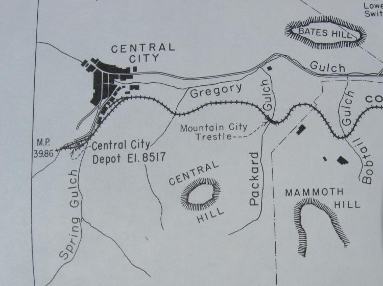
UpSideDownC
in New Zealand |
Re: Colorado Central RR Central City Map
|
This post was updated on .
I've always loved the direct, clean style of Haley's maps. It provides a nice interpretation of the Central City situation between ca 1890 and ca 1900.
While not pre-C&S, I might as well add this section of the July 1905 Gilpin map, from notes made in Aug and Sept 1904, done by the C&S--so very contemporaneous to the USGS 1906 Special. The Central City yard shows some variation to the USGS map. To my eye it confirms the main ran on the northwest side of the depot at this time, as also seen on the 1918 ICC map--the definite side of choice for the post-1899 yard reworking and perhaps earlier. 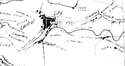 Zooming in we see the depot yard in a slightly different configuration, with a spur on the SE side of the depot, a passing loop around the structure and what is almost certainly the team track on the SE edge of the yard. 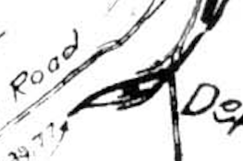 More fodder for interpretation.
Dave Eggleston
Seattle, WA |
Re: Colorado Central RR Central City Map
|
I'm wondering about the origin of your version Dave, was that from Hollenback's Gilpin Tramway book of the late 50's? Seems to be a more artistic version of Haley's above, the runaround track downgrade of the Sectionhouse & Depot is missing on both versions.
The track shown in these don't exactly mesh with the pictures. I had some notes from the 1980's on Central as to the supposition of just what could have been off camera, but have yet to locate them.
UpSideDownC
in New Zealand |
Re: Colorado Central RR Central City Map
|
Chris, I found that map online years ago and unusually for me didn't put a source in the file name. A quick google of "1905 Gilpin Tram map" yielded it, on the gilpintram.com site.
The survey noted on the 1905 Gilpin map definitely is noted as the source for Hollenback's map, so Frank had access to it. And his map is far cleaner, less "hand drawn." Here's the Central City detail from his book. Yes, C&S tracks indicated are a bit different in his map--but again, the interest was more on the Gilpin OR the original was misread. We're finding issues with all the 1904-1906 maps discussed so far compared to what we see in photos and documents. 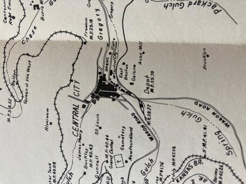 I wonder that since there is an 1898 Black Hawk map done by the C&S at CO Historical Society if there might well be one for Central, in that collection. It would pre-date the yard changes of 1899.
Dave Eggleston
Seattle, WA |
|
In reply to this post by Jim Courtney
Hi Guys,
I wish to question a couple of items in this thread. One is the Central City Mine spur. According to the Valuation Maps, this was a spur separate and apart from the Sauer-McShane Mercantile spur. According to the yard maps, both of the siding tracks on the freight side of the depot were double ended with a single ended spur still there when the valuation was done, but at that time having the three tanks on the concrete plinths. I haven't seen it published, but the Harry Lake collection has a photo of both the plinths (empty after abandonment) and with the cars set in them. I saw those eons ago at the SHSC library, they had Harry Lake's original scrapbook. Did Harry Brunk ever model Central City? No. I did at one time and the yard, to HO scale, using no "Modelers License" was 2' x 8'. I did the articles on the Central City Structures in the Gazette back in the 1970's. There was a three way turnout during the C&S era (after the 1909 brick depot was built) located on the bridge that you see in the UPD&G photo posted earlier, it connected the three "Back Tracks"on the back side of the Freight part of the Depot. You can see that the track in front of the depot was extended across Spring Street after the 1909 depot was built. Perhaps to make it easier to Switch, I am not sure, or to allow a freight to set out and pick up cars while the Passenger Train was spotted there. Remember, the tail track on the upper switchback was only 373 feet long and would only accomodate about four Passenger Cars and a locomotive. With the Hawley Merchandise Company getting 30 cars in one month, I am sure that the crews dreaded that switch.... I found that the field notes and the track map don't agree on the exact end of the switchback and the heel blocks for the turnout. I will post the other part of the map as soon as I get it scanned. This Map, by the way, was taken from the actual (Full size) valuation map that I have from the National Archives and a C&S Engineering map that I found at the State Historical Society of Colorado in about 1975. As for Chris Walker not trusting the yard maps on the USGS Maps... Wise choice. I have found that most of the "Yards" are just a series of parallel lines which do not indicate industries or spurs. 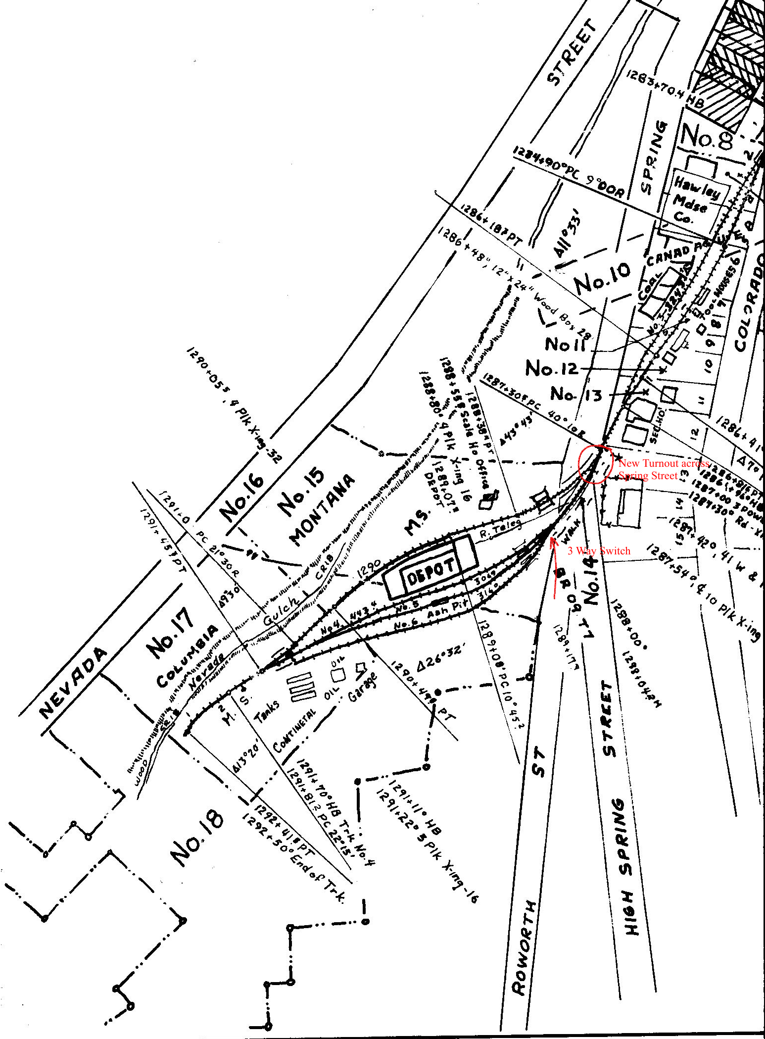
|
Re: Colorado Central RR Central City Map
|
In reply to this post by Dave Eggleston
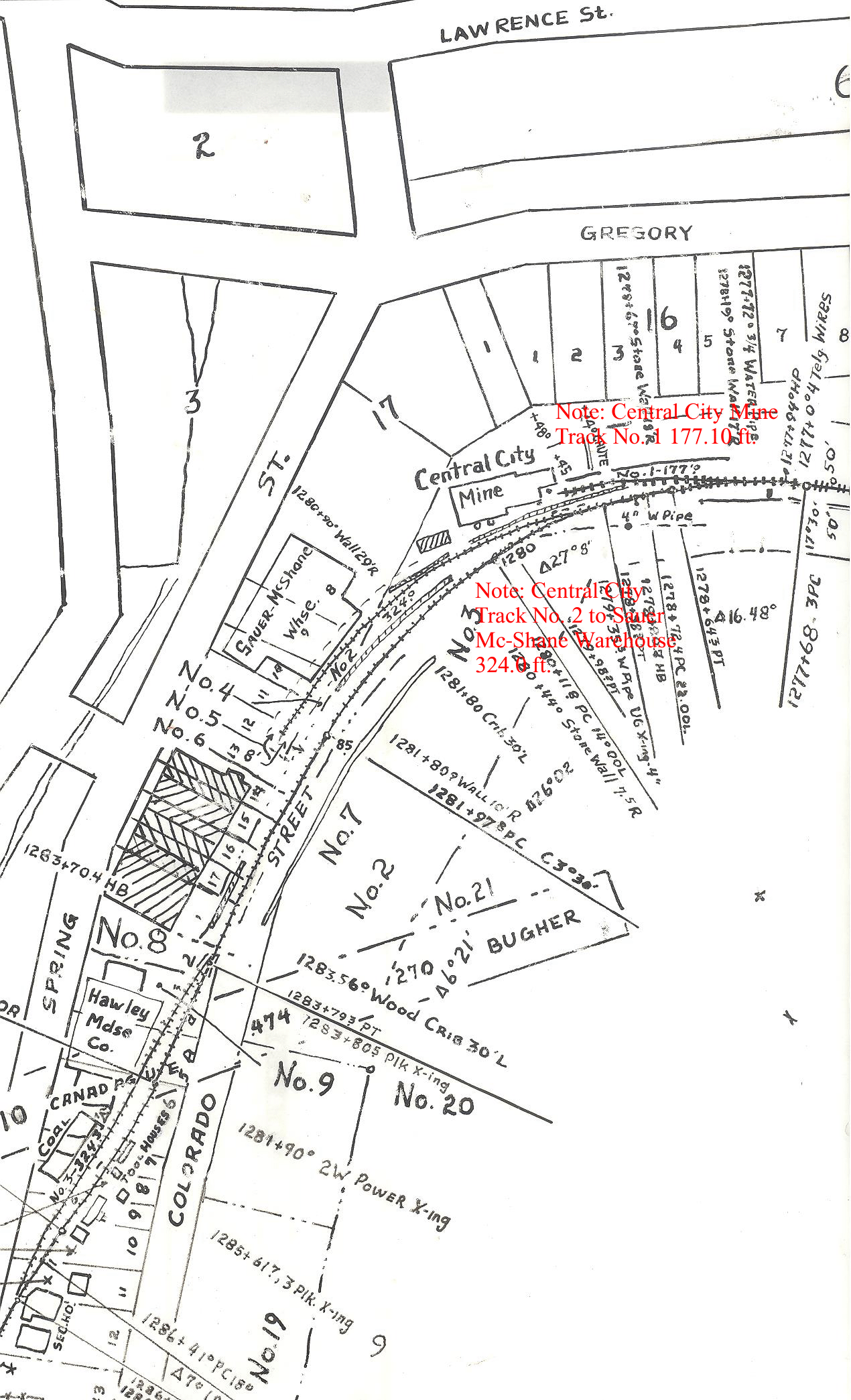 Second Half note the two separate tracks for Central City mine and Sauer-McShane Warehouse. |
Re: Colorado Central RR Central City Map
|
In reply to this post by Dave Eggleston
Another from C&S
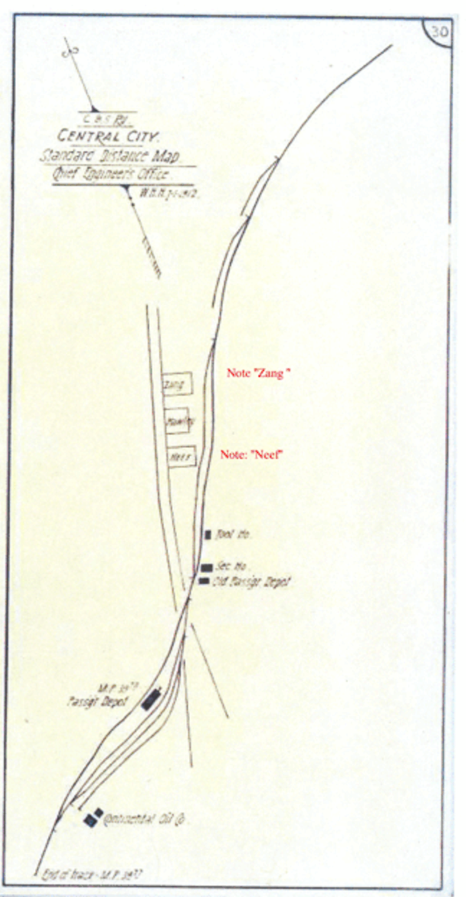 Official Mileage Guide July1, 1912, cross checked against the same from January 1, 1928 |
Re: Colorado Central RR Central City Map
|
Thanks, Rick. Fantastic map!
This conforms to the 1918 ICC map, and confirms the Neef beer warehouse. Interesting the coal shed is not included--nor the Sauer-McShane nor the mine, perhaps because all three may have been out of business by 1912? I know Sauer-McShane closed down around WWI and the coal operation was being handled more in the team area. The 3-way switch appears to have been replaced with 2 normal switches. And the Quigley lumber spur isn't shown, though it should be there at this time...hmmm.
Dave Eggleston
Seattle, WA |
Re: Colorado Central RR Central City Map
|
Dave,
You were asking about a pre-C&S Black Hawk map. I uploaded one here at one time but when we changed servers it somehow got lost in the shuffle. I can send you a .pdf file of the one that I have. This is dated 1898. The original shows the ink eradicated marks for the UPD&G in the title block and the UPD&G and CC are listed at the extreme right end of the map. This was after the turntable was moved from beside the depot to across the street. It is fascinating to watch the changes and decline in business over the years. e-mail me directly at: rick@labellemodels.com and I will be happy to send you out the .pdf. I am unfamiliar with the Quigley Lumber Spur unless it shared a spur with someone else. It may have been very short lived. The information that I got was from the Valuation and the C&S Engineering map. I don't believe that the original C&S Central City yard map survives. The C&S one that I have that is more current from Black Hawk doesn't extend to Central City. Oh yes, as for the three way switch. Don't believe everything you see. The Heel blocks for the three way switch were still there in 1970. If the Turnout had been changed, they would have been removed. The city was pouring the concrete walkway on that side of the street and the backhoe had uncovered the Heel Blocks and rail leading into the yard. The Yard in Central City was never torn up. Don't worry about what was and wasn't listed I think that Hawley was singled out so the crews knew which business was where when spotting cars for unloading. There was no spur to the Coal shed/dock when the valuation was done, either. Rick |
|
In reply to this post by Chris Walker
Chris, note in the photo that you posted of the train entering the freight yard in Central City in the CC?UPD&G era that the Track to the north of the freight house is non-existent.
|
Re: Colorado Central RR Central City Map
|
In reply to this post by Rick Steele
LC McClure provided us with visual evidence  MCC-3027 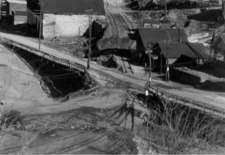
UpSideDownC
in New Zealand |
|
This post was updated on .
In reply to this post by Jim Courtney
Post edited for clarity.  I'm a little slow on all these tit-bits....long days of Summer are still with us, so time to respond is down to 10% atm. A Nice new Depot.... a view showing the revision of the yard tracks to put the Mainline Passenger arrival track orientated to the City(as it should be) and no room (yet) for the Public Scale. L-207 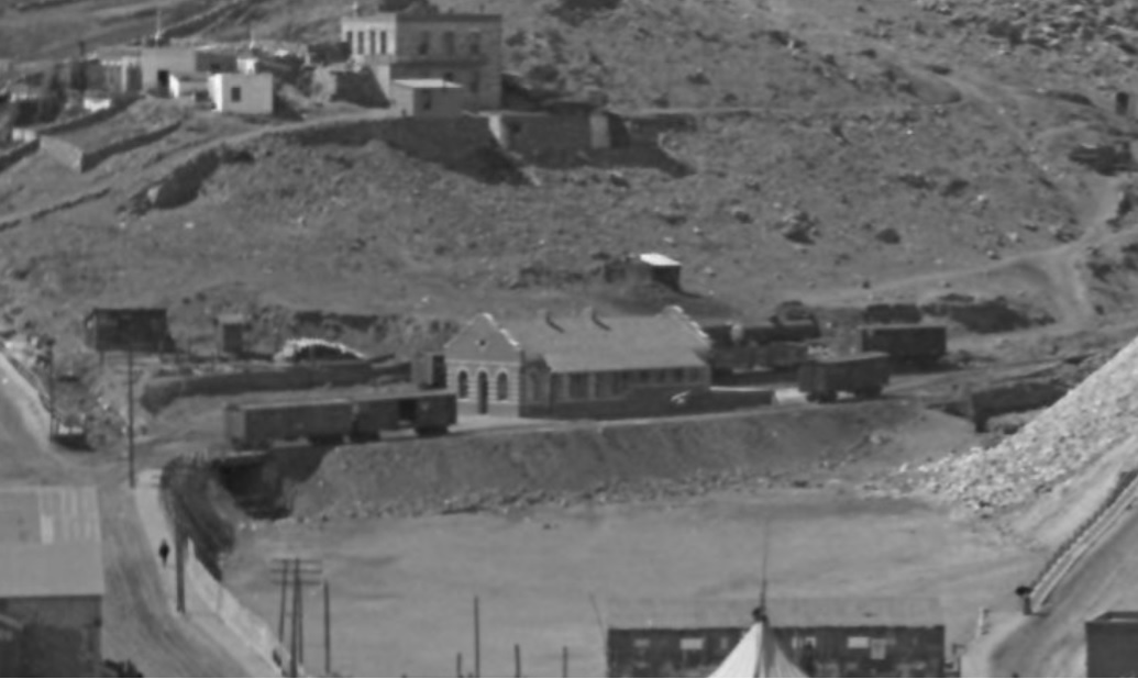 Note in the above view: The Boxcar at the right rear appears to be on a stub-end track No.5, and not the No.4 track alongside the Freightdoors of the Depot. The Boxcar visible left rear of the Depot is further back than it should be if it was on the Depot Freightdoor No.4 track. The Tankcar appears on the rearmost, team track No.6 stub-end track; it's too close to the Depot to be the later Fuel dealer tanks shown further down. That arrangement seems to match the Harry Lake view of the two stub-ended tracks, 4 fifths of the USGS Topomap, and not Dave's interpretation as far as I see it. At this time of the early Depot years, the yard tracks No.5 & 6 both appear stub-ended. Others have written the C&S again revised the yard after the UPD&G. Compare this view with the Flatcar proximity to the No.4 track Freightdoor side of the Depot building itself, for distance reference. If you have ever leant out of a loco cab to see cars on adjacent tracks, then you'll see what I mean here. L-240 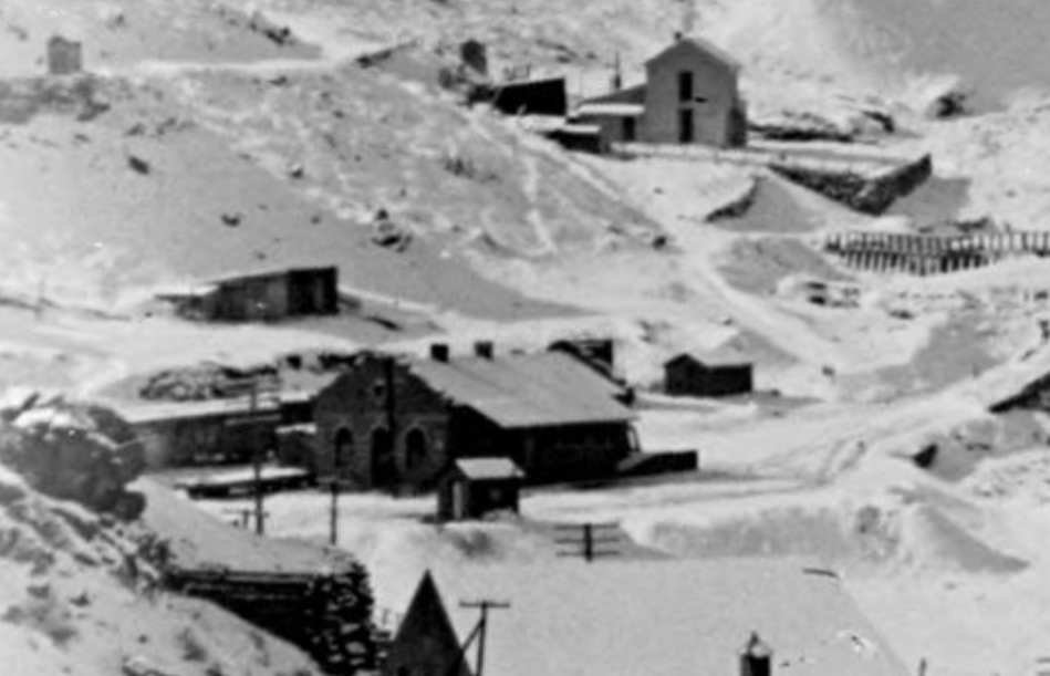 Compare the location of the switch connecting the middle siding to the third siding shown here: also the rearmost siding is elevated in all these photos, including the Harry Lake picture with the 4 Coalcars on it, team track No.6. 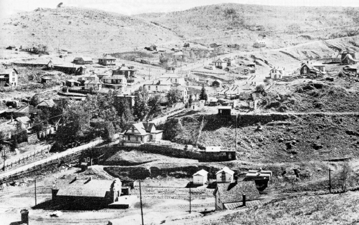 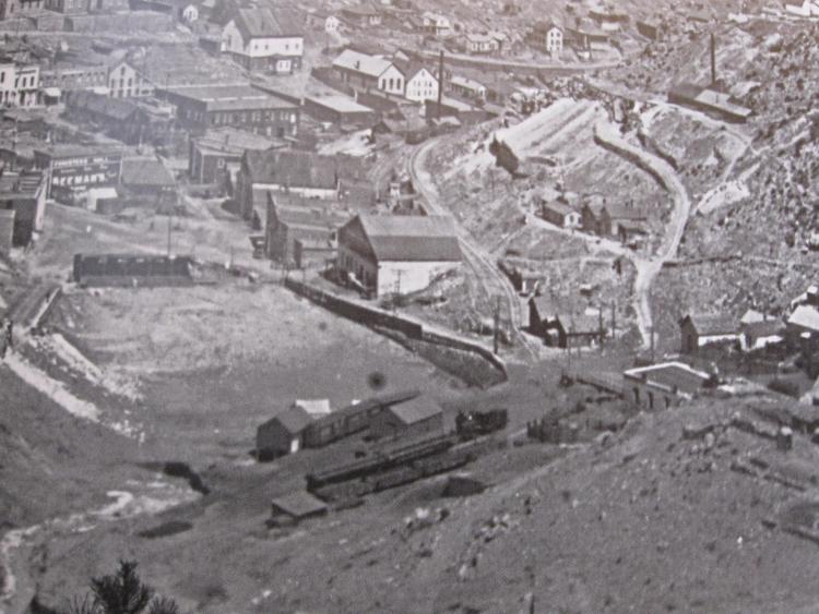 I still can't see where the USGS extra loop Siding on the Cityside of the old Freighthouse could be, that area between it and the Boxcars on the curved siding would be needed for Teamster(public) access to the freight doors. I love a good mystery.  Oh one more thing: Rick, the D&CC Mine was listed as closed on the 1900 Sanborn. fwiw. Rick Steele's Map: for track number references. 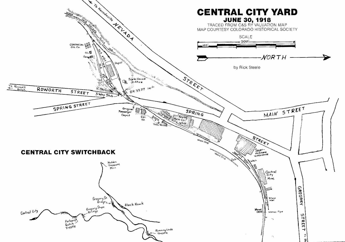
UpSideDownC
in New Zealand |
|
Just to keep the terminology straight, a siding is connected at both ends, a spur is connected at one end.
Yes, there was definitely the main line (on the passenger side of the depot), two sidings and a spur track in the yard. It wasn't big enough for much more. 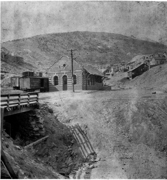 Looking at this pic, there is definitely only one track on the passenger side of the depot. 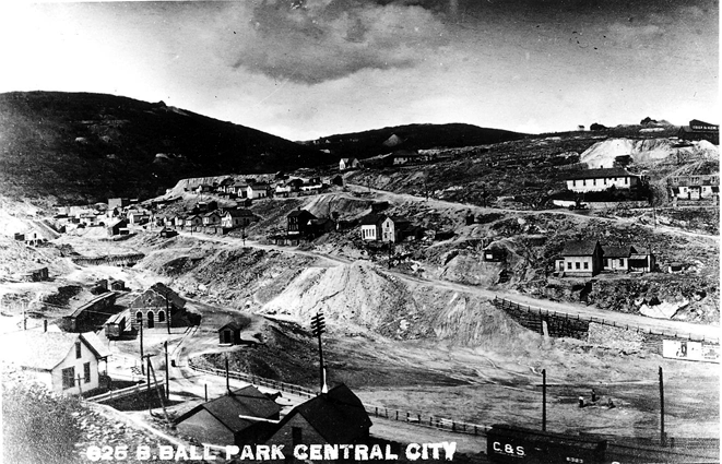 This one shows the three tracks on the freight side and the Scale House. 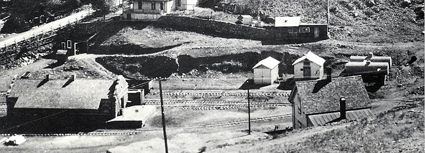 This is a close up of the shot that Chris Posted. Look closely at the ties. You can see where the two siding tracks merge together on the freight side of the depot. Follow the ties and you will find the turnout. Rick |
|
In reply to this post by Chris Walker
Just to top things off a bit, here is a closeup of the "Ball Park" view showing the yards.
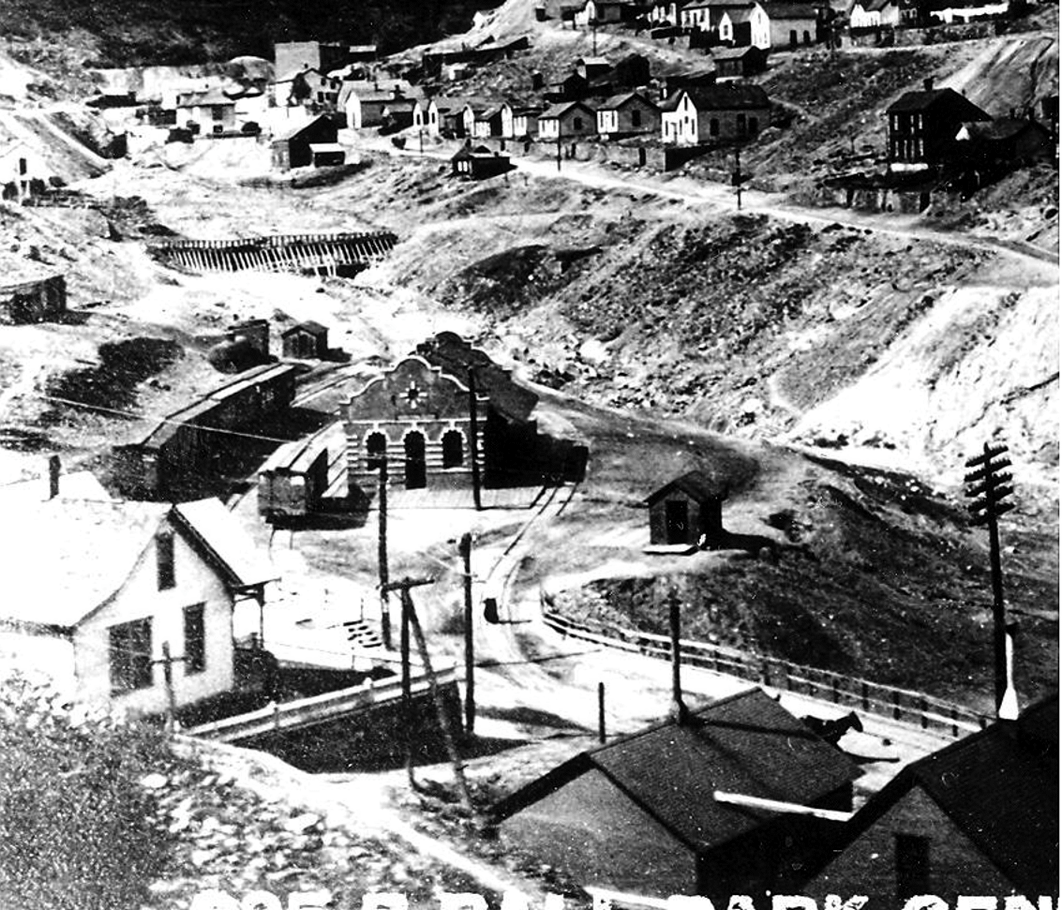 And last, but not least, an AP Photo of the new Central City Depot. It is a copy of a Newspaper photo, so it's not the best. 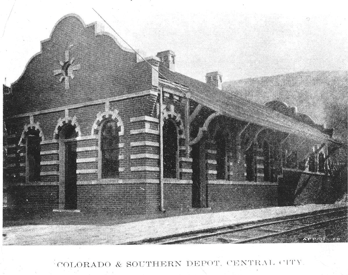 I am working from actual photos, so I have no idea where/what or how the negative numbers are at DPL or SHSC. Rick |
|
This post was updated on .
In reply to this post by Rick Steele
Rick, thanks for all the photos and input. On the Central City mine, photos show coal cars parked on the Sauer-McShane spur feeding chutes to the mine. Also, on the valuation map, note "chute" written next to spur 1. This was the lumber chute.
One correction: the lumber planing mill was named Quance, not Quigly. It was on Gregory just below the Central City mine and would've been a perfect candidate for a chute right from the start. But I've seen no evidence of one, and no photo indicating a chute off the mine/Sauer-McShane spur (#2 on the 1918 Valuation) before it was put in in April 1905. Chris, the one photo where you mention a boxcar sitting on a spur to the right of the station, to my eye I see the tracks continuing on to right to the switch just prior to the EOT. One thing about L-207: is that a tank car or a tank used for oil storage? Also planning to stare at this a while, that is where the team spur turned in to fit the space.
Dave Eggleston
Seattle, WA |
|
In reply to this post by Rick Steele
Fixed it for you (and others): See my above post with edits in bold for clarification. 
At least I didn't use my old NZR terms, we usually called 'em "roads". "Run down an empty road", "walk up and set the road", or "put it on the 3rd road".  Rick, is there any merit to suggesting that the Topomap Surveyors "saw" wagontire tracks in the dirt and mis-took those for the track between the old Freighthouse and the curving Boxcar track in the Harry Lake photo? These do show in latter views of the Scale and could at a distance be thought as rails.
UpSideDownC
in New Zealand |
|
Rick and Chris,
Thanks so much for the additional photos! I dunno, Chris, I think that your initial interpretation of the topo map that you posted on the first page of the thread is correct: 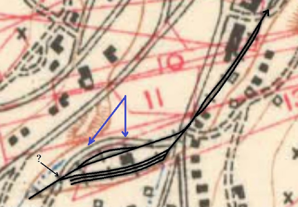 The map shows the teamsters wagon road running in a curving manner to the city side of the freight house / depot at the edge of the embankment above the ball park (blue arrows) and outside of the short 4-5 car siding with boxcars in the Lake photo. Consider the beautiful enlargement of the depot area in the "Ball Park" photo that Rick posted: 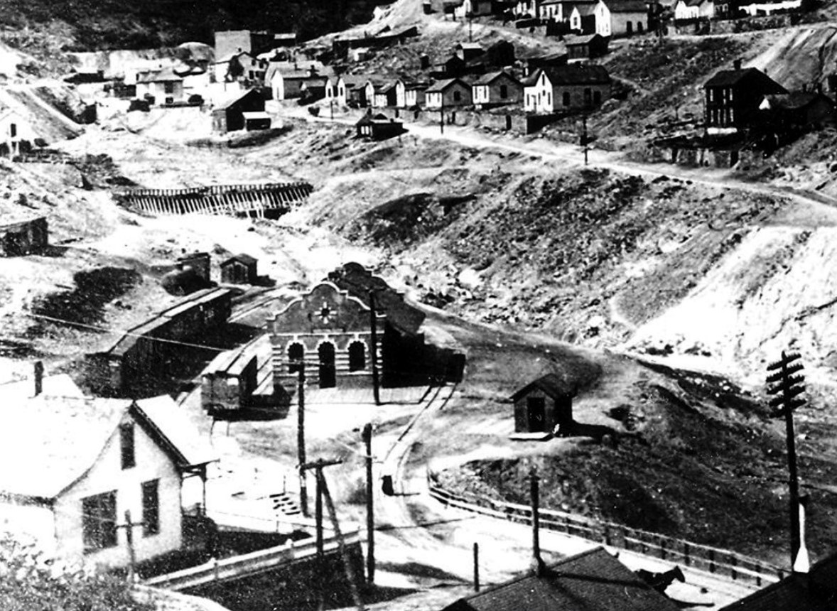 To me, the teamster road is still there, curving along the top of the embankment, passing past the small wagon scale house. If you imagine that the old freight house is located exactly where the new brick depot sits, I think there is adequate space for the short double ended siding by the little warehouse on stilts, inside of the wagon road, as seen in the Lake photo of the 1890s. I think there would be adequate clearance of the track next to the city side of the freight house / later brick depot: 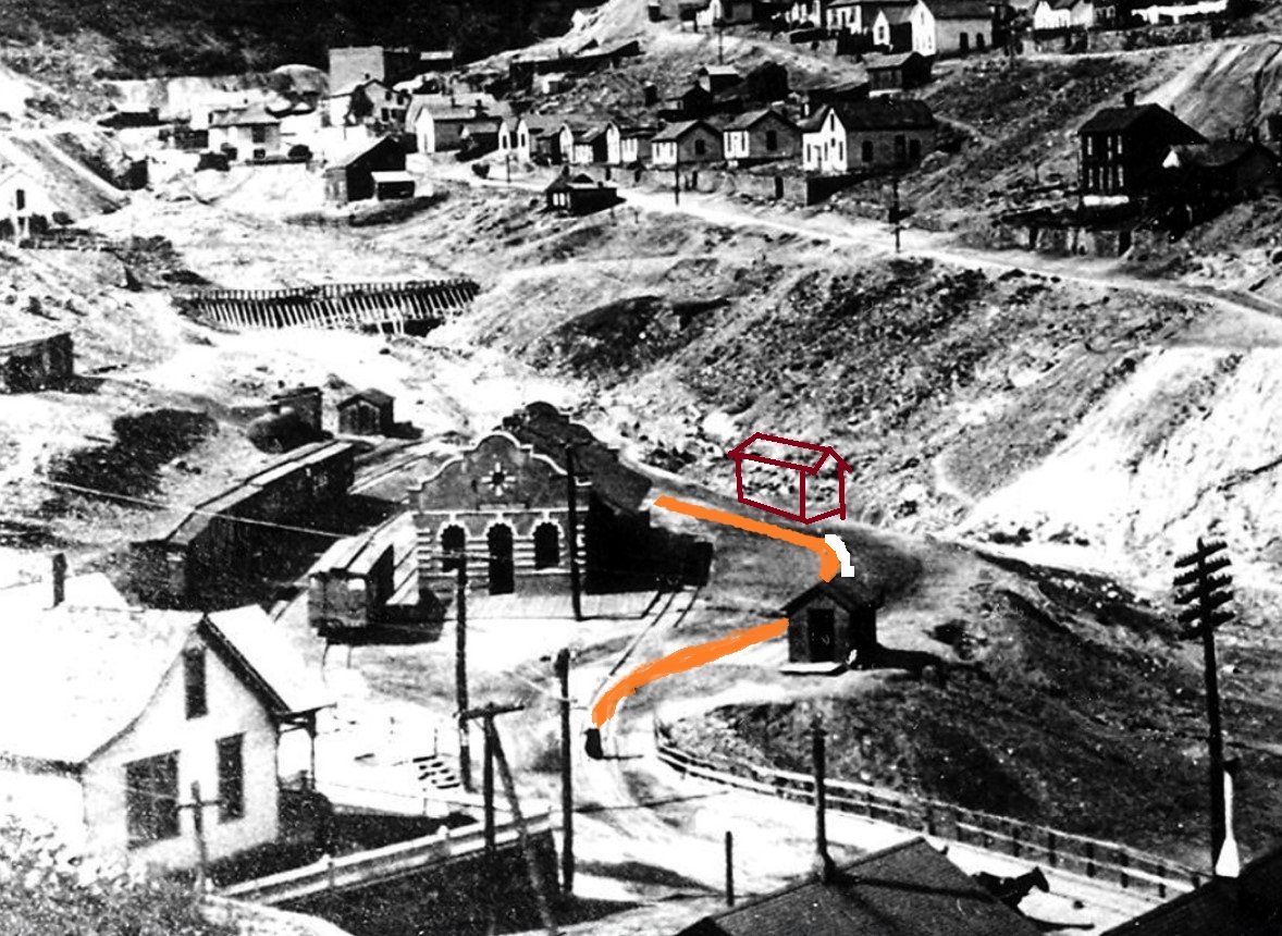 The little warehouse on stilts was probably gone long before the brick depot was built, likely the short siding as well. If the yard area had be widened with the trackage spread to accommodate the new brick depot, seems to me that it was done by digging out part of the hillside to the left of the depot. Your topo map doesn't show a teamster road on the uphill side of the yard to serve the left-hand spur, but there was one there after the brick depot was built:  The new teamster road also allowed access to the little oil depot at the far end of the yard. Just my two more pesos worth. . .
Jim Courtney
Poulsbo, WA |
«
Return to C&Sng Discussion Forum
|
1 view|%1 views
| Free forum by Nabble | Edit this page |

