Okay, now let's move forward and address a "Phenomena."
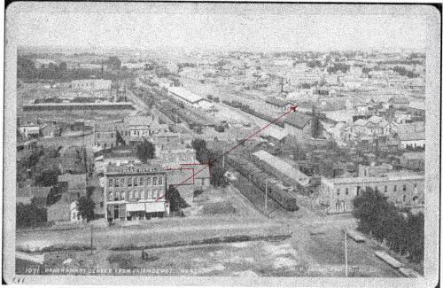
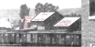
I have drawn a red line that intersects two roof tops which is in line with the corner of KP station.

They appear to be beyond the D&RG station which would be positioned at the time the photo was taken, South West of 19th and Wynkoop Streets.

In this greater photo, (Please follow link), the freight building invasion once again. But there are no two other buildings that might line up to appear in line from the corner of the KP that align.
But anyway, we know that the D&RG station and freight depot were behind the telegraph line along 19th street.
And we are established that the Ben Delaney building was on the corner of 19th and facing Wynkoop St. (Longer than it was wide.)
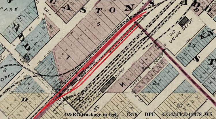
This is what throws me. Chris has pointed out that the D&RG Freight building and station are here North East of the Ben Delaney building.

I am not dismissing it Chris. You have shown a map that positioned 'depots' in this area. 1883 according to the city directory.

maybe these depot and station were just moved along to the South West corner afterwards? It is nothing more or less than I have suggested, that is sliding the D&RG station or part of, in-between the Ben Delaney building and the building next door, both of which I say were moved to Como.
I say, it would be easier to do this than sending the carpenters team to build new buildings with a pack of wood and their hammer, hand saw, chisel, and plane.
But Chris,
I am interested. Do you know the date this last photo was taken? Or have any other detail? 1883 would be the key.