In Gerard's recent sawmill thread, our esteemed South Park, asked the question,
What was shipped at Braddocks, on the High Line above Breckenridge ? Was it just props ?
I do remember an over-track crane/rack for loading and stacks of material waiting to be loaded. Seems to me, I recall the material was sawn, but I could be remembering it wrong.The more interesting question is not what was shipped out of Braddocks, but
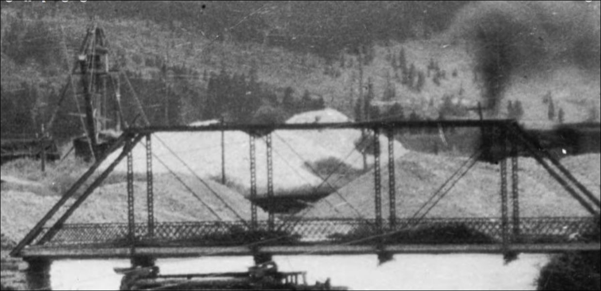
what was shipped into Braddocks.Braddocks was located 3.29 miles north of Breckenridge and had a 32 car siding, offset a ways from the mainline a bit. Prior to the turn of the century it was merely a passing siding between Dickey and Breckenridge, as this familiar photo illustrates:
Kindig, et al.,
The Pictorial Supplement . . .A four engine Boreas bound freight is in "the hole" for the Leadville passenger train to pass.
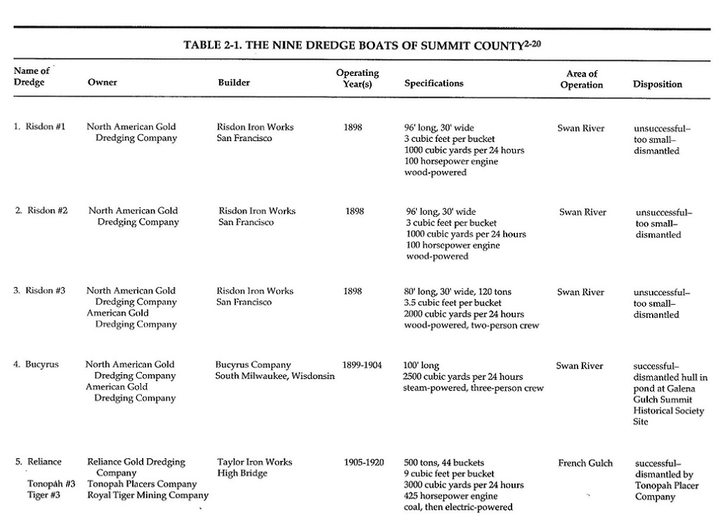
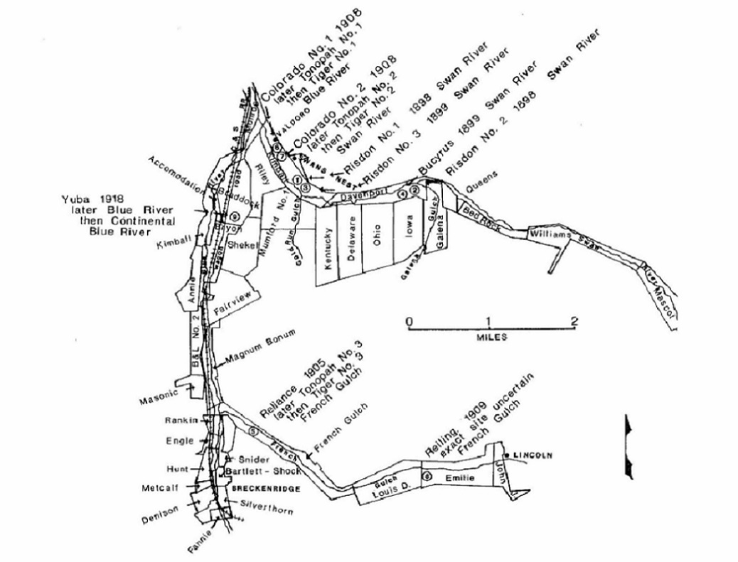
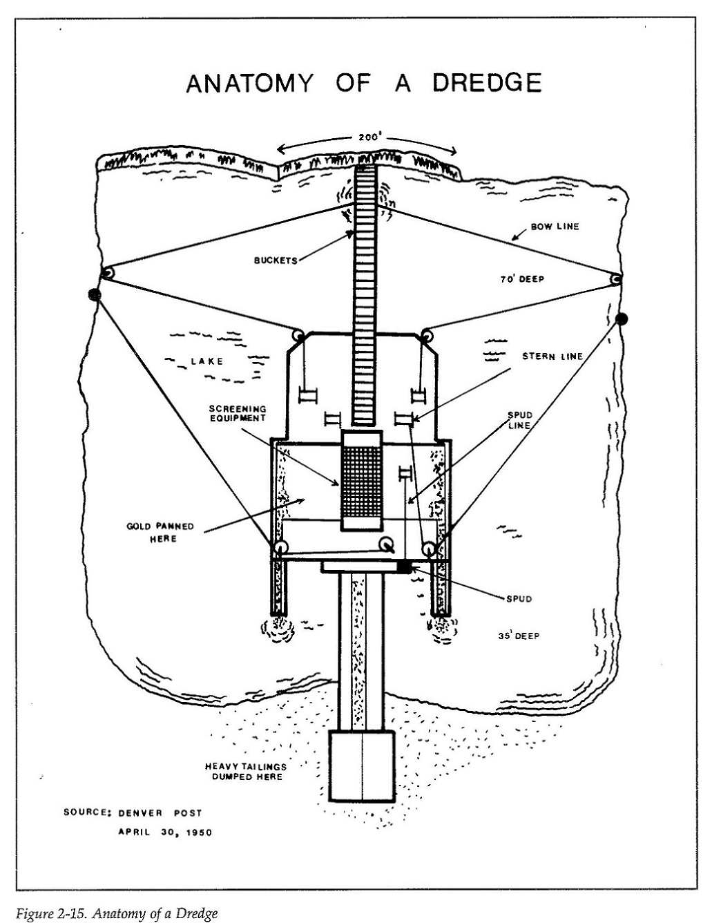
But beginning in 1898, Braddocks and Valdora (a 13-car spur one-half mile to the north, near the confluence of the Swan and Blue Rivers) became the staging areas for the construction of most of the gold dredges that were built between 1898 and 1918.
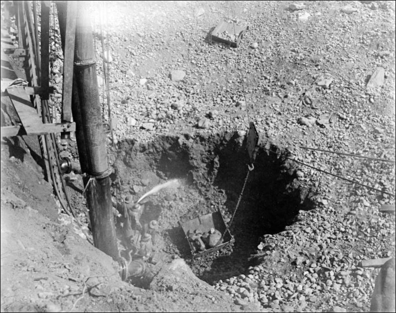
All the timber for constructing the hull, deck and super structure of the vessel, most of it Oregon fir, was shipped in by the C&S and unloaded at Braddocks or Valdora and moved to the construction sites by team and wagon. That was followed by carloads of machinery from the east coast or California (depending on the builder) including the power plant (boilers in the early dredges, later large electric motors), the large bucket arms, the buckets themselves and parts for the spud poles (anchoring the dredge in it's pond) and the metal parts for the conveyors that deposited those ugly piles of gravel behind the slowly moving dredge.
The materials for the first two (unsuccessful) Risdon dredges were likely unloaded at Braddocks in 1898 and hauled up to the Swan River for construction.
The third Risdon dredge was constucted in April of 1899, with 18 carloads of machinery set out at Braddocks.*
The fourth dredge was the first Bucyrus dredge constructed, also in 1899:
As far as materials for the 4th dredge, DL&G records indicate that 100,000 board feet of timber from Portland, Oregon, was shipped to Braddocks, one-fourth of the timbers were 40 to 50 feet long, requiring two flat cars to haul them from Denver. Some of the timbers were 24 inches square. In addition, 200 tons of machinery were shipped. The steel spud poles required shipping on 3 flat cars, one being an idler between the load bearing cars.
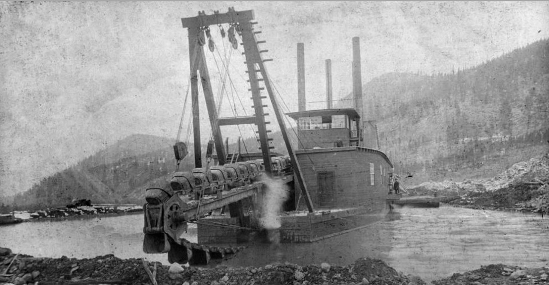
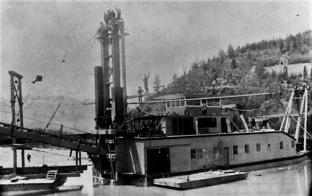
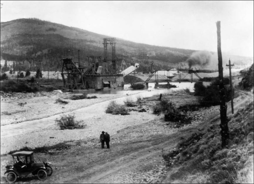
In 1907, the Colorado Gold Dredging Co. simultaneously built the 6th and 7th dredges, Bucyrus products, on the lower Swan River, just above its joining with the Blue River. The spur at Valdora to the river building site was constructed then, so that materials on C&S freight cars could be delivered directly to the building site. Both dredges were electrically powered and cost $105,000 each to construct. Both began operation in May of 1908:

The 7th dredge (right) is beginning its journey up the Swan River. The 6th dredge (left) will work a short distance down the Swan, make a left turn at the Blue River and work the east bank of the Blue River all the way to Breckenridge, stopping near the depot in the 1920s.
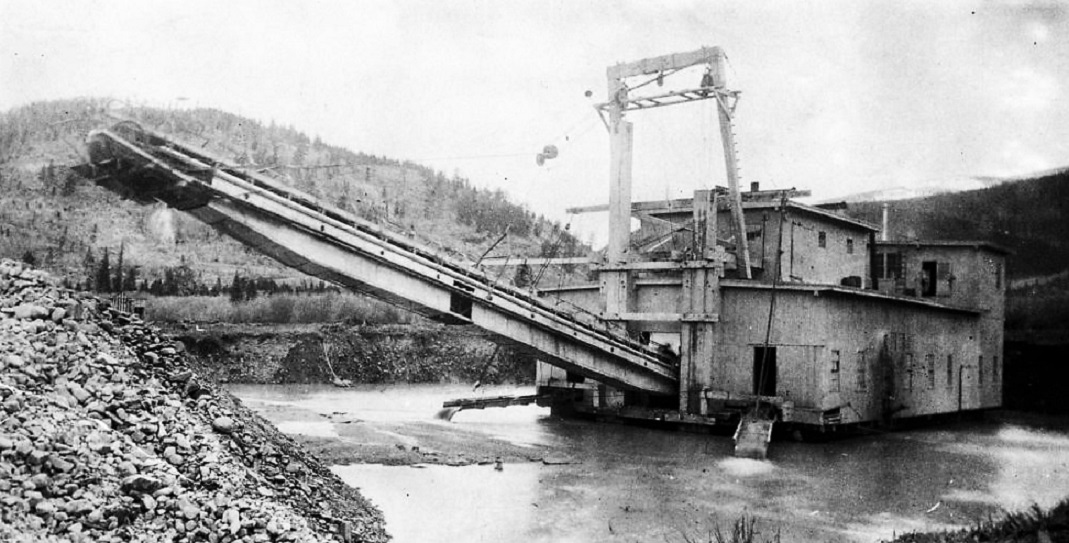
Some photos of the 6th dredge:
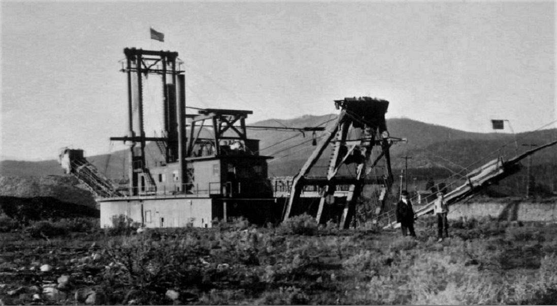
June, 1917. A WWI view, flying a battle flag.

July, 1918. At Two-Mile Bridge.
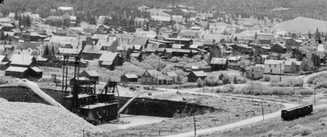
About 1925. Resting near the C&S depot and yards in Breckenridge. The dredge wouldn't begin working into Breckenridge proper until after 1938, when the railroad was gone.,
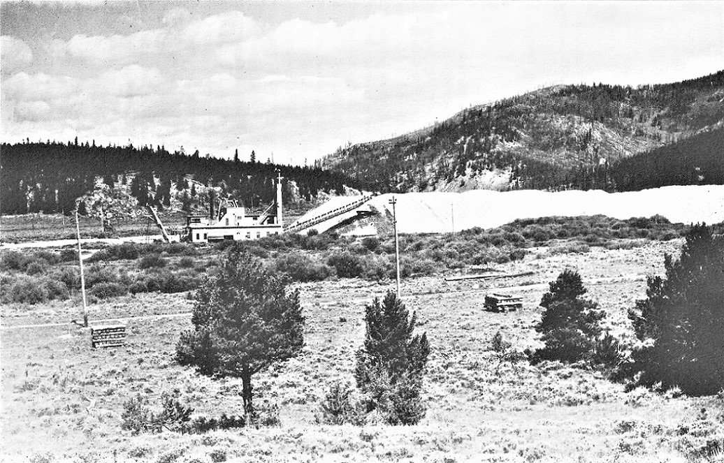
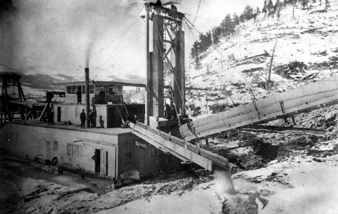
The busiest time period for Braddocks was 1917-1918 when it served as the staging area for construction of the 9th and last dredge, built by the Yuba Dredge Company of California for the Powder River Gold Dredging Co. The dredge pond was dug across the river from Braddocks siding, on the west bank of the Blue. A tent city of Californians was set up at Braddocks for the construction. The 97 bucket dredge was finally completed in April, 1918, a shortage of C&S railroad cars having delayed delivery of the large transformers for the power plant.**
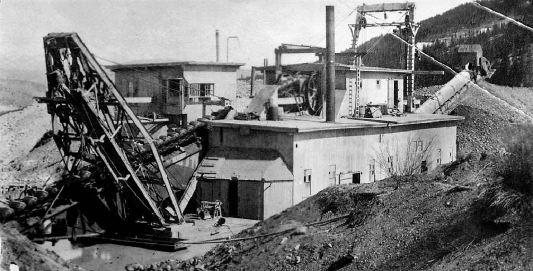
This is how the big dredge looked:
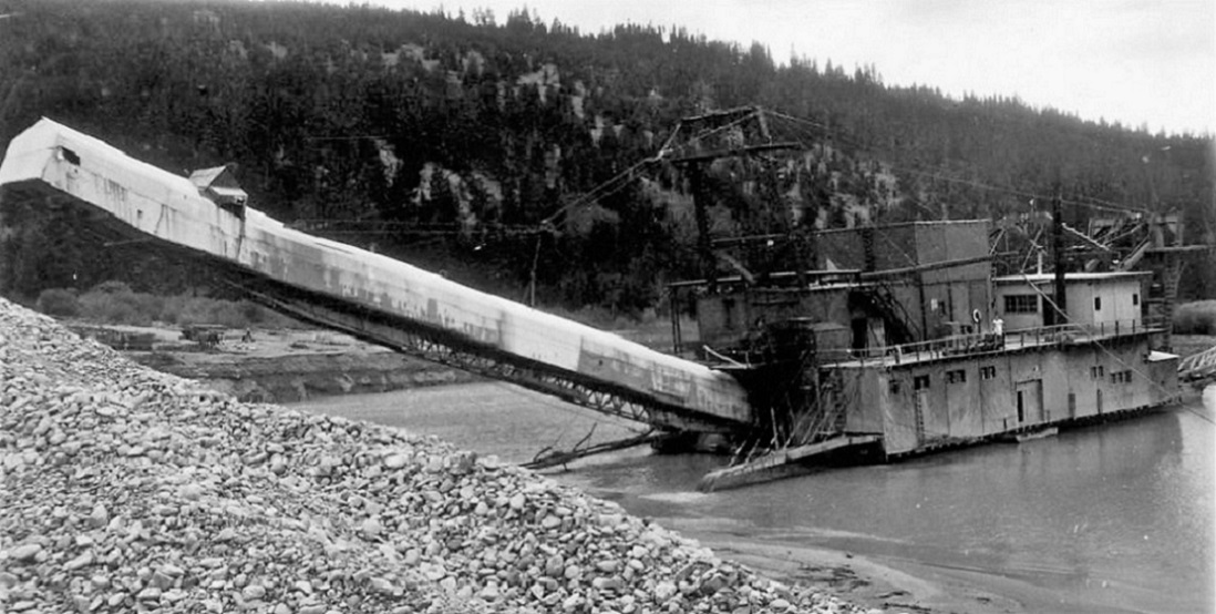
1922
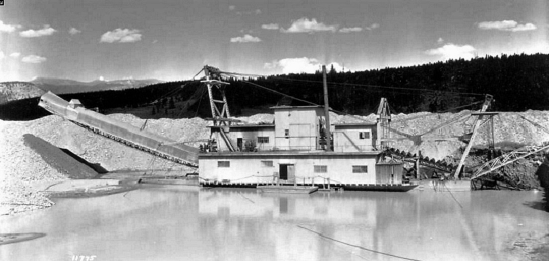
1924

1925
The Yuba dredge was likely the most successful of the Summit County gold dredges, from 1918 to 1938 it was in almost continual operation, under at least four owning companies. It made multiple round trips between Braddocks and the outskirts of Breckenridge, thoroughly chewing up the gravels of the west bank of the Blue River. During its 20 year carrier, it burned to the waterline once and sank in its own pond on multiple occasions, always re-floated or rebuilt. Several employees were crushed, electrocuted or drowned in the dredge pond. When operations ceased in 1938, the dredge was dismantled, the machinery and buckets installed in a new dredge hull near Fairplay. This shipment was likely by truck over Hoosier Pass, as the C&S was gone by then.
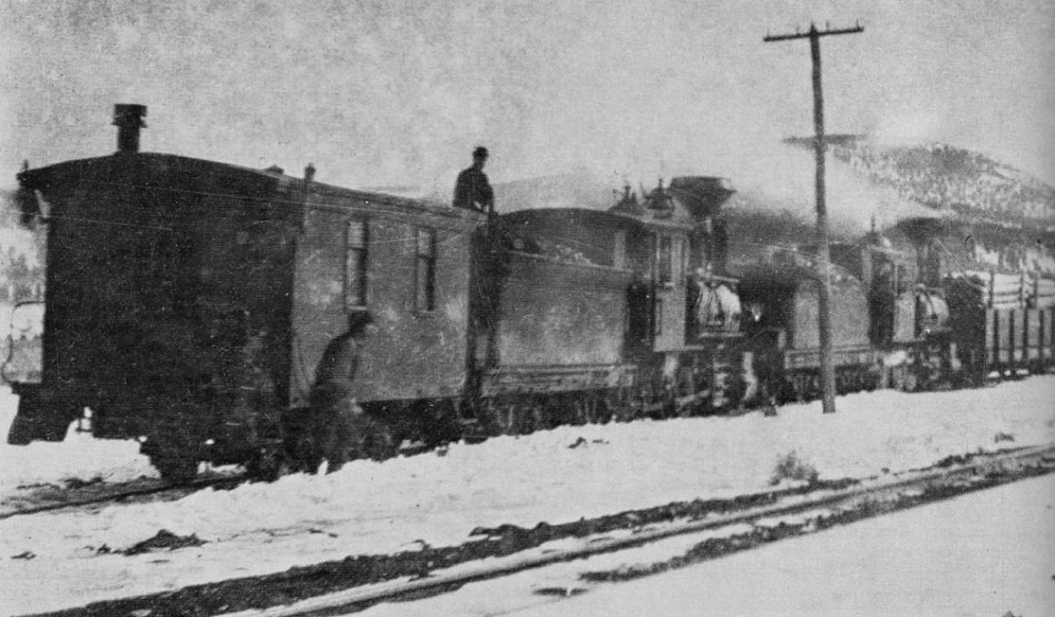
After 1918, Braddocks reverted to being a siding for loading mine props and sawn timbers / ties, the Yuba dredge occasionally passing by, on its back and forth journeys to Breckenridge:

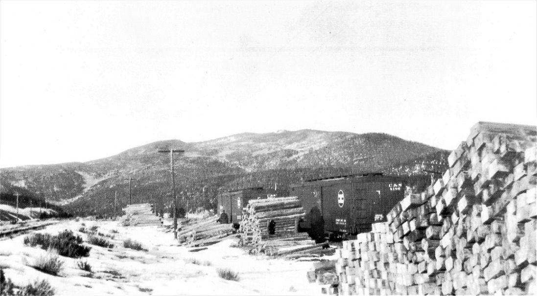
Both photos dated November, 1928. Whately Collection in the Klingers" C&S Platte Canon Memories . . .
It isn't clear whether the wood crane that straddled the siding was installed during the Yuba Dredge construction or was a later addition for the folks shipping timbers.
______________________________________________
*The source for the dredge construction information and photos was Ellis, Erl H.,
The Gold Dredging Boats Around Breckenridge, Colorado, Johnson Publishing, Boulder, CO, 1967. I was lucky to acquire a signed copy many years ago.
**1917-1918 was a time of intense activity in the Climax area. Three companies sought to develop the molybdenum deposits there for the WWI war effort. In addition to the first mill at Climax, a competing mill was built just to the north of Fremont Pass. The C&S was quiet busy delivering hundreds of carloads of construction materials and machinery to the two mill sites, hence the freight car shortage.
When the war ended in 1918, both mills shut down. The Climax mill was the only one to reopen in 1924, as demand for moly again began to grow for industrial uses.
Jim Courtney
Poulsbo, WA


 ...
... ...
...