Braddocks, MP 113.29 -- Center of Gold Dredge Construction
12


12
Re: Re: Braddocks, MP 113.29 -- Center of Gold Dredge Construction
|
Well, what a marvelous thread!
Though I have heard of the Blue River Navy, I never knew it was so extensive. Being that I might just be modelling this area, it is interesting to see, though I don't want to get distracted building a dredge. Constructing a siding a Braddocks has the potential to generate some interesting traffic,though. I wonder how deep the water had to be to be effective? I see references to 30 feet deep in one location. I suppose the key is to create a deep spot in the immediate area around the dredge? Speaking of favorite piles, here are 71, 8 and 69 (I think) making their journey back to Denver after being stored one last winter in Dickey. I am guessing this is the trestle at Two-Mile? 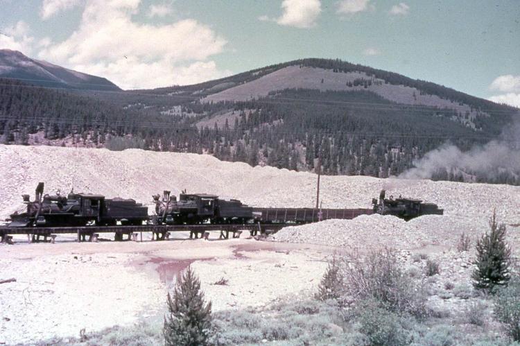 Someone else posted this years ago and I saved a copy for my own enjoyment. I suspect this is from a Kindig slide taken just prior to scrapping. Considering I might be modelling this area someday, modelling those infernal rock piles might warrant some study. Here is the same area today. Colorado Mountain College occupies the area where the rock pile was. 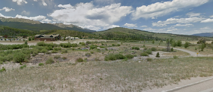
Keith Hayes
Leadville in Sn3 |
Re: Re: Braddocks, MP 113.29 -- Center of Gold Dredge Construction
|
FWIW, there are more posts at the bottom of the first page.
Well, Keith, Como Depot is right! Not much left of the dredging piles today. I seem to remember them to be still present when I was last there in the late 1990's. For you folks who like to collect photos, here are two copies of Jeff Ramsey's "panorama" with out the white center fold "gap". On is the original amber tinted photo, the other in black in white that I played around with. Sorry, I don't remember where I found it:   The panorama of the Tenmile Range (Breckenridge to the left, Dickey to the right) would make a great model backdrop. Now if I can only find someone to "colorize" them.
Jim Courtney
Poulsbo, WA |
Re: Re: Braddocks, MP 113.29 -- Braddocks / Valdora Station Map
|
In reply to this post by Keith Hayes
Since Keith expressed interest in possibly modeling Braddocks, I thought that I'd post part of the 1918 ICC Valuation Map:
 There is a "loading trestle" indicating straddling the Braddocks siding at about the same location as the overhead wooden crane in the 1928 photo posted on the first page--not certain if it is the same one. In 1918, the spur to the Valdora construction site of the 6th and 7th dredges still exists, but is out of service, the switch on the main noted as "disconnected". South Park should note that both the telephone and power lines on either side of the C&S main line are clearly designated. And there is another trestle crossing the Blue for Keith to model, noted as "5-span pile" trestle. To finish posting the stuff I've collected over the years, here are a few photos of dredge construction at Valdora in 1907-1908. All are (poor quality) scans from Sandra Pritchard's Roadside Summit . . . 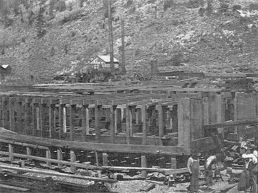 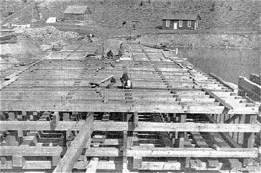 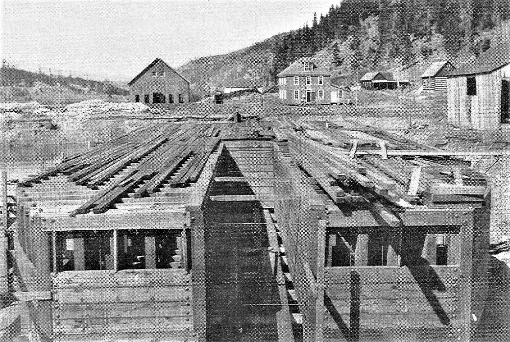 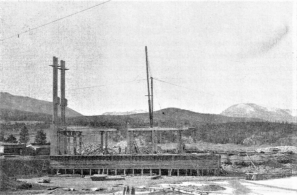 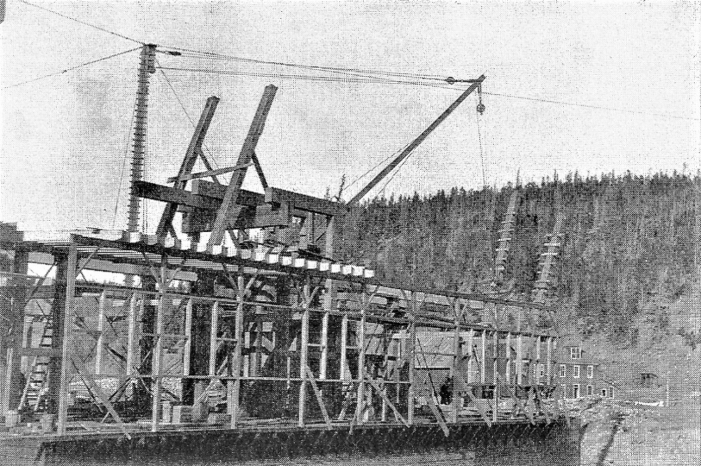 All photos in the Colorado Historical Society collection. And before scrapping operations began, Dick Kindig climbed up on top of the wooden loading crane in the summer of 1938, to take a last look at Braddocks, view to the north, towards Dickey. 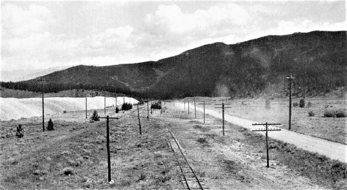 Richard Kindig in Narrow Gauge Pictorial VIII
Jim Courtney
Poulsbo, WA |
Re: Re: Braddocks, MP 113.29 -- Braddocks / Valdora Station Map
|
That last photo really makes me want to get in my Model T
time machine and go driving around the narrow gauge/mining areas in 1920 ! 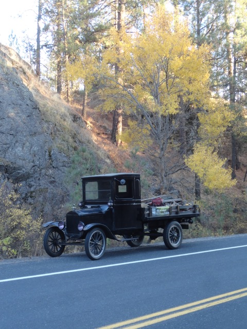
"Duty above all else except Honor"
|
|
I have some photos somewhere of the dredge used on the Tarryall, seemingly much smaller and of course a different design.
|
Re: Re: Braddocks, MP 113.29 -- Braddocks / Valdora Station Map
|
In reply to this post by South Park
I got dibs on shotgun!
Jim Courtney
Poulsbo, WA |
Re: Re: Braddocks, MP 113.29 -- Braddocks / Valdora Station Map
|
OK, I'll be in charge of the transport. You be in charge of spinning the
calendar backwards.  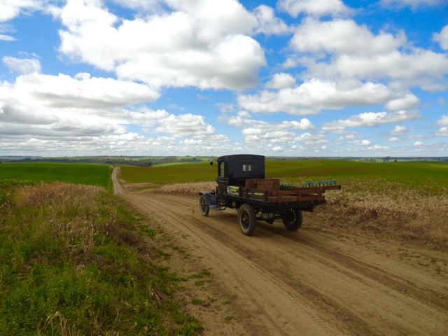
"Duty above all else except Honor"
|
Re: Re: Braddocks, MP 113.29 -- Braddocks / Valdora Station Map
|
Just back from a fall Denver Water survey trip to Breckenridge. I was able to convince the family that it was absolutely important to visit the Swan River drainage with the intent to see the dredge remains in person. Here is what it looks like as of October 2022.
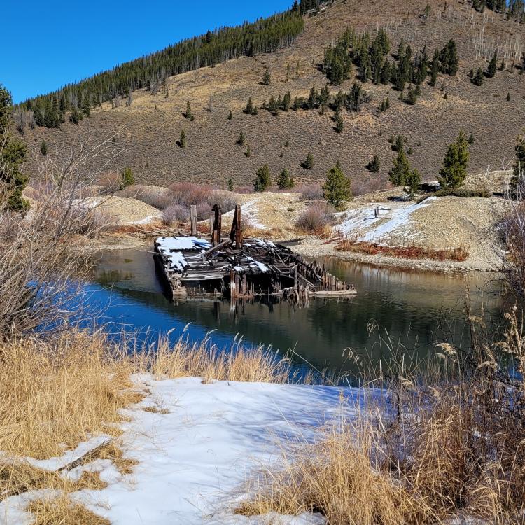 The view from the Blair Witch trailhead parking lot. 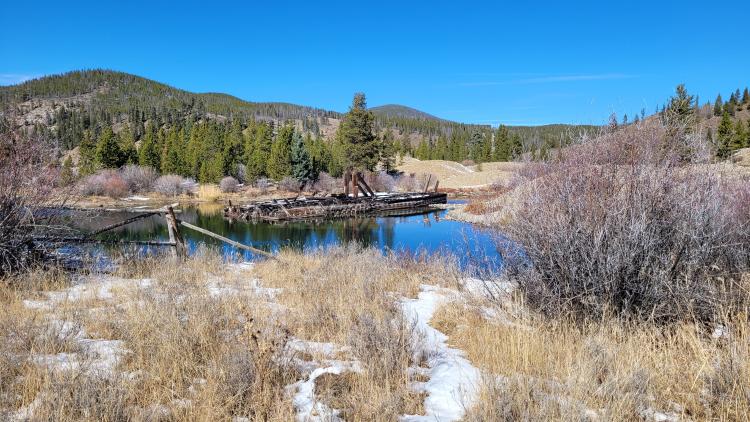 The stern (?) 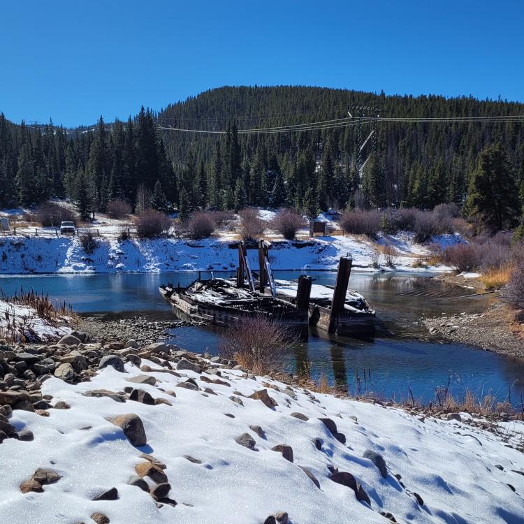 The bow--that is to say the more pointy end 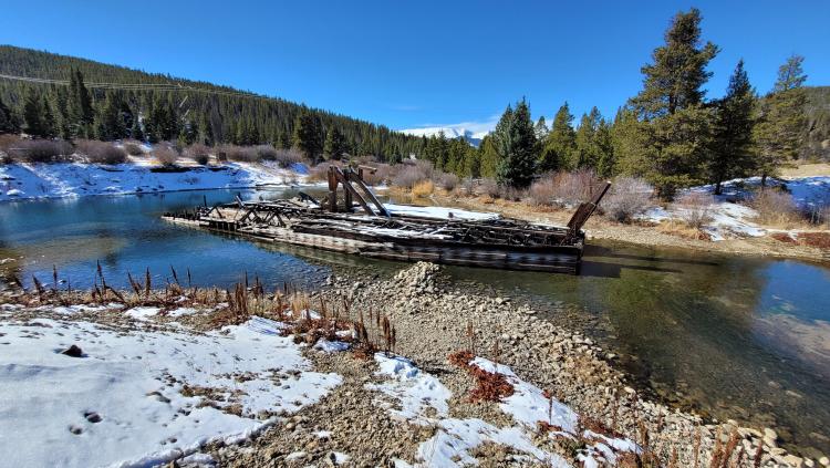 A side view, the eastern edge as it rest in the pond. 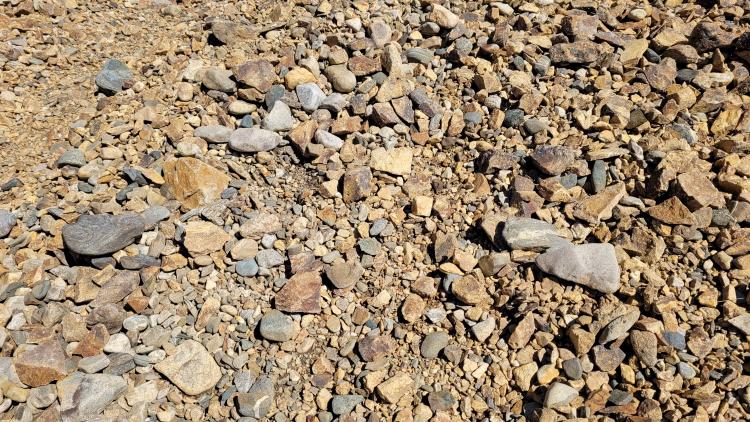 A view of the waste rock for those of you seeking an accurate color reference.
Keith Hayes
Leadville in Sn3 |
Re: Re: Braddocks, MP 113.29 -- Center of Gold Dredge Construction
|
In reply to this post by Jim Courtney
Jim,
The panorama is from the library of congress panorama collection. https://www.loc.gov/item/2007661969/ Ken Martin |
«
Return to C&Sng Discussion Forum
|
1 view|%1 views
| Free forum by Nabble | Edit this page |

