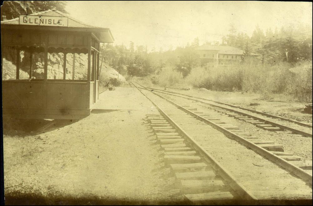
Another DPL Gem: Glenisle.
|
A neat little rustic flagstop and 3-car siding, 100 points to the Brakeman that can get 4 in there.
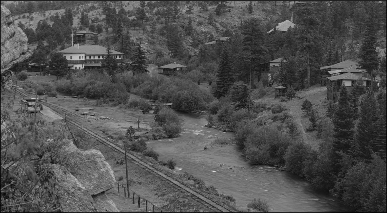 http://digital.denverlibrary.org/cdm/fullbrowser/collection/p15330coll22/id/78009/rv/singleitem/rec/1745
UpSideDownC
in New Zealand |
|
SWEET!
Thanks, Chris. I must model this siding somehow. A while back, the guy in Hawaii worked with Bragdon to develop a slab mould which I have been meaning to order so I could build the flag stop shack that is behind the tree.
Keith Hayes
Leadville in Sn3 |
|
Shawnee was "slab" clad, 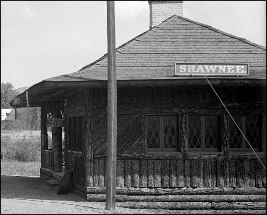 Framed for Glenisle. 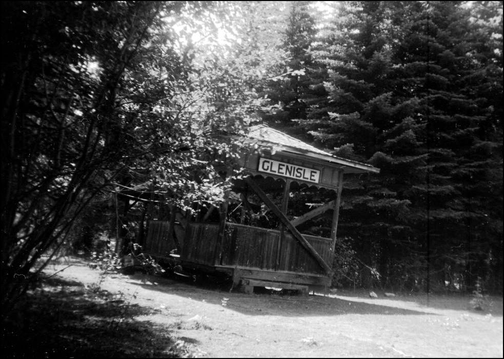 http://digital.denverlibrary.org/cdm/fullbrowser/collection/p15330coll22/id/6171/rv/singleitem/rec/29 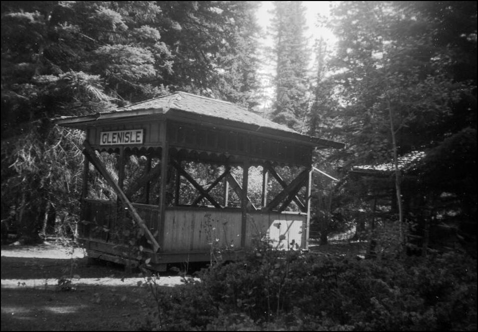 http://digital.denverlibrary.org/cdm/fullbrowser/collection/p15330coll22/id/6173/rv/singleitem/rec/31
UpSideDownC
in New Zealand |
|
This post was updated on .
In reply to this post by Chris Walker
The little depot still exists (as of August 2013), restored and in the little park at Baileys.
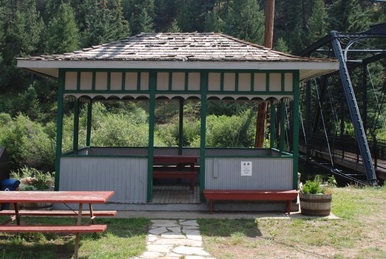 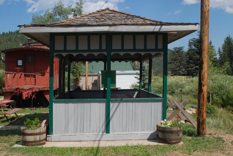 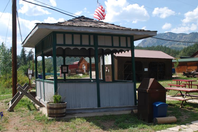
Jim Courtney
Poulsbo, WA |
|
In reply to this post by Chris Walker
I recall there we several other slab-clad flaf stops along the line. Perhaps towards Buffalo? They were much smaller. Shawnee and Glen Isle were rather formidable, what with the double slope roof and the fancy shingle pattern.
Keith Hayes
Leadville in Sn3 |
|
In reply to this post by Chris Walker
Chris, the flag stop that caught my eye turns out to be Ferndale. Much smaller and all slab-clad.
Keith Hayes
Leadville in Sn3 |
|
Administrator
|
In reply to this post by Keith Hayes
Mike Blazek offers plans for all of the Platte Canon flag stops: http://blazeksplan.com
|
Re: Another DPL Gem: Glenisle.
|
I notice that Mike lists under the label Chalk Creek:Depot Prototype.What station does this represent?
|
|
Administrator
|
You'll have to ask him Robert.
|
|
In reply to this post by Jim Courtney
Hats off to Pat Mauro for the preservation the this structure and the Society he volunteered for.
|
|
In reply to this post by Chris Walker
Here is the wait station at Santa Maria shot in 2012 during the DSP&PHS meet in Bailey.
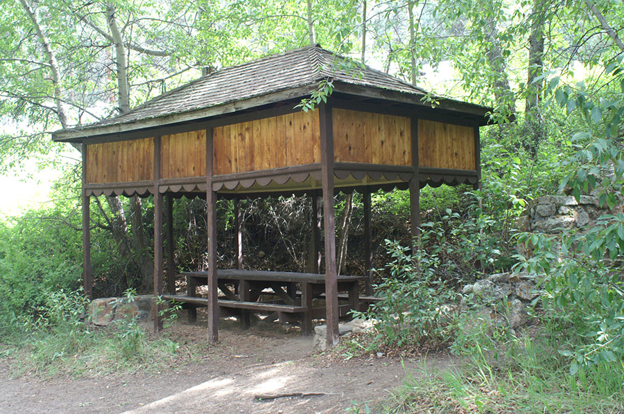
|
 http://cdm16079.contentdm.oclc.org/cdm/fullbrowser/collection/p15330coll21/id/11629/rv/singleitem/rec/44
UpSideDownC
in New Zealand |
|
Hi Chris,
This might partly answer another (mostly unrelated) question I had: is there a ditch between the main and a siding on the C&S? It would appear from the Glenisle picture (purposefully left in the reply to ease comparison) that the roadbed is essentially flat across the bottom of the ties, and what little ditch there is is a result of the ballast rising to top-of-tie-height between the rails. The picture of the stub switch and Jefferson siding you brought my attention to earlier (below) is a bit different. The top of the siding rails appears about even with the bottom of the mainline ties, with no ditch at all between the lines: Was either one or the other more typical, or were they all pretty varied? Thanks, Jeff.
|
|
Interesting question, after a quick perusal, I think given the Riverview siding is on the only cultivatable patch of rivers edge, that it is the oddity. That ditch may precede the siding date, thus requiring the seperation or the topography led to the ditch being dug where it is regardless of the siding, who knows? It is certainly different from the normal passing sidings and mainline locations I had a quick squiz at.
NZR was fond of lowering the passing tracks making getting ones bag and self up on to the Loco at changeover a heck of a stretch. C&S doesn't appear to have favoured raising the main, but it may just be a case by case and time period scenario to consider. There is certainly no shortage of pictures on which to base your choice but these pictures are scattered throughout all the usual C&S books, and my illustrations are not the areas that you want to model either. Cliff. 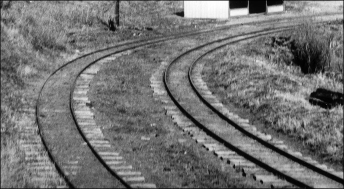 http://cdm16079.contentdm.oclc.org/cdm/fullbrowser/collection/p15330coll22/id/4516/rv/singleitem/rec/1 South Platte. 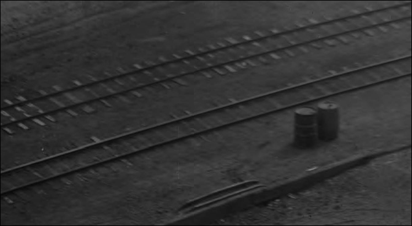 http://cdm16079.contentdm.oclc.org/cdm/fullbrowser/collection/p15330coll22/id/12914/rv/singleitem/rec/1 Webster seemed to be elevated slightly as did Crossons. 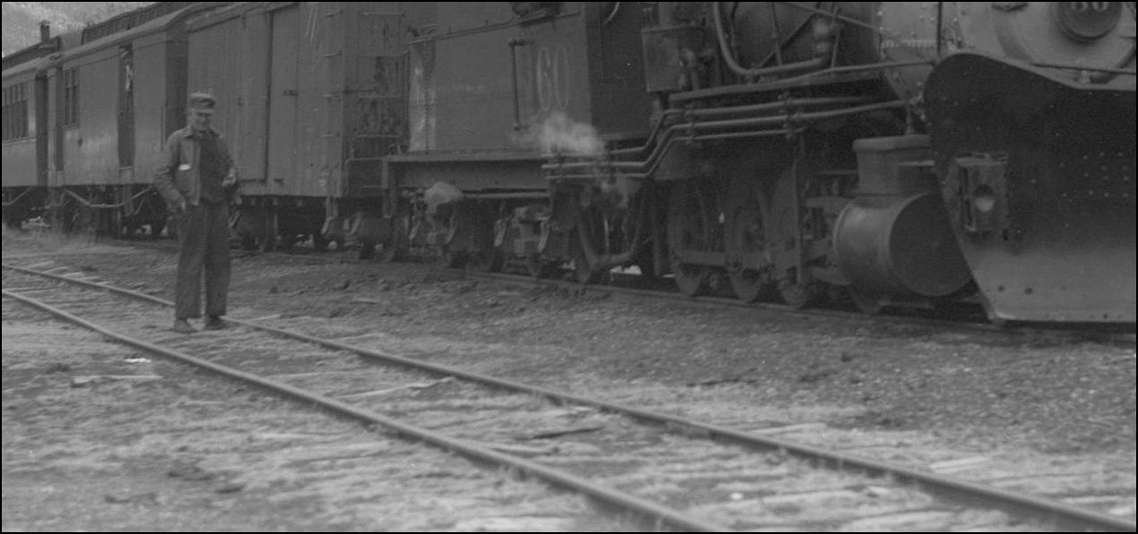 http://cdm16079.contentdm.oclc.org/cdm/fullbrowser/collection/p15330coll22/id/42523/rv/singleitem/rec/2
UpSideDownC
in New Zealand |
|
Hi Chris,
Thanks for those additional scenes. My four sidings are Jefferson and Kokomo (on the C&S), and Sargent and Marshall Pass (on the D&RGW). Fortunately, I’ve found documentary evidence for three of them: Jefferson and Marshall Pass with elevated mains but minimal ditches, and Sargent pretty dang flat. I imagine drainage wasn’t much of a problem for the Kokomo siding / wye (being up on the knoll above the D&RGW ROW). Given the other examples, I think I’ll go with flat there. Cheers, Jeff. FWIW, Marshall Pass does have a ditch on either side of the pair of tracks to drain the cut through the ridge. And post-1940 pictures of Sargent appear to show the main slightly elevated, but that’s just because it has been upgraded to 85# rail while the rest of the yard is ~ 50#. |
|
This must be the most abbreviated Flagstop structure yet.
Located in Platte Canon, at M.P.63.5, Alt. 8353ft with a siding 450ft long, one mile downstream from Cassells. Also known as Chaseville, Weller, Llangollan. 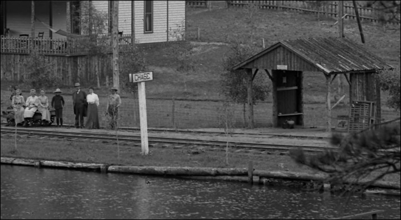 http://cdm16079.contentdm.oclc.org/cdm/fullbrowser/collection/p15330coll22/id/78104/rv/singleitem
UpSideDownC
in New Zealand |
«
Return to C&Sng Discussion Forum
|
1 view|%1 views
| Free forum by Nabble | Edit this page |


