Stanley Mills: Part Three. Two Smelters and the Consolidated Stanley Mines.
Stanley Mills: Part Three. Two Smelters and the Consolidated Stanley Mines.
|
This post was updated on .
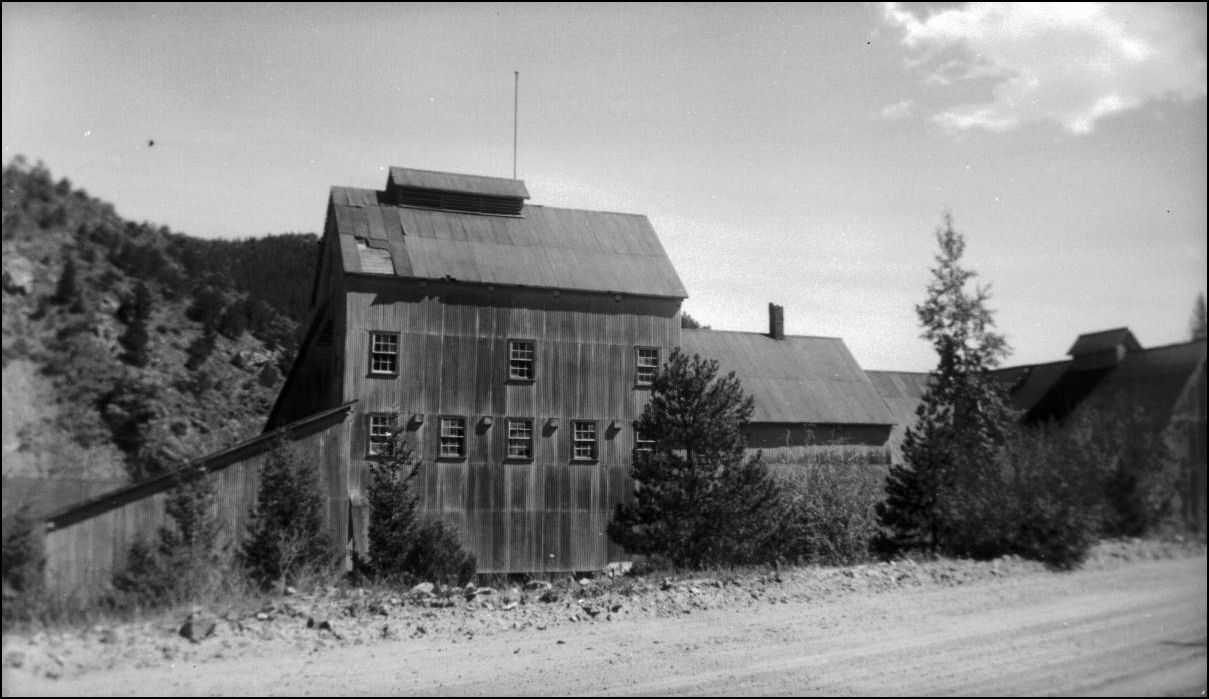 X-3508 http://cdm16079.contentdm.oclc.org/cdm/fullbrowser/collection/p15330coll22/id/6201/rv/singleitem Out past the Western end of Idaho Springs was a place called Spanish Bar named back in the days when the Clear Creek was being Placer mined. Once the sluice miners moved on further upstream to richer "diggings" the hardrock miners moved in and laid claim to this area that later came to be known as Stanley Mills on the C&S. Here there were a large number of mines and a couple of smelters were established. The location of the largest and longest lived Mine, actually on a Railroad siding served by the C.C./U.P.D.&G./C.&S. and still standing today pretty much in the same form as when the C&S pulled out way back in 1939, that story is to be found here. One of these Smelter buildings was re-purposed for a seperate mining claim before being demolished. There has been several mis-interpretations of that in previous publications which I hope to set right here and also show why the new Shafthouse of the Plutus was completely replaced by another nearby only after a few short years. Much re-development of this area under the Con. took place over the years and the following photographs will illustrate this to good measure. I have touched on this area previously in Stanley Mills: Part One....The Lincoln and Alma-Lincoln Mills. http://c-sng-discussion-forum.254.s1.nabble.com/Stanley-Mills-Part-One-The-Lincoln-and-Alma-Lincoln-Mills-tp3389.html and in Stanley Mills: Part Two. Salisbury Mill and Donna Juanita Mine. http://c-sng-discussion-forum.254.s1.nabble.com/Stanley-Mills-Part-Two-Salisbury-Mill-and-Donna-Juanita-Mine-tp3483.html In past written works, this whole area has some confusion as to the application and useage of the Stanley Mine name which was the Road Level Tunnel located adjacent the (newest) Gehrmann Shafthouse that still stands today, the "old" Stanley Shafthouse was the Plutus Mine. Add into this the former Hukill and Whale Mines became the Stanley Consolidated with the Crockett, Salisbury, Pride-of-the-West and York properties among a host of other claims and you can easily see where some confusion exists in the vernacular. The Whale Adit has also been known as the Stanley Mine and the Skyrocket Mine was also called the Stanley Mine to add further confusion. To this extent I have used the USGS references 1908, 1917 and 1966 to compile this but make no attempt to unravel the complex corporate structure of the various Mining Companies that oversaw the operation of the numerous claims.    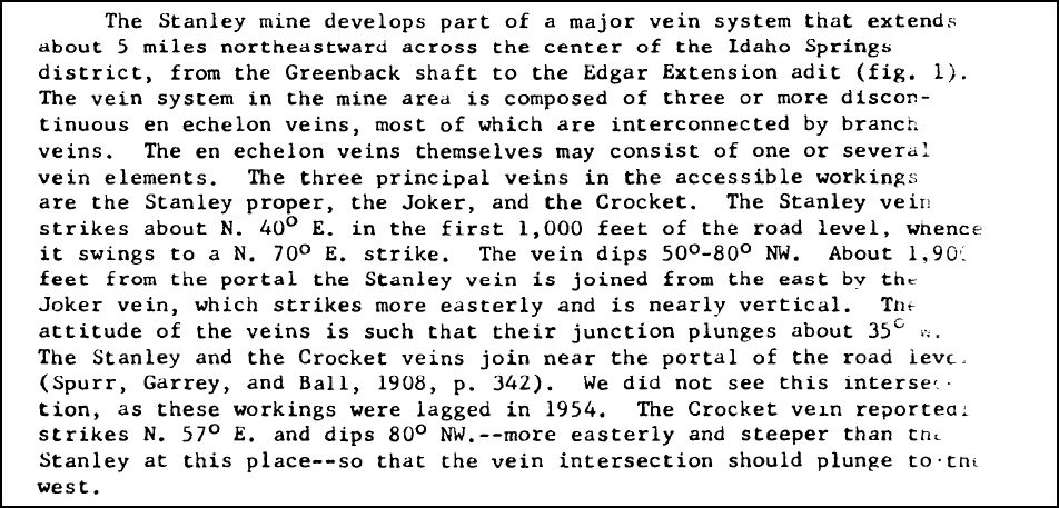 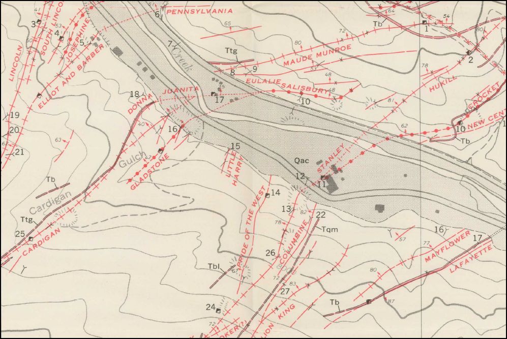
The first of the "new era" Smelters on Spanish Bar was the Whale. 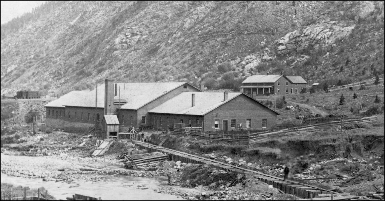 CHS.X4592 http://digital.denverlibrary.org/cdm/fullbrowser/collection/p15330coll21/id/10098/rv/singleitem/rec/63 This building was later truncated and modified into a Mill for the adjacent Crockett Mine on the North Bank of Clear Creek but lasted in this configuration only for a short time. It did not become the Stanley Con Smelter as stated in Abbott/McLeod Colorado Central Rail Road, Sundance Publications pg320 and 322. The derelict Brick foundation rectangles of this building were still to be seen in many of the later views and the adjacent Boardinghouse, that later became the Stanley Hotel provides a key locator. The single large-stacked Whale Smelter building construction was similar but differing considerably to that of the nearby Plutus Smelter built later and shown in this photo below.  from pg 26 Secure The Shadow: Lachlan McLean: Colorado Mining Photographer Duane Smith/Hank Wieler CSM Press 1980 Of interest was the Crockett Tunnel portal directly alongside the grade of the Colorado Central. The Mill building is now only half the original length of the Whale Smelter. In the foreground is the newly constructed Plutus Hoisthouse. 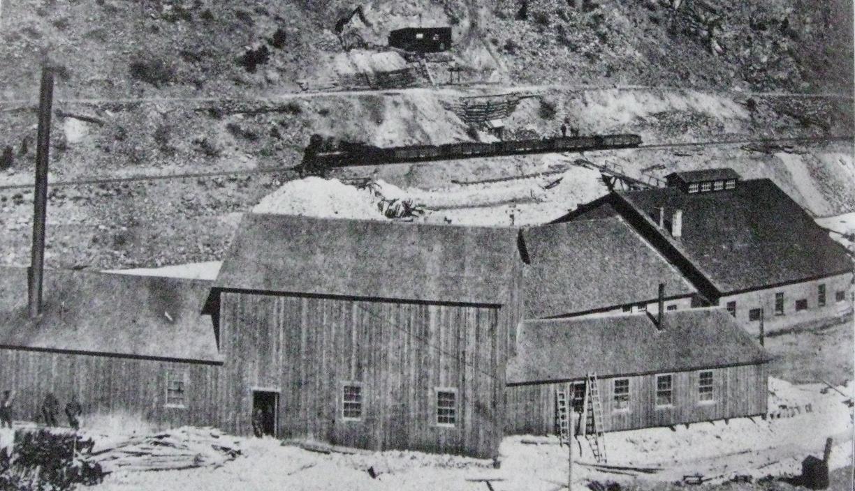 from Abbott/McLeod Colorado Central Rail Road, Sundance Publications pg322. In Mills of Fall River. Connecting the Dots. http://c-sng-discussion-forum.254.s1.nabble.com/Mills-of-Fall-River-tp2576p2809.html I introduced several photos of a Flume under construction shown here in a companion view by Lachlan McLean.  Z-4758 http://digital.denverlibrary.org/cdm/fullbrowser/collection/p15330coll22/id/87952/rv/singleitem/rec/525 that led to this building shown on the left. 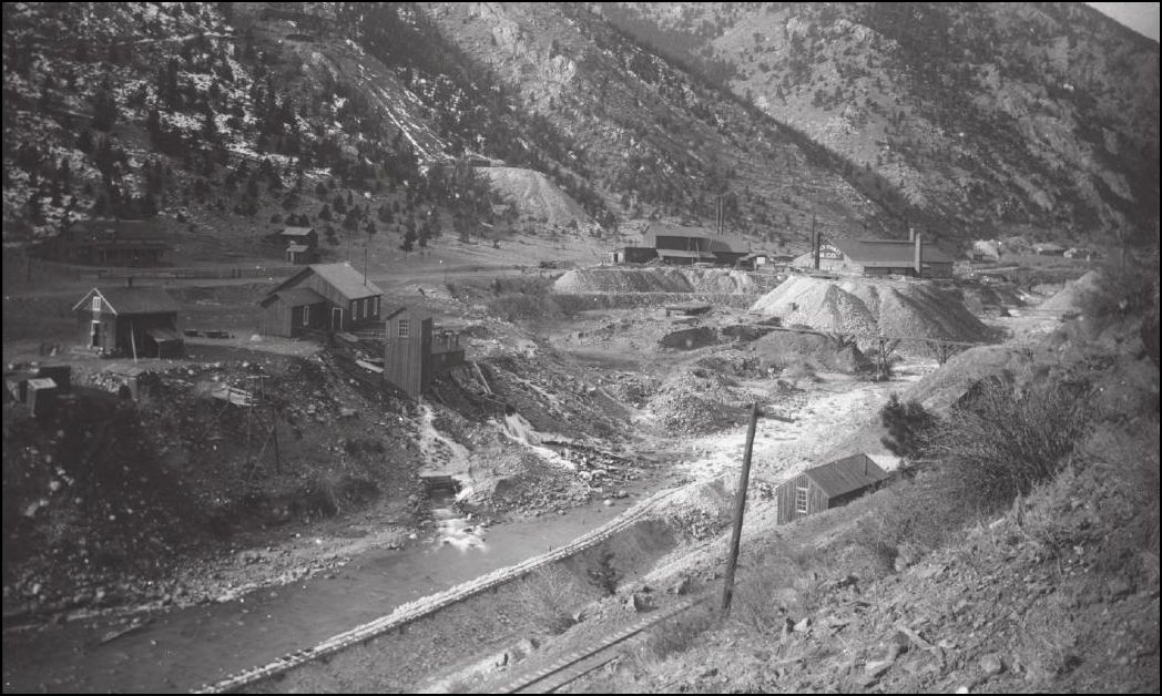 Lachlan McLean photo Idaho Springs Historical Society coll. An inside view of the Compressor House. 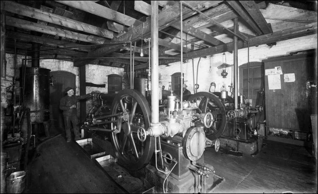 CHS-B396 http://cdm16079.contentdm.oclc.org/cdm/fullbrowser/collection/p15330coll21/id/3886/rv/singleitem/rec/43 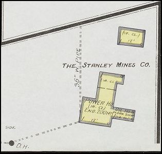 Sanborn Fire Map 1908  from the Colliery Engineer and Metal Mines 1894, Volumes 14 and 15. (SIC Standley) Installation of the Nozzle that required some good old-fashioned hard work digging down that deep in the bed of Clear Creek with only handtools. 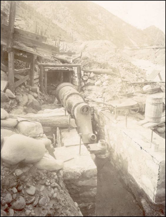 Z-4761 http://digital.denverlibrary.org/cdm/fullbrowser/collection/p15330coll22/id/80202/rv/singleitem Note that this snippet from Colorado School of Mines Library confirms the 1894 Date. General mining news. Colorado (Nov. 3, 1894).  1. Plutus Smelter 2. Plutus Mine Hoisthouse 3. Salisbury Mill 4. Foundation remains Whale Smelter 5. Boardinghouse 6. Powerhouse 7. Crockett Tunnel 8. Whale Adit dump 9. (Future site) Gehrmann Shafthouse 10. Lincoln Mill 11. (Future site) Donna Juanita Headframe (orange) 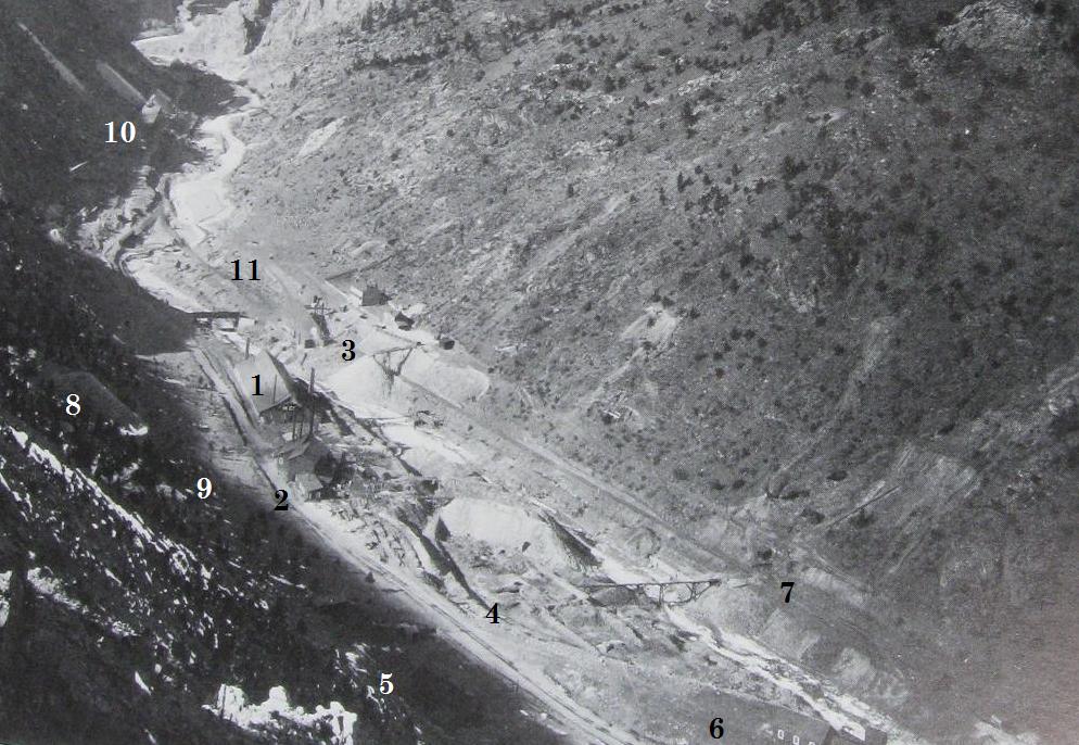 Lachlan McLean photo Idaho Springs Historical Society coll. The Mayflower Mill and Hoisthouse was a short distance East of the Whale Smelter. 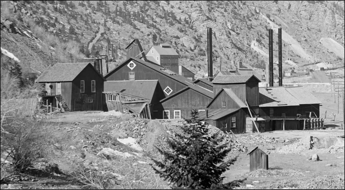 CHS-B678 http://digital.denverlibrary.org/cdm/fullbrowser/collection/p15330coll21/id/4034/rv/singleitem/rec/510  Sanborn Fire Map EDIT: Lachlan McLean photo 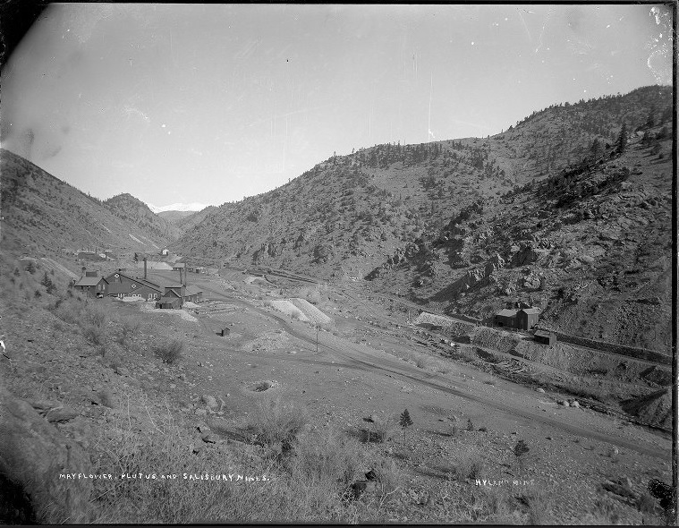 enlarged to show the Hyland Mine(the stealthiest mine building ever).  The Mayflower came under control of new owners.  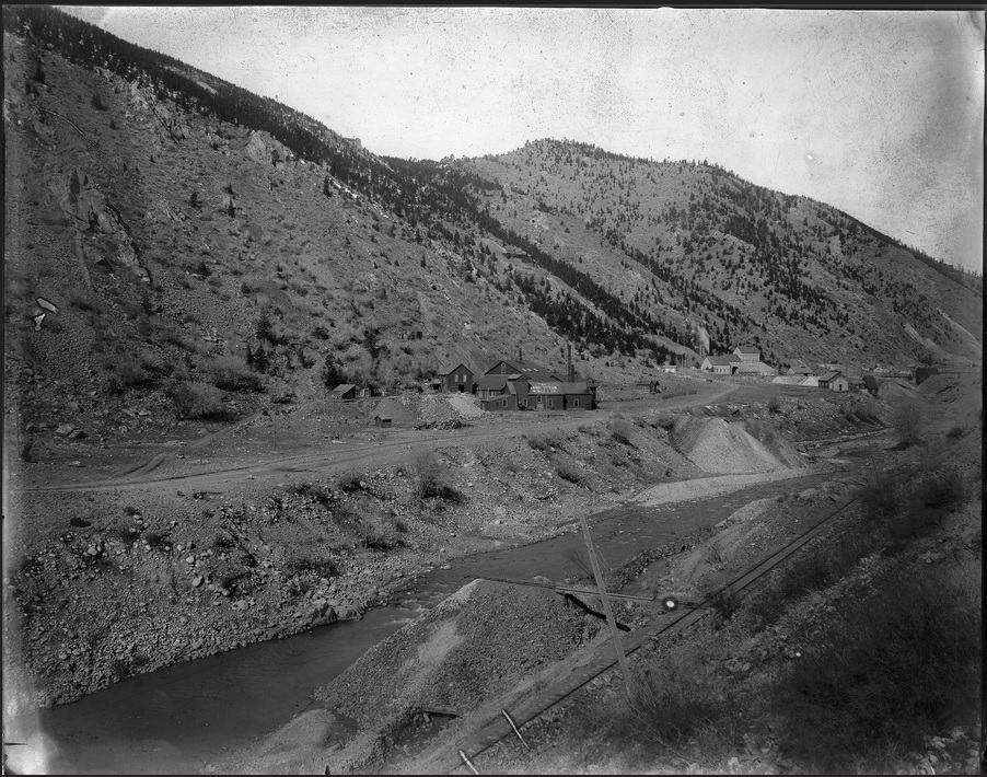 Lachlan McLean photo 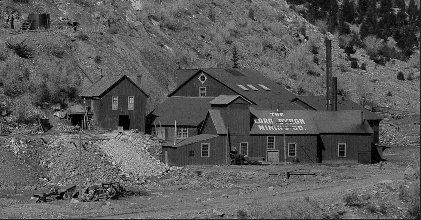
UpSideDownC
in New Zealand |
Re: Stanley Mills: Part Three. Two Smelters and the Consolidated Stanley Mines.
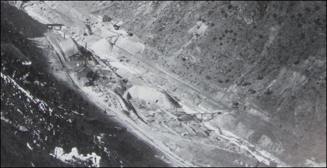 Lachlan McLean photo Idaho Springs Historical Society coll. What a marvelous inspirational sight this must have been to the Mining Investor. The Complete Plutus nestled in the Clear Creek Valley. By the date of this the Whale Smelter is but a few bricks left, this snippet from the 1879 Engineering and Mining Journal 28(13) p 221-222 may or may not provide an answer ... The Hukill, now including the Whale, is showing good ore; The Hukill concentration mill was removed due to insecure foundation walls; a new mill of 100 tons will be built. the Crockett Tunnel now just a waste rock dump outlet and the Plutus Shafthouse will be replaced within 5 years. 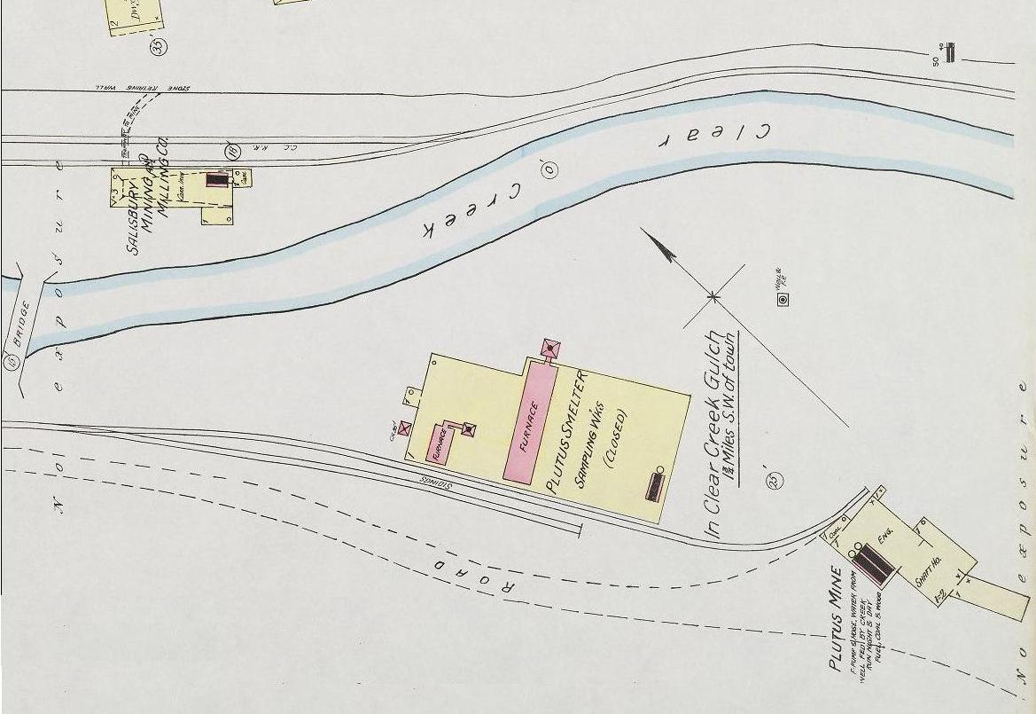 Sanborn Fire Map 1891 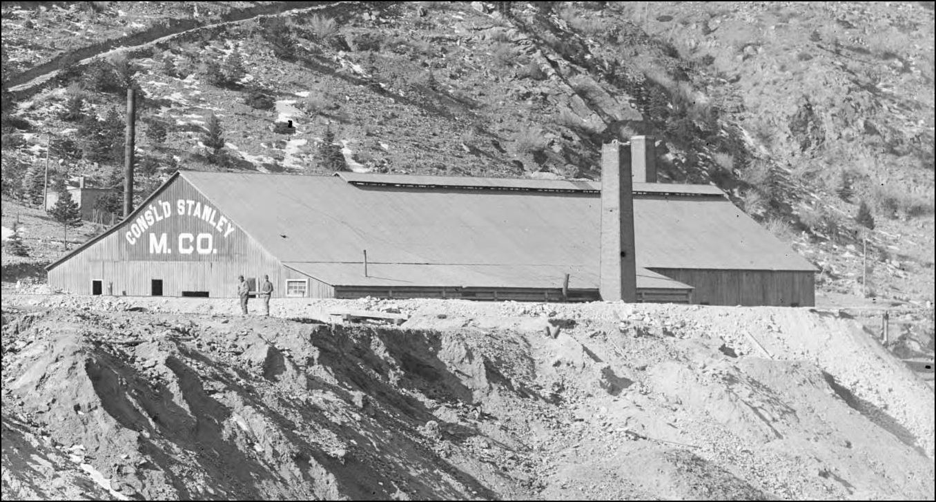 CHS-B1486 http://digital.denverlibrary.org/cdm/fullbrowser/collection/p15330coll21/id/4932/rv/singleitem/rec/1626 An inside view of the Plutus Smelter, note the longitudinal ridge cupola. 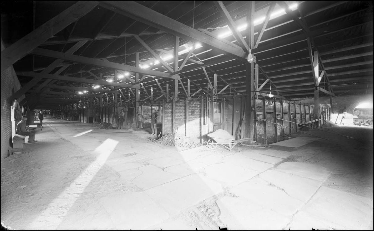 CHS-B398 http://cdm16079.contentdm.oclc.org/cdm/fullbrowser/collection/p15330coll21/id/3902/rv/singleitem/rec/48  from USGS 1917 Here is the reason that the Plutus Mine Hoisthouse was replaced so soon by the much larger Gehrmann Shafthouse. 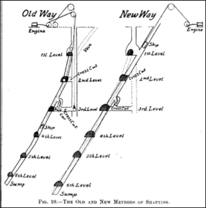 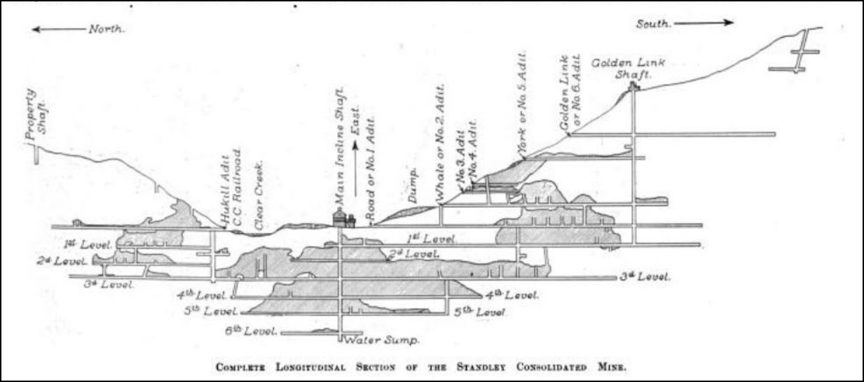 from the Colliery Engineer and Metal Mines 1894, Volumes 14 and 15. (SIC Standley)
UpSideDownC
in New Zealand |
Stanley Mills: Part Three. Stanley Hotel Flagstop. Addendum.
|
This post was updated on .
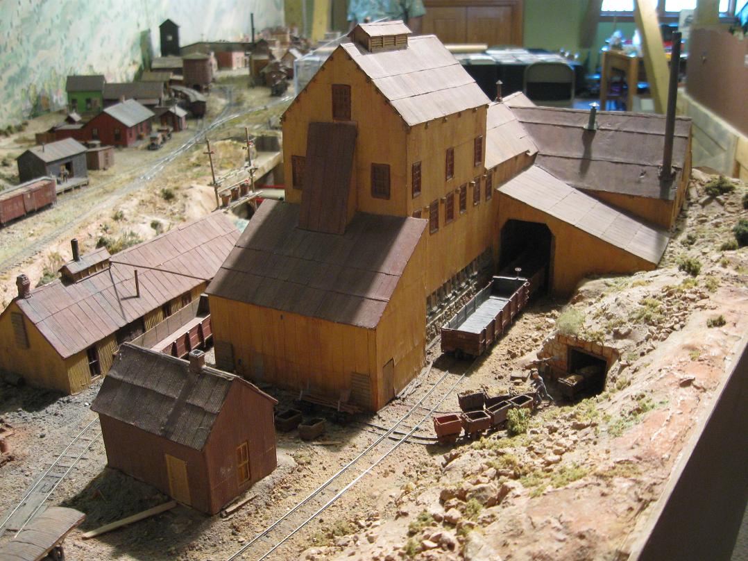 Harry Brunk's model version. The last and largest Stanley Consolidated Hoisthouse was called the Gehrmann and should not be confused with the German Shaft, which was another Mine at the head of Virginia Canyon above Idaho Springs. Rather than bore you with the details of this new Shafthouse, I will include snippets from the USGS and Trade Journals of the time to give a far better description of the works. Mining details can be boring to modellers or not, I leave it to you. My thanks to Ken Martin for linking me with the answers to some very old questions regarding what had always looked like to me to be an Inclined Shaft structure. 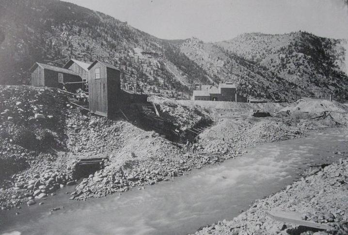 Lachlan McLean photo Idaho Springs Historical Society coll  Lachlan McLean photo Idaho Springs Historical Society coll.  Composite Sanborn Map  CHS-B1486 http://digital.denverlibrary.org/cdm/fullbrowser/collection/p15330coll21/id/4932/rv/singleitem/rec/1626 Looking into the above view, is this the only picture that may show a Locomotive on the Siding? 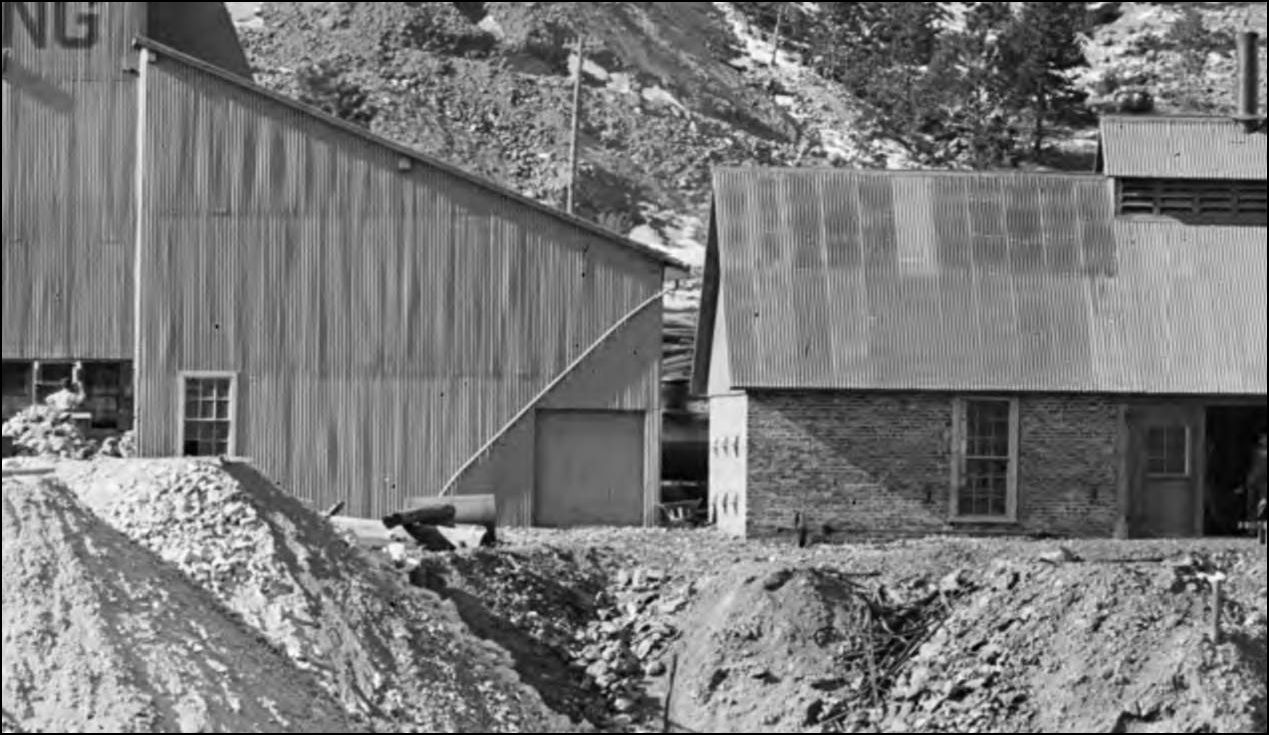 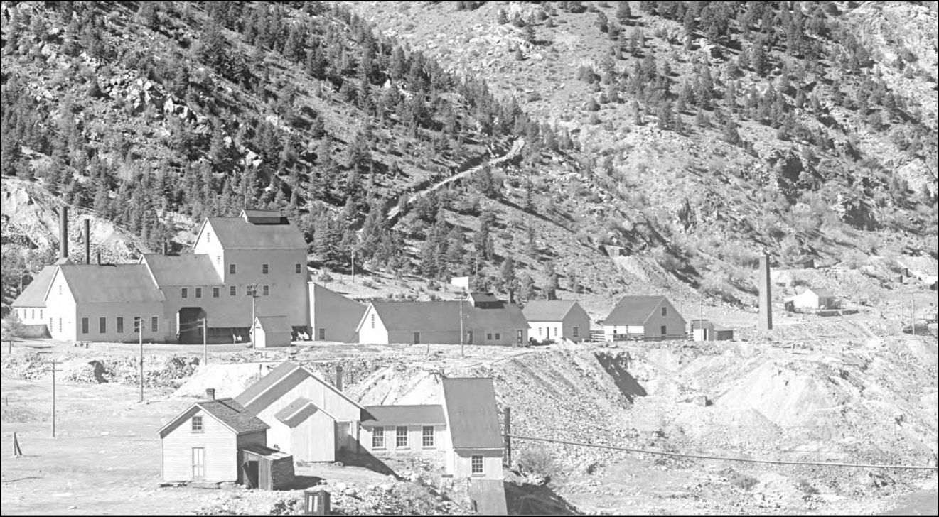 MCC-368 http://digital.denverlibrary.org/cdm/fullbrowser/collection/p15330coll22/id/77738/rv/singleitem/rec/16  from USGS 1966 The Road Level Tunnel was across from the Shafthouse as seen in this view.  From A History Of Clear Creek County. 2004. Historical Soc. of I.S. An inside view. 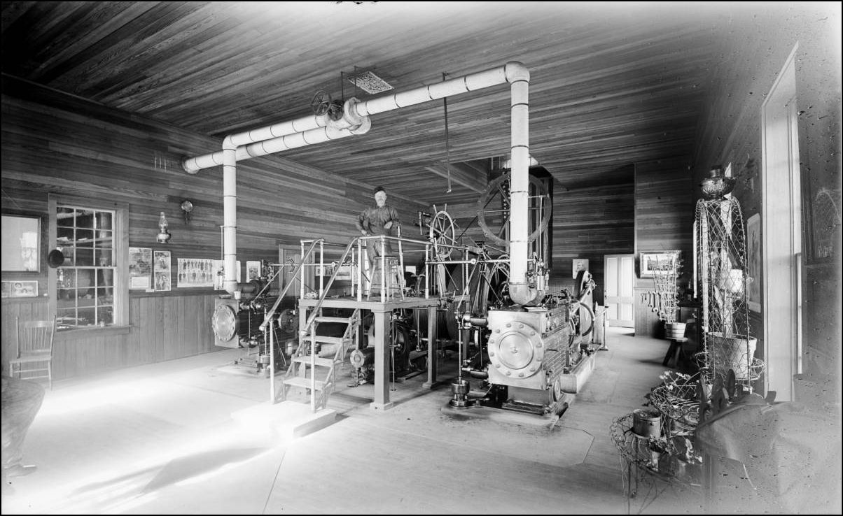 CHS-B337 http://cdm16079.contentdm.oclc.org/cdm/fullbrowser/collection/p15330coll21/id/3790/rv/singleitem/rec/75 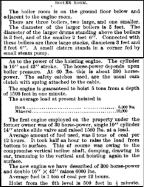  from the Colliery Engineer and Metal Mines 1894, Volumes 14 and 15. (SIC Standley) The previously unknown Stanley (Mills?) Flagstop. At the time of the great Yellow paint splurge, which co-incided with the name change from The Stanley Consolidated Mines Co. to The Stanley Mines Co., the ground was prepared for the new Flagstop: note the small trestle Br. No. 14 on the curve, this crossed the 18" gauge minetrack into the Crockett Tunnel. 12lb rail was still in place there at the time of the 1939 valuation survey indicating some reworking during the 1930's. Also of note is the Suspension Footbridge, which is just that, not a "pipe" support structure. 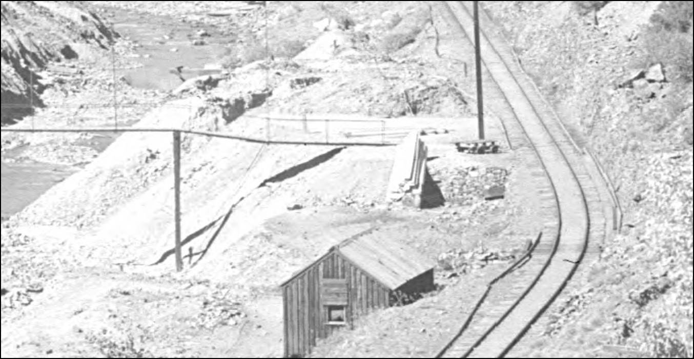 MCC-368 http://digital.denverlibrary.org/cdm/fullbrowser/collection/p15330coll22/id/77738/rv/singleitem/rec/16 Lachlan McLean photo 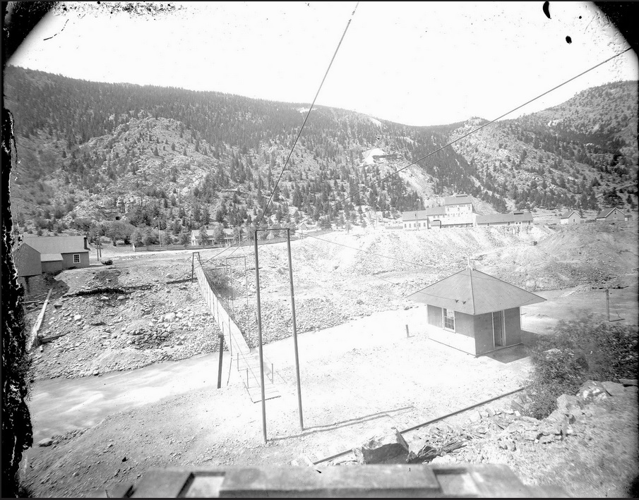 enlarged to show the details of this little building. 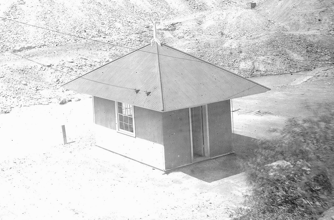 Lachlan McLean photo   X-60762 http://digital.denverlibrary.org/cdm/fullbrowser/collection/p15330coll22/id/36555/rv/singleitem/rec/51 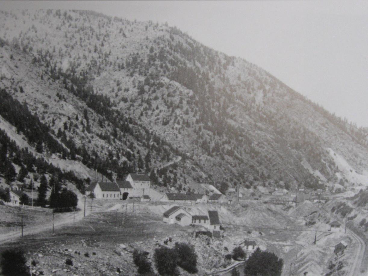 From A History Of Clear Creek County. 2004. Historical Soc. of I.S.  X-60762 http://digital.denverlibrary.org/cdm/fullbrowser/collection/p15330coll22/id/36555/rv/singleitem/rec/51 Rounding out this segment of the Clear Creek valley, a last look at the Boarding House from the era of the Whale Smelter. At some point the rearmost addition was truncated or rebuilt. 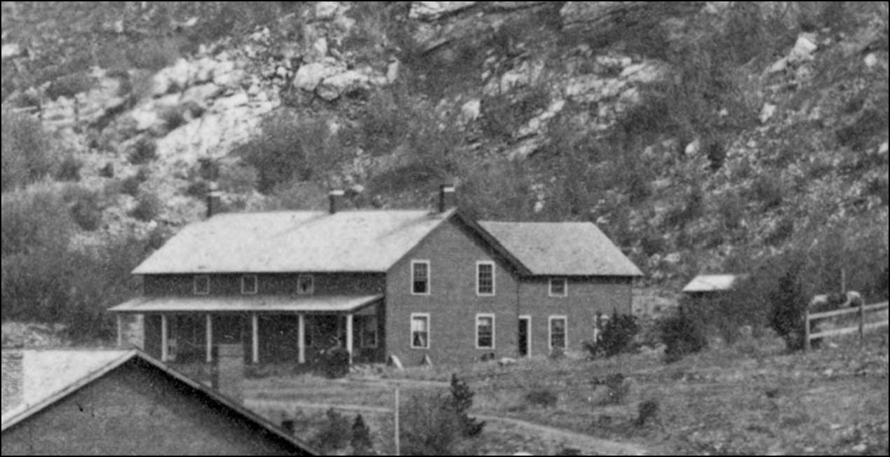 CHS.X4592 http://digital.denverlibrary.org/cdm/fullbrowser/collection/p15330coll21/id/10098/rv/singleitem/rec/63 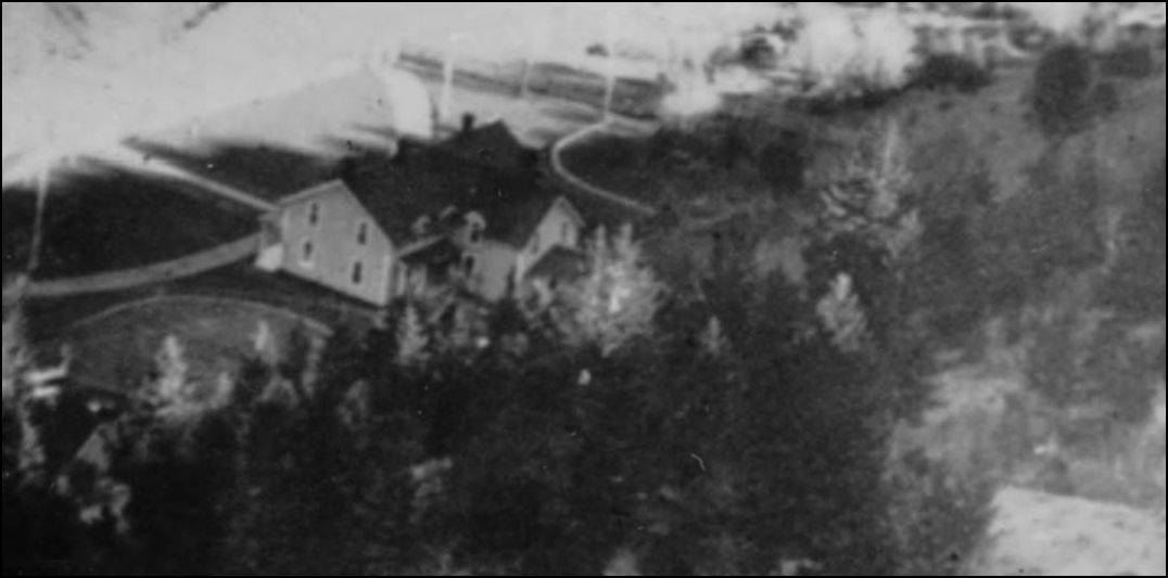 X-60762 http://digital.denverlibrary.org/cdm/fullbrowser/collection/p15330coll22/id/36555/rv/singleitem/rec/51  MCC-368 http://digital.denverlibrary.org/cdm/fullbrowser/collection/p15330coll22/id/77738/rv/singleitem/rec/16 Lachlan McLean photo enlargement.  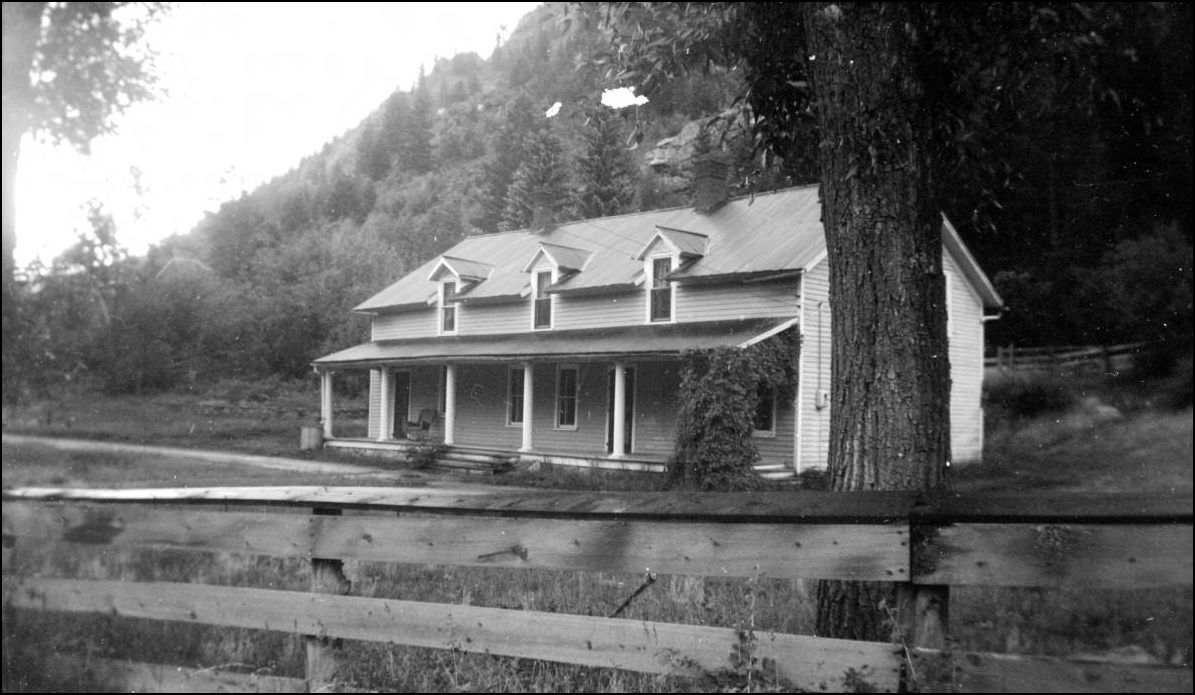 X-3328 http://digital.denverlibrary.org/cdm/fullbrowser/collection/p15330coll22/id/2821/rv/singleitem/rec/257
UpSideDownC
in New Zealand |
Re: Stanley Mills: Part Three. Two Smelters and the Consolidated Stanley Mines.
|
For those who desire to learn more about the convoluted Stanley Mines claim history
  Harry Brunk in his Stanley Mines article in the Nov/Dec 1985 NG&SL Gazette queried the existence of Mill equipment inside the Shafthouse, these snippets should explain the ore-sorting process. 
 
UpSideDownC
in New Zealand |
Re: Stanley Mills: Part Three. Two Smelters and the Consolidated Stanley Mines.
|
This post was updated on .
In reply to this post by Chris Walker
A fascinating read, Chris.
On my first trip up Clear Creek, in January of 1973, I have vivid memories of the Stanley Mines structure to the south as I drove up the Interstate. I wish I had found an exit and explored the site and taken photos. I'm looking forward to future installments of your series, especially the mines and mills of Silver Plume. Jim
Jim Courtney
Poulsbo, WA |
Re: Stanley Mills: Part Three. Two Smelters and the Consolidated Stanley Mines.
|
Anybody else notice the man's face peeking out of the open elbow of the pipe fitting ???
"Duty above all else except Honor"
|
Re: Stanley Mills: Part Three. Two Smelters and the Consolidated Stanley Mines.
|
Yes, but I wasn't sure what I was seeing . . . thought it might be an example of "possessed" plumbing by a deceased spirit. Like the P-trap under my kitchen sink.
Jim Courtney
Poulsbo, WA |
Re: Stanley Mills: Part Three. Two Smelters and the Consolidated Stanley Mines.
|
Great stuff, Chris. I enjoyed reading that.
Cheers, Jeff. |
Re: Stanley Mills: Part Three. Two Smelters and the Consolidated Stanley Mines.
|
In reply to this post by Chris Walker
Thanks for the excellent posts, Chris!
This area has captured the imagination of generations of modelers since I-70 was improved through this area in the 60s. I myself attempted a flat of the Stanley Consolidated shaft house:  It is a large beast of a thing--even at just over a inch deep, it is about 24" long. I never got to finish the lettering, as I demo-ed the layout and started construction on Leadville. The parts persist however and may reappear. Thinking out loud, maybe I can repurpose this at Climax? 
Keith Hayes
Leadville in Sn3 |
Re: Stanley Mills: Part Three. Two Smelters and the Consolidated Stanley Mines.
|
In reply to this post by Chris Walker
Thanks to Colorado Artifactual for revealing this part of the improvement (rebuilding) process at the Gehrmann Shafthouse.
These views are of the Road Level Tunnel referred to previously(above) and that was modelled by Harry Brunk see:http://c-sng-discussion-forum.254.s1.nabble.com/Stanley-Mills-Part-Three-Two-Smelters-and-the-Consolidated-Stanley-Mines-tp5619p5621.html for context. It's not often one gets before and after shots taken in the same place(the later view was already presented above).. 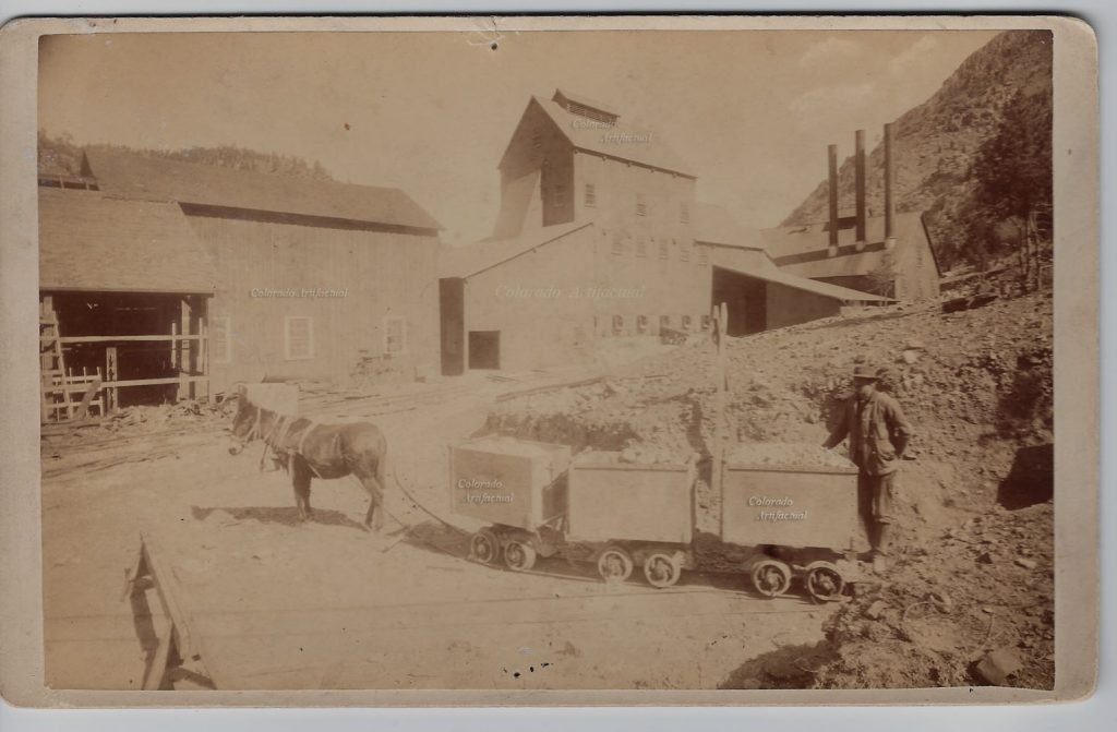  Another view of the Gehrmann Shafthouse.  Another view of the Ore-dressing room, this is located on the floor above the Chutes, the sorted Ore being dropped through the square hole into the ore-pocket below: one for the interior detailers, eh!.  
UpSideDownC
in New Zealand |
|
In reply to this post by Chris Walker
Bringing back an old thread-great info Chris. I was digging through the Colorado School of Mines website and came upon this photo of the Stanley that included another photo of the little flag stop and the bridge. This one actually gives us a date- July 1931 so it was still there. https://repository.mines.edu/handle/11124/173328 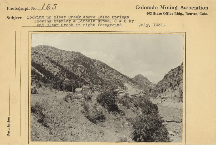 Better view (the link to the website has a higher resolution) 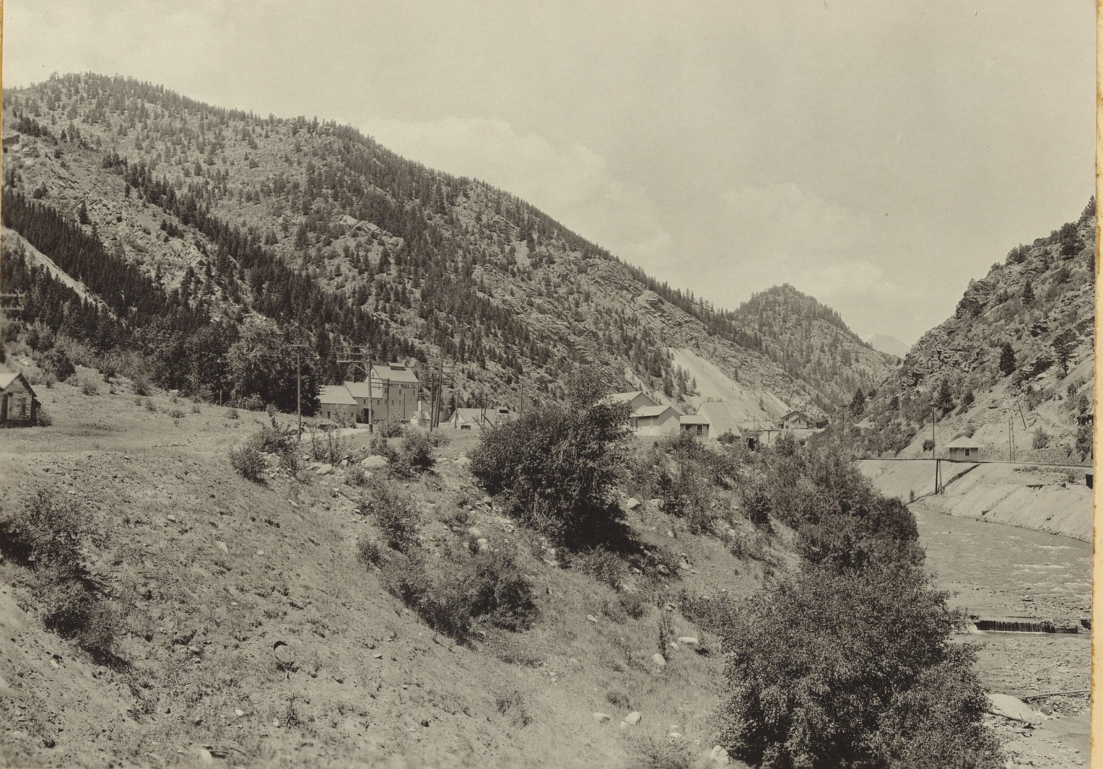 Here is a zoom in of the flagstop 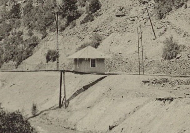 Looking at the bridge from the side with its really spindly construction one can see how it would easily be interpreted as a pipe bridge. It really looks like one from that angle. The "handrails" as such just do not show up in a distant picture. A photo of it in Georgetown and the Loop p 102 was the inspiration for an article by Harry Brunk in 2004 on a pipe bridge. (may be the same as the first one of course he did not have the enlargement to work off of then.) The presence of the flagstop is what makes it apparent what it is and it wasn't in that photo. Of course as we all know the best way to get new info to surface is to build a model of it. Harry had a far better record than me- it took 12 years to appear after that article and now we are 20 years later. For me new info generally shows up about a week or so after I complete the model. 
Do we have a date for the construction of the flagstop? Obviously it was not there at one point even though the bridge was there. In any event Stanley does show up as a timetable location this is from my 1897 UPD&G timetable. 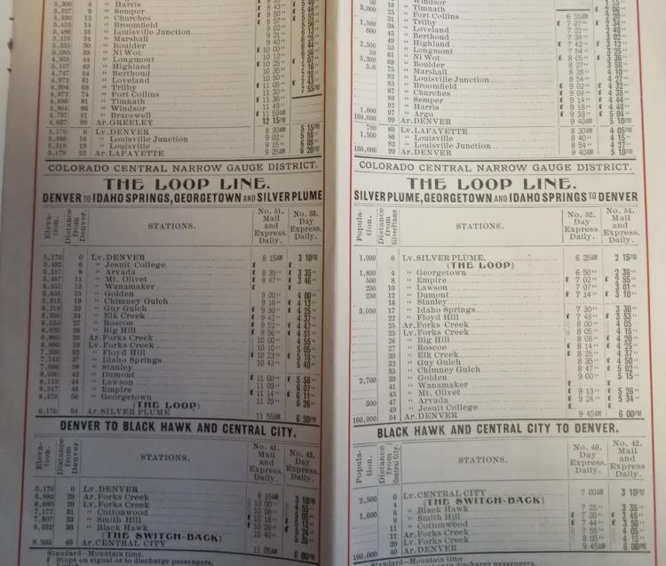
Jim Curran
|
«
Return to C&Sng Discussion Forum
|
1 view|%1 views
| Free forum by Nabble | Edit this page |

