Stanley Mills: Part One....The Lincoln and Alma-Lincoln Mills.
Stanley Mills: Part One....The Lincoln and Alma-Lincoln Mills.
|
This post was updated on .
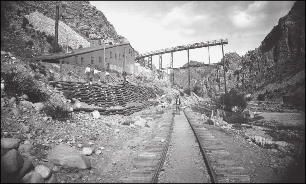 Lachlan McLean Photo: Idaho Springs Historical Society Coll. This outstanding view of the Lincoln Mill taken by Lachlan may have been part of a series that was produced in 1894-95 showing the progression of the Wooden Stave Conduit for the Consolidated Stanley Powerhouse that had its intake upstream of the Fall River Sectionhouse. The second picture I presented here: http://c-sn3-discussion-forum.41377.n7.nabble.com/Mills-of-Fall-River-tp2576p2809.html appears to be taken just about upstream of the dump Trestle over the Railway. Lincoln Mill first on Sanborn Maps in 1895 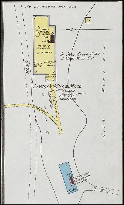 Sanborn Map of 1900 From a greatly enlarged Lachlan McLean photo of the Clear Creek valley taken high above the Stanley Properties, is the Lincoln Mill and further on the Plutus Mill. This is the only view I've seen to date that has clearly captured the two Mills. 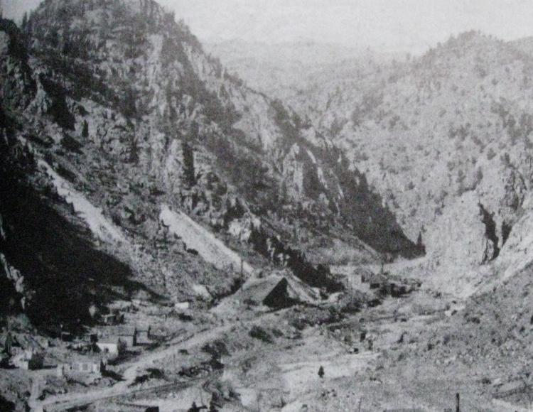 Lachlan McLean Photo: Idaho Springs Historical Society Coll. A refresher look at the Plutus Mill at the outlet of Trail Creek 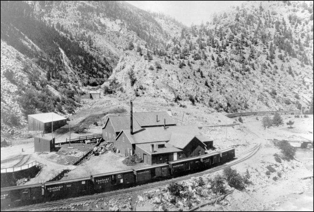 http://digital.denverlibrary.org/cdm/fullbrowser/collection/p15330coll22/id/38845/rv/singleitem Quite a small community has sprung up at this location. The Switchstand for the short branch to the Plutus Mine and Smelter, later the Consolidated Stanley Mines is visible alongside the C&S Mainline here. 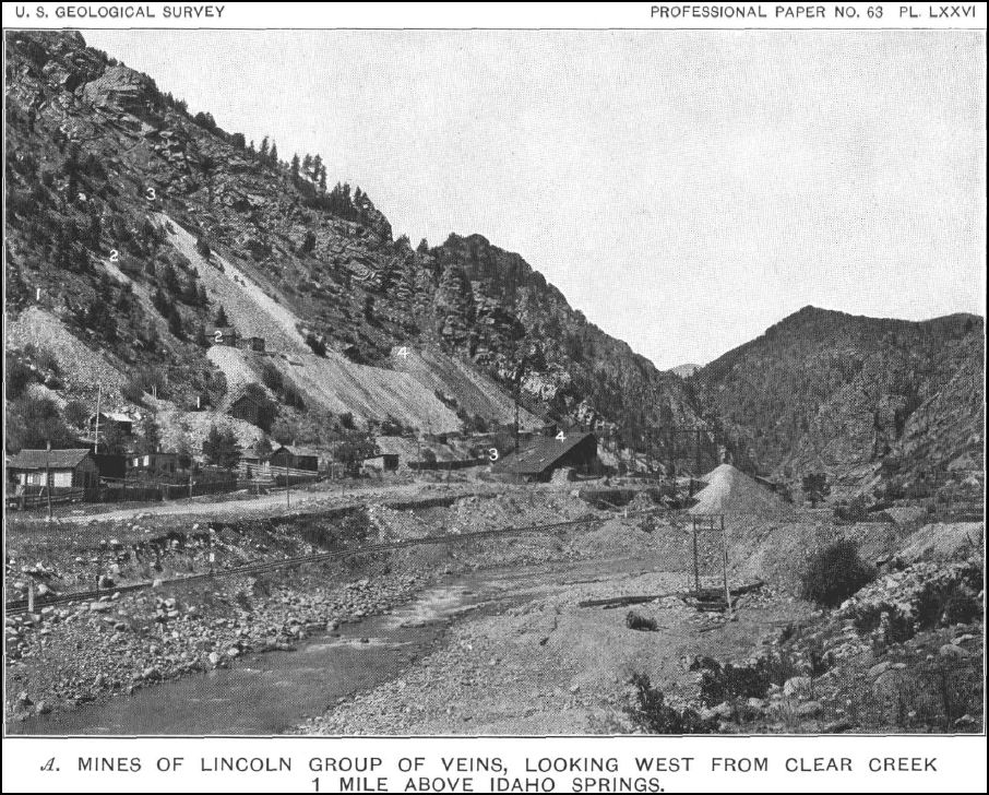 USGS Professional Paper NO. 63. Economic Geology of the Georgetown Quadrangle. Here is the earliest view of the new Alma-Lincoln Mill with the now-truncated Lincoln to the right. The infant wasterock dumps indicate some activity underground with a number of openings on multiple levels. 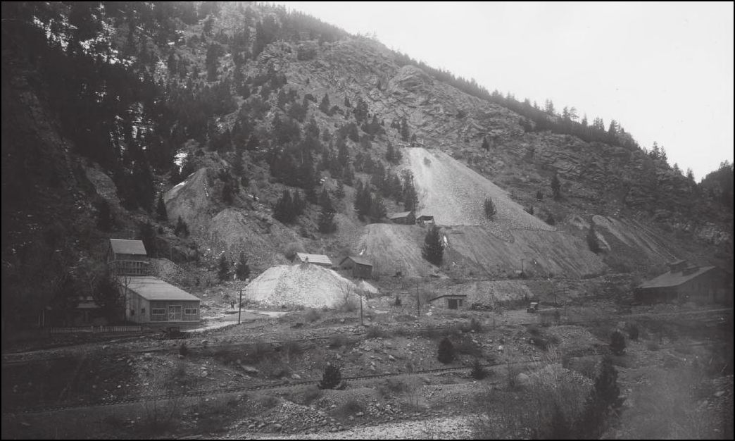 Lachlan McLean Photo: Idaho Springs Historical Society Coll. Stanley Mills Location sign C&S Railway Milepost 39.06 By this time the sign has weathered much like the Mining industry here in Clear Creek. Note in the background a new Orebin under construction and Incline to an upper level being worked. 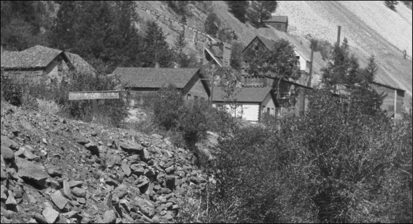 http://cdm16079.contentdm.oclc.org/cdm/fullbrowser/collection/p15330coll22/id/14316/rv/singleitem A wider view of the Stanley Mills sign shows the abutment construction of C&S Bridge #39 formerly numbered 716. This crossing of Clear Creek was the site of several replacement bridges over the years since the Colorado Central first built Bridge #16, a 54ft span. 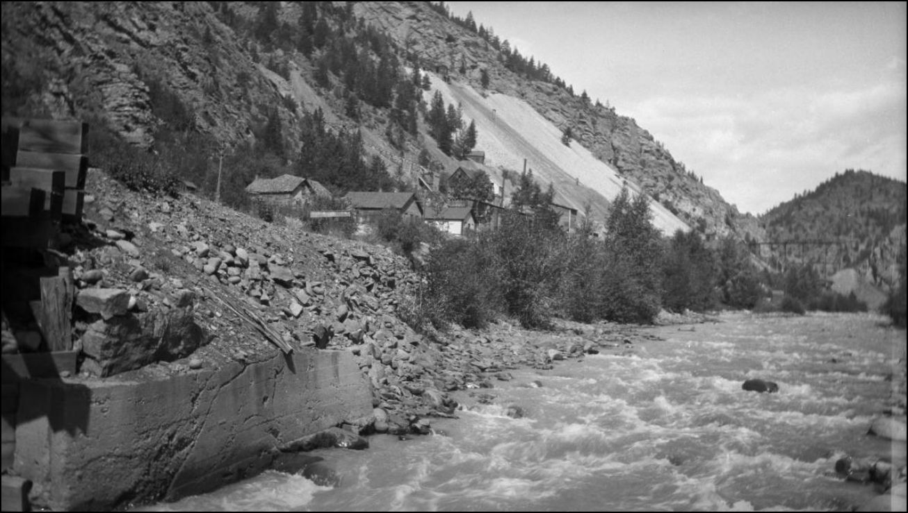 http://cdm16079.contentdm.oclc.org/cdm/fullbrowser/collection/p15330coll22/id/14316/rv/singleitem Another progressive pictorial comparison, this photo shot at the same time as the creeklevel Picture. The loading bay has not yet been built nor the 2nd West Elevator. The old Lincoln Mill and dumptrestle over the roadway and the C&S mainline is prominent in this view. 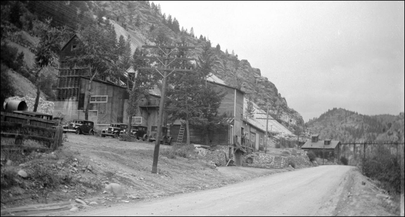 http://cdm16079.contentdm.oclc.org/cdm/fullbrowser/collection/p15330coll22/id/14313/rv/singleitem 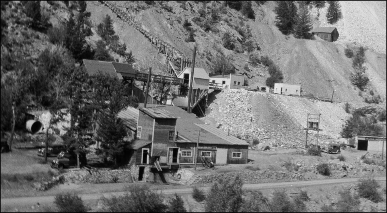 http://cdm16079.contentdm.oclc.org/cdm/fullbrowser/collection/p15330coll22/id/14317/rv/singleitem/rec/812 Here we see that the new Alma-Lincoln Mill has had the first covered loading dock added on and the outbuildings higher to the right at the Adit have been completed along with the new Orebin at the foot of the Inclined Tram. The Alma Management kept up a spiffy image to project to the passing public here. More to come on this section of the Lincoln Mine. 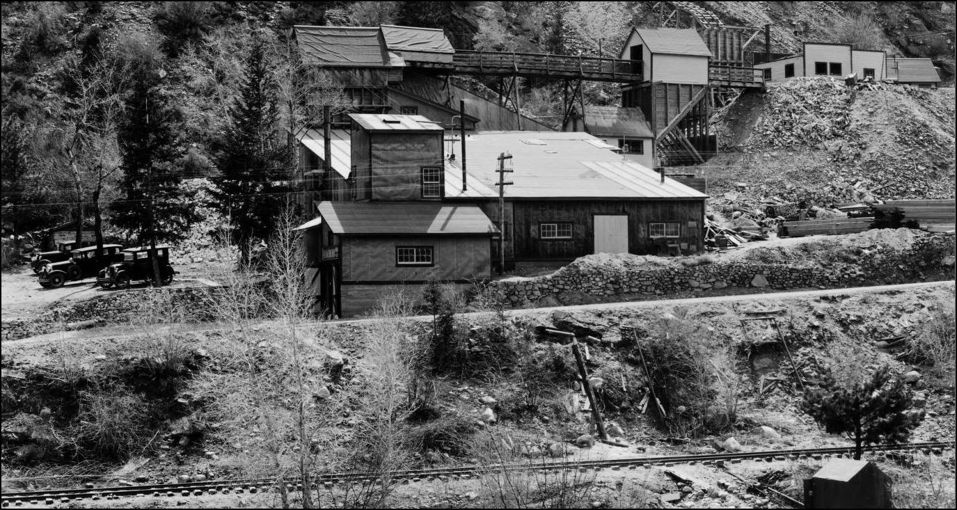 http://digital.denverlibrary.org/cdm/fullbrowser/collection/p15330coll22/id/38887/rv/singleitem This later picture shows the New Alma-Lincoln with a second Elevator Tower and the carpark now on the Western side of the Mill since the stockpile took over the whole downstream parking area. The tramway trestle at the upper rear is now hidden behind a snowshed added in front to connect to another third Orebin. This has to be one of the most interesting Mills with documented improvements available for comparison. 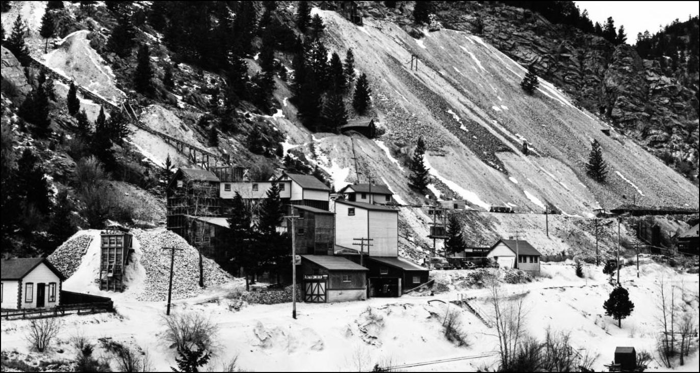
http://digital.denverlibrary.org/cdm/fullbrowser/collection/p15330coll22/id/16567/rv/singleitem And in this somewhat later image; note the carpark Dump(stockpile) has now been removed and the Orebin (extreme left) has shifted back alongside the Mill. The dry-stacked rockwall has been modernised at the left of the mill. 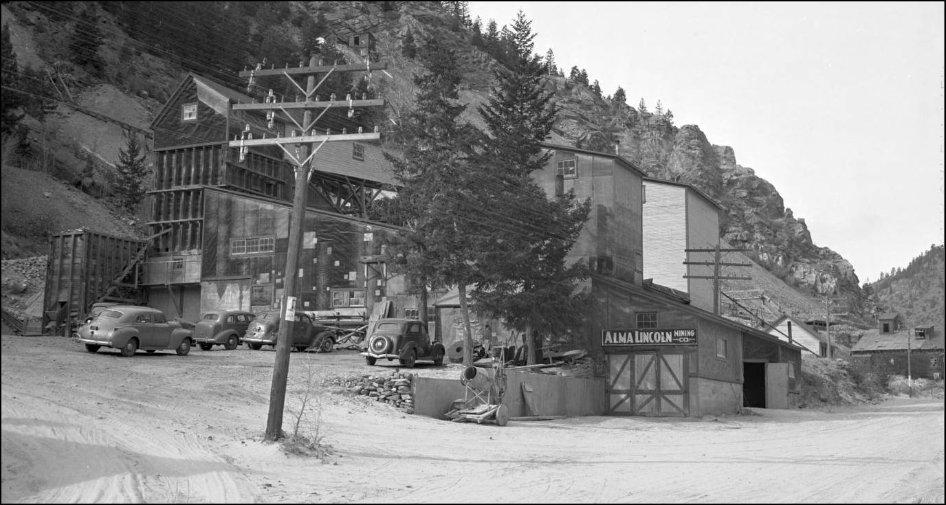 http://digital.denverlibrary.org/cdm/fullbrowser/collection/p15330coll21/id/11496/rv/singleitem And here we are in 1950: End of the road. RIP Alma Lincoln. 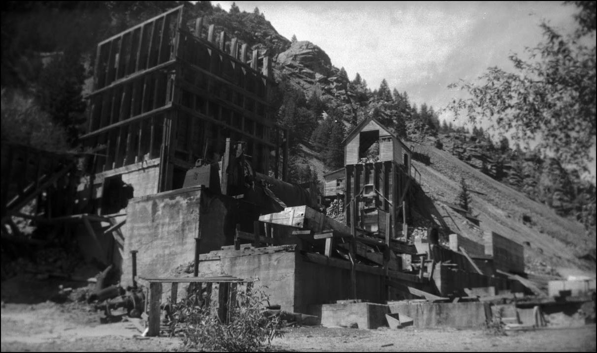 http://cdm16079.contentdm.oclc.org/cdm/fullbrowser/collection/p15330coll22/id/6199/rv/singleitem/rec/15
UpSideDownC
in New Zealand |
Re: Stanley Mills: Part One....The Lincoln and Alma-Lincoln Mills.
|
Chris, this is the tailings pile that is just west of the Stanley on the south side of the Creek that we still drive by today?
Nice cars, bye the way!
Keith Hayes
Leadville in Sn3 |
Re: Stanley Mills: Part One....The Lincoln and Alma-Lincoln Mills.
|
Yes Keith, still standing out as a Monument to Miners (and Mining)
 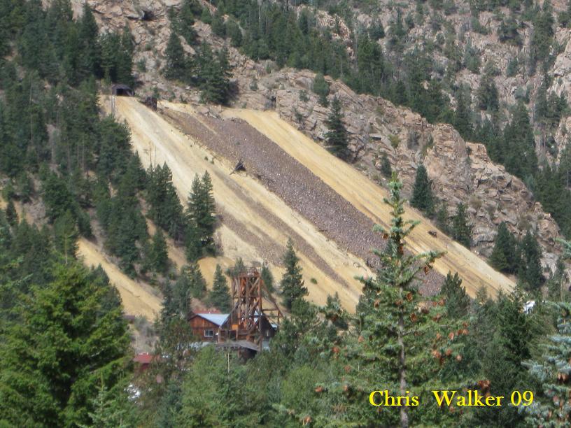 Some of the Alma Lincoln Millyard rockwalling. 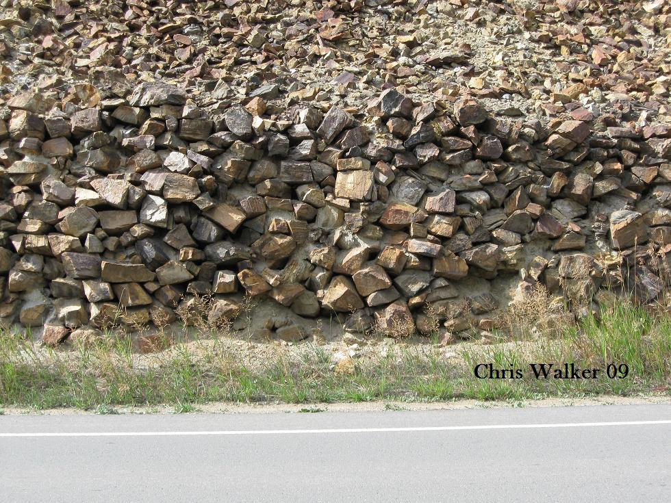
UpSideDownC
in New Zealand |
Re: Stanley Mills: Part One....The Lincoln and Alma-Lincoln Mills.
|
This post was updated on .
These views above the Mill show some otherwise undiscernable details of the two Elevator towers and the stacks of Timbers for the mine workings. Is that an International truck? 1941 model maybe? Looking at this sequence of photos taken around the Portal one can piece together the surface trackage. The tramtrack in the foreground runs back behind the photographer to the old Lincoln Mill and the Westernmost adit
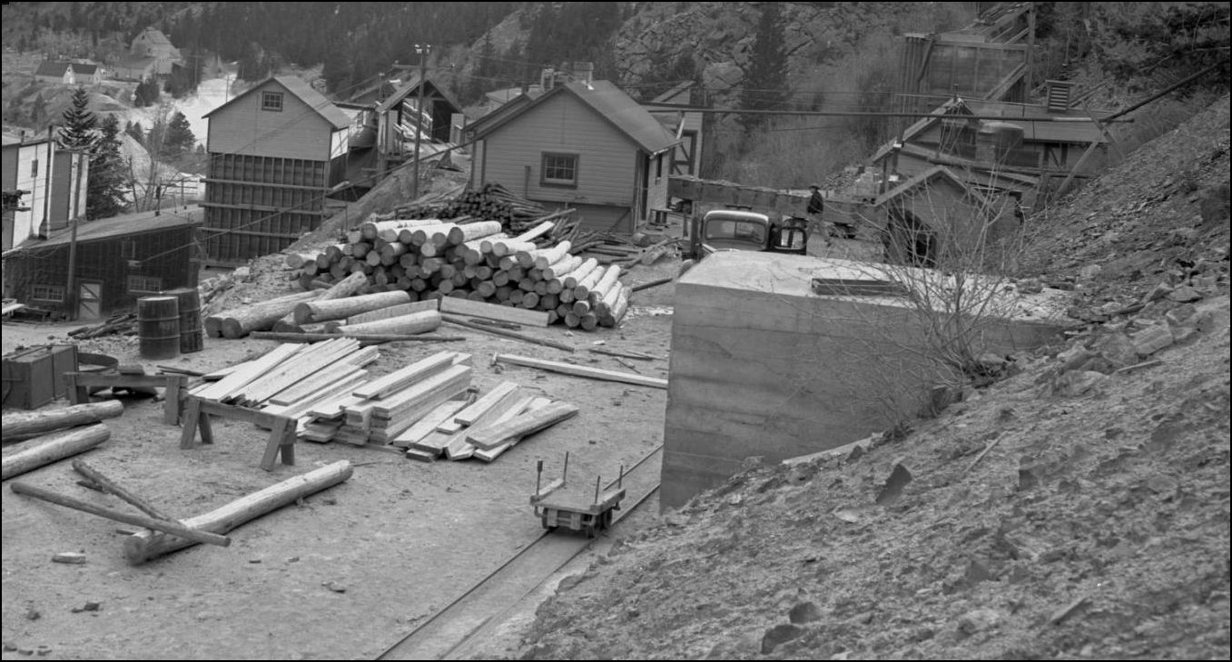 http://digital.denverlibrary.org/cdm/fullbrowser/collection/p15330coll21/id/11495/rv/singleitem/rec/270 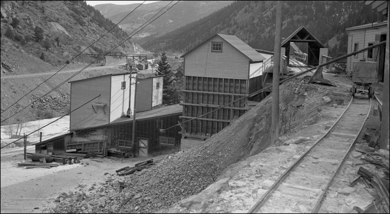 http://digital.denverlibrary.org/cdm/fullbrowser/collection/p15330coll21/id/11494/rv/singleitem/rec/270 An enlargement of this picture http://cdm16079.contentdm.oclc.org/cdm/fullbrowser/collection/p15330coll22/id/14317/rv/singleitem/rec/812 shows that the tramway needed slidesheds build to protect it from the ever-encroaching wastedump. 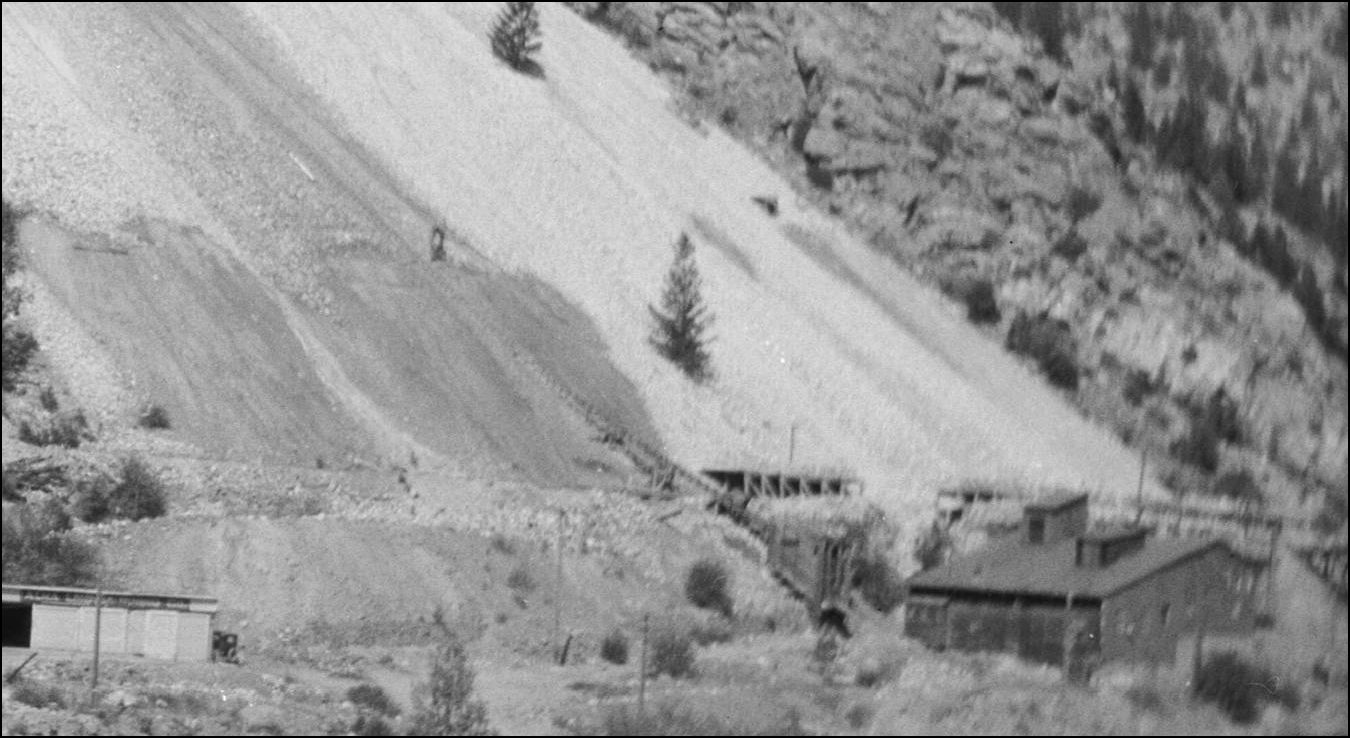 An earlier view of the ALma Lincoln Adit. This working is post publication of the USGS 1917. 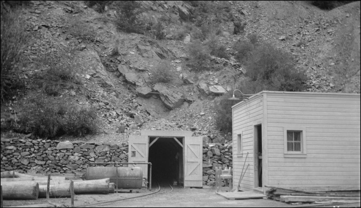 http://cdm16079.contentdm.oclc.org/cdm/fullbrowser/collection/p15330coll22/id/14315/rv/singleitem/rec/3 This photo was used by Harry Brunk in the Nov/Dec 1982 issue of the Gazette pg58 describing the Newhouse/Argo Tunnel. Whether Harry thought this was the Argo or just showed the picture as an illustration of a horsedrawn minetram, I can't say. I'm surprised that he didn't click as the Newhouse was built double-track right from the begining and the Alma portal is very narrow in comparison. 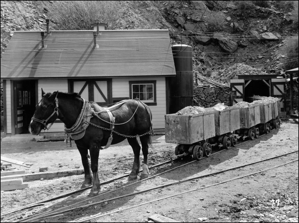 http://digital.denverlibrary.org/cdm/fullbrowser/collection/p15330coll22/id/38885/rv/singleitem/rec/2 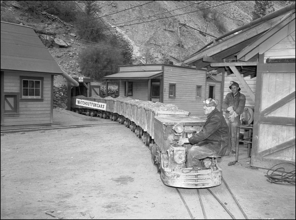 http://digital.denverlibrary.org/cdm/fullbrowser/collection/p15330coll21/id/11493/rv/singleitem/rec/159 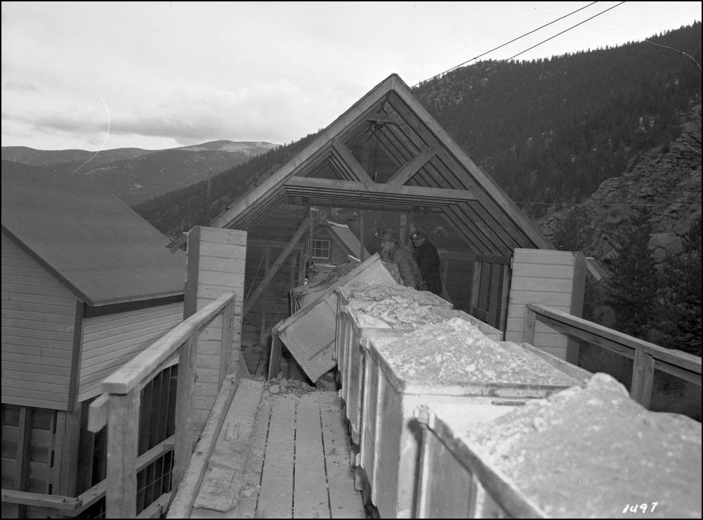 http://digital.denverlibrary.org/cdm/fullbrowser/collection/p15330coll21/id/11498/rv/singleitem/rec/386 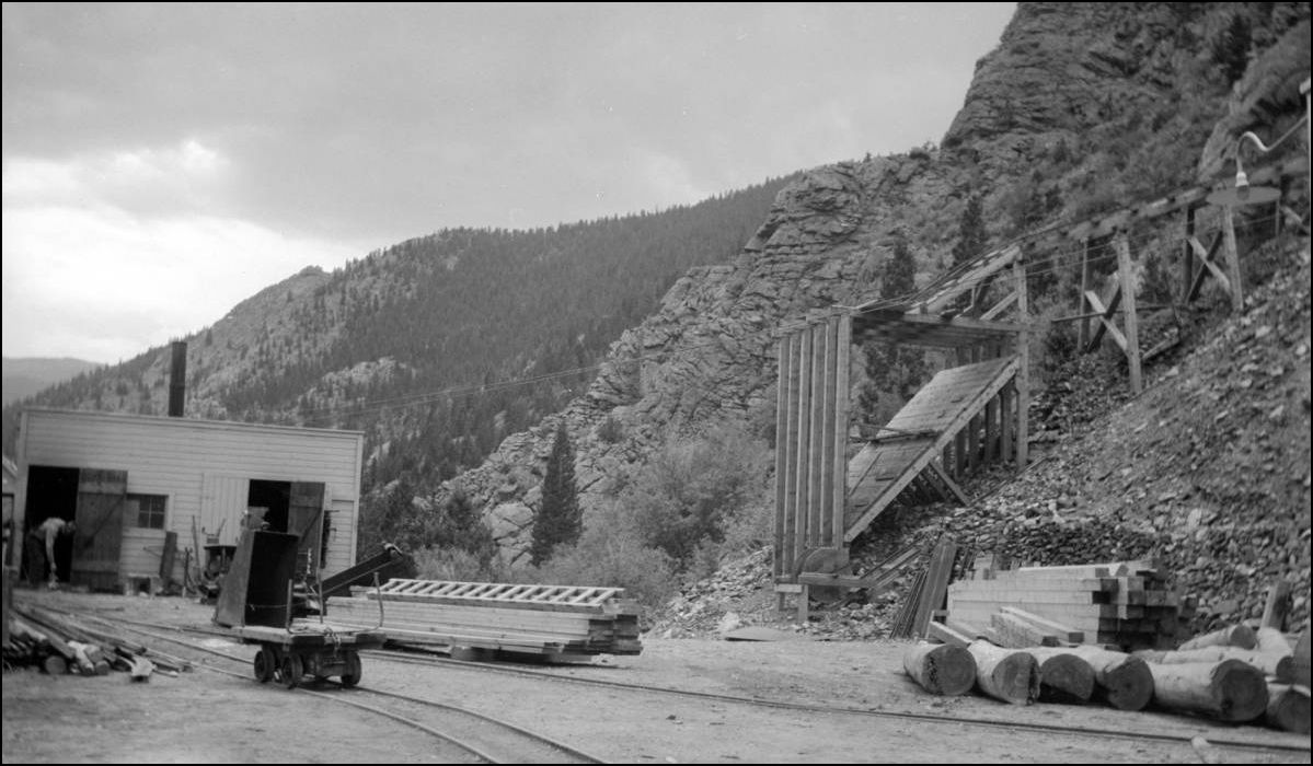 http://cdm16079.contentdm.oclc.org/cdm/fullbrowser/collection/p15330coll22/id/14314/rv/singleitem/rec/227 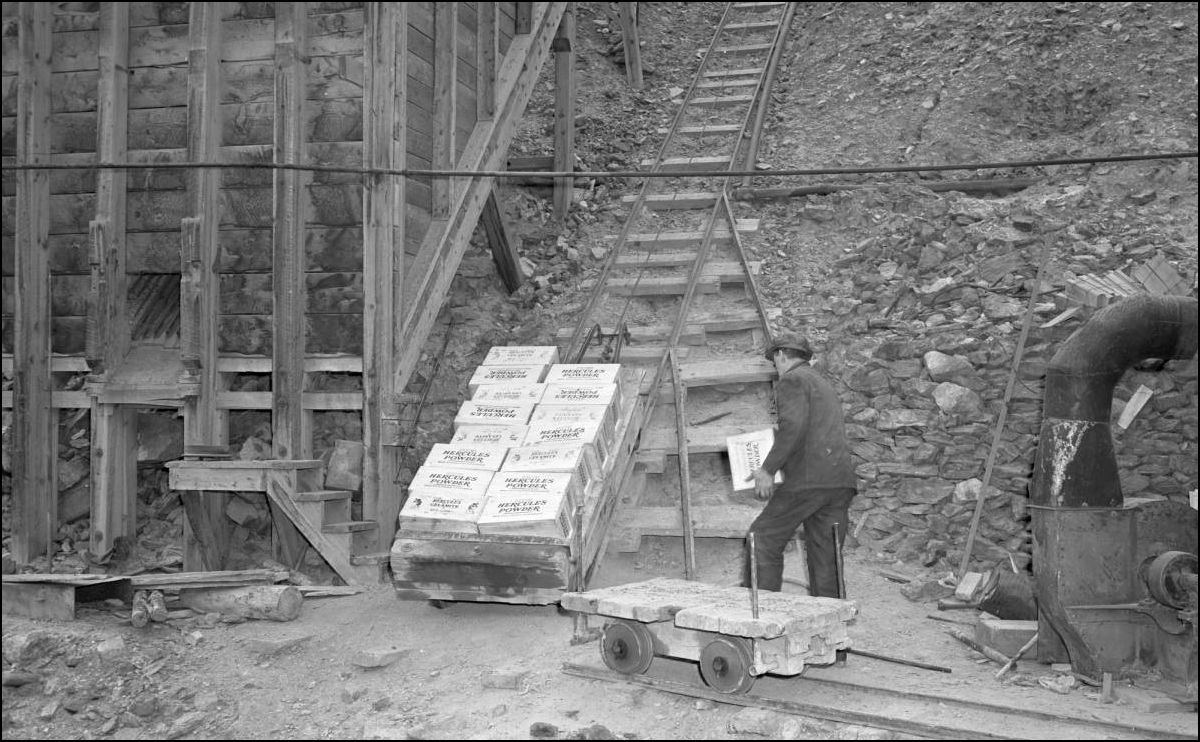 http://cdm16079.contentdm.oclc.org/cdm/fullbrowser/collection/p15330coll21/id/11490/rv/singleitem/rec/33 I'll cover more in the next offering of Stanley Mills: Part Two. Salisbury Mill and Donna Juanita Mine. Soon.
UpSideDownC
in New Zealand |
Re: Stanley Mills: Part One....The Lincoln and Alma-Lincoln Mills.
|
Chris--these are AWESOME photos.
I don't know that I have ever seen such a nice collection of images that illustrate the mine entry, stored material and utilities. Across eras, even. Also, it is great to see the photo of the guys dumping the cars into the bin. I bet the horse was happy to go to pasture when the locomotive arrived. Note the chain to transfer the load of the cars to the horses shoulder. When Ragg's came out with the outbuildings for the Huykill, I got both sets, and these look very much like the humble buildings adjacent to the adit entry. The doors are a nice detail, too. I also forgot to add in my first post, that is some trestle over the road! Not sure I would want to push a car full of waste rock across that!
Keith Hayes
Leadville in Sn3 |
Re: Stanley Mills: Part One....The Lincoln and Alma-Lincoln Mills.
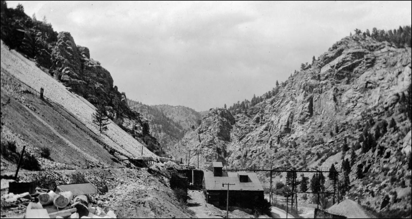 http://digital.denverlibrary.org/cdm/fullbrowser/collection/p15330coll22/id/39746/rv/singleitem Another photo of the Old Lincoln Mill has come to light, hiding mis-labled in the DPL. This is of considerable interest as it shows the waste rock slideshed being constructed over the mine tramway that accessed the westernmost Adit(Lincoln Tunnel). Also the log-cribbing keeping the wastedump off the C&S Mainline is to be seen on the right.
UpSideDownC
in New Zealand |
Re: Stanley Mills: Part One....The Lincoln and Alma-Lincoln Mills.
|
And a bonus surprise...thanks to Keith Pashina.
The Old Lincoln mill prior to being truncated and seen from across the Creek. 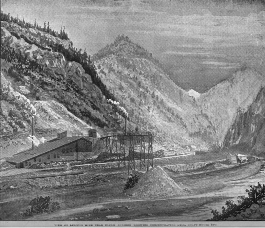 from the pages of the 1899 Mining Reporter. courtesy of Keith Pashina. Apparently there was erroneous reporting back then too....as the "Shafthouse" refered to in the caption is in fact the Powerhouse for the Mine Compressor as per the Sanborn Fire Map above.
UpSideDownC
in New Zealand |
Re: Stanley Mills: Part One....The Lincoln and Alma-Lincoln Mills.
|
A nice little Tit-Bit, to go with your afternoon Tea....
 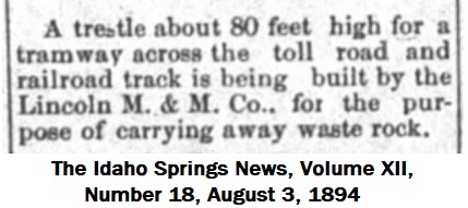 Lachlan McLean Photo  Lachlan McLean Photo enlargement 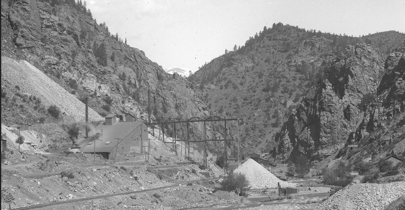
UpSideDownC
in New Zealand |
«
Return to C&Sng Discussion Forum
|
1 view|%1 views
| Free forum by Nabble | Edit this page |

