Silver Mountain Mill At Empire (Station).
12


12
|
Empire always struck me as odd in that the railroad never saw it fit to serve (North) Empire. In my life it has always been a wide spot in the valley dominated by the rock out crop seen in the photos. I am loving that mine structure, though. If it was not in multiple pictures, I would think it was drawn in: it sure evokes a rich and prosperous mine!
Keith Hayes
Leadville in Sn3 |
Even though the main would have to curve to head to Georgetown- it was always a bit strange that a spur was never built into Empire. (How much elevation change was there by the way) Which brings up another question- what happened to the ores from North Empire- just wagon loaded in to a team track???? Jim
Jim Curran
|
|
This post was updated on .
Jim,
One consideration on the spur to Empire is pure financials. Reading the Documentary History series of books you'll get a sense of the hurdles in place for any expense requests by the UP. When Trumbull took charge of the UPD&G and DL&G, and into his running of the C&S, these checks on expenses were tightened significantly. Things weren't built unless there was a solid, profitable reason to do so. I have no idea of the business potential of Empire--the real potential, not the advertised promise--but suspect it didn't justify the spur in the eyes of the railroad. And on moving the ore, it may have been common for mines to team directly to one of the mills, not the railroad, in the area.
Dave Eggleston
Seattle, WA |
Mills At Empire and North Empire.
|
This post was updated on .
Empire (Station) Elev. 8246ft (Poor: DSP&P)
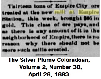
Empire (Town) Elev. 8636ft (USGS: 1910) 1.2 miles distance, 350ft elevational change. 1in18 or 5.5% gradient required. North Empire (Mines) further 3/4 mile Elev. 9200ft and 1.5 miles Elev. 9700ft. EDIT: just added for confirmation. 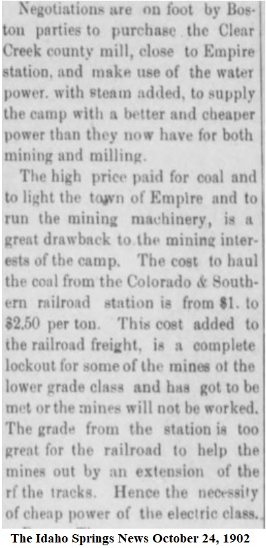 Hence why there were two Empire (Station) Tunnel enterprises driven underground directly to the Mine workings at Nth Empire and cutout the need to hoist the ore, and reduce haulage costs. Actual distances penetrating and results vary from sources. I haven't reviewed the USGS reports on the area. Early Mills in Empire, namely the Atlantic, Badger, and Kistler seem to have been failures at treating the local ores, later Mills were built up at Nth Empire, most likely following the loss of the Silver Mountain(nee Atlas) Mill. These were the Empress, Conqueror and the (new) Silver Mountain Mill. I take it these were after the processes were developed to profitably treat the Zinc content. EDIT: Not mentioned in Mills in Central City region treating gold-silver or silver ore USGSpp94 1917. Only Mill at Empire mentioned was Silver Mountain Mill as per clipping; see first post. Digerness' Mineral Belt V-III has a good description of the early Empire mining days pgs215-222: as does the History of Clear Creek County in Googlebooks. Both are limited to the early time period though. DPL X-3165 + X-3166 show the Conqueror and Empress(ruins) X-3168
UpSideDownC
in New Zealand |
Ok that explains it quite well why there was no spur with the change in elevation. Did not realize the Empire Tunnel went all the way to North Empire and the gradient worked out. Makes sense. (Empire is a town that I have never been to- I missed it on my only solo trip there YEARS back) I need to get back to Colorado- doesn't help I am clear on the other side of the country. Mineral belt III is still on my hit list to pick up-( don't want to sell one of the kids to buy it though for what it is going for on ebay  ) )
Jim
Jim Curran
|
|
In reply to this post by Dave Eggleston
UpSideDownC
in New Zealand |
About That Water Tank, Empire (Station).
|
In reply to this post by Jim Courtney
I'm going out on a limb here:
as per the 1883 Colorado Miner Article  Lidar ground imagery 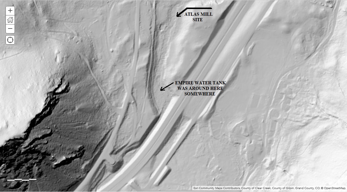 A contempory view of the Backdrop below Douglas Mountain, in the general area. Note the open, rising ground at the base, further West the trees block this detail. 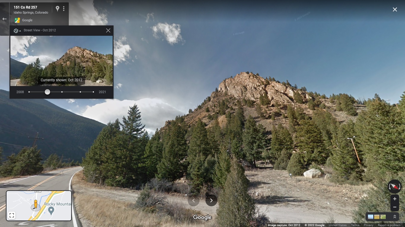 Coel's Goin' Railroading book on pg164 has this image purported to be Morrison. Clearly it is C&S #22, but there are no Buildings visible in the background so I'm sure it's not, nor is it Idaho(uptown) Springs, due presence of structures there too. 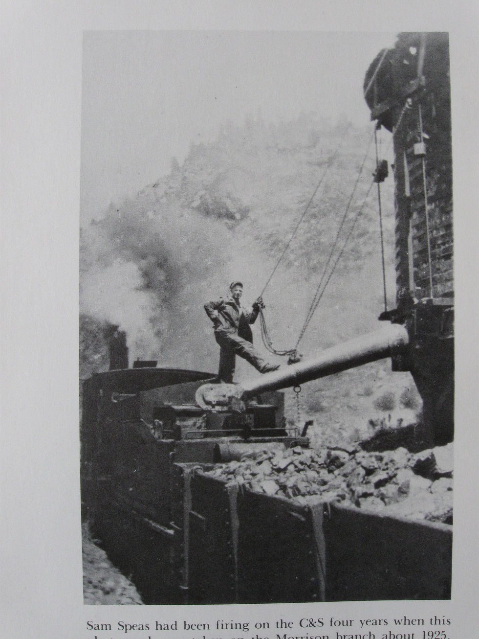 It does not fit with any other views I have of C&S Tanks at all with the background lower or upper for what is visible in descerning rock strata nor does it fit with Tank banding details per other locations such as Crossons, Elk Creek or Smith Hill. Note the closely spaced bands for the lower 2/3rds of the tub, is this the clue? Any suggestions as to just where these details present at another location?
UpSideDownC
in New Zealand |
«
Return to C&Sng Discussion Forum
|
1 view|%1 views
| Free forum by Nabble | Edit this page |

