Silver Mountain Mill At Empire (Station).

12

12
Silver Mountain Mill At Empire (Station).

|
This post was updated on .
Another piece of the C&S jigsaw.
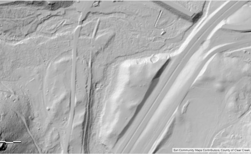
 DPL MCC-2356 El Capitan, Clear Creek Canon. Louis Charles McClure. 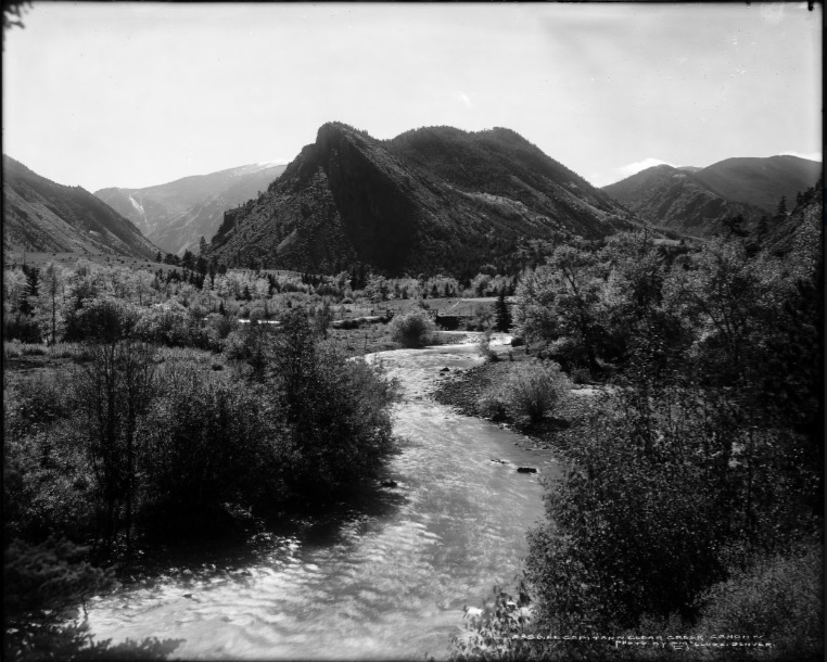 I must add that the Clear Creek valley gap at the West Fork and "El Capitan" (Douglas Mt.) at Empire(Station) has been etched into my psyche since I first laid eyes on it in 1982, memorising the colour views in Mineral Belt III the following year, and it has been the only place I ever visited(outside of Home) that I really felt a connection. Yeah, I know....  Unfortunately I-70 has re-written the appearance of this once bucolic valley but thankfully the Mountain sentinels haven't changed. 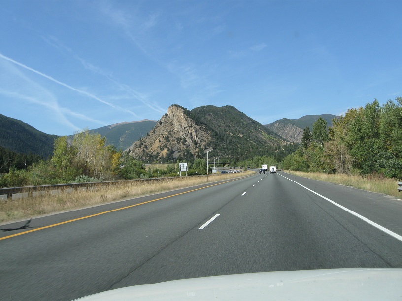 Comparing this "modern day view" one can see the impact of the Colorado Central line vs the modern Interstate highway had on the once awesome valley. 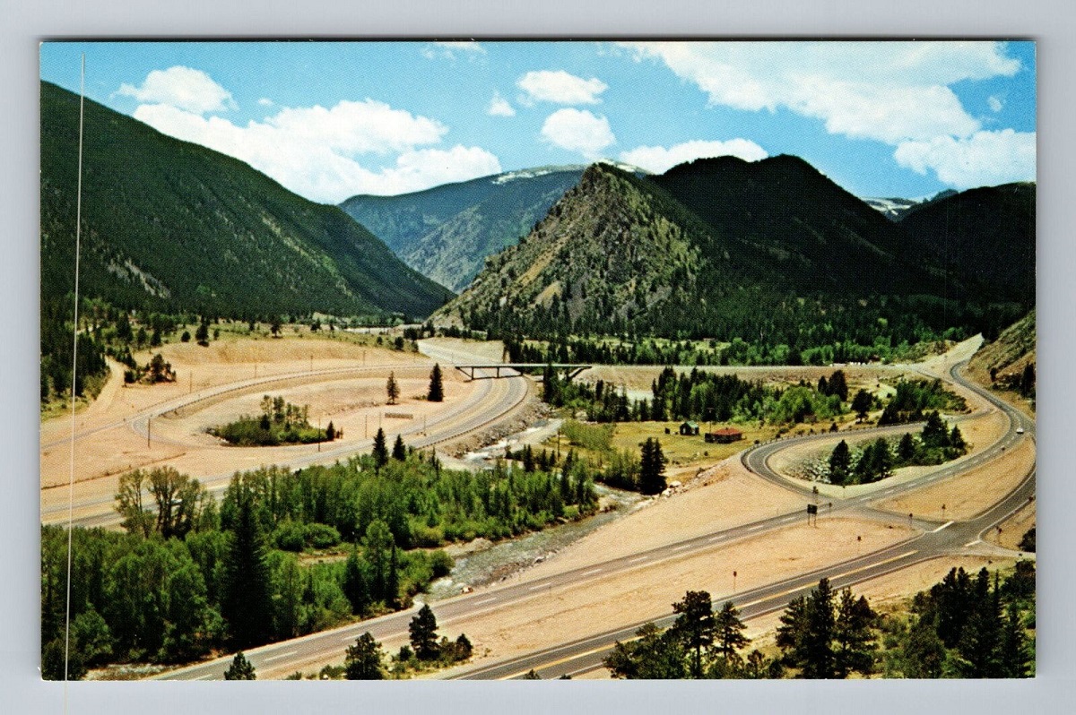 DPL-Z-5322 (upper half)Above Lawson, C.C.R.R. Colorado Central trackage near Empire(Station) visible extreme right. Scar of road ascending the flank of the mountainside to left.  The picture enlarged. 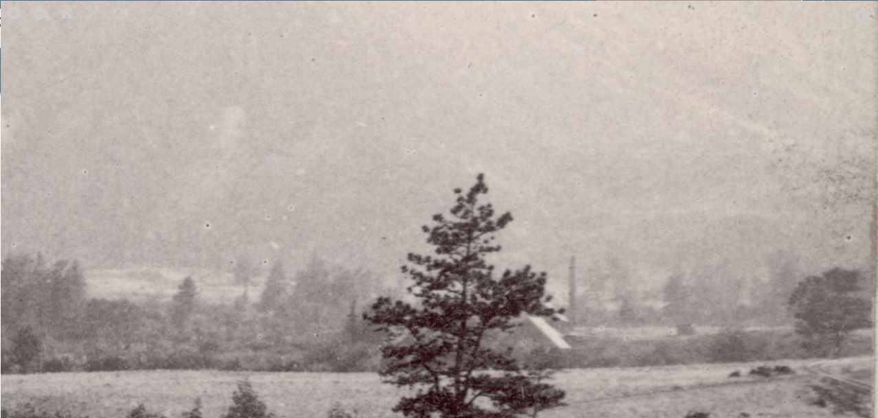 This "Above Lawson" view may just be earlier than I first thought, around the time of the Colorado Central reaching Georgetown, and maybe the only photo taken of John Collom's Smelter building built at Swansea(Empire Station) operated 1869-1871, then became Richard Pearce's Smelter operation, operated 1872-73 and closed due to insufficient ores available at Empire and competing Blackhawk smelters with new direct Rail service. The substantial Chimney has a more Smelter look to it. Nothing else has turned up on this, other than a mention such as this 1879 listing, that adds another name/entity to the puzzel. 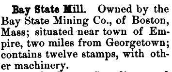  This was the Grinding mill equipment of the time(described above).  Apparently either the Millmen were not that good, or the Mill process wasn't able to save efficiently or just behind the times for the difficult Empire area ores being mined. A number of Newspaper articles have referred to these issues at this time.  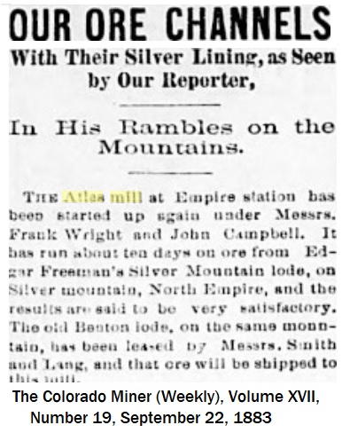  A number of years ago, prior to my memory issues and pre a hard drive loss, I had come across two seemingly related DPL Mill photos, of a group of 4 related images, all dated [1899] Re-finding those images and related identification materials has taken quite some time, but here goes. These were just identified as Clear Creek County Mine and Mill, which given some thought could apply to a very large number of candidates and possible location. The first viewed DPL image had a distinctive road(or trail) cut across the mountainside in the background which I swear I had seen "somewhere", just "where" wasn't coming to mind. DPL X-60753 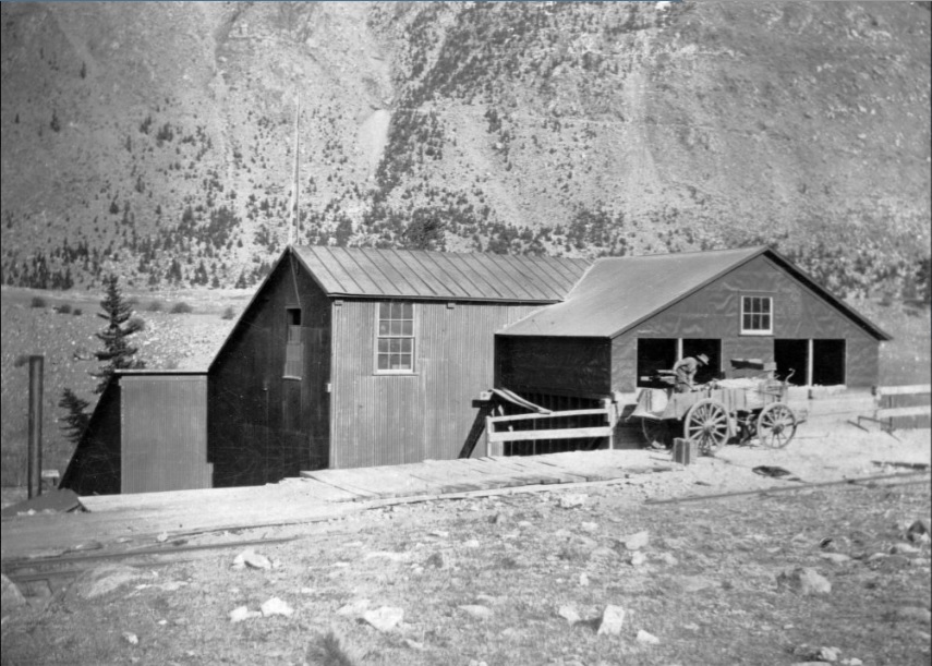 Viewing this WH Jackson image of the Valley taken looking North from the Empire Pass Road yeilded a clue. DPL WHJ-932 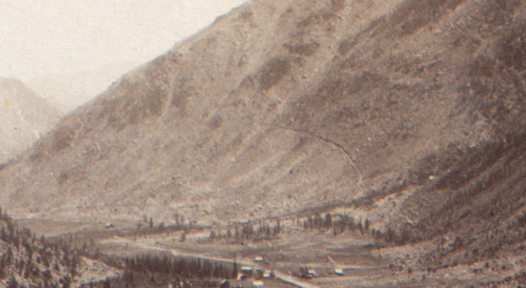 The second mystery Mill image viewed "just felt like Empire", but my subsequent investigation(s) at the time failed to turn up any mention of a Mill, or Siding where I thought it was. DPL X-60754 Fred_Bishopp (DPL spelling).  At first glance this didn't seem to be the same Mill, given the(recently added) Siding but the structure materials, window openings and flagpole sealed it; and combining the features of both backgrounds sort of confirmed Empire as the most likely place. An added bonus of this view, is the partial inclusion of the original gable roofed Colorado Central Depot there.  USGS Central City 1910 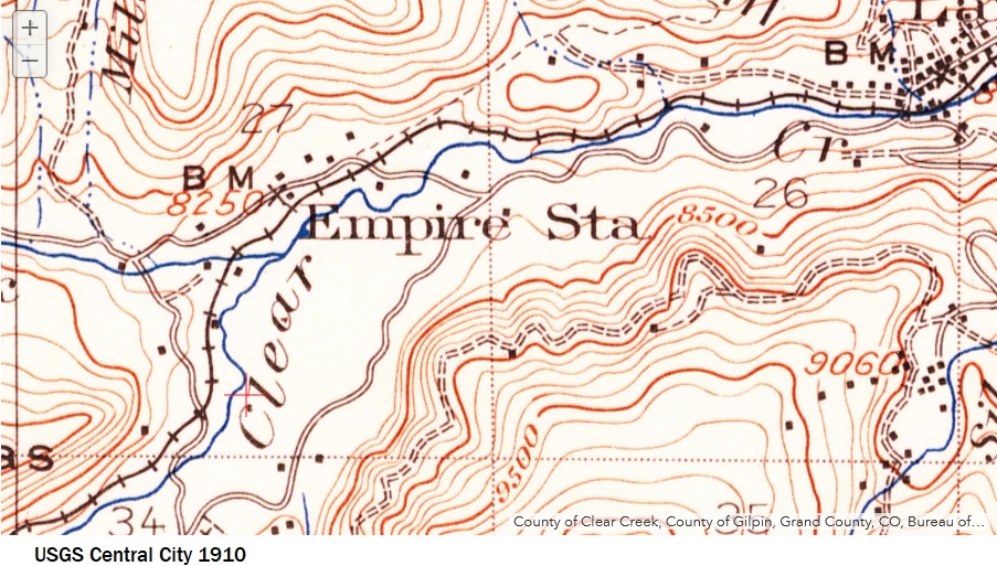 Coming across this 1906 Mining Districts of Clear Creek & Gilpin Counties Map in the Uni Boulder Library supplied the name of the Mill. I had previously thought the reference in the USGS 1917 was of a Mill nearer the Town of Empire, since the Siding depicted did not survive to be recorded in the C&S Valuation of 1918. No other C&S images taken around Empire(Station) show any such Mill structure(s). Lidar Imagery revealing the excavation of the Millsite hidden in the Foliage.  I-70 is the dominating feature here. I-70 is the dominating feature here.
  This Rock formation clearly fits with the trackside view above, the location denoted on the Mining Claims Map. 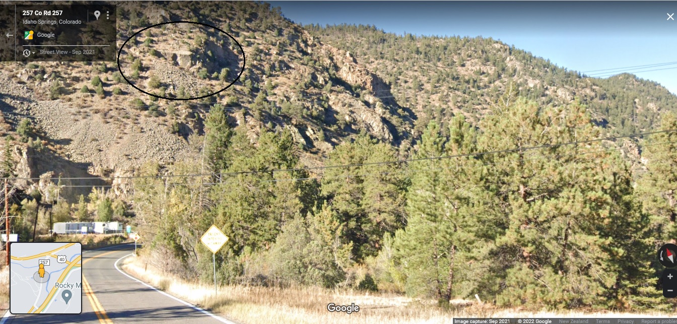 Inside the Mill. 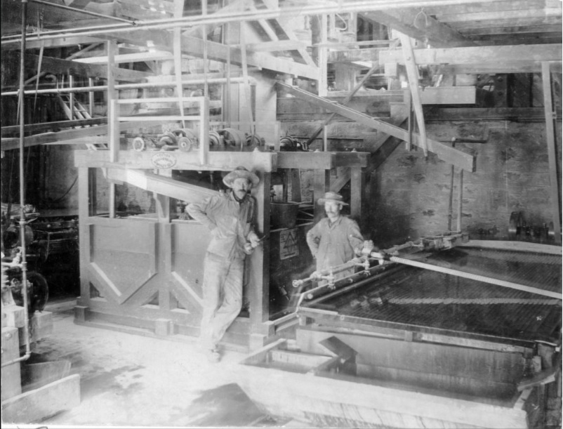 Apparently the Man(Fred Bishop) seen standing on the track beside the Silver Mountain Mill had even bigger dreams.  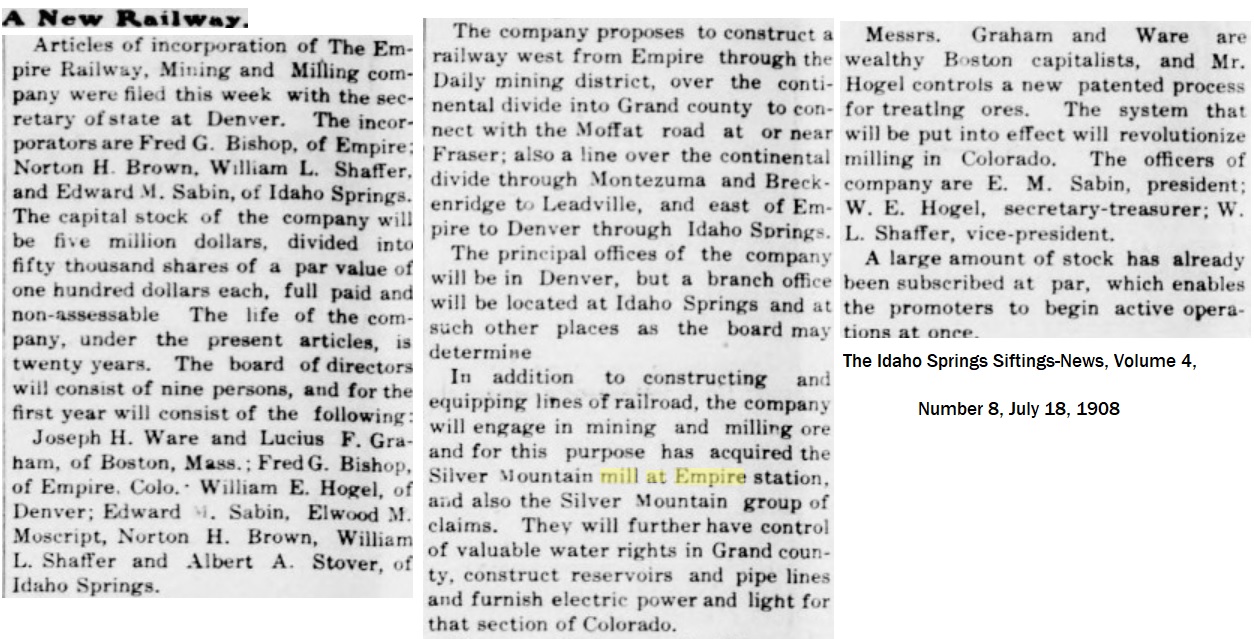 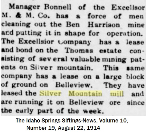  What I find interesting is that the C&S had no reference to this Mill Siding in the 1918 Valuation of Clear Creek. Perhaps the Orewagon unloading view is the later of the two images and the Siding had been removed and the grade alongside the Orebins planked over? Given that a Sash no occupies the upper window. Whilst searching GoogleStreetview for clues, I came across this treasure: I have long since forgotten whether I did know of its existance.   
UpSideDownC
in New Zealand |
|
|
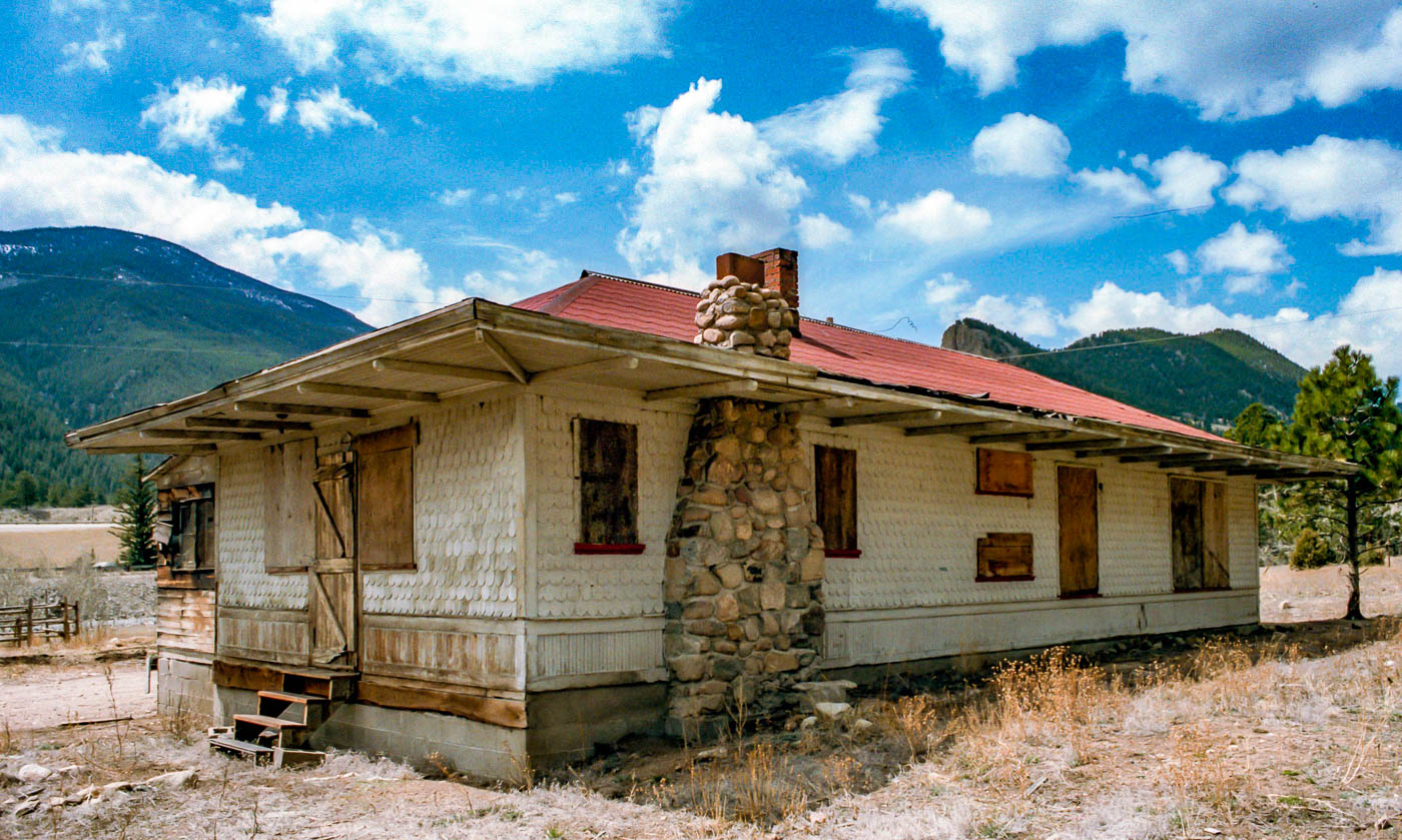
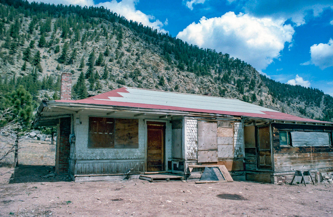
Very interesting- I have always thought that Empire is one of the most "undermodeled" locations. Maybe that is because the town was away from the station and there are so few pictures even of it. However that would make it more of a "scenery" location where it could be modeled along side the right of way. We had discussed the surviving Empire station over in the C&S FB group several months back (not sure about here)- it is a private residence- it appears that the stone fireplace was built over the location of one of the baggage doors.
A couple of photos of the station from the DPL- the one fellow on the platform appears to be the same guy in the trick triple exposure photo taken in a Gilpin ore car. DPL X-8209 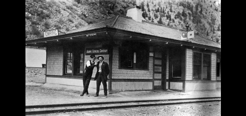 Another taken- those boys had better be good- looks like the grim reaper is on the right side (yea I know its just movement blur  ) DPL X8186 ) DPL X8186
 In addition here is another one shared over on the Georgetown FB group by Paul Conway 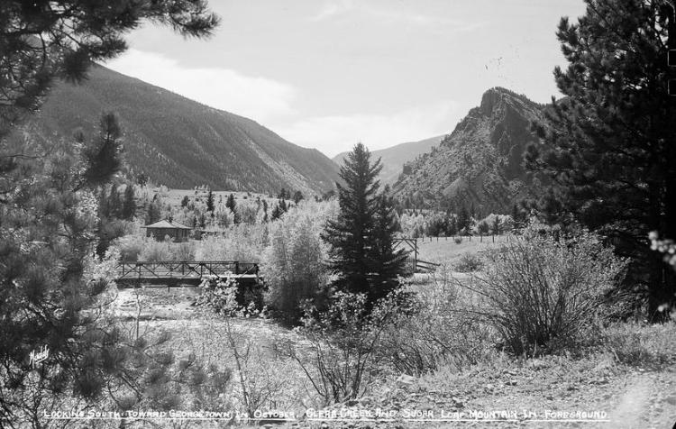 Interesting isolated place Jim
Jim Curran
|
Re: Silver Mountain Mill At Empire (Station).
|
|
This post was updated on .
In reply to this post by Chris Walker
Great article, Chris!
It's good to see that Upside Down Publishing has the Clear Creek Chronicles back in print, with a new issue.  I agree with Jim, that Empire is a very underestimated part of the C&S Clear Creek line, and is very modelagenic. No sheer canon walls, that part of Clear Creek opens up into a broad valley, from Falls River to just below Georgetown. I also had a sense of deja vu when looking at your maps, where the C&S crossed the Middle Fork of Clear Creek. I knew that I had seen photos of that bridge! Turns out it was Bridge 722 (originally number 22). I found a photo in Abbot's Colorado Central:  A neat bridge, with paired bents enclosed with cribbing and filled by stone. But the photo that I most remembered was this beauty by Dick Kindig in the Colorado Rail Annual: 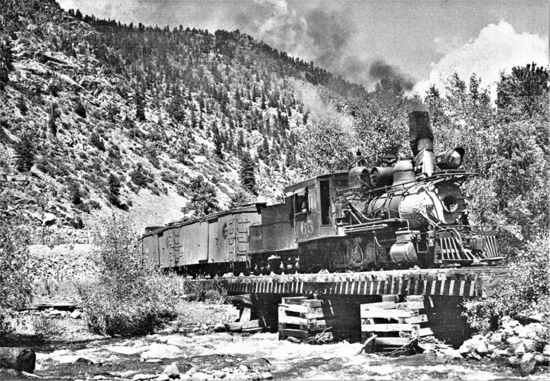 Speaking of maps, the Klingers' Clear Creek book has a copy of the 1918 valuation map of Empire Station:  The book also has the all time station facility list for Empire Station:  I've never seen a photo of a water tank and/or pump house at Empire Station. This Wm. Moedinger view, dated 1933, shows the railroad facilities pretty well, including the depot privy: 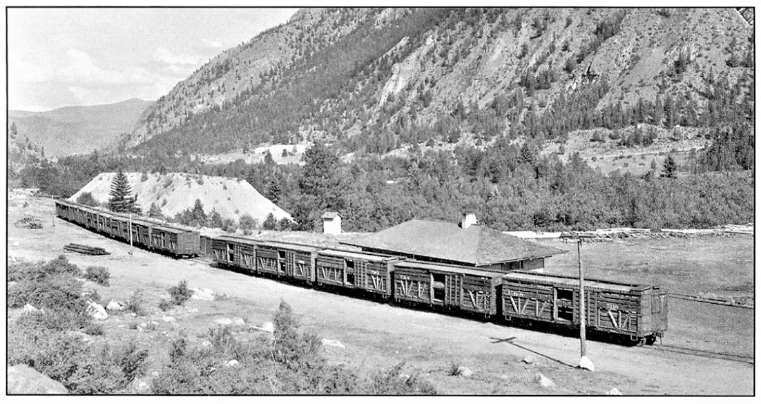 The long string of double deck stock cars on the siding are a curiosity. No reference to stock pens at Empire Station that I could find. It is speculated that they are being stored, for eventual sheep loading at the stock pens on the shores of the White Reservoir, just below Georgetown. The "coal house (boxcar body)" may be visible between the cut in the string of stock cars. Note the pile of waste rock to the left of the privy. The valuation map suggests that this is from the Marshall and Russell Gold Mining Co., that included a trestle or tramway that crossed the C&S tracks overhead. A challenge for Chris--can you find a photo of said ore tipple and trestle / tramway??? 
Jim Courtney
Poulsbo, WA |
Re: Silver Mountain Mill At Empire (Station).
|
|
In reply to this post by Chris Walker
I only visited the depot site once about 40 years ago. IIRC, back when it seemed to be abandoned.
|
|
|
In reply to this post by Jim Courtney
Hmm
This blurb about there being an original Empire station that was moved makes me think of another mystery that surfaced a little while back on the C&S Facebook group- There was a photo in the DPL labeled as Stevens- we batted it around for a while supposing that it could be mislabeled (Not that the DPL ever does that  ) or part of the depot at Lawson but I wonder now- has anyone seen a pic of the original depot at Empire?? ) or part of the depot at Lawson but I wonder now- has anyone seen a pic of the original depot at Empire??
 Here is the link in the DPL https://digital.denverlibrary.org/digital/collection/p15330coll22/id/5602
Jim Curran
|
Re: Silver Mountain Mill At Empire (Station).
|
|
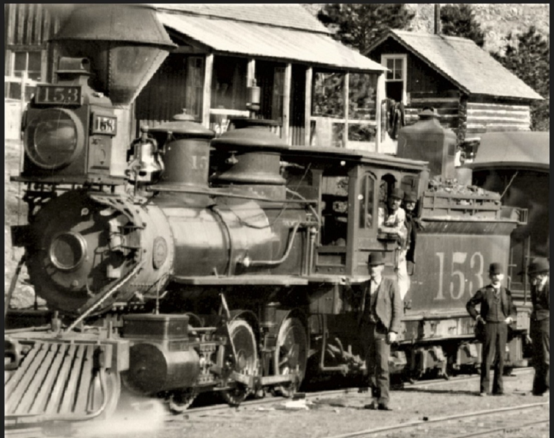
Might as well post this photo as well, since we are discussing Empire (Station) depots:
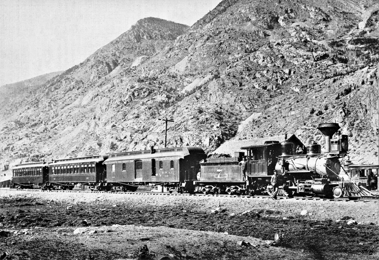 J.C. Thode collection in Poor's Memorial Edition, Denver South Park & Pacific This is one of my favorite photos, because: a) It is a great photograph in its own right, technically, in terms of composition, exposure, etc. b) It is a great portrait of one of the Cooke 2-6-0s in the McConnell stack era, the locomotive that would go on to become C&S 12. c) The passenger consist--the first coach, directly behind the RPO, is the Pullman Tourist Sleeper that was sold to the UPD&G and refitted as a first class coach, eventually becoming C&S number 62 in 1906. Note the missing window at the left end, removed for the installation of a Baker heater. But there are a lost of weird things in the photo, in terms of time and perspective: Poor and Digerness both firmly date the photo to August 7, 1894. But Pullman records show that Pullman Tourist Sleeper number 466 was sold to the UPD&G in 1896 for $1,250.00. The UPD&G rebuilt it as first class coach 193. In 1899 it became C&S coach 153, renumbered 62 in 1906. So how does a coach purchased in 1896, show up with UPD&G paint / lettering in an 1894 photo??  To me, 1894 seems too early for a McConnell stack on the locomotive. I would think late 1890s would be a better dating, i.e. 1897-1899. That would reconcile the Pullman written records. But the depot seems to be a smaller, gabled structure. The facilities record showed the abandoned original depot moved in 1894, which seems odd if the photo is truly from the late 1890s, 'cause it is still there. Mac Poor's station list doesn't list a depot at Stevens. just downgrade. Finally, there is weirdness of perspective, that has always confused me. Note the locomotive at the right frame. My eye sees the rail of the siding behind the depot just barely below the cab of the older locomotive. It seems to be sitting lower that the railroad grade. Is it derailed?? Is there some sort of depressed track beyond the siding, like a coaling track for locomotives?? Can anyone identify the little locomotive??
Jim Courtney
Poulsbo, WA |
Re: Silver Plume mis-labled as Empire (Station).
|
|
Ya'll getting ahead of me here....
The contributions to this thread are most appreciated: I just love a good discussion. Jim C's latest post picture of #7 is actually Silver Plume, this picture has numerous authors decribing it as Empire. My correction was accepted by DPL see the notes: MCC-3197. Actually Digerness' Mineral Belt III has two S.P. pictures mis-labeled as Empire,; one look at the mountains should tell you otherwise.  Here's the streetview capture I did back in April 2018 for the DPL. 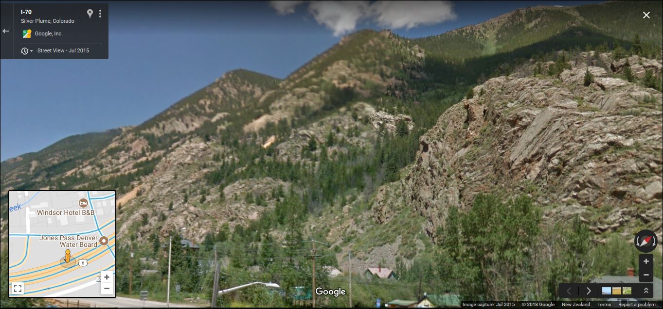 At the same time, this corroborating view of the same peaks was cropped from an Argentine Central Shay picture by Lachlan McClean DPL MCC-3161  And there is always this later view. 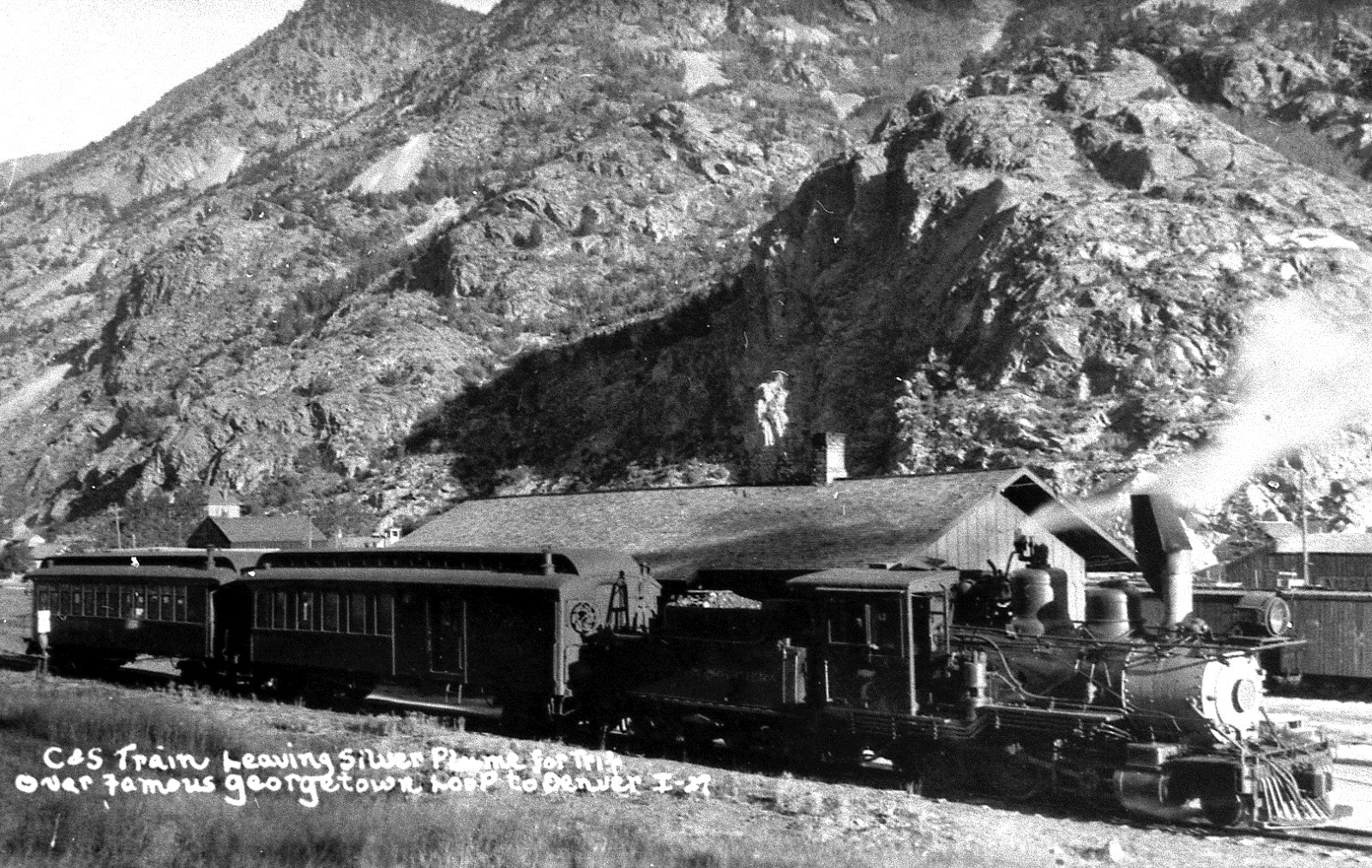 Yes the original Depot at Empire(Station) was a Gabled structure, and the(similar appearing) Depot at Stevens also has been confused with Lawson: the wider, undulating area topography(backdrop) doesn't fit there either. Digerness even got the station of Stevens mixed up with the mining claims of Stephens in the text. more to come; it's a lovely sunny Spring day outside.
UpSideDownC
in New Zealand |
Re: Silver Plume mis-labled as Empire (Station).
|
|
This post was updated on .
 Well . . . how embarrassing! Well . . . how embarrassing!
Just goes to show ya, you can't believe any caption in any C&S book, even if Mac Poor or Richard Kindig is the author.  Of course UPD&G number 7 and train are at Silver Plume. The gable roofed small structure isn't a depot, it is the Silver Plume section house. The water tank is just out of frame to the right, the depot itself is much further to the right.  The train is probably the morning down train to Denver, hasn't yet pulled down to the depot to load yet. It seems it was common to turn the train on the wye, then spot the train overnight down by the section house, below the switch for the cross over to the depot house track. That location also explains the weird perspective of the locomotive in the background--the house track and spur to the north were a bit lower than the mainline grade. The little locomotive is likely on the house track, right about the location of the 3-way stub in teh photo above. I'd still like for someone to identify the locomotive in the background. And being a South Park kind'a guy, I'm not that familiar with CC / UPD&G locomotive rosters. A little reading showed that UPD&G 107 (formerly CC 14) was renumbered to UPD&G number 7 in 1896. So, that dates the photo to 1896-1898, no conflict with the Pullman records for former Tourist Sleeper C&S number 62. So Mac Poor got both the date and location wrong. I've not been this disillusioned since I discovered, at 3 years of age, that ice cream cones were hollow inside.  (BTW, Chris, when I enter "MCC-3197" in the DPL search bar, I get no result found--is the link correct??)
Jim Courtney
Poulsbo, WA |
Re: Silver Mountain Mill At Empire (Station).
|
|
In reply to this post by Jim Courtney
Jim, edit: https://digital.denverlibrary.org/digital/collection/p15330coll22/id/30887/rec/1 yes, the call # is correct, and your Sanborn Silver Plume view is the other Digerness mistake I mentioned above. you're a hard taskmaster. I'd love to have been able to present that image, maybe sometime in the future, perhaps? However somewhere I do have some info on the predecessor Empire Tunnel and Gold Mining, Milling and Transportation Company. I pontificate that the "Marshall and Russell Gold Mining Co." was indeed a speculative revamp and the notation of trestle over the C&S tracks in the Valuation record, still being in existance at the time of the survey(nothing to say it was in use though); just how much longer that wastedump track trestle existed for I have no idea. That time period seems to be a bit of a dead zone, perhaps some Lachlan McLean images reside in the UCB Norlin Library? Ebay listing. 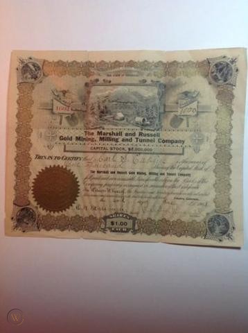
UpSideDownC
in New Zealand |
|
|
In reply to this post by Jim Courtney
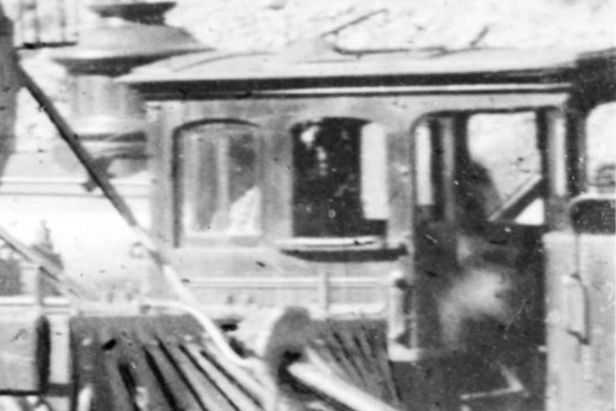
Here is a blow up of the engine in the background of the Silver Plume (incorrectly labeled Empire) At first glance it could be mistaken for a bogie in the larger picture but it isn't (we had a discussion on this one in the C&S FB group) I don't know if there is enough to tell what loco but maybe this might be a help.
 Jim "other C" (Curran- not Courtney )
Jim Curran
|
Re: Silver Plume mis-labled as Empire (Station).
|
|
Jim C
 That steamdome does resemble CC#10, but only because I haven't seen pictures of #9's the first cab window had a mullion visible. see DPL Z-5458 Colorado Central eng[ine] #10 at Crisman, Colo.
UpSideDownC
in New Zealand |
Re: Silver Plume mis-labled as Empire (Station).
|
|
I guess it could have been this one in UPD&G lettering (former CC 11).
 Anyways, one of the Colorado Central Brooks 2-6-0s. Jim, the other C.
Jim Courtney
Poulsbo, WA |
Re: Silver Mountain Mill At Empire (Station).
|
|
This post was updated on .
In reply to this post by drgwcs
Jim, indeed it was mis-labled, but the DPL had it listed as Lawson. sometime ago I had it corrected, the background terrain(at Lawson) is rising riverbanks much flatter than around the corner.
EDIT: Probably mis-labled as Lawson as Digerness in Mineral Belt III also states same. His caption does mention the enlargement of the Depot at Lawson as well. Your comment about facebook and the "or part of the depot at Lawson", has anybody discussed the possiblitity that this Stevens depot was moved downstream to become part of Lawson's depot? I'm suspicious of the Lawson depot roof outline, that's all. Also, thanks for posting the Empire view: I have that "post-abandonment" postcard somewhere in my collection, but failed to recall it.
UpSideDownC
in New Zealand |
Marshall and Russell Gold Mining Co.: Empire Station
|
|
In reply to this post by Jim Courtney
This one's for Jim,  and an excerpt from a Georgetown Courier clipping... to colour the imagination for the reader. 
UpSideDownC
in New Zealand |
|
|
In reply to this post by Chris Walker
We actually questioned a bit about that this might have been moved to Lawson. In regards to this pic we really did not come to a firm conclusion on anything. It appears that Stevens was pretty close to Lawson so it is a possibility that this was moved- There is only one "good" photo of this end of the depot at Lawson. The other (freight end) had no windows. (Of course this was an addition if the Stevens depot became the Lawson depot) Looking at the windows they are a match- but those were likely a purchased commodity. If someone has eyes better than my trifocaled ones (sad at 56) they might be able to count and compare board and battens count and locations. The Stevens depot appears to have disappeared and considering its proximity it is a possibility of a move. We did bat about as has been said mislabeling and Empire was brought up too. We were left scratching our heads. 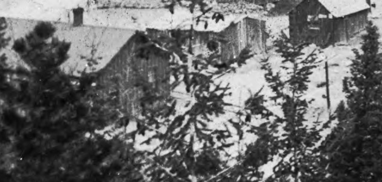 Here is the link to this photo http://https://digital.denverlibrary.org/digital/collection/p15330coll22/id/9852/rec/167 And the photo labeled Stevens https://digital.denverlibrary.org/digital/collection/p15330coll22/id/5602/rec/1
Jim Curran
|
Re: Marshall and Russell Gold Mining Co.: Empire Station
|
|
In reply to this post by Chris Walker
Well done, Chris, well done!
Although the M&R tunnel house has obviously been drawn in, likely for an investors prospectus, the rest of the photo rings true. The overhead trestle, main / siding and background mountains seem like the real deal. Consider if the "photoshopped" elements are cropped out: 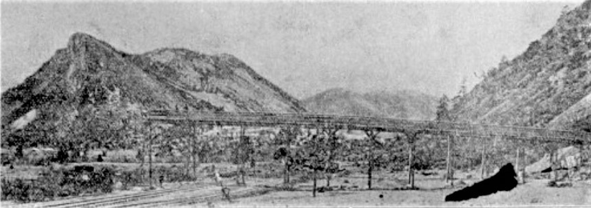 Note the harp switch stand at the derail for the siding. There is no depot visible to the west. But if the blurb upthread about the Empire facilities is correct, there many not have been a depot structure present between 1894 and the building of the new depot by the C&S in 1899. so perhaps the actual photo was taken in the late 1890s--doesn't look like much mining has occurred, as there is little waste rock at the end of the overhead trestle. Again, Chris, you never disappoint . . .
Jim Courtney
Poulsbo, WA |
Re: Marshall and Russell Gold Mining Co.: Empire Station
|
|
This post was updated on .
Hehehe Jim,
Thanks for that, I aim to present all I can.   Jim, at the time of the Feb, 1902 Newspaper account, the tunnel was only 200ft in, so the waste rock pile would most likely have been all under that fancy Building, and bear in mind this Tunnel is being driven to intersect the veins of existing Mines at Nth Empire, some 7750ft away. All the images in newspapers at that time seemed to suffer from exaggeration, maybe to do with the lithography processes of the era?  I for one will take these sort of images for what they are, evidence of existance and maybe others will get model building inspiration from the info presented. All the coverage on the CC and C&S have basically passed by Empire(station) but shown the town of Empire better. A later, wider view from across the valley, waste rockpile developing. The competing Empire Tunnel is to the left and slightly higher.  DPL-X-12302 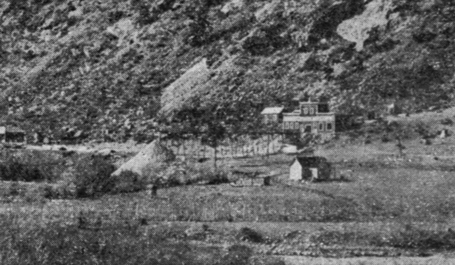 In fact I'm going to have to rewrite the first post, I've got more to share, because this place went under several names, i.e. Marshall Park, Empire Junction and Empire Station and my collection has stuff filed under each, plus I've unearthed more background information as well. Also there were search terms that applied equally to other localities making it so much harder and the Mill under discussion went under several names, each revered by the newspaper reporters of the region. Oh, and by the way, whilst sifting newspaper articles of the time, one reporter innocently described the location of the Mill(at Empire Station) as being just South of the Empire(Station) Water Tank. I'll include that 1883 clipping in the rewrite.
UpSideDownC
in New Zealand |
|
|
So agreed on this- Empire the town was shown much better than the station. Most general photography of the area would have concentrated on the towns with the railroad as incidental, the exception being of course the loop and a couple of tourist locations such as the pavilion. Think about for example how many more photos we have of the towns (especially scenic overlooks) along the Clear Creek Line vs the railroad facilities themselves. Empire was a bit of a strange situation as the railroad bypassed it and most of the mining was going on in North Empire. Photographers would naturally gravitate toward the town and to a lesser extent the mines. The junction area was overlooked. That being said there are a lot more photos of Empire itself than Lawson or Dumont.
Jim Curran
|
Re: Marshall and Russell Gold Mining Co.: Empire Station
|
|
Looking around again....fwiw
here's the Marshall and Russell Tunnel dump, still in existance depite the CDOT's best efforts at rearranging the landscape at Empire Station.

UpSideDownC
in New Zealand |
|
|
The title post has been rewritten, should you wish to re-read it: A number of surprises are in store for those who do.

UpSideDownC
in New Zealand |
«
Return to C&Sng Discussion Forum
|
1 view|%1 views
| Free forum by Nabble | Edit this page |