Silica
123
123
|
This post was updated on .
There seems to be very little info on the web about this branch (or in Mac Poor, although I haven’t dug out my picture supplement yet to see if there’s more).
The branch was originally built (in 1908 or 1909) to service the Silicated Brick Co, which quarried limestone, burned it to make lime, and manufactured sand/lime bricks. The company failed in 1912 and was reorganised as the Silicated Brick and Clay Co (suggesting they were also manufacturing regular clay bricks at that point?). It failed again in 1916 and was shut down. Photos from 1910 (http://www.douglas.co.us/about-us/historic-preservation/county-landmarks/silicated-brick-company/ <http://www.douglas.co.us/about-us/historic-preservation/county-landmarks/silicated-brick-company/>) show a variety of structures at the site, including a lime kiln, brick manufacturing building, superintendents office, boarding house and several outbuildings. One picture shows a couple of (2’?) mine tracks with ore carts. There was also a “town” called Silica, although it was no more than 6 - 8 houses just west of the brick yard. Otto Perry captured some lovely images in 1941 which show the site still active. Judging from the photos (and the earlier history), it appears they were mining limestone at that point: 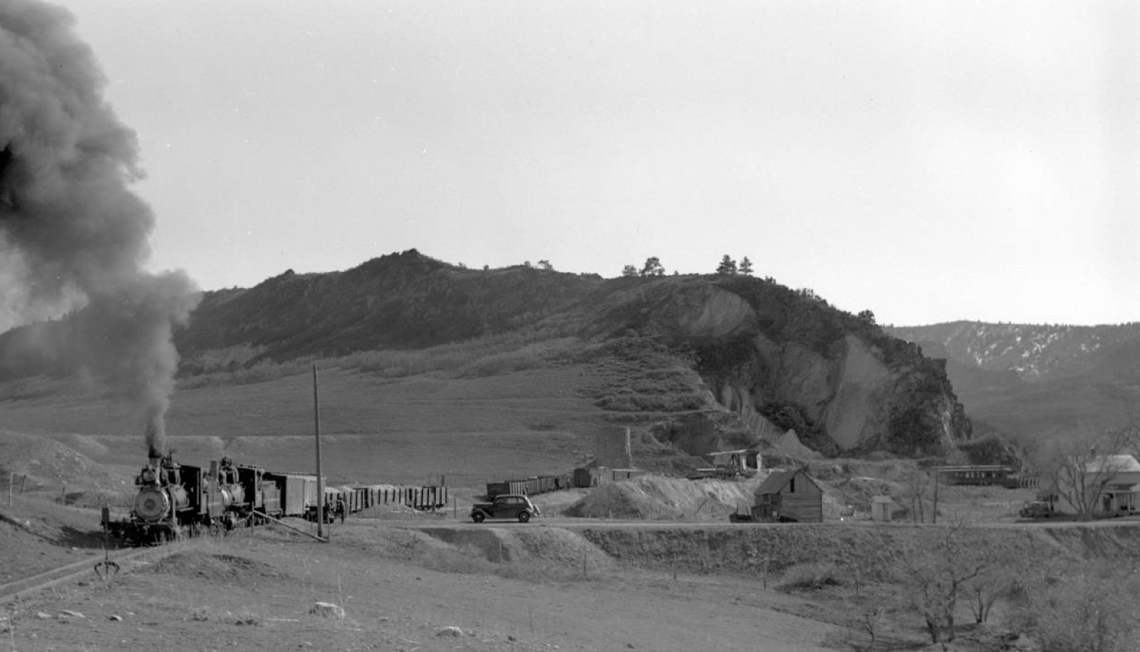 http://digital.denverlibrary.org/cdm/singleitem/collection/p15330coll22/id/42565/rec/16 <http://digital.denverlibrary.org/cdm/singleitem/collection/p15330coll22/id/42565/rec/16> The same picture also reveals what appears to be a C&S passenger car body being used (or having been used) as a bunkhouse: 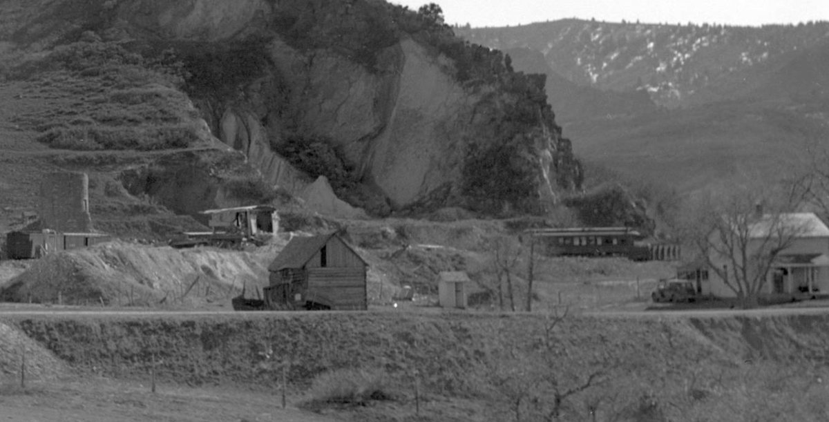 (although that area is the approximate location of one of the spurs, so perhaps the car body is still on its trucks). The line was finally abandoned in October of 1941. Anyone know more? Of particular interest would be when the site was active post-brick manufacture (all of 1916 to 1941?), what was being quarried/mined (presumably limestone), what passenger car this was, and whether it was still on its trucks or not. Cheers, Jeff. |
|
The Pictorial Supplement includes two of the Otto Perry pictures, and answers two of the questions:
The passenger car body is in fact combination car #41, is standing on the ground, and was used as the Silica station (rather than as a bunk house). Cheers, Jeff. |
|
There was a close-up photo of this car in a Bogies & Loop issue 1or 2 years back.
|
|
Thanks for the heads-up, Robert.
It took some searching (as the article is somewhat less-than-helpfully titled “More information from Ken Martin” and the DVD archives are one-file-per-page), but it’s on page 5, July 2012 (Volume 13, Issue 4).
Cheers, Jeff.
|
|
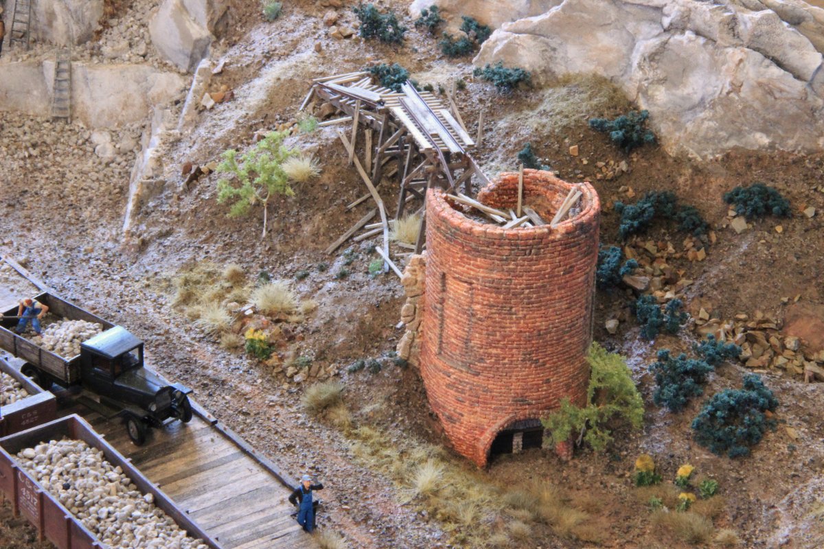
My lime kiln is more-or-less complete:
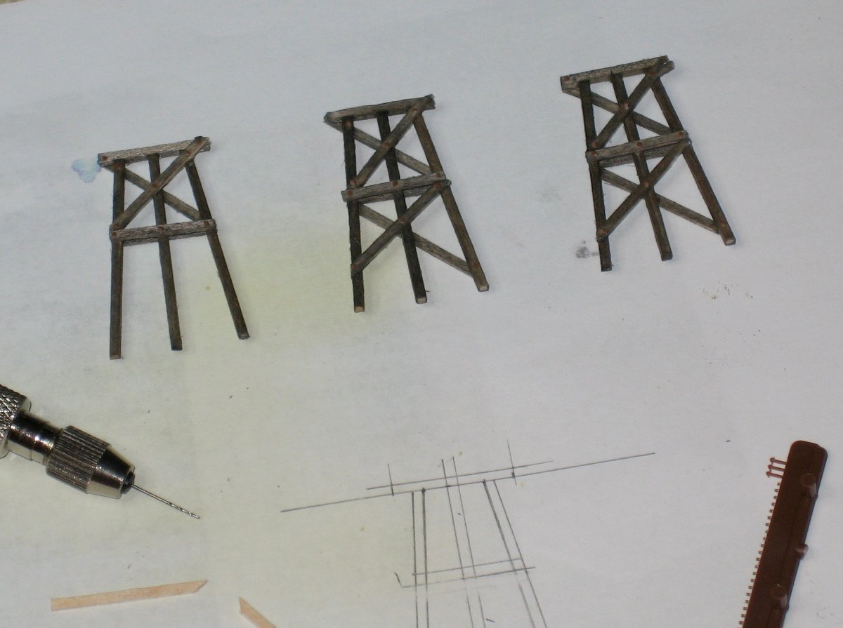 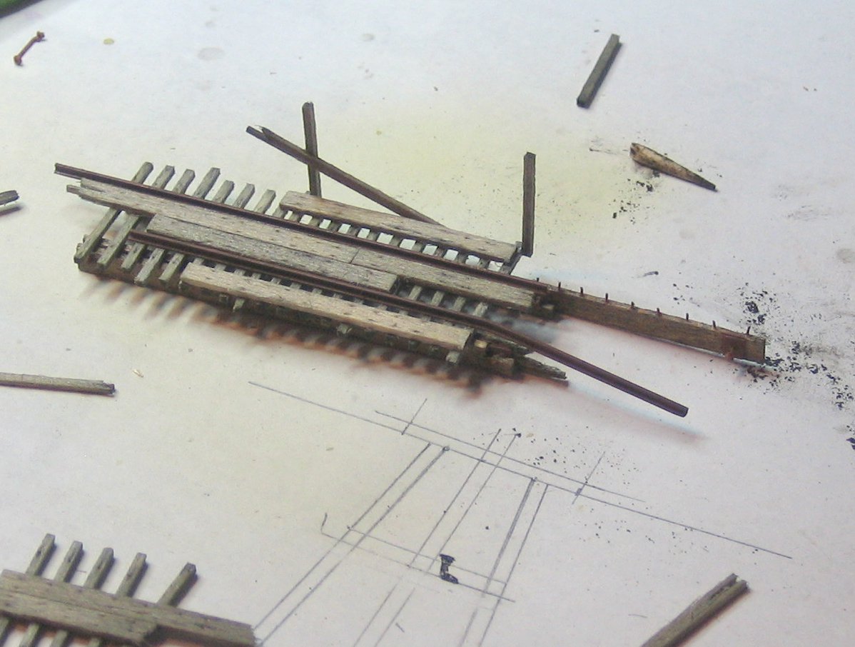 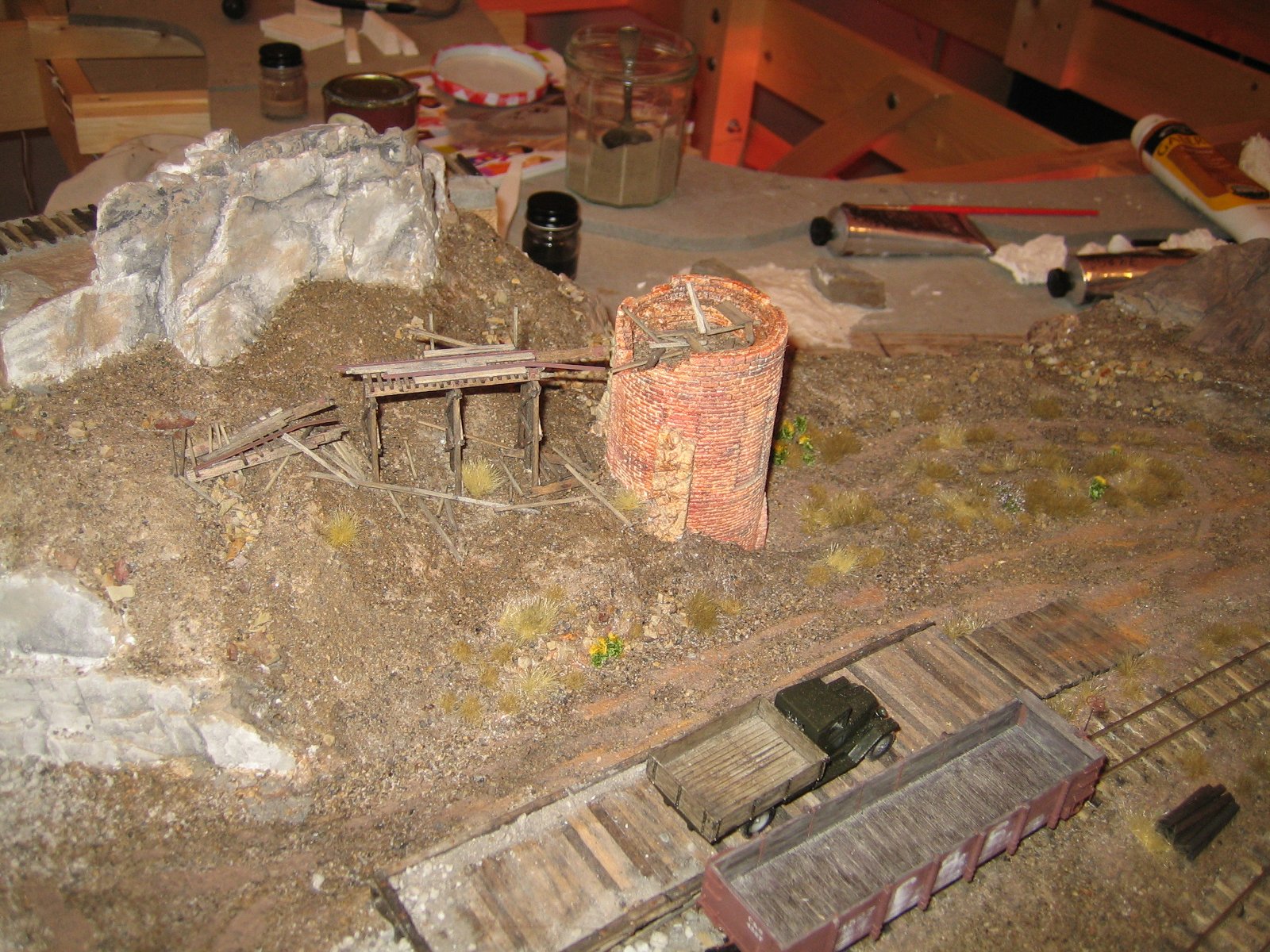 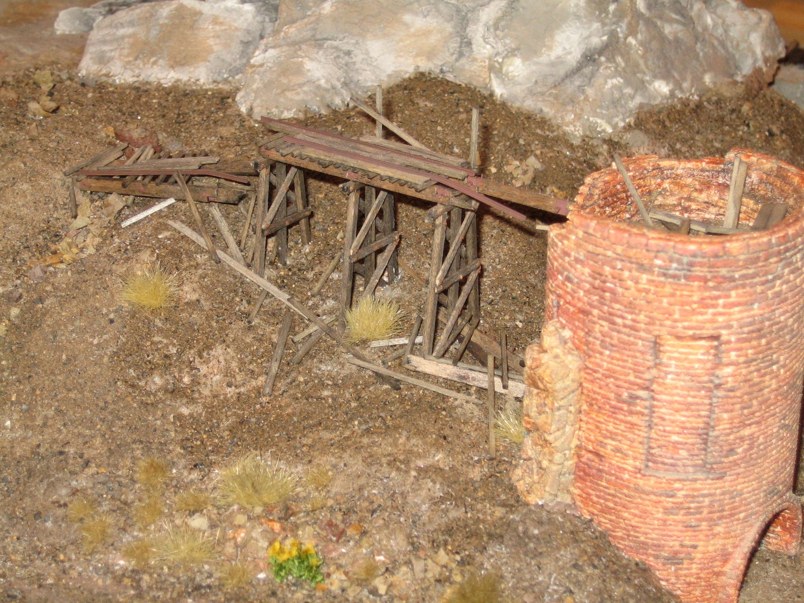 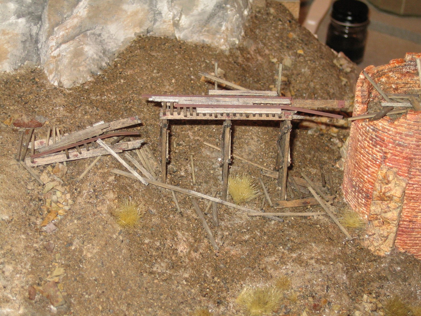 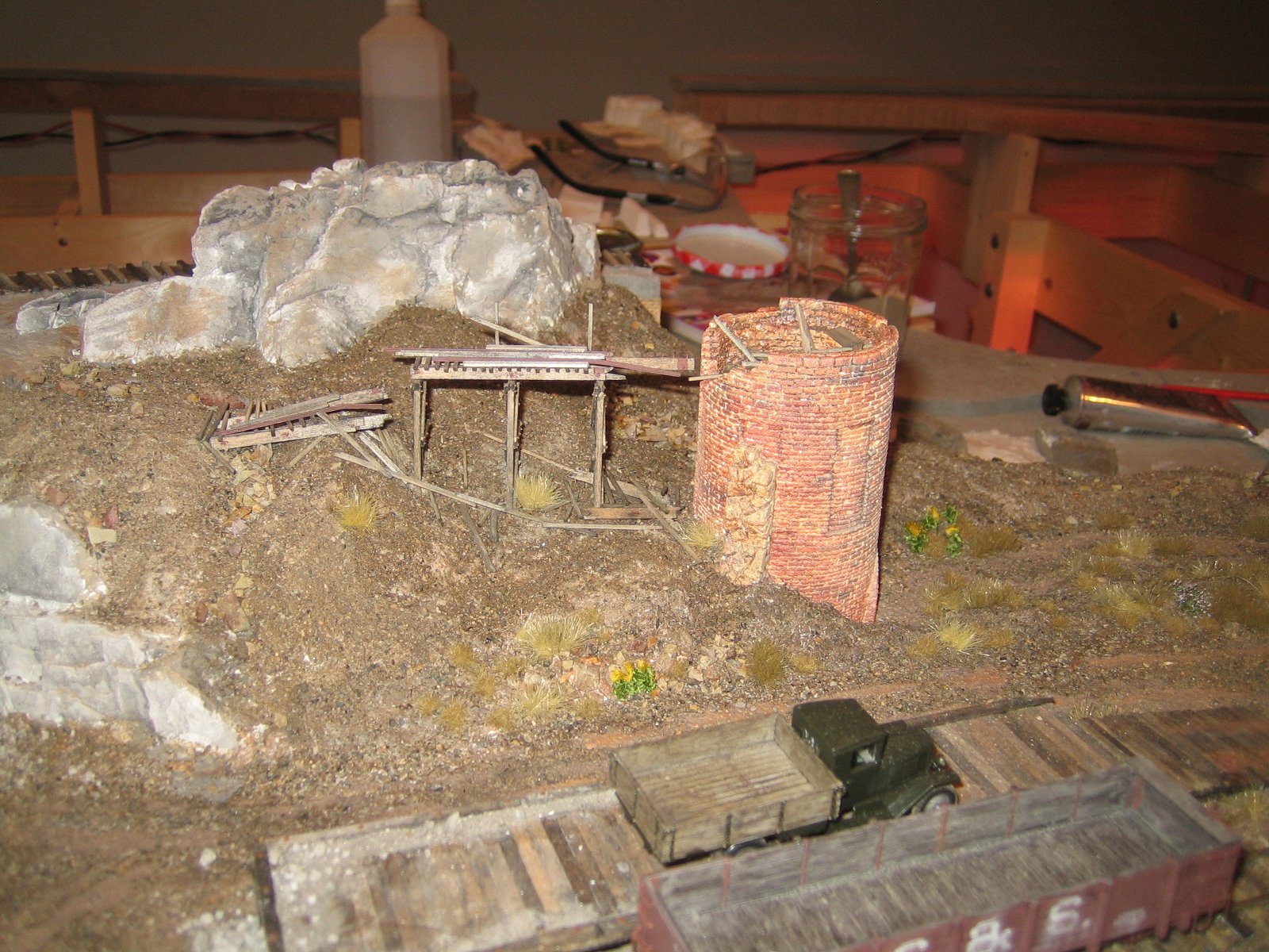
|
|
Very nice work, Jeff! (Man, those NBWs are tiny!)
Keith Hayes
Leadville in Sn3 |
|
In reply to this post by Jeff Young
Hi group, new member Norm here. I think the information and photos posted here are excellent. I have been daydreaming about modeling the terminus of this branch for years now (I`m in On3 and I've only gotten as far as the stub turnout on the Waterton wye). From looking at the Silica pictures from 1941 it seems there were two parallel spur tracks, one for staging cars and one for loading silica. A loading platform like the one in Blackhawk would have been useful, but probably not affordable for the branch. I've always assumed the long piles adjacent to the loading track were loaded by hand, although it would be very difficult to shovel from the ground level into the cars. There is also a photo somewhere of a crew of men transloading ng silica cars with shovels to standard gauge gons in Denver, so it's easy to assume that was the preferred transfer method in Silica as well. Any ideas?
It's also interesting to note that a derail with a harp stand seems to be located before the road crossing. I currently live about 1.5 miles north of the old Silica town site. The old roadbed and quarry cart track bed are still clearly evident when walking the site, which is the current home of the Roxborough Park fire station. I have to sheepishly admit that I've toyed with the idea of modeling a dilapidated steam shovel to help those overworked shovelers... Thanks for all the great info, photos and modeling data.
Norm in Littleton, CO
- on the C&S Silica Branch |
|
Well, darn Norm, take some pictures of your layout and post them!
Keith Hayes
Leadville in Sn3 |
|
In reply to this post by Norm Acker
Hi Norm,
According to the ICC maps, it was a siding rather than parallel spurs. There’s just enough of the branch line after the siding re-joins to run an engine around a cut of cars. The ICC maps also show a “chute” about 3/4 of the way down the siding, but I don’t know what it looked like. In the early days (when the brick factory was running), they also unloaded limestone from Bolton for the lime kiln. Probably coal or coke as well. There appears to be a light narrow gauge track running from near the road crossing back around to the trestle that feeds the top of the kiln. (Limestone and either coal or coke would be loaded into the top in alternating layers; after burning the quicklime would then filter out the hatches under the arch at the bottom.) It would be great to know if there’s any sign of this grade left. As for loading, it’s possible they were still using the “chute”, whatever it was. I’ve always assumed the piles were tailings. I don’t think a man could shovel from ground level into a coal car. If you look at the aforementioned transfer picture (Narrow Gauge Pictorial Vol VIII) you can see that the top board of a coal car would be above a man’s head when standing on the ground. I suppose you could shovel from the *tops* of the piles into a coal car, but building a timber dock would be easier than blasting out enough additional feldspar to stand on. I agree that they were quite economical during later years. Take, for instance, the outer layer of feldspar on the lime kiln shown in the early pictures. While it’s possible the metal bands rusted through and it just collapsed, I think it more likely that they broke it up and shipped it out with the rest of the product. Given the lack of evidence (and my need to greatly compress the space at Silica), I went with something along the lines of the Blackhawk dock. I have no real evidence that such a thing existed, however. About 2/3 of the way back to Waterton is the Bolton limestone quarry. There’s a spur there with a fork at the end. There’s also the (very short) “Frauenhoff” spur near the Bolton quarry, which I imagine is related to the quarry. Info on either of these appears to be pretty scarce. Anyway, might be another location for your steam shovel. ;) Cheers, Jeff. |
|
In reply to this post by Jeff Young
I've finally gotten a shot or two to post, and I'm going to share a couple more photos of Silica in the next day or so. Here's my On3 version of Waterton, the Silica branch (in a very condensed form) will be to the right. Due to space considerations I had to bend my Waterton around a curve. My mockup of the depot is based on the only three pictures I've been able to find anywhere, including the Denver Water Board, who were kind enough to share some good images with me. The second shot is looking from the Silica tail of the wye back towards town. I've got lots of scenery work to do...
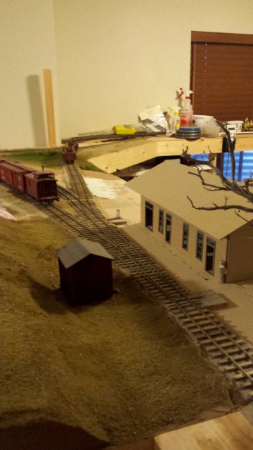 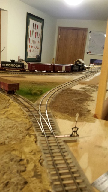
Norm in Littleton, CO
- on the C&S Silica Branch |
|
In reply to this post by Jeff Young
And a couple of photos of Silica
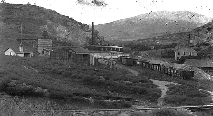
Norm in Littleton, CO
- on the C&S Silica Branch |
|
In reply to this post by Jeff Young
Oo
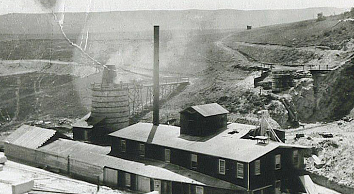 ps, here's the second one... ps, here's the second one...
Norm in Littleton, CO
- on the C&S Silica Branch |
|
In reply to this post by Norm Acker
Looking good, Norm!
|
|
A couple of SUF coal cars on the siding at Silica:
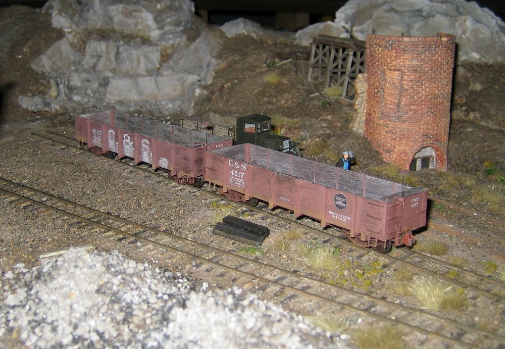
|
|
The Record-Journal of Douglas County, Sept 26, 1941:
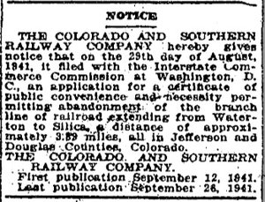
|
|
A sheriff's sale was held in 1917 to pay some of the debts of the failed Silica Brick and Clay Company. The bottom half of this article gives a priceless glimpse of the equipment in use at the brick factory.
(As a bonus, note that it also identifies the quarry track shown in some of the 1910 photos as being 28" gauge.) The Record-Journal of Douglas County, Mar 30, 1917: 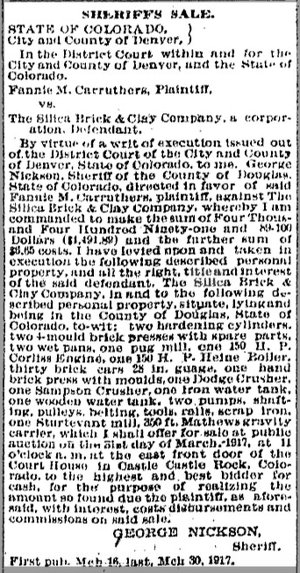
|
|
A description of the venture during its hey-day.
The Record-Journal of Douglas County, Feb 3, 1911: 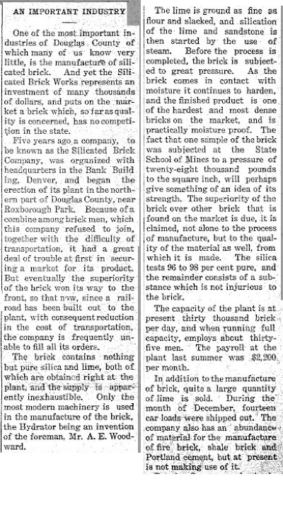
|
|
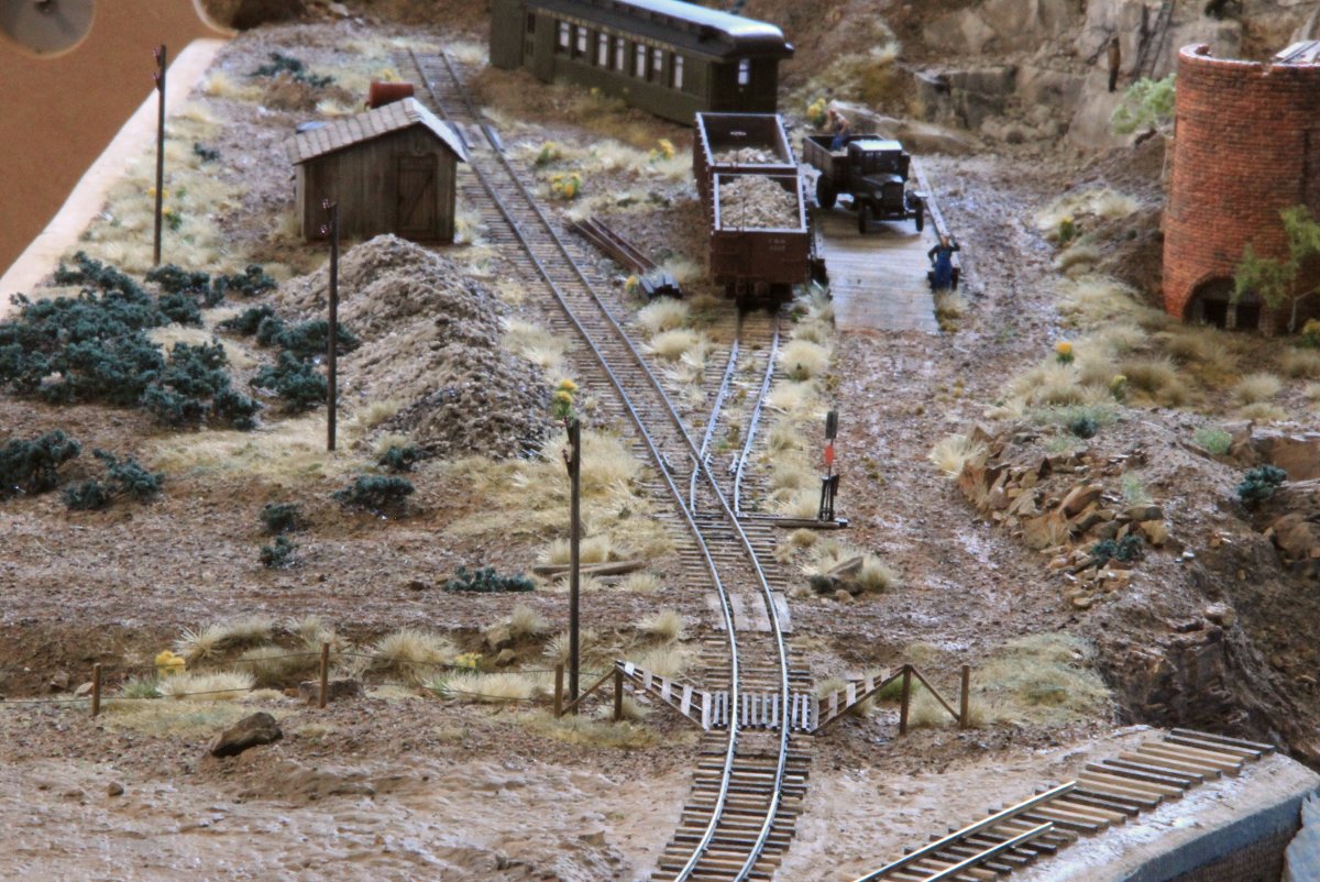
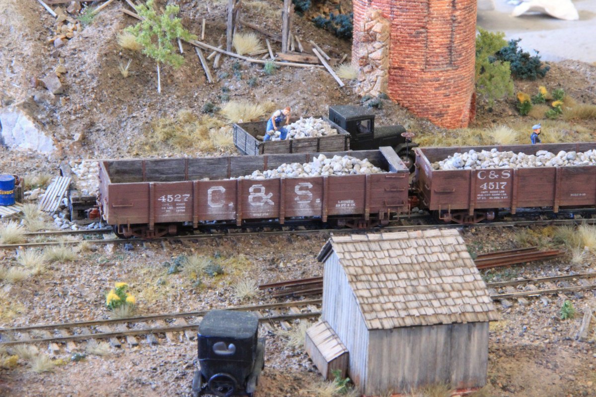
An update on my progress:
|
|
Awesome, inspiring work, Jeff.
And all please note, a cattle guard in HOn3! Jim
Jim Courtney
Poulsbo, WA |
|
Jeff, et al;
This kind of scratch-built modeling is just too neat. I'm not a modeler, but it sure is fun to see and walk through this research with you guys. On your layout, Jeff, I see a sidepin lead running off to the left. Photos of this site are limited, but I have not seen such a line in RR era pix. Is this based on a photo I have not seen, or a case of "modeler's license" ? Great looking work. 
"Duty above all else except Honor"
|
«
Return to C&Sng Discussion Forum
|
1 view|%1 views
| Free forum by Nabble | Edit this page |

