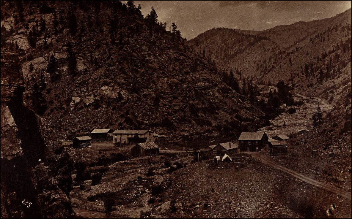
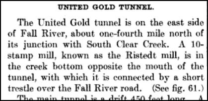
Fall River.
 http://digital.denverlibrary.org/cdm/fullbrowser/collection/p15330coll21/id/12599/rv/singleitem/rec/9
Idaho Springs western Yard Limit Board was at Mp 39.17,
Fall River, the Hoosac Mill Spur at M.P 39.39.
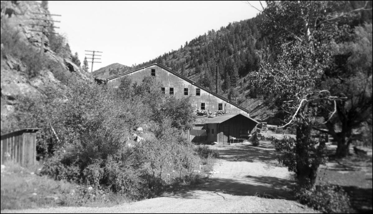
Here are several new pictures of Fall River, some two miles West of Idaho Springs Depot. While these pictures presented here are not of the knock-your-socks-off, infinite-depth-of-field, glass-plate-variety, they do serve a purpose in delineating this until now, hidden corner of the Colorado Central Railroad/Colorado&Southern Railway.
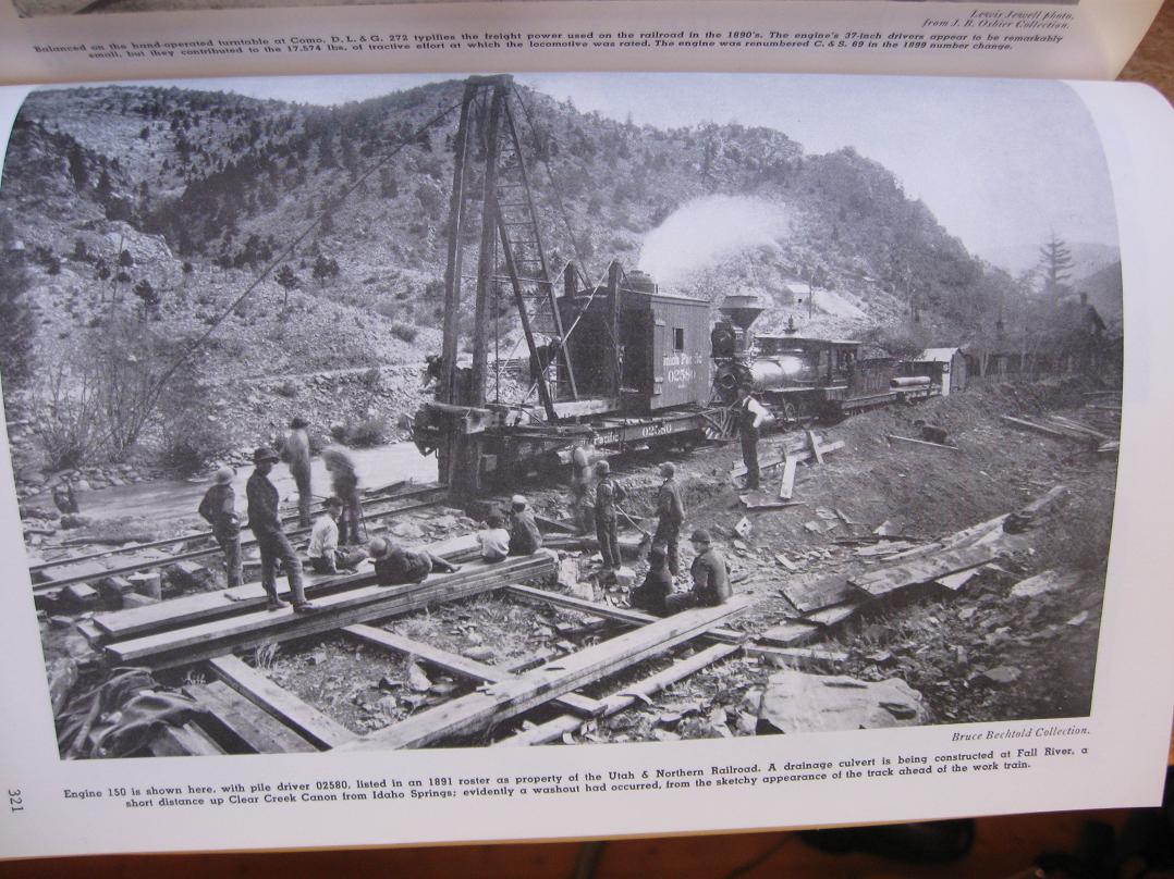
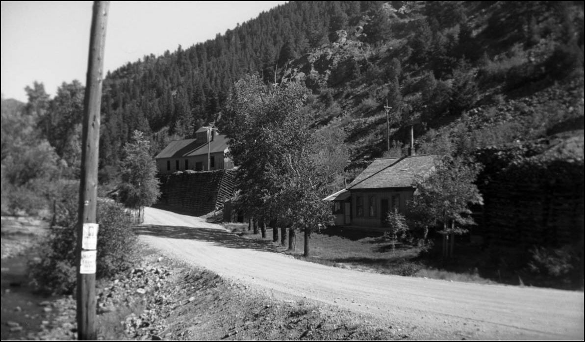
Only Abbott and McLeod's Colorado Central RR book by Sundance showed the Sectionhouse here, both CRRA #10 and Mineral Belt 3 neglected to show the location at all. Accordingly there is nothing in Poor's DSP&P other than a notation in the Station list, nor in Pict. Supt. to DSP&P. (Abr Ed.)
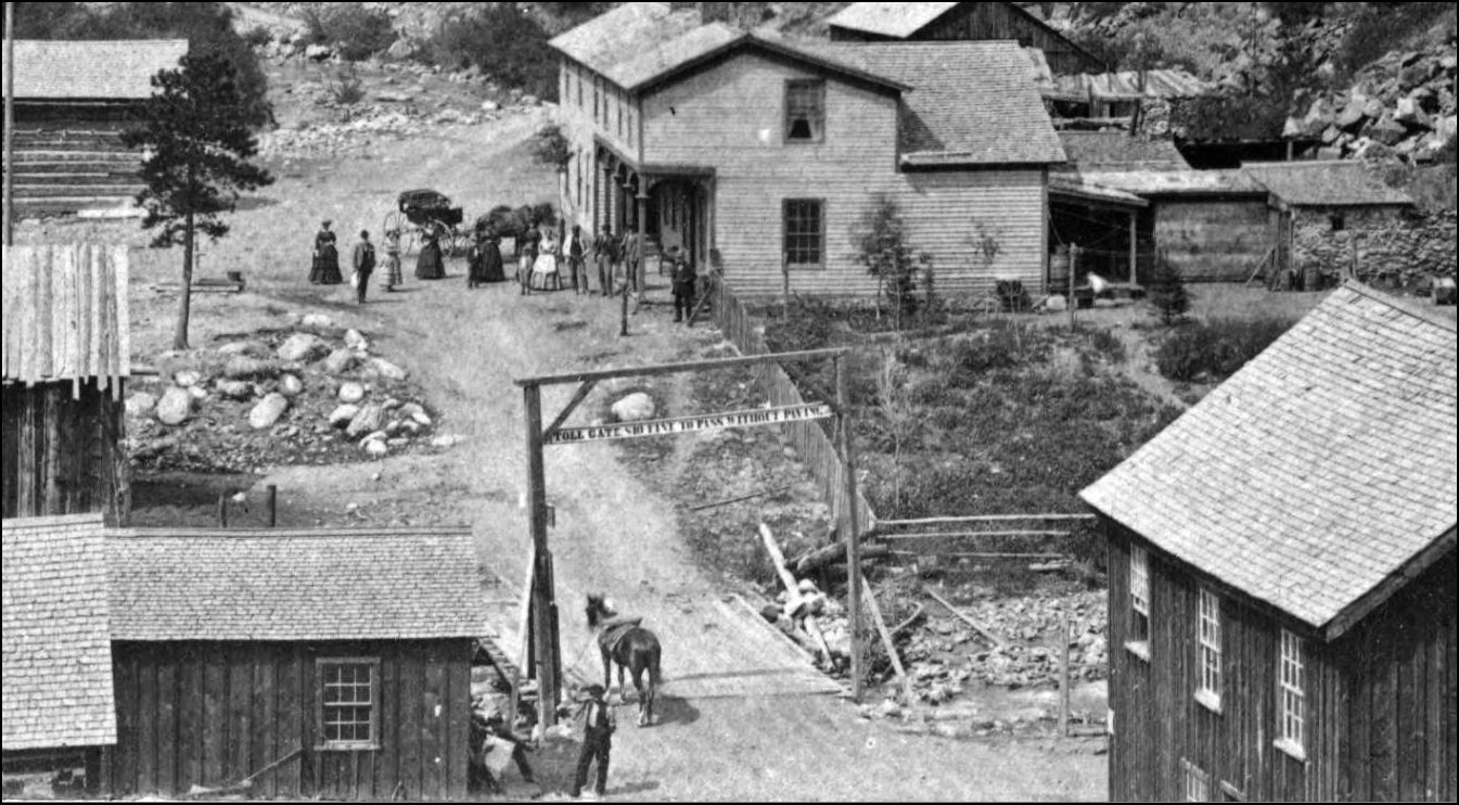
EDIT: See page 321 of the Abr. Ed. for an over-looked picture of the SectionHouse.
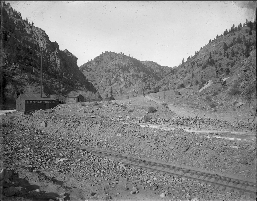
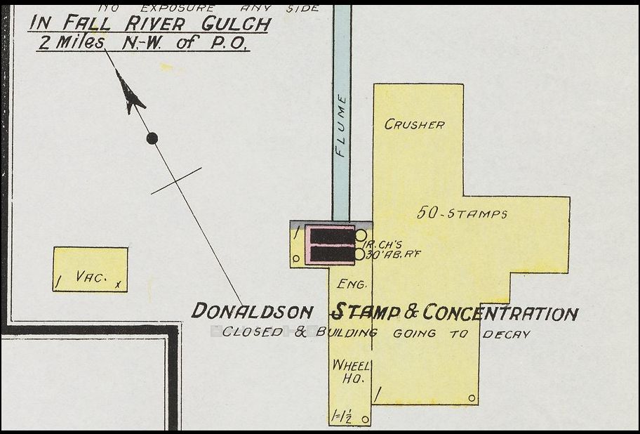
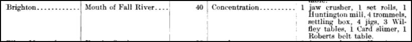
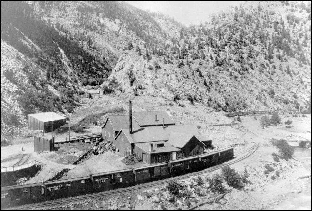
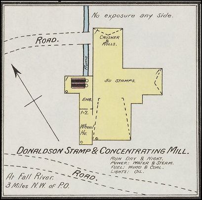
The USGS 1917 lists 3 Mills at the mouth of Fall River, the "Donelson"(sic), "Brighton" and "Hoosac".
Digging deeper into this I identified the 1912 built Mill as the Hoosac leaving the guess as to which of the two others were which?
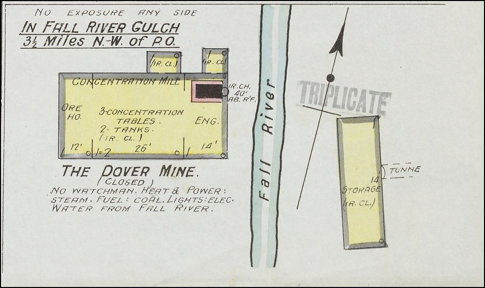
The Donaldson Mill is listed as having 50 stamps which appears most likely to be the Dover Mill in Muriel Wolle's picture. (2nd to last photo at bottom)

That only leaves the Brighton, the Aerial trams are visible in several of these pictures I present here and so far I haven't yet uncovered any pictures of Fall River showing another mill there. The Laclan McLean picture of this very same mill is unidentified.
from
The Mining&Engineering World Dec 14 1907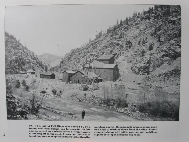
from
Duane Smith/Wieler Secure The Shadow Colorado School Mines. pg71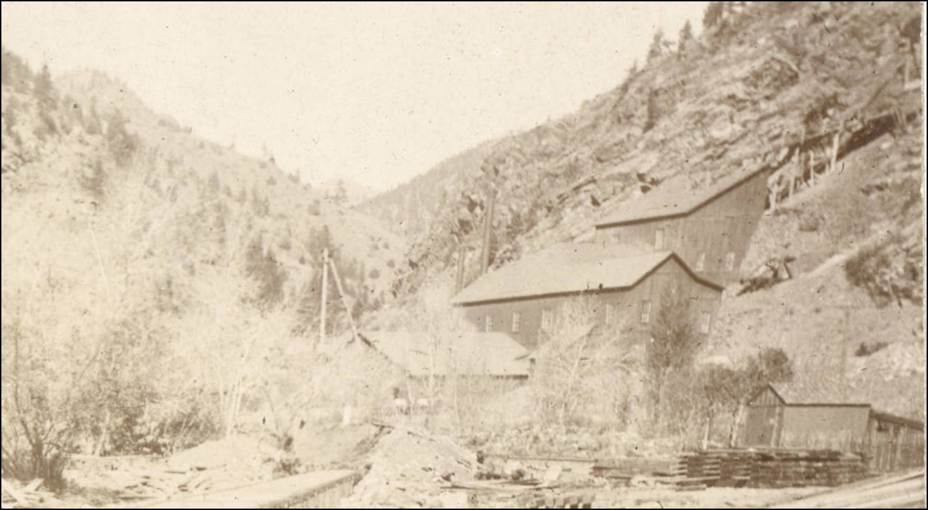 http://cdm16079.contentdm.oclc.org/cdm/singleitem/collection/p15330coll22/id/80208/rec/1
The USGS 1917 made mention of yet a third smaller Mill but this is 1/4 mile up the Fall River.

The Mill is at the outlet of Trail Creek and has been shown in Mal Ferrell's South Park Line on Pg351. Mal lists this Mill as the Hoosac, DPL have no name but note Freeland Mill in the description. Freeland was a townsite and mining area further up Trail Creek Gulch apparently refered to as Freeland Gulch in the earlydays.
 http://digital.denverlibrary.org/cdm/fullbrowser/collection/p15330coll22/id/38845/rv/singleitem/rec/18
However Sanborn in 1891 list Trail Cr. Mill as the Plutus Concentrating Mill.
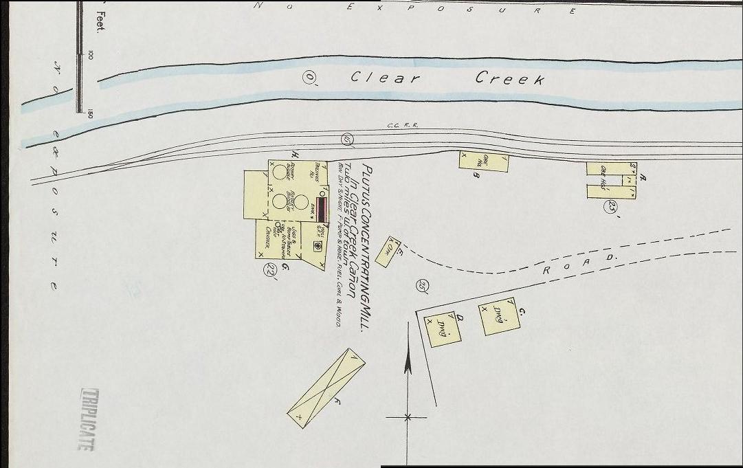
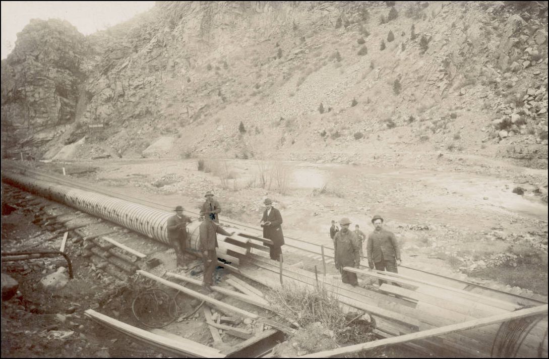
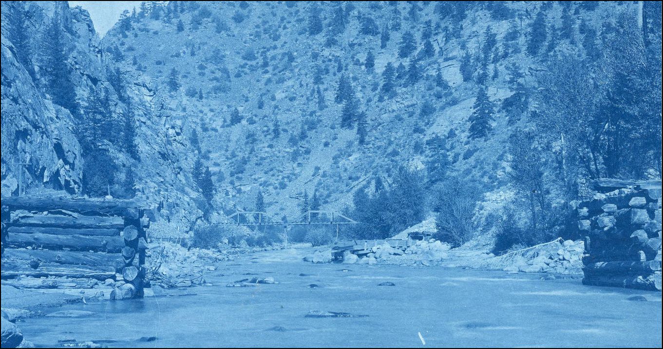
Flumebox with Mill and Handcar shed, but before the Bunkhouse was constructed apparently Bridge #17, 16ft long was needed to cross this flume to the Mill at the mouth of Trail Cr. This flume construction served the later Stanley Consolidated Mines Powerhouse downstream (this will be shown in another future installment)
 http://digital.denverlibrary.org/cdm/singleitem/collection/p15330coll22/id/89251/rec/36
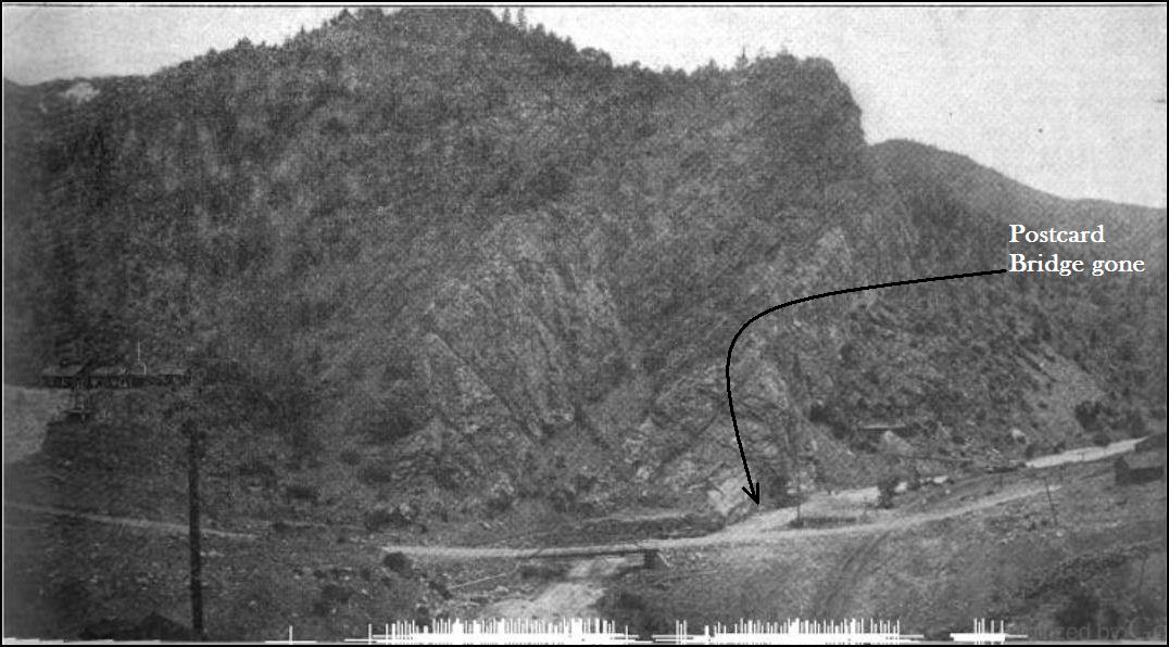
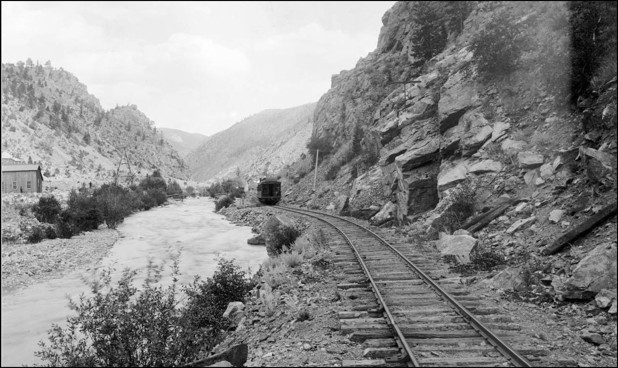
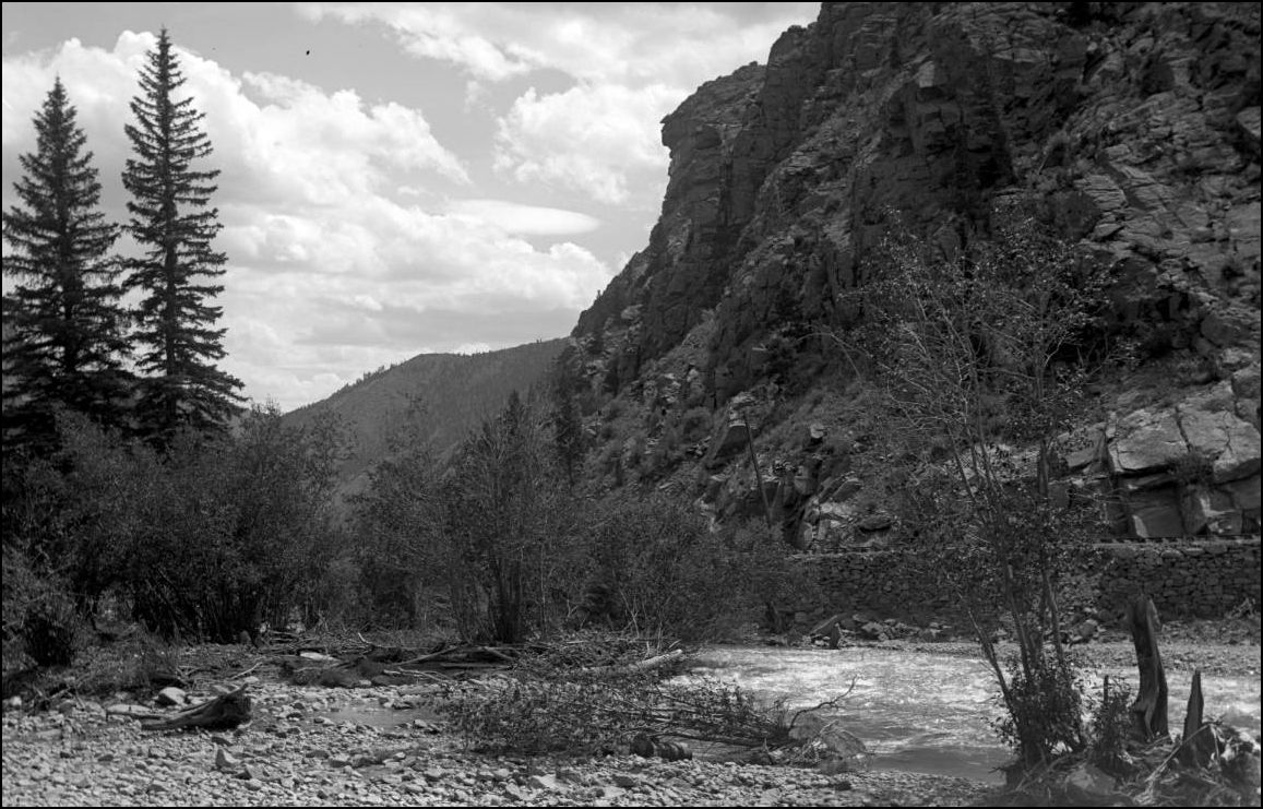
Rock Wall opposite the outflow of Fall R. This is the very spot where W.H. Jackson stood to take the Thread Title picture.
 http://cdm16079.contentdm.oclc.org/cdm/fullbrowser/collection/p15330coll22/id/74633/rv/singleitem/rec/84
A perfect modelling opportunity hitherto unknown has gone unremarked.
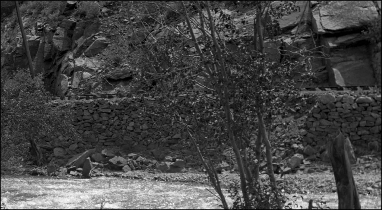
At this location, in the W.HJackson picture enlarged, directly in front of the Locomotive can be seen a turnout. This as yet unremarked siding may be connected with the light tramway Bridge across Clear Creek to the Dover Mill. Also this unpublished photo reveals an unseen view of the C&S Section House.
 http://digital.denverlibrary.org/cdm/fullbrowser/collection/p15330coll21/id/12599/rv/singleitem/rec/9
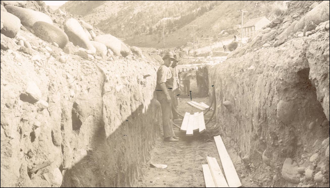
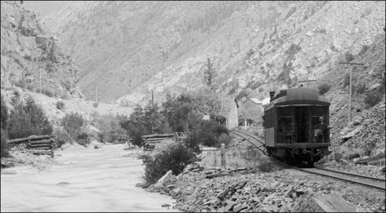
Downstream of crib abutments looking upstream.
 http://cdm16079.contentdm.oclc.org/cdm/singleitem/collection/p15330coll22/id/89248/rec/1
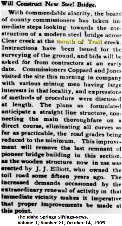
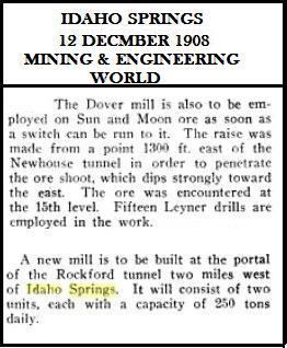
This clipping may explain the Tramway Bridge, the Sun&Moon referenced was deep inside the Newhouse/Argo tunnel and would require C&S cars to be loaded at the Cribchutes then dragged up to fall River. Wonderful modelling opportunities of shorthaul traffic abound here.
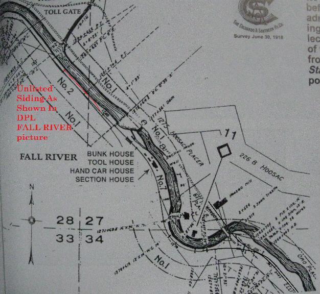
C&S TT No. 35, Oct 21 1912 Fall River 39.3 *8 car spur connected at North end.
C&S TT No. 56, Jun 6 1920 Fall River 39.39 *8 car spur connected at North end.
C&S 1929 folio book Station and Trackage Map. Fall River. Hoosac Mill Spur P.S. 526ft.
Abbott/McLeod in Colorado Central also list other various length sidings at different times for Fall River.
The topomap (undated)Pg304-305 in MinBelt3 shows the siding as connected from the Northern end (TT direction) on the Southside of ClearCreek.
The Sanborn maps of 1891, Plutus Con. at Trail Creek and corelates with this orientation but doesn't show the end of the siding track nearest Idaho Springs..
Colorado Central RR, Pg321, 1918C&S Rly Valuation Map shows the same but the siding is double-ended.
Colorado Central RR, Pg327, 1918 C&S Rly Valuation Map shows a siding crossing Clear Creek to a Mill noted Hoosac siding 526ft.
from
Abbott/McLeod Colorado Central Rail Road pg327 Sundance Pub.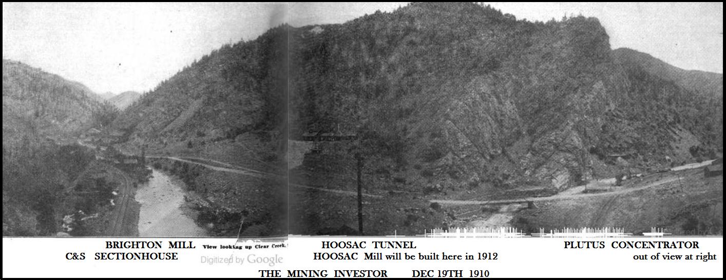
from
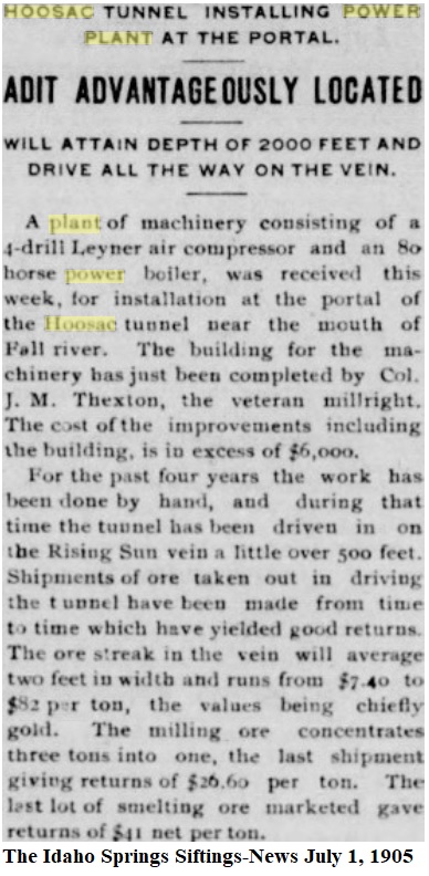
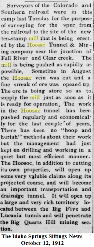
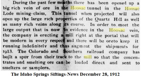
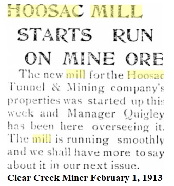
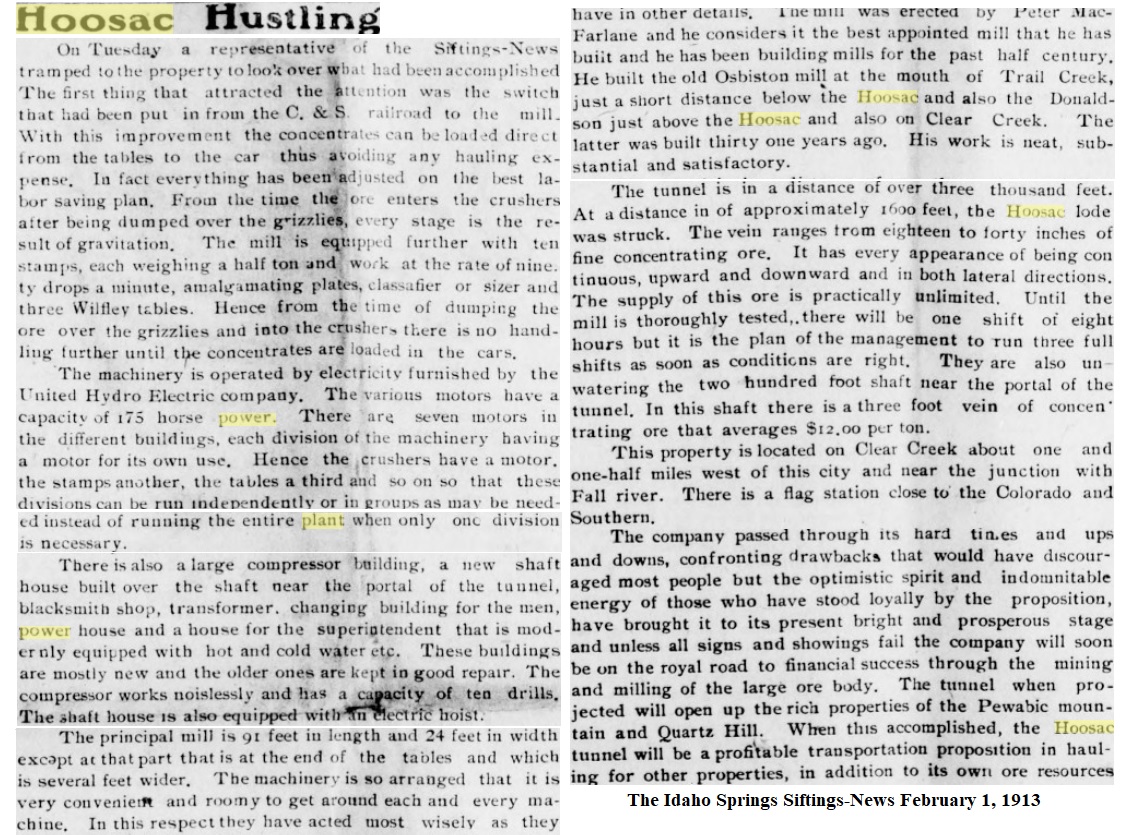
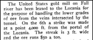
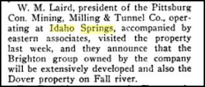
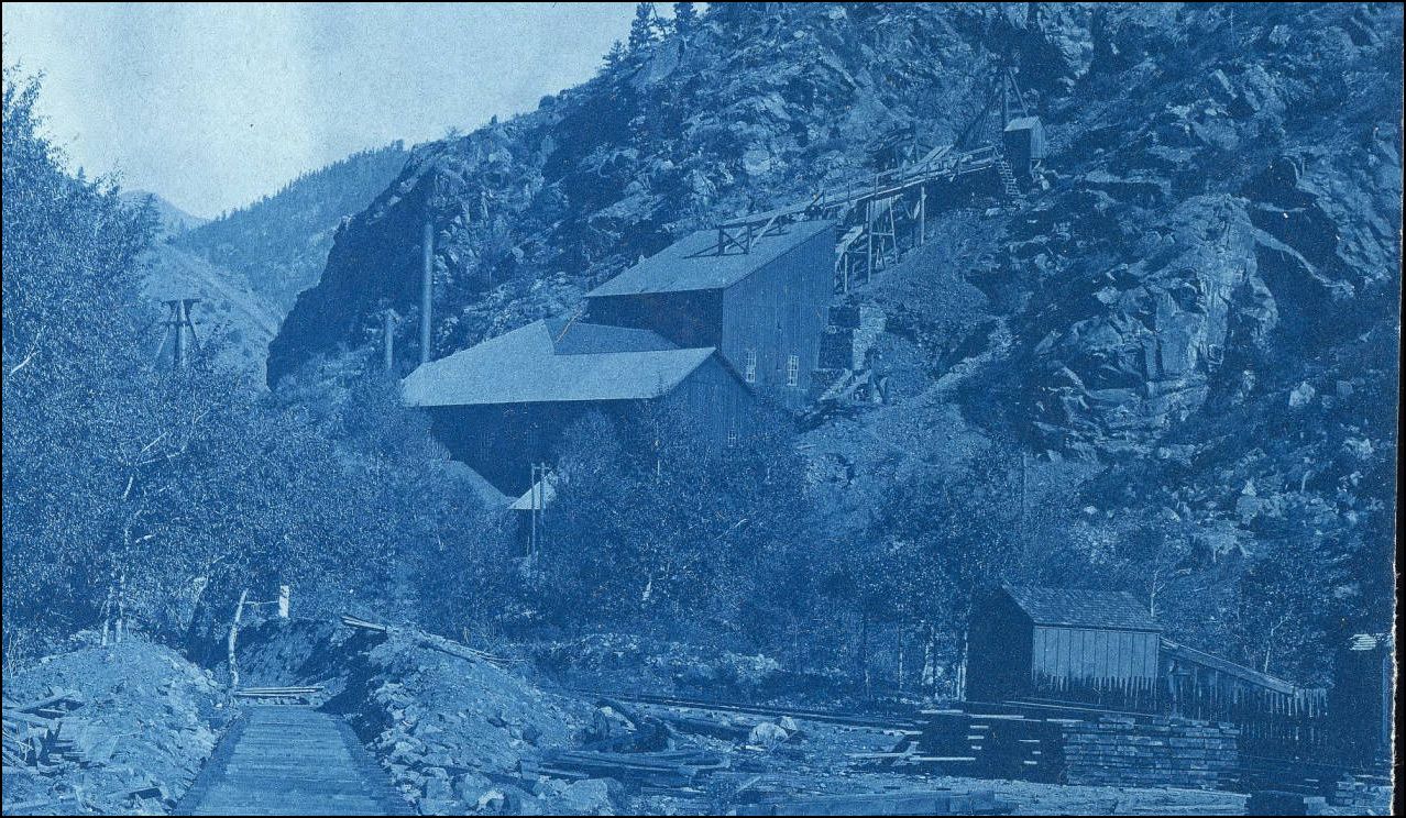
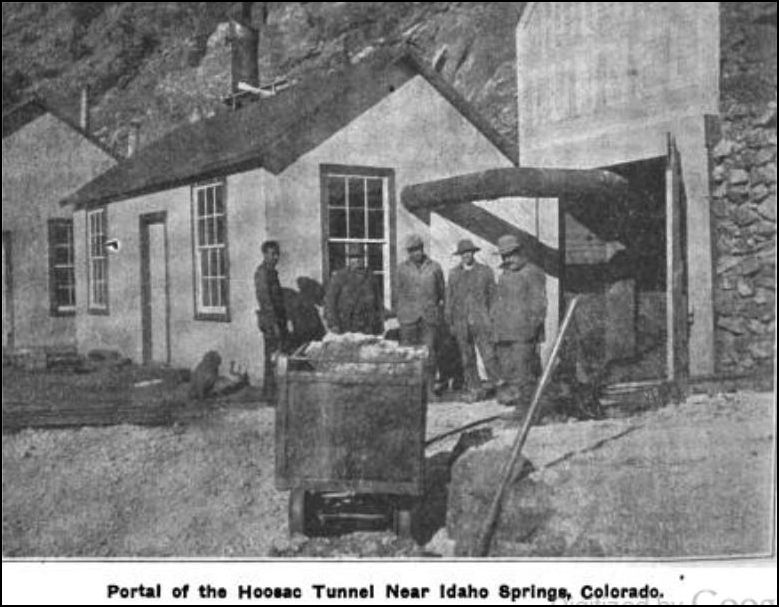
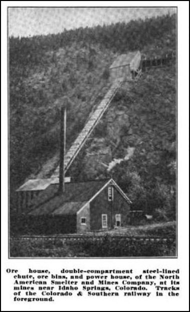
The Mining Investor Dec 1910The Mining Investor of March 1913 yeilded this view of the new Hoosac Mill.
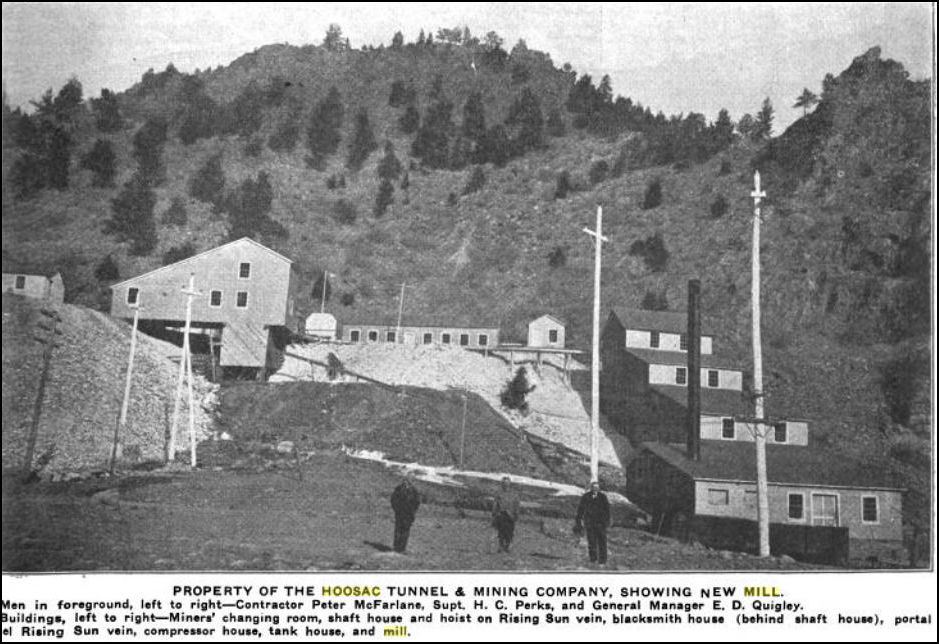
and of the Hoosac Tunnel.
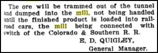
References to Mill concentrates being handled directly by the C&S.
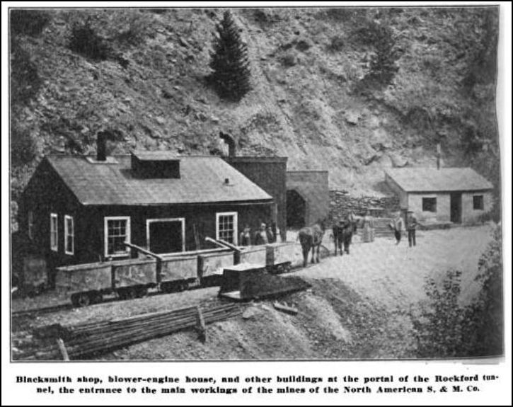
Further West on the Southside of Cl.Cr. was the Rockford tunnel in Turkey Creek Gulch, the Freeland mines exported their ore out through the Rockford via a mule-drawn tramway and around the bluff for an unknown distance closer to Fall River to this Chute OreBin alongside the C&S tracks.
I have however found reference to a siding being built here at Mp40.39 at 324ft servicing the Silver King Mill on the C&S 1929 Folio and Trackage Map. I haven't yet found anymore on this but suspect that there are several pictures possibly in the Laclan McLean Collection in the Norlin Library. I base that idea on many of the McLean pictures were used in the Mining Investor of the times. Maybe even the USGS has pics in some repository.
1895 Sanborn
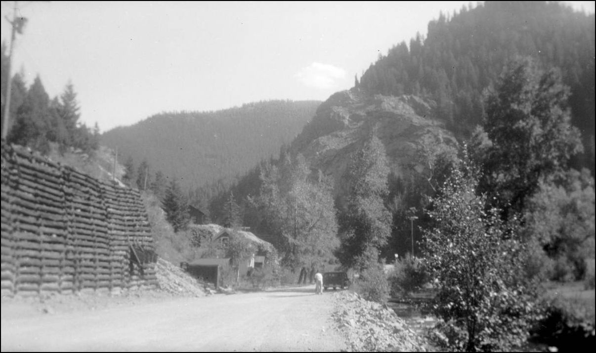
Dover Mill, the Stone Foundation walls can still be seen today at #44 Fall River Road. This view is looking up Fall R.
 http://digital.denverlibrary.org/cdm/fullbrowser/collection/p15330coll22/id/2760/rv/singleitem/rec/125
Dover Mine buildings, this is the Pennsylvania Tunnel
 http://cdm16079.contentdm.oclc.org/cdm/fullbrowser/collection/p15330coll22/id/2772/rv/singleitem
The Bins and the small building on the right can be seen today.
UpSideDownC
in New Zealand