Breckenridge
12


12
|
As I make progress on Leadville, my mind is turning to the far end of the layout. One of our august members once espoused Breckenridge as an excellent modeling challenge, and I confess I don't know much about the place. There was the depot, and the odd water spout, and the partially-built coal trestle.
What was the track configuration like? What sorts of industries were there?
Keith Hayes
Leadville in Sn3 |
|
This post was updated on .
Hooo boy, great minds must think alike, Keith!
I've taken Chris's admonition that Breckenridge would make for a nice "set piece" layout to heart as well. I've been scribbling some track plans for my 20 x 10 foot shop area, if I ever get to retire. What was the track configuration like? Just so happens that my new set of 1918 valuation maps from the Colorado Railroad Museum includes a complete station map of Breckenridge. The three maps below, run north to south, left to right -- Dickey, as modeled by Darel Leedy and Mike Trent, are a few miles north (to the left) of the first map. First the yard and depot area: 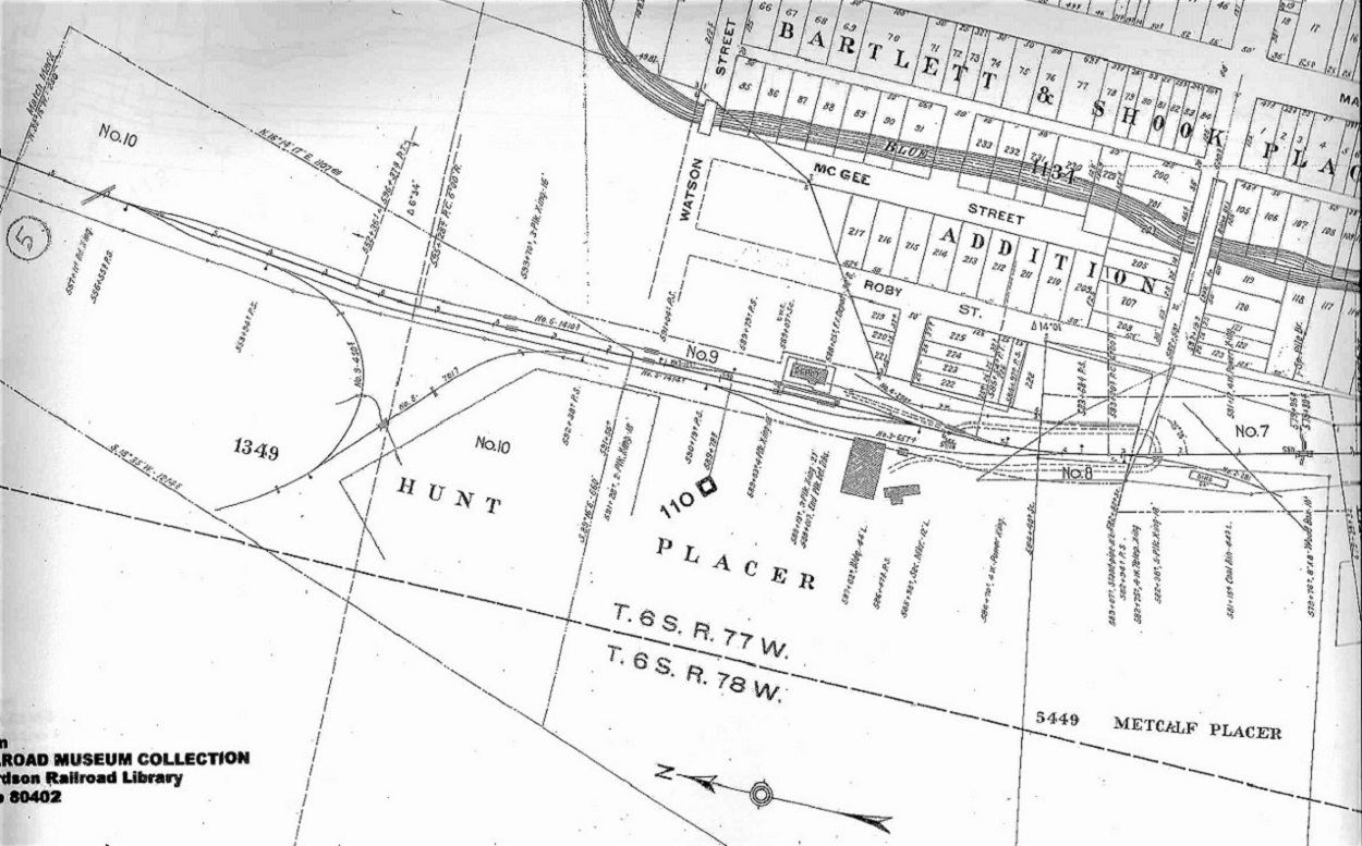 Moving south, the track between the coal spur to the crossing of the Blue:  Finally, the mainline turns to the southeast, up Illinois Gulch, on its way to Boreas, passing the Gold Pan Shops (later the Tonapah shops): 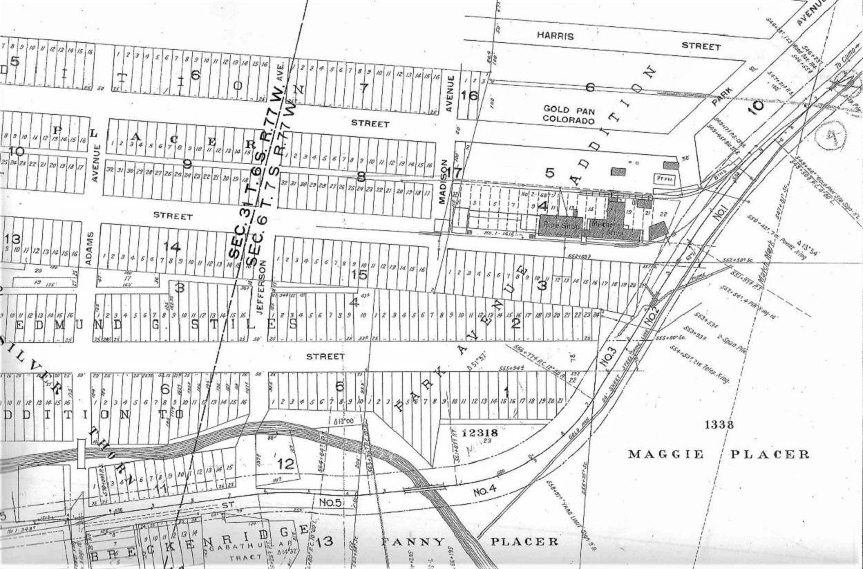 Later tonight, if I get caught up with my chores, I'll start posting some photos, unless Chris beats me to it!. Jim
Jim Courtney
Poulsbo, WA |
|
There is hardly anything to be seen now, I have been told that you can make out the wye if you look really closely, certainly not obvious from driving by.
|
|
This post was updated on .
In reply to this post by Keith Hayes
OK Keith, chores are finished. So let's have some fun, illustrating Breckenridge with photos.
 I'll start by posting all the photos that I have of the C&S yard and depot grounds over the years. In later installments we can add the mills to the west of the C&S main, and lastly the Gold Pan shop area as the C&S turned southeast for Boreas Pass. I'm sure Chris has better info on the mills than I do. But everyone should chip in with your photos. Let's do Breckenridge proud, like we just did with Central City. The Breckenridge depot and yards over the years . . . 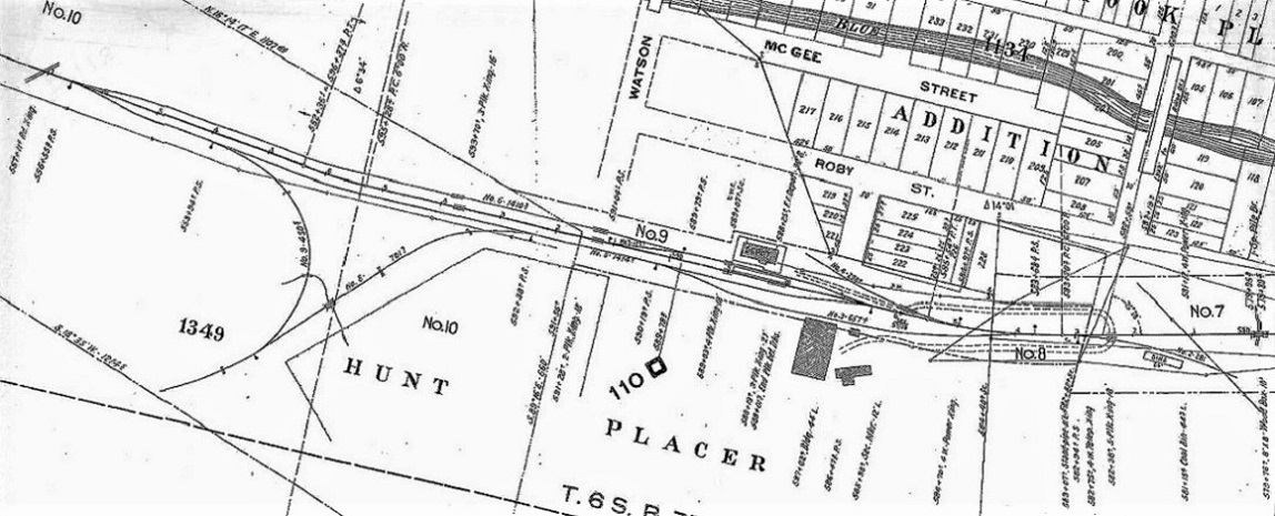 The yard at Breckenridge was compose of two sidings, one on either side of the main, both connecting to the main (at north and south ends) with 3-way stub switches. The wye came off the west siding. The siding next to the depot had a crossover just north of the depot to allow freight cars to be spotted next to the depot platform, for LCL and other freight. A spur just to the south of the depot functioned as a team track.  In Digerness, The Mineral Belt, Volume 2 The earliest photo of the Breckenridge depot and yard dates back to DSP&P days, 1888. Note the long coaling platform this side of the depot. The original 3-way stub switch is at the right frame. http://digital.denverlibrary.org/cdm/fullbrowser/collection/p15330coll22/id/2441/rv/singleitem 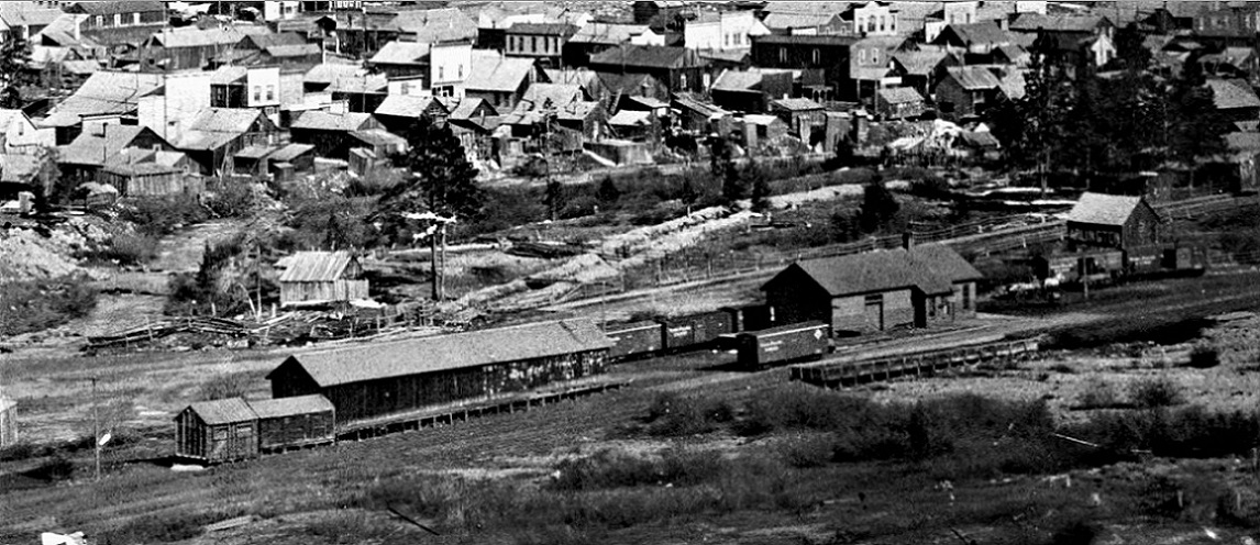 In the mid 1890s, the spur (track No. 4 on the map) extended along the backside of the depot platform. A long freight house and two small coal bins are to the north of the depot.  Dr. Clinton H Scott photo from the Ed and Nancy Bathke Collection By 1897, the framing for the aborted coal chute was in place. It is not clear whether the spur still extends behind the depot; perhaps it was undermined by a flood of the Blue River, and removed. http://digital.denverlibrary.org/cdm/singleitem/collection/p15330coll22/id/2506/rec/293 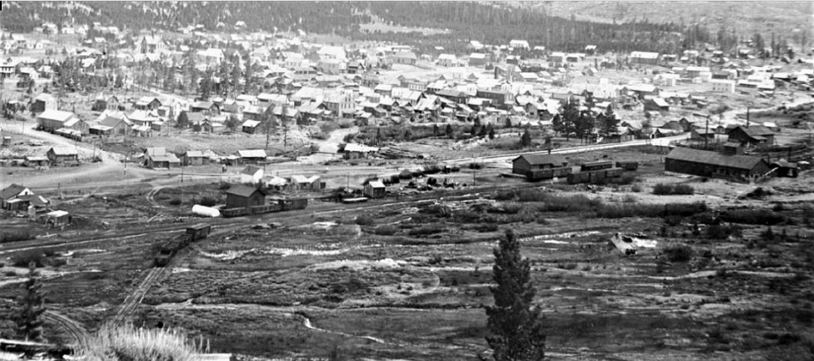 By 1898 or 1899, on the eve of the creation of the C&S, things have changed: The Chamberlain-Dillingham Ore Co's Sampler has been built and the elevated siding serving the mill (track No. 3 on the map) has been installed. The freight house and coal bins north of the depot are gone. An oil storage house, with storage tank are down near the south switch of the wye. http://digital.denverlibrary.org/cdm/singleitem/collection/p15330coll22/id/78301/rec/868  This McClure view probably dates from about 1907 (note block lettering on the freight cars). The oil facility north of the depot is gone and several new coal bins have been erected. The aborted coal chute is gone.  This enlargement of the previous view, shows an overview of the depot area. From left to right: The water standpipe. The City Electric Plant (it had its own short spur at one time). At center is the Chamberlain-Dillingham Ore Co's Sampler, office and small coal bin. Note the boxcar on the elevated siding at the east end of the sampler. The depot at right still seems painted in the dark UP scheme. 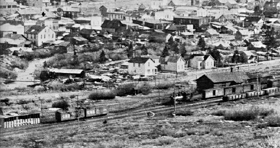 Otto Westerman photo, in Digerness, The Mineral Belt, Volume 2 This view also dates from about 1907-08, but from the other side of the depot. A locomotive switches the house track in front of the depot. A 1899 St Charles boxcar is at the right frame. The coal bins at left are of crude construction.  Summit Historical Society: https://www.facebook.com/summithistorical By 1910, the depot has been painted in the light (grey and green scheme). A boxcar is spotted in front of the depot, and all manner of LCL and freight are being unloaded. 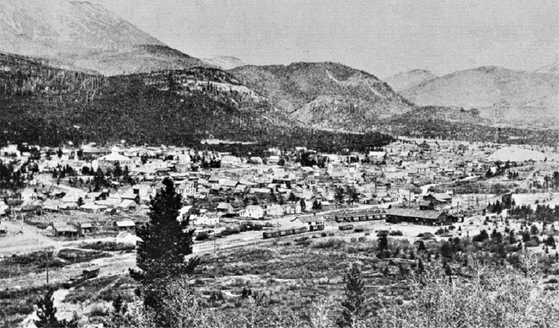 In Digerness, The Mineral Belt, Volume 2 An overview of the yard also from about 1910 shows a string of boxcars on the team track No. 4. There don't seem to be any coal bins left to the north of the depot. http://digital.denverlibrary.org/cdm/singleitem/collection/p15330coll22/id/2481/rec/356 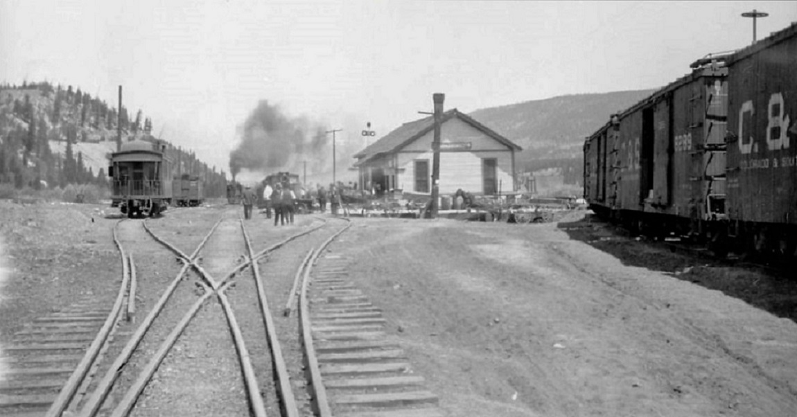 This view and the following two are all from 1917. This view looks north at the 3-way stub switch. The elevated siding to the C-D Sampler is at left (note harp derail stand). Team track No.4 at right with several teams at the depot awaiting the arrival of the eastbound passenger. http://digital.denverlibrary.org/cdm/singleitem/collection/p15330coll22/id/2480/rec/493  Depot, teams, team track. http://digital.denverlibrary.org/cdm/singleitem/collection/p15330coll22/id/2482/rec/490  Looking south from the 3-way stub. The water stand pipe is in the distance with the coal bin for the Pankhurst & Whipple Concentrating Works beyond. To the right is the C-D Sampler elevated siding. The P&W Concentrating Works buildings are above the coal cars. http://digital.denverlibrary.org/cdm/singleitem/collection/p15330coll22/id/2447/rec/166 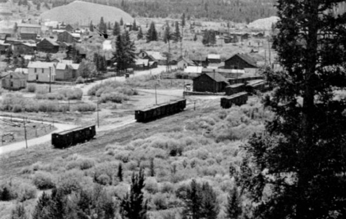 By the mid 1920s, the house track in front of the depot still has cars spotted at the platform. The crossover from house track to main, with its switch stand, is just this side of the depot. The passenger train is stopped on the main. No sheds of any kind are visible to the north of the depot. A faint dirt road might suggest that the boxcars spotted on the east siding were loaded with ore here.  John Halliman Collection, in the Klingers' South Park's Gunnison Division Memories . . . By the 1930s, the house track and the entire east siding had been removed. Note the platform to the left, formerly between the house track and the mainline. The town's tobacco shipment has arrived -- Breck's new cannabis smoking industry is far in the future. The Water Stand Pipe . . . 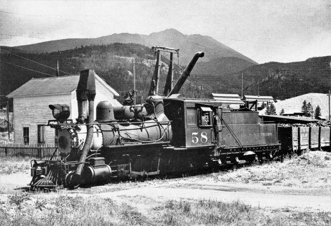 Colorado historical Society, neg F22 640A, in the Klingers' C&S Highline Memories . . . By the 1930s, the stand pipe had been moved to the west side of the tracks. The Gold Pan Shops are visible over number 58's tender. The gravel pile from the Gold Pan Pit is above the coal car.  A.A. Anderson photo in the Klingers' C&S Highline Memories . . . A better look at the back side of the water stand. Date is 1937. Trains at the Breckenridge depot over the years . . .  C.O. David photograph, in Digerness, The Mineral Belt, Volume 2 Sam Speas sits in the cab window of C&S 6, as the Leadville bound passenger train makes the station stop c1908. 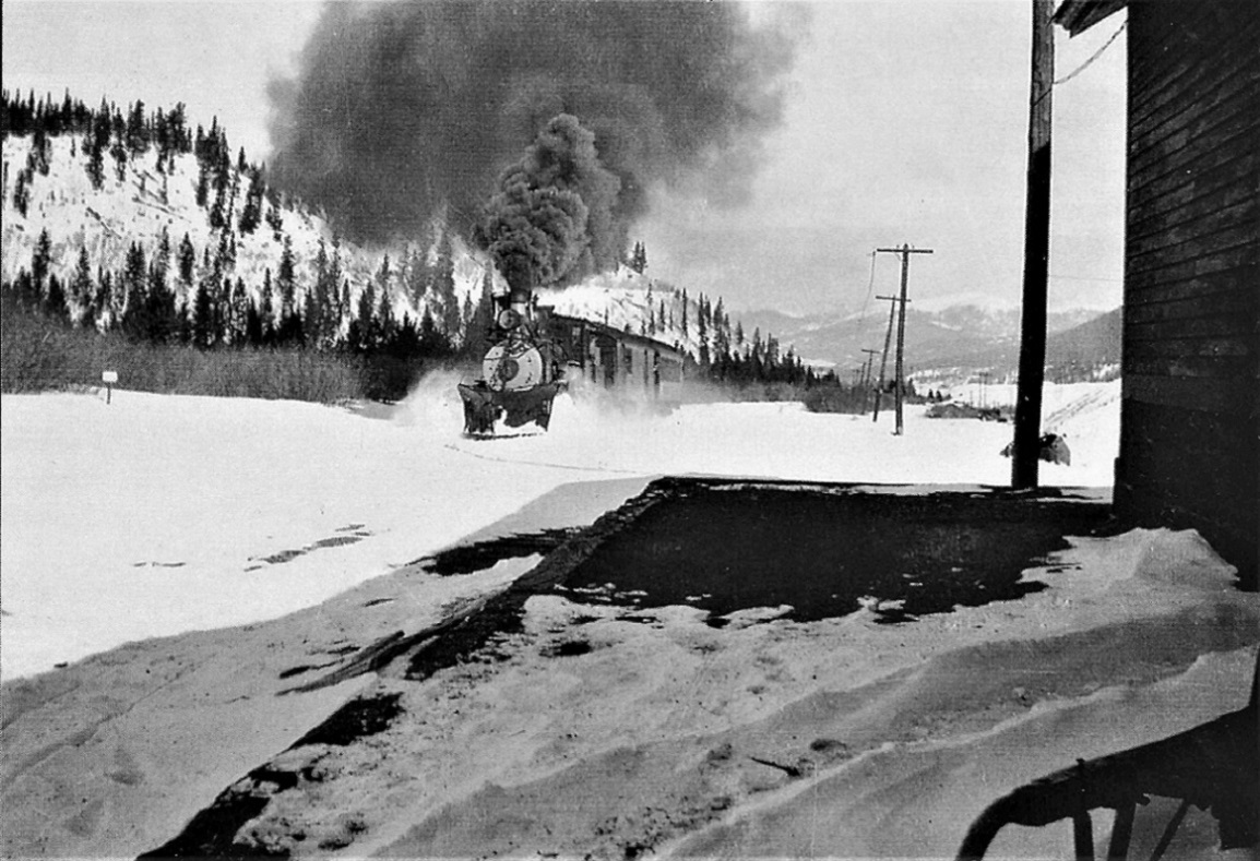 Albert G. Hale photo, Brent Michiels Collection, in the Klingers' C&S Platte Canon Memories . . . The eastbound passenger approaches in snow, 1930s. 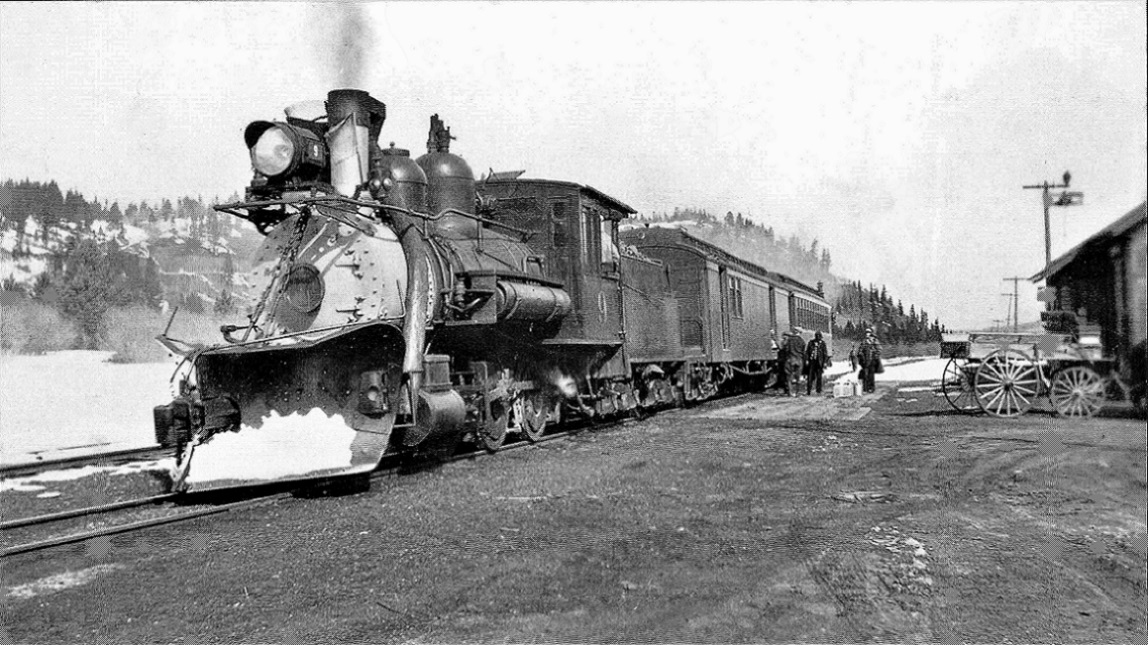 John Halliman Collection, in the Klingers' South Park's Gunnison Division Memories . . . Number 9 and train are met at the depot by yet another team, even though it's the mid-1930s. 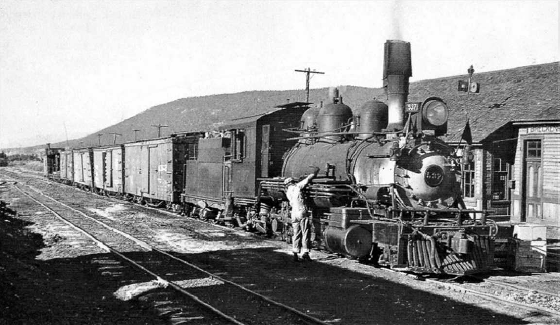 Brent Michiels Collection, in the Klingers' C&S Platte Canon Memories . . .  In Digerness, The Mineral Belt, Volume 2 Two views of one of Mike Trent's favorite locomotives, on Labor Day, 1931.  In Digerness, The Mineral Belt, Volume 2 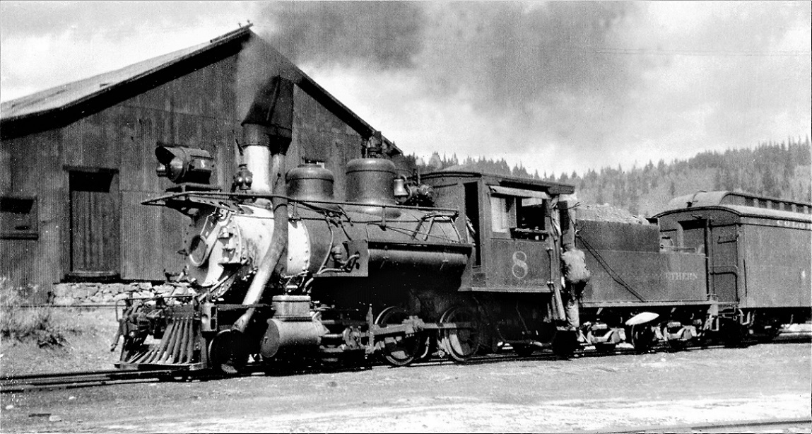 Two views of C&S number 8 making the station stop on August 8, 1935. Note the elevated siding for the C-D Sampler behind the locomotive. http://digital.denverlibrary.org/cdm/singleitem/collection/p15330coll22/id/43671/rec/343 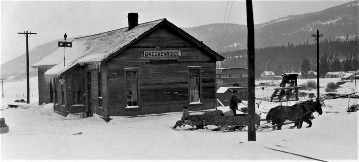 Not much moving but horse and sleigh in the winter of 1936. 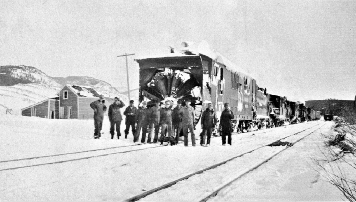 In Digerness, The Mineral Belt, Volume 2 A few days later, the rotary train stops on the main, bound for Dickey.  Richard B Jackson photo in Ferrell's C&Sng: Colorado & Southern Narrow Gauge The very last train movement by the depot on July 6, 1938. And about that dredge . . . Anyone who wishes to model Breckenridge, needs to consider how to accommodate the gold dredge next to the yards: http://digital.denverlibrary.org/cdm/singleitem/collection/p15330coll22/id/2447/rec/166 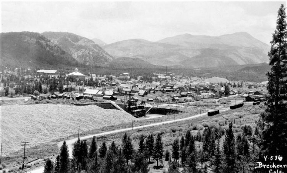 As best as I can tell the so called "Sixth Dredge," built for the Colorado Gold Dredging Co in 1908, gradually worked south along the east bank of the Blue River. It finally arrived at the Breckenridge town limits in the mid-1920s, by then owned by the Tonapah Placers Co. 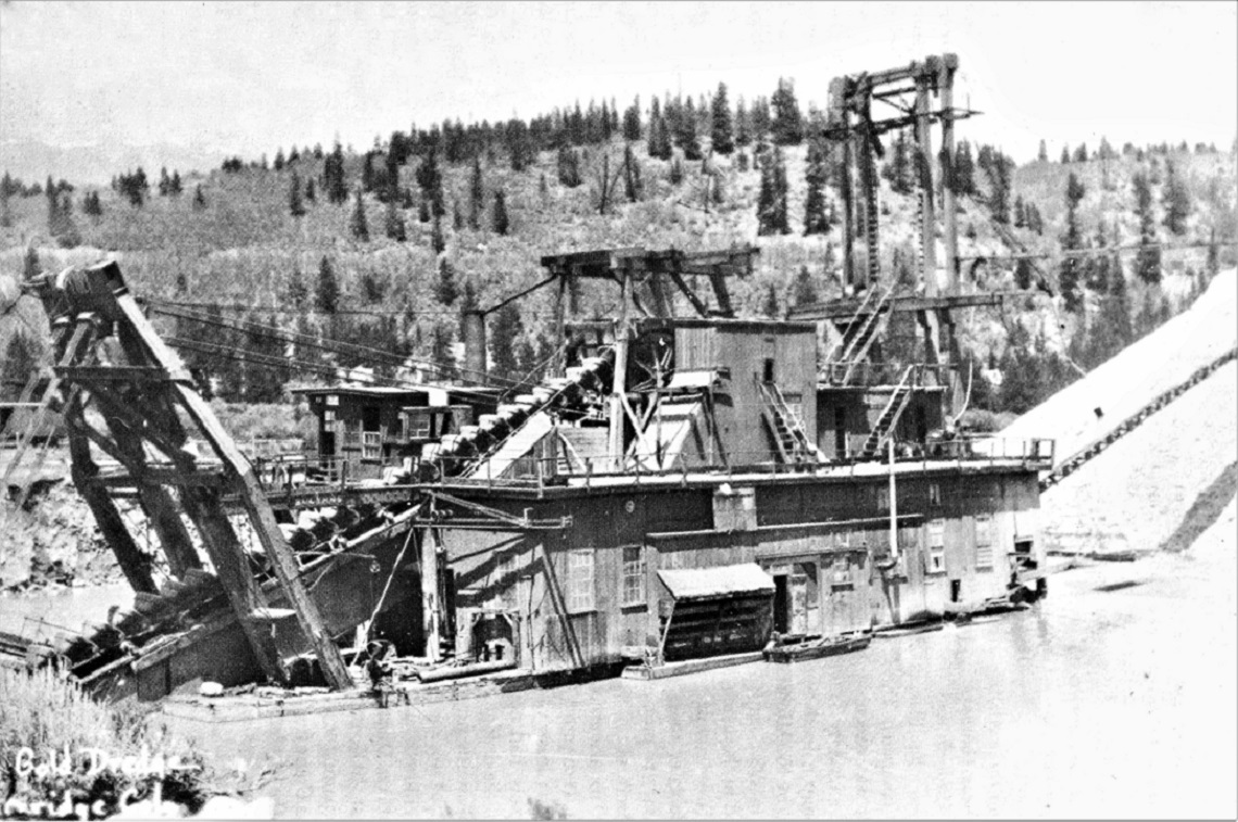 The dredge sat in its pond next to the yard (note C&S boxcar at left frame) for almost 15 years, with various owners trying to convince the town fathers to permit them to chew up the entire east bank of the Blue River in Breckenridge proper, all the way south to the site of the Gold Pan Pit.  Chris Walker enlargement of the DPL photo above. By the eve of the C&S abandonment, the dredge was owned (and heavily rebuilt) by the Royal Tiger Mining Co., and lurked just behind the depot, waiting for the railroad to be gone, so it could go back to work. Building a dredge in its pond would be quite the challenge in any scale--but look at the upside, Keith: Lots of opportunities for 3-D printing, including those 85 buckets!  We really need to discuss the gold dredges at length sometime . . . but that's for another day. I'm tired and need a beer! 
Jim Courtney
Poulsbo, WA |
|
Somewhere I've seen a picture of C&N #25 posed by the depot when they were experimenting with using it on the C&S.
|
|
Isn't that the big rotary?
|
|
This post was updated on .
In reply to this post by Robert McFarland
Here you go, Robert:
 In Mal Ferrell's The South Park Line " Colorado & Northwestern shay 25, along with her engineer Billy Tipps . . . at Breckenridge in 1900". The Breckenridge depot is at the left frame, behind the shay's coal bunker.
Jim Courtney
Poulsbo, WA |
|
Wow, brilliant job, Jim!
|
|
Thanks, Jeff.
As a part time Breckenridge resident, have you come across any local source of photos or other C&S information there?
Jim Courtney
Poulsbo, WA |
Re: Breckenridge Depot Dimensions
|
In reply to this post by Jim Courtney
I have Mike Blazek's 1:64 scale drawings for the Breckenridge depot. Per his plans, the depot scales out to just shy of 24 feet wide and just over 75 feet long (corner to corner, not including eaves).
Mac Poor lists the dimensions as 24 x 60 feet. Dillon depot, in general a mirror image of Breckenridge, is listed by Poor as 24 x 80 feet. Does anyone have access to B&B books or inventories that would confirm the dimensions of the Breck depot? Jim
Jim Courtney
Poulsbo, WA |
|
In reply to this post by Jim Courtney
> As a part time Breckenridge resident, have you come across any local source of photos or other C&S information there?
The museum in the tourist office has some nice mining stuff, but nothing of the railroad. I once found an artistically nice but technically poor pen-and-ink sketch of #22, but the incorrect details bothered me too much to buy it. The ski area has a couple of shots of rotary trains on Boreas blown up on the walls, but they’re all the standard ones you’ve already seen. I’ll keep looking though. Cheers, Jeff. |
|
In reply to this post by Jim Courtney
Jim,
Thank you for the very interesting and informative Breckenridge photos. Thanks for sharing. Lee Gustafson |
|
In reply to this post by Jeff Young
The dimensions of the Depot should be on the ICC Report, I do have Mike Blazek's book on Como and know there are differences to actuality, not sure where he obtained his data.
I was intrigued by the paint schemes, the grey and green seems clear and as far as you can tell is the same as Como, the later Red Green scheme did not seem to be applied. Does anybody know what the earlier scheme was, difficult to tell. |
|
I was intrigued by the paint schemes, the grey and green seems clear and as far as you can tell is the same as Como, the later Red Green scheme did not seem to be applied. Does anybody know what the earlier scheme was, difficult to tell.
I've always thought that the late 1880s to mid-1900s depot paint scheme was a solid UP barn red color, without off setting trim. But the Breck depot from 1888 to at least the 1897 period (first three photos above) appears to be a two-toned dark scheme. By the c1907 McClure photos, the depot seems to be painted a dark color throughout. The light grey / green scheme seems to show up about 1908-1910. Unlike Como, there is no obtaining paint chips from the Breckenridge depot. Fascinating stuff. Jim
Jim Courtney
Poulsbo, WA |
|
The Breckenridge depot was moved to Denver to replace the
depot they moved to Como. You can get color photos and paint samples from the display in the lobby.
"Duty above all else except Honor"
|
|
In reply to this post by Jim Courtney
Jim, you are Da BOMB! Thank you.
Keith Hayes
Leadville in Sn3 |
Re: Breckenridge Electric Light Plant and Water Standpipe
|
I discovered this photo as I was browsing around in the Dorman Collection online:
http://ngtrainpics.photoshelter.com/gallery-image/RD075-C-S-Views-Stations-2/G0000qjNlP0Ye3qQ/I0000L_lDtxDn2Hc/C0000Vd2qoA2MbNU 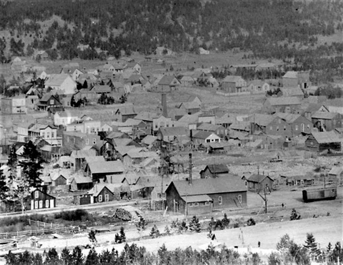 Back when we discussed the C&S coal chutes http://c-sng-discussion-forum.41377.n7.nabble.com/The-C-amp-S-Coal-Chutes-Pine-Como-Dickey-Pitkin-and-almost-Breckenridge-td4269i80.html, Chris walker posted this Sanborn map of the Breckenridge Electric Light Plant on page 5: 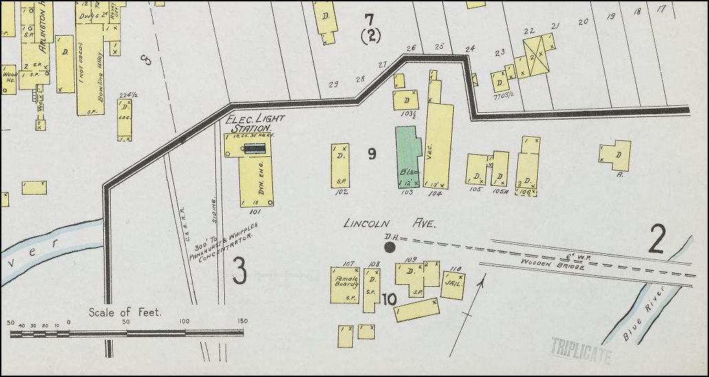 Photos of the aborted coal chute also included this structure. The photo above appears to be late 1880s or early 1890s as the boxcar on the spur is still lettered "DSP&P", I think. The Breckenridge depot would have been out of frame to the left. Note the water standpipe to the right of the building. It looks different from the later device with wood supports. It has a cast iron look to it, much like the standpipes at Crossons and Fisher. The Electric Light Plant and its spur were gone by the time of the 1918 valuation map. When the Gold Pan Company began building their operations in 1900, one of the first projects was to build a hydroelectric plant south of Breckenridge, at Spruce Creek, on the road to Alma: 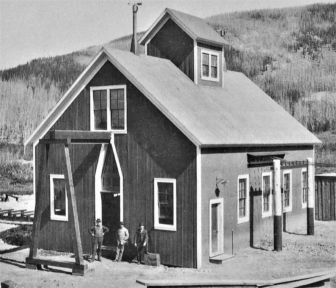 In Nichols, Gold Pan Mining Company and Shops Later, when the Gold Pan Shops and the large pipeline to the shops and Gold Pan Pit were complete, an additional hydroelectric plant was constructed in the shops. This provided enough surplus electricity that the entire "city" of Breckenridge could be lighted. Electricity was also sold to nearby mines and mills.
Jim Courtney
Poulsbo, WA |
Re: Breckenridge Electric Light Plant and Water Standpipe
|
I sure would like to see a photo that shows the outfeed insulators
in that last photo better !
"Duty above all else except Honor"
|
|
X-62425
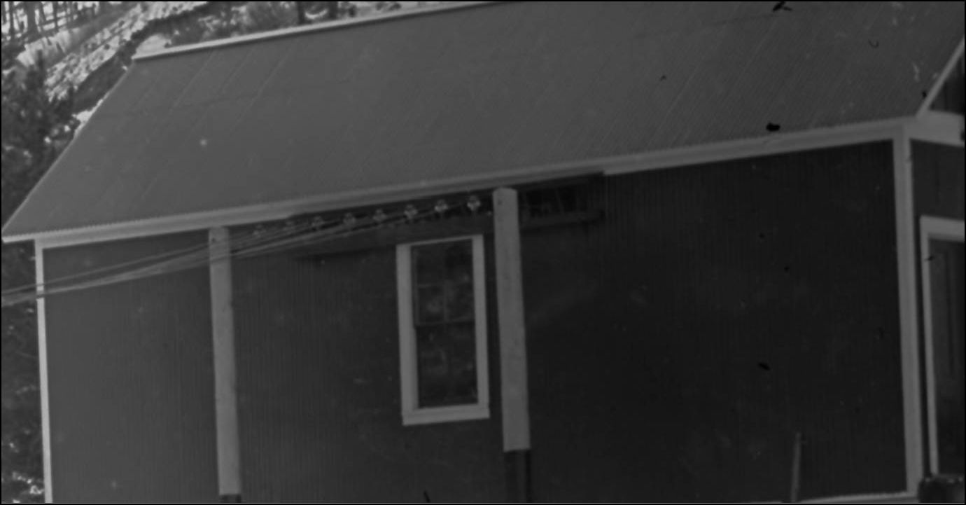 http://digital.denverlibrary.org/cdm/fullbrowser/collection/p15330coll22/id/15093/rv/singleitem/rec/23
UpSideDownC
in New Zealand |
Re: Breckenridge Electric Light Plant and Water Standpipe
|
This post was updated on .
In reply to this post by South Park
Sorry, SP, but I have no other photos . . .
. . . but, the book I took the photo from says "insulators manufactured by Western Flint Glass Company of Denver (in operation September 1899-November, 1900--just better than a year) supported the wire that conducted alternating current along the transmission line north to Breckenridge and south to mines toward Hoosier Pass." Perhaps if Jeff visits Breckenridge this summer, he can drive up to the site and look around for one for your collection.  Another shocking Breck electricity tidbit that I turned up from late night reading: The electric light plant in the top photo, was evidently built in 1892, owned by the Breckenridge Electric Company. The facility was a coal-fueled steam plant, and was the only source of electricity for Breckenridge from 1892 until the Gold Pan Co. became the town provider in August 1901. The Breckenridge Electric Company's daily hours of operation were from "dark" until 2:00 AM. The Gold Pan took over the power franchise, despite making a higher bid for service to the town and with no written contract--perhaps the town fathers wanted the lights on all night!
Jim Courtney
Poulsbo, WA |
«
Return to C&Sng Discussion Forum
|
1 view|%1 views
| Free forum by Nabble | Edit this page |

