A gallery of rail removal at Alpine Tunnel 1939-1960

Previous Topic Next Topic
 
classic Classic list List threaded Threaded
4 messages Options
Reply | Threaded
Open this post in threaded view
|

A gallery of rail removal at Alpine Tunnel 1939-1960

Kurt Maechner
About a mile of DSP&P/C&S trackage was left in place after the 1923/1924 scrapping of the Alpine Tunnel line between Quartz and Hancock. This included track inside the tunnel and west a bit downgrade beyond the Alpine Tunnel facilities. I am trying to piece together when the tracks were removed. This seems to have been done in different segments and not all in order.

I put a blog post together with a collection of photos showing the progression (Here is the post on Substack). I hope to analyze what can be determined from the photos. Keep a look out for future posts where I will identify locations and observations of these images. If anyone knows more or can provide other photographs, please chime in. I'm eager to learn.
Reply | Threaded
Open this post in threaded view
|

Re: A gallery of rail removal at Alpine Tunnel 1939-1960

Kurt Maechner
Here's an update. It looks like the first removal of rail of the remaining track at Alpine Tunnel was in the second half of 1940. Photos on the blog post suggest this date.
Kurt
Substack version
Reply | Threaded
Open this post in threaded view
|

Re: A gallery of rail removal at Alpine Tunnel 1939-1960

Matt Hutson
Thanks for putting these together, Kurt. Interesting stuff. Around sixty years ago, my dad hauled a hand-hewn tie home from the Alpine side. It still even had a spike in it. When he died, I ended up with it. It moved with us from house to house and town to town until it finally disintegrated.

Cheers,
Matt
Reply | Threaded
Open this post in threaded view
|

Re: A gallery of rail removal at Alpine Tunnel 1939-1960

Kurt Maechner
This post was updated on .
In reply to this post by Kurt Maechner
 I've always wanted to find the spot where the rails left behind after the 1923/1924 dismantling work stopped. Using Google Earth I was able to pinpoint the spot.


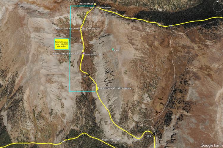
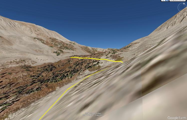
I matched up the below screenshot from Google Earth with one of the photos of the end-of-track and then placed a pin on the DSP&P overlay on Google Earth. I was particularly trying to line up both a turn to the right of the roadbed, a rocky embankment on the right, and a similar background of the mountain contour and trees.


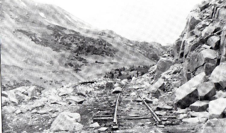
June 24, 1956 R.H. Kindig photo from Tom & Denise Klinger's Gunnison Memories and Then Some

While there is one more right turn (just before the track would straighten out for the Alpine Tunnel station complex), the mountains look a bit too close when viewed on Google Earth. It also doesn't seem to match the rocky bank on the right as well as the spot I chose.

It's the same thing, but here is the above on a blog post.