Romley and the Mary Murphy mine
|
I’ve seen quotes indicating that there were two trams at the Mary Murphy which brought ore down to Romley. However, looking at Google Earth (https://www.google.ie/maps/place/Mary+Murphy+Mine,+San+Isabel+National+Forest,+Colorado+81236,+USA/@38.6699096,-106.3520422,1553m/data=!3m1!1e3!4m2!3m1!1s0x871550032a283833:0x1d3a49ab82c1383b), I can clearly see at least 5 tram lines:
2 from the upper mines to the bottom of Pomeroy Gulch (just a bit upgrade the Romley bridge), 1 straight down-hill from the upper mines to midway up Pomeroy Gulch, where there is a more-or-less intact double-decker tram house and boarding house, 1 at right angles to the above which goes from the lower storey of the tram house to the Mary Murphy mill (a bit down-grade from the bridge), 1 going back up-hill from the mill toward Iron Chest mine (but it looks like it ends in a fallen-down tram house at another mine a bit lower than the Iron Chest). There’s also the Alie Belle tipple, which is often listed as a lower tram house for the Mary Murphy. However, it’s up the ROW quite a ways from the other tram lines, and doesn’t appear to be a tram house at all (there’s at least one mine directly behind it, so there doesn’t appear to be a need for a tram either). 1) Is the Romley townsite just upgrade of the bridge (near where the two tramlines come down)? 2) Anyone know the name of the mine slightly lower down the hill from the Iron Chest (where the other tram from the mill goes)? 3) Anyone know what any of the lower tram houses looked like? (I have pictures of the one at the mill going to near the Iron Chest, and one picture of another, but without any location details so I don’t know which it is.) 4) Presumably only a couple of the trams were in use at any given time. Anyone know the order and/or staging of them? Cheers, Jeff. A very interesting blog with some excellent pictures: Some more good pictures: A 4-part posting on ghosttowns.com with some useful pictures: |
Re: Romley and the Mary Murphy mine
|
Hi Jeff,
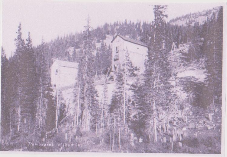
You have studied the tram lines that show on Google Earth more than I have. It's amazing how after 100+ years the lines are so clearly visible. 1. Here is an early picture of 2 tram houses reported to be at Romley. 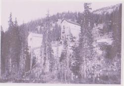 2. A 1989 drawing by Derrell Poole of the Romley town site published in the The Call Board. 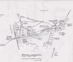 3. I have included Darrell's commentary. This material was provided to me by Todd Hackett.  4. A dark picture of Romley below the railroad grade. 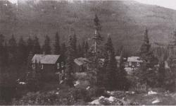 5. A picture of the Romley Post Office. 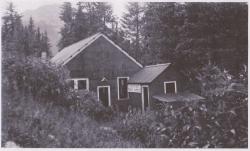 An excellent book From Gold to Ghosts by Peter Anderson published in 1991 has an extensive discussion of the mines above Romley. You probably know that the Mary Murphy Mine was purchased by a British group in 1904. 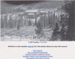 This group built a large mill at Golf, downgrade from Romley. They also dug a tunnel to bring ore out of the mountain to the mill so no trams were used. If others have different, better information, or pictures, I hope they will share. Cheers, Randy |
Re: Romley and the Mary Murphy mine
|
In reply to this post by Jeff Young
  <    
|
Re: Romley and the Mary Murphy mine
|
In reply to this post by Randy Rieck
Great stuff, Randy. Sounds like the two trams to the Golf mill were indeed later (with the tunnel probably later yet). But I didn't realize there were mills in Romley proper as well, serving the earlier two trams (or at least one of them). Thanks for posting. Cheers, Jeff Sent from my iPad
|
Re: Romley and the Mary Murphy mine
|
In reply to this post by Randy Rieck
CONTENTS DELETED
The author has deleted this message.
|
Re: Romley and the Mary Murphy mine
|
Hey Derrell, if you're out there... not questioning your drawing but what is the source for the location of the original depot vs the "new" one. Did the original depot coexist with the Ogden eating house? And would that have been at the location of the "new" depot? That is what I would surmise from the Kiersey photo. I always thought the sequence was Ogden, then Hancock depot then the "new" depot and that none existed concurrently.
Don Peterson |
Re: Romley and the Mary Murphy mine
|
To echo Don Peterson’s question, was the original Romley depot around at the same time as the Ogden Eating House? Going off of Derrell Poodle’s map in this thread and comparing with the photos I’m posting here, I’m assuming the Ogden might have been located where Derrell shows the 1908 depot. The Ogden/Jull Plow comparison photo here looks to be taken from a similar vantage point (notice the tram house/ore bin at upper right in both photos, the boards appear to match up as does the curve in the mainline track). I also wonder if the HL King photo here is taken from the same vantage point as the previous two. If so, I wonder if the building with the sloped roof directly above the boxcar might be a modified (shortened) version of the old tram house/ore bin. I added a red rectangle on Poole’s map here where I’m guessing the old tram house/ore bin was located. I assume all these photos were taken roughly where the word “assay” appears on Poole’s map.
I’m slowly working on my model of Romley and the Golf Mill area on my Nn3 layout, and Romley’s timeline of structures has proven to be tricky (for me at least). I’m not super committed to having my Romley area be 100% accurate, for example I plan to have both the Golf Mill and Ogden Eating House on my layout. Mostly just wanting to get an idea of where the structures are in relation to each other for a relatively accurate visual aspect. Sorry for the long post. Thank you! 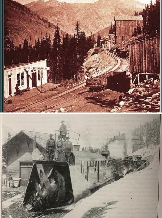 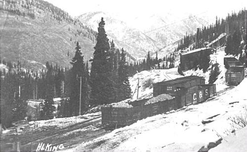 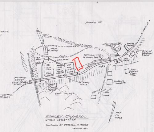
Preston Sands
Tucson, Arizona -Modeling St Elmo to Palisades in Nn3- |
Re: Romley and the Mary Murphy mine
|
Preston, I know this was just discussed at length in the C&S FB group so I won't go over all that. One addition to the story covered on FB (that the Ogden sits approximately where the Hancock station would be moved to) is that I don't think the Golf Mill was up during the South Park or DL&G days, or if it was it was very much at the end of that period. There was, I believe an earlier mill downhill, below the ore bins but I don't recall if it was east of Pomeroy Gulch.
The sloped building I think you're referring to was the power house as far as I know.
Dave Eggleston
Seattle, WA |
|
Timely insert here.
 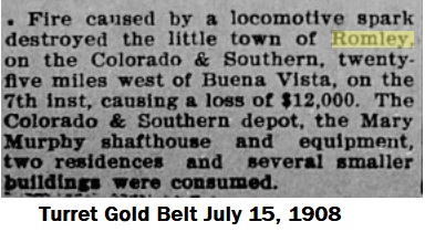
UpSideDownC
in New Zealand |
«
Return to C&Sng Discussion Forum
|
1 view|%1 views
| Free forum by Nabble | Edit this page |


