Pictorial Supplement to Train Time in Morrison
1234


1234
Re: Pictorial Supplement to Train Time in Morrison
|
CONTENTS DELETED
The author has deleted this message.
|
Re: Pictorial Supplement to Train Time in Morrison
|
In reply to this post by Jeff Ramsey
CONTENTS DELETED
The author has deleted this message.
|
Re: Pictorial Supplement to Train Time in Morrison
|
In reply to this post by Chris Walker
CONTENTS DELETED
The author has deleted this message.
|
Re: Pictorial Supplement to Train Time in Morrison
|
The Pumphouse wasn't mentioned by Mac Poor in his Station List DSP&P pg 415, but mentioned a Handcar house. Unfortunately these items of interest are always just out sight in most photos.
UpSideDownC
in New Zealand |
Re: Pictorial Supplement to Train Time in Morrison
|
This post was updated on .
CONTENTS DELETED
The author has deleted this message.
|
Re: Pictorial Supplement to Train Time in Morrison
|
Could the boxcar body bunkhouse be an old Hallack Bros.boxcar?
|
Re: Pictorial Supplement to Train Time in Morrison
|
CONTENTS DELETED
The author has deleted this message.
|
Re: Pictorial Supplement to Train Time in Morrison
|
In reply to this post by John Schapekahm
John, I can't remember ever seeing Handcar setouts angled as such, as you mentioned no handcar shed (yet present or under construction), or even room for one, although this earlier(maybe) view http://cdm16079.contentdm.oclc.org/cdm/fullbrowser/collection/p15330coll22/id/10275/rv/singleitem/rec/136 does show a small building in the general area, and as I previously commented on the vagaries of Mt Vernon Creek, and given that this skeleton track wasn't present in the two other pictures taken from this angle either. Compare also with the view from pg16 The Mineral Belt. Volume II. There appears to be something resembling track in a slightly different location further West. Couple that to what does look like two spare rails parallel to the track that could bridge the gap, the "temptrack" appearing to be elevated slightly higher than the Northside Siding to allow the insert rails to seat directly on the siding then I would be leaning towards a expedient temporary track laid for the purposes of loading or unloading material(s) from a Car on the Depot siding(Southside). There is a rather prominant stack of boards adjacent the far end that may be intimating this reason; there appears no evidence in photos that there was any loading directly of Cars on the Southside siding from road vehicles, horsedrawn or otherwise. Note in this early view other than those two freight doors there is no siding on the southside to load Cars on.  http://digital.denverlibrary.org/cdm/singleitem/collection/p15330coll22/id/10315/rec/74 Digressing slightly, those two freight doors served the Southside siding only after the revison of track following the removal of the Turntable, I wonder why the Railroad removed the Northernmost siding and also angled the Southside siding away from the Freightdoors? Any freightcar(s) left by the Freightdoors would have prevented the escape of the Locomotive to the Turntable so did the Railroad expect loading to take place only on the Northsiding, the angled track being exclusively for the Passenger? These set-ups were very useful to move quantities of material or Timbers, Stone etc short distances that wheelbarrows couldn't handle without many workers. 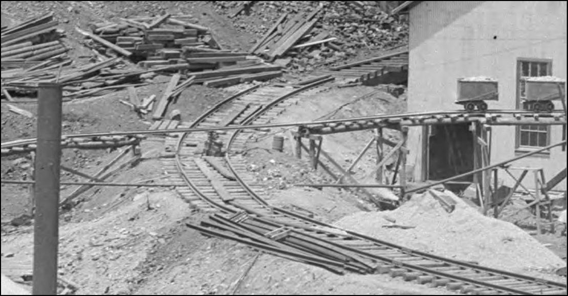 This example is during construction at the Oak Creek Coal Co. but is illustrative of the flexibility offered by this long forgotton expedient. The concept also allows for the quick reinstatement of the line being crossed with minimum time and effort, and can be relocated at a whim. 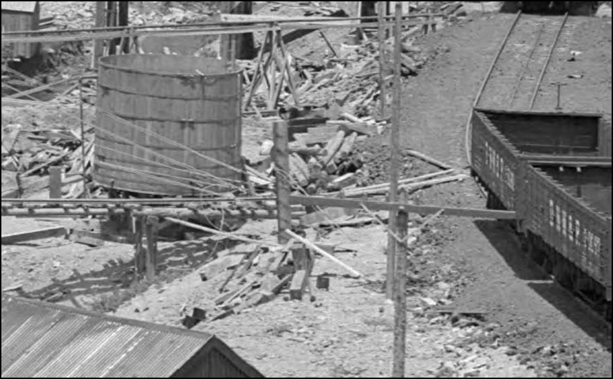 http://digital.denverlibrary.org/cdm/fullbrowser/collection/p15330coll22/id/439/rv/singleitem/rec/9 Anyone else have an idea on these rails?
UpSideDownC
in New Zealand |
Re: Pictorial Supplement to Train Time in Morrison
|
This post was updated on .
In reply to this post by John Schapekahm
CONTENTS DELETED
The author has deleted this message.
|
Re: Pictorial Supplement to Train Time in Morrison
|
CONTENTS DELETED
The author has deleted this message.
|
Re: Pictorial Supplement to Train Time in Morrison
|
In reply to this post by Chris Walker
CONTENTS DELETED
The author has deleted this message.
|
Re: Pictorial Supplement to Train Time in Morrison
|
When was the original Morrison turntable replaced?
|
Re: Pictorial Supplement to Train Time in Morrison
|
This post was updated on .
In reply to this post by John Schapekahm
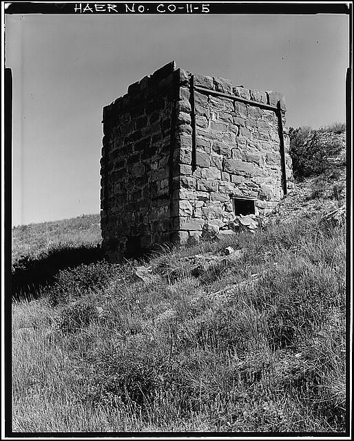 The HAER photographic record, 10 pictures of the Garfeild Lime Kiln can be found here. http://www.loc.gov/pictures/collection/hh/item/co0096/
UpSideDownC
in New Zealand |
Re: Pictorial Supplement to Train Time in Morrison
|
Where are the remaining photographs?
|
|
go to search put in lime klins go down to#18
|
Re: Pictorial Supplement to Train Time in Morrison
|
In reply to this post by John Schapekahm
CONTENTS DELETED
The author has deleted this message.
|
Re: Pictorial Supplement to Train Time in Morrison
|
This post was updated on .
In reply to this post by John Schapekahm
Now what is interesting about this structure is that it is very similar to the dimensions of the DSP&P depots that were at Dome Rock, Eastabrook and quoted from the 1886 UP B&B summary of the depot at Slaughts, later Maddox, There is no listing of a Fort Logan depot at this station at this time. Fort Logan did not become a Military base until 1887 although the Fort Logan depot seems to have the dimensions and architectural features (door, window trim and eave brackets) of the depots built around 1879-1880. Could this structure have been moved from Slaughts?, perhaps to Bear Creek Junction (Sheridan Junction), then to Fort Logan?
 It is rumored with people in the City of Sheridan that the Fort Logan (C&S) depot still exists about a thousand feet from it's original location on S Lowell St. The width of the structure matches at being 18', but the length is about 32'. Perhaps there was a end addition added after it was moved? If so the eaves were cut back but the roof pitch seems close. The tenant was less than friendly when I started measuring her after knocking on the door with no answer. Needs more research and investigation? Possibly this is a surviving DSP&P structure? 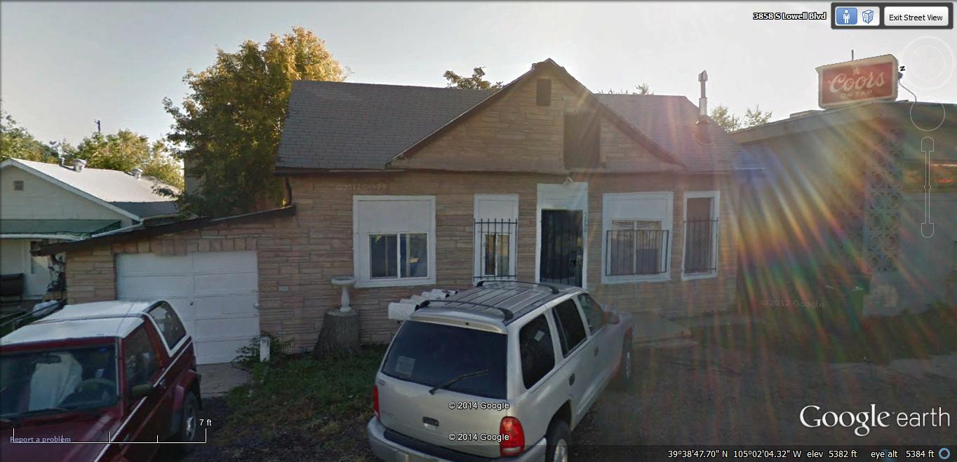 |
Re: Pictorial Supplement to Train Time in Morrison
|
This post was updated on .
In reply to this post by John Schapekahm
Another blurry view of Sheridan Junction. Maxwell photo of 1941, showing the 2 story section house of Hampton Blvd, sight of C&M Irons and Metals today viewed from Hwy 285. The Sheridan Historical Society claimed that "The red depot" (section house) was demolished in 1956.
 Photo of the D&RGW SG/3rail diamond of the C&S near Military Junction, Sheridan Junction, 1964. C&S was abandoned 1955 at this location. Site today of the west end of the Englewood Golf Course of Oxford Ave. 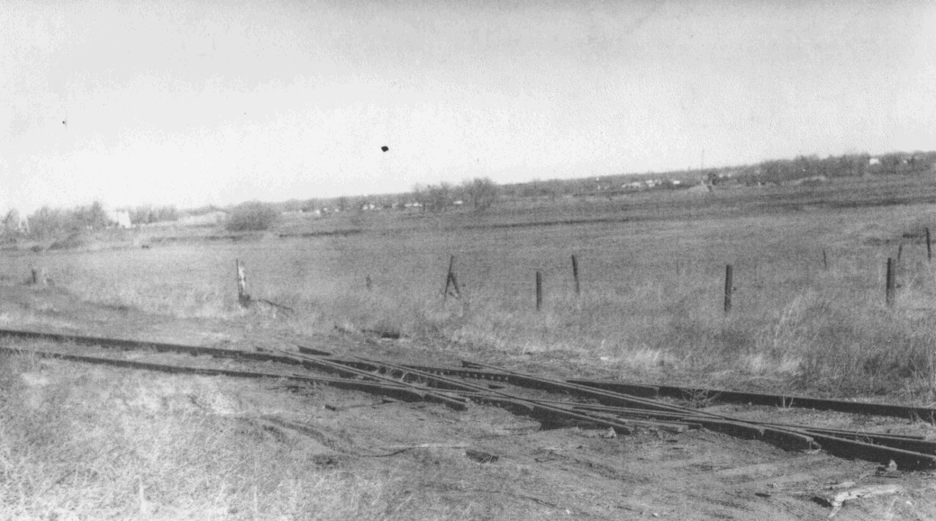 DPL view of Fort Logan from near Loretta Heights. The road running by is Lowell St. The field to the right is now Mullen H.S. 
|
Re: Pictorial Supplement to Train Time in Morrison
|
The Sheridan Historical Society claims that the section houses survived until 1956. Other side of Hampton Blvd. is the current end of the BNSF, South Park Branch or Park Line.. Very still active today at this point.
|
Re: Pictorial Supplement to Train Time in Morrison
|
In reply to this post by John Schapekahm
Another image of the lime kiln near Morrison before it was demolished about 10 years ago to make what was a expansion of the Bandimere Speedway parking lot and roadway. I remember the rail that braced the kiln was 1877, I don't remember the make.

|
«
Return to C&Sng Discussion Forum
|
1 view|%1 views
| Free forum by Nabble | Edit this page |


