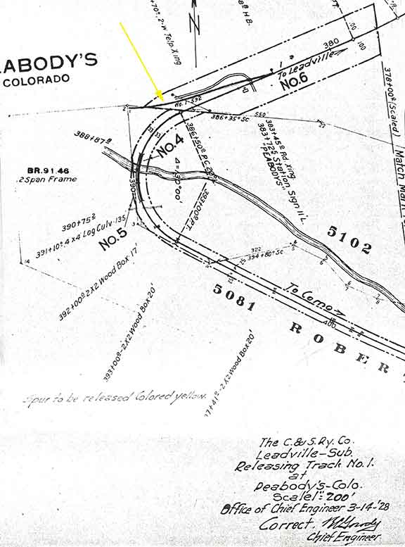
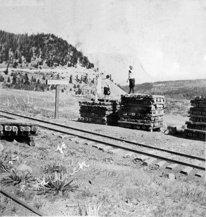
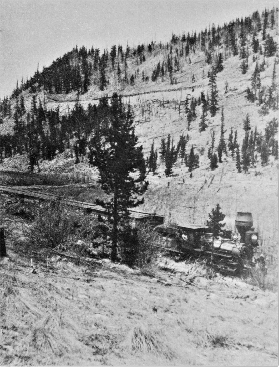
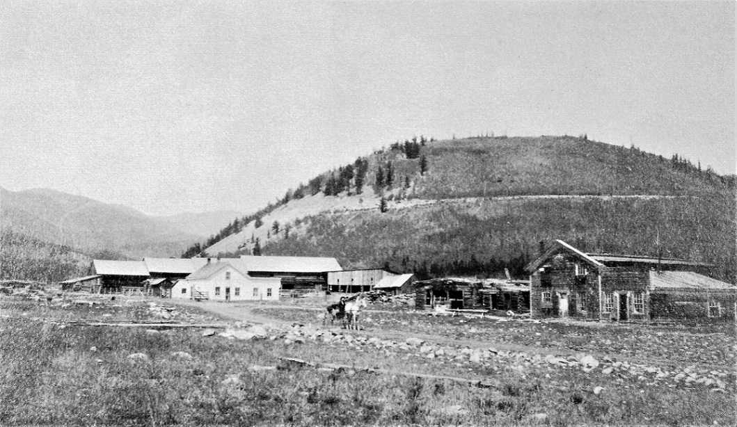
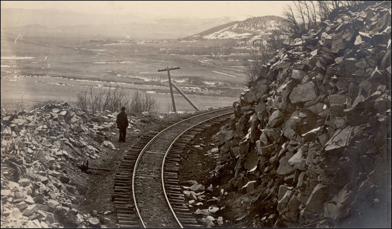
Peabody curve

Previous Topic Next Topic
 
classic Classic list List threaded Threaded
24 messages Options
12
Reply | Threaded
Open this post in threaded view
|

Peabody curve

Ken Martin
Last summer at DPL library I found an AFE for the removal in 1928 of the spur at Peabody’s curve M.P. 91.5 Leadville Subdivision. Sadly when I copied it I cropped the AFE number off.

From the AFE.
"Reason:
        This  track was constructed about 40 years ago as a loading spur for ties and mine timbers, and was also used occasionally for passage of trains.

         The timber has now been cut of f the land adjacent to this spur, and therefore there is no further necessity for same. It is proposed to take up and abandon the track, recover the usable material and obviate the necessity of future maintenance.

        Total cost to be borne by the Colorado and Southern Railway Company."

Estimated gross cost of project $43

It is just a small bit of info on traffic.

Ken Martin


Reply | Threaded
Open this post in threaded view
|

Re: Peabody curve

Jeff Young
Hi Ken,

I think county road 801 follows the spur, with the headblock more-or-less where the Boreas Pass road turns off.

Cheers,
Jeff.

Reply | Threaded
Open this post in threaded view
|

Re: Peabody curve

Lee Gustafson
In reply to this post by Ken Martin
Ken,

How long, in feet, was that spur? Thanks.

Lee Gustafson
Reply | Threaded
Open this post in threaded view
|

Re: Peabody curve

Chris Walker
It appears to be written No.1 -592 (ft) on the plan.
UpSideDownC
in New Zealand
Reply | Threaded
Open this post in threaded view
|

Re: Peabody curve

ComoDepot
In reply to this post by Ken Martin
I have walked the area and there is very little to see due to the dredging and road widening at that point.

I did meet a lady who used to stay on the Peabody Ranch before Cooley dredged the valley, her Uncle owned it, believe it was sub divided in the 1960's. Certainly now there are some very large Pine's on the south side.

Looks like the road has moved shows a very distinct kink, I remember there is a sign of an old trail from roughly where the gate to the Pass is going down to Roberts Cabin, wonder if that could be it?
Reply | Threaded
Open this post in threaded view
|

Re: Peabody curve

Southpark
In reply to this post by Jeff Young
In response to Ken's post about Peabodys you may want to look at a post by Keith Hayes on 1/24/16 under Boreas Turntable.  Keith shows a photo looking west bound across Peabodys.
TomKlinger
Reply | Threaded
Open this post in threaded view
|

Re: Peabody curve

ComoDepot


This photo.

I nearly went there but as it has been raised will do so.

If you look at old photo's marked Peabody and Hamilton they seem to be all of the same complex a ranch area outside of the Boreas Pass entrance.

And the above photo would make sense as a point to serve that complex. But it is not the area the map describes.

I am not sure the lady I spoke to is still around, she must have been 90 ish when I spoke to her, at that time I assumed Peabody was where the curve is crossing the Tarryall. And as she spoke about the valley just assumed it was in the valley. Probably too late to clarify.
Reply | Threaded
Open this post in threaded view
|

Re: Peabody curve

South Park
  From memory, "Peabody's Curve" was the big, sweeping curve
where the railroad reversed direction, and began climbing the hillside
toward that point seen in the distance in this last photo.  "Peabody"
or "Peabody's Spur" was just upgrade from the curve,  just as seen
in this same photo.
"Duty above all else except Honor"
Reply | Threaded
Open this post in threaded view
|

Re: Peabody curve

Lee Gustafson
In reply to this post by Chris Walker
Chris,

Thanks. I see it now.

Lee Gustafson
Reply | Threaded
Open this post in threaded view
|

Re: Peabody curve

Jeff Young
In reply to this post by ComoDepot
I think the photo is the same location as the map.  Robert’s Cabin would be about straight behind the sign post.

Cheers,
Jeff.
Reply | Threaded
Open this post in threaded view
|

Re: Peabody curve

South Park
  I have never seen a photo showing the telegraph line between
Como and the point above Peabody's (is there not a name for
that point ???).

  Did the telegraph follow the track up the valley and back out
onto the point, or did thepoles cut off cross-country and up the
hill to meet the tracks there ?
"Duty above all else except Honor"
Reply | Threaded
Open this post in threaded view
|

Re: Peabody curve

South Park
  Found this shot.  I know I have seen others in the same area.

http://digital.denverlibrary.org/cdm/singleitem/collection/p15330coll22/id/72280/rec/12

  Anyone know of a photo showing the telegraph between this point and Peabodys ?

.....  or did the line cut cross-country toward Como from here ?
"Duty above all else except Honor"
Reply | Threaded
Open this post in threaded view
|

Re: Peabody curve

Jim Courtney
SP,

Here are a couple of photos near Peabody, from Digerness's The Mineral Belt, Volume 2:


A circa 1885 photo of a Como bound train behind Brook's mogul 157, just down grade from Peabody curve.


An undated photo of the hamlet of Hamilton, evidently just northwest of Como.  The South Park / C&S grade above Peabody is in the distance.
Jim Courtney
Poulsbo, WA
Reply | Threaded
Open this post in threaded view
|

Re: Peabody curve

Chris Walker
In reply to this post by South Park
Sth'Parks picture he found.

Z-5659

http://digital.denverlibrary.org/cdm/fullbrowser/collection/p15330coll22/id/72280/rv/singleitem

Nice selection of Railbrace styles in use together on that curve.
UpSideDownC
in New Zealand
Reply | Threaded
Open this post in threaded view
|

Re: Peabody curve

South Park
  The only reason a railroad would keep the telegraph trackside on such a hairpin
of extra mileage would be for ease of access for maintenance OR there was a station
along that stretch of track to warrant a connection.  AFAIK, there never was a station
along that stretch of track and upon thinking about it, I cannot recall ever seeing a
photo showing the telegraph between Como and that point.  Why build 2-3 extra
miles of line when you can just cut straight up the hill ?
"Duty above all else except Honor"
Reply | Threaded
Open this post in threaded view
|

Re: Peabody curve

Jeff Ramsey
In reply to this post by Jim Courtney
I think there was some rock quarrying in the early days in vicinity of the rock slide area WB from Peabody spur. If one looks in DSP&P pictorial there is the same Mellon image that Jim posted and there appeared to me to be a primitive road switch backing up the hillside beyond 157s tender. Also in that image can be seen a small cabin and what look like to me a system on gin poles, cables and a Derrick from the upper track area to the bottom of the valley. I Investigated this area last summer and found the cabin site, road and the stumped remains of numerous very large (12x24) timbers, one of which can be seen right next to the road leading to Boreas/ Selkirk CG on the south side of the road in the aspen grove. The rock or stone from this area matches samples I have collected from the Como tenement building, boiler house and stone store (garage), but not the roundhouse. I have found no other information on this enterprise.
Reply | Threaded
Open this post in threaded view
|

Re: Peabody curve

Chris Walker

1568. Peabody Ranch. Circa 1930s. Windmill remains are shown. Source: Special Collections, Tutt Library, Colorado College, Colorado Springs, Colorado
http://www.parkcoarchives.org/photos/photos4/photos_peabody_ranch.html
UpSideDownC
in New Zealand
Reply | Threaded
Open this post in threaded view
|

Re: Peabody curve

ComoDepot
In reply to this post by Chris Walker
I hav
Chris Walker wrote
Sth'Parks picture he found.

Z-5659

http://digital.denverlibrary.org/cdm/fullbrowser/collection/p15330coll22/id/72280/rv/singleitem

Nice selection of Railbrace styles in use together on that curve.
I have a hard copy of that view, on it you can see a car seemingly set out on the spur to the Upper Como coal mines. Do not think I have ever seen another photo of that spur.

I assume we have 3 Peabody's

The Ranch otherwise known as Hamilton

The siding serving the Ranch

The curve by Roberts Cabin.

The Telegraph cut across the gulch behind the Como Depot so it seems quite possible something similar would happen here.

Always amazed by the lack of trees in what is now a heavily wooded area, gives a completely different feel.

If you look closely in the film of the last Train in April 1937 the shot looking back to Como includes the dredge in the Hamilton area, the Dredge worked until 1946 uit I do not know when they started. The grade as it turned to go up to Peabody's curve seems to be well within the scope of the dredging.
Reply | Threaded
Open this post in threaded view
|

Re: Peabody curve

South Park
  Evergreen trees grow slowly at that elevation.  Every last stick
was cut for mine props, ties, or firewood when that area was so
populated and the mines running.  I am always amazed by an early
photo at Baker's Tank with a heavy forest of old growth evergreens
all around.  
"Duty above all else except Honor"
Reply | Threaded
Open this post in threaded view
|

Re: Peabody curve

Robert McFarland
The one with the Mason Bogie and the Bowers&Dure combine?
12