Patience Pays: Sanborn Maps
|
If you have been hanging out here, you know I am the Leadville guy. As I work towards the impossible dream of finishing the Leadville portion of the layout, there are a couple areas that I could use a photo of, or a map. One is a long barn parallel to the tracks between the Roundhouse and the Freight Depot, I think at 12th Street. The other is the elusive location of the oil dealer in Leadville. And...if you have been hanging out here a while, you know that my patience waiting has been repaid several times over.
 Last night while watching a movie, I got to thinking about this and idly did a search for "insurance map leadville" and got a link to the Lake County Library and their collection of Sanborn maps: https://lakecountypubliclibrary.org/houseresearch/sanborn. A terrific resource, but all pretty old for me. However there is a note with a link to a 1939 set of Sanborn maps at the Library of Congress! https://www.loc.gov/resource/g4314lm.g010311937/?st=gallery Now this is the ticket! I have been waiting to find these for a few years: I think Chris found them on the Norlin website, but I was never able to access them. For those of you who don't know, Sanborn was an insurance company in the day, and being an insurance company, they wanted a really good handle on the risk they were taking on. I don't know why they took this on themselves, but thank goodness they did, because these are amazing resources for us today. Oh, and the originals are literally watercolors and pretty much works of art in their own right. Here is the key for the 1939 map: 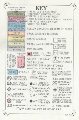 You can see that the color of the building indicates the type of construction--frame, brick, metal clad; they type of chimney, the number of fires/ flames in a building, and in the case of buildings like, oh, a roundhouse, if there is a full time attendant watching the fires. 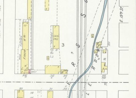 Map 11 shows a long thing building like the one I am looking for, and since there is a scale on the map, I can figure out the dimensions pretty easily. 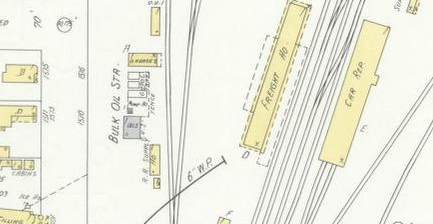 Also on map 11 there is a Bulk Oil Station just west of the D&RGW Freight House. Could this be where the CONX tanks were loaded to ship petroleum products to Breckenridge and Baileys? My success led me to wonder if our fearless surveyors wandered up to Climax, and I was rewarded! Yes, and in the same set no less are maps of Climax (and Stringtown and the Smelter)!  I am disappointed to see that the trackage within the mine at Climax at this date is rather simple, but that can lead to different challenges as I can use spots along the long single track for different loading positions. The map does confirm the railroad buildings in place at the end of the 30s, and a number of homes which I hope to recreate using forced perspective (multiple iterations of the same building in diminishing scale, ideally an odd number). As I know a few of you are interested in other sites, I looked up Breckenridge too. And yes, LOC has a 1914 set of maps. 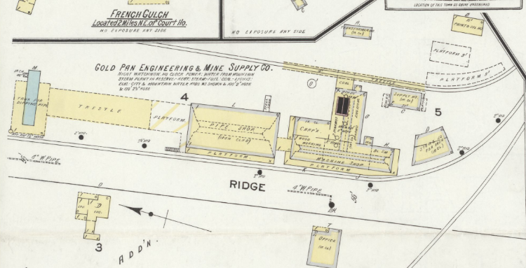 Here is the Gold Pan operation just before WWI. Unfortunately there is less detail along the ROW and only this at the Breck Depot: 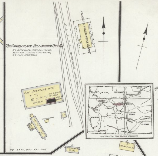 So search away my friends and see what you find!
Keith Hayes
Leadville in Sn3 |
|
Fantastic!
And who would have thought -- roller skating in 1886 Kokomo: 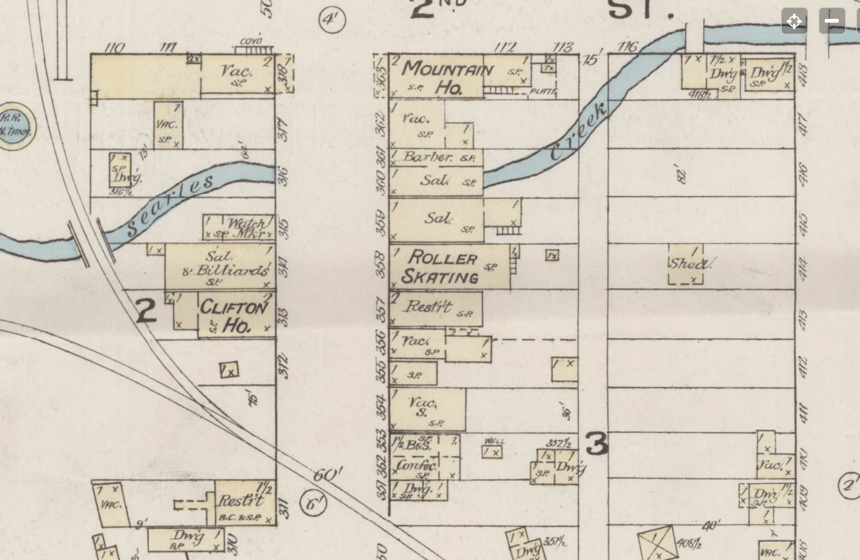
|
|
In reply to this post by Keith Hayes
For you Pitkin lovers they have 1893, 1900 and 1910.
|
|
In reply to this post by Keith Hayes
Thanks for thinking of Breck, Keith.
The map of the Gold Pan Shops (1914) as well as the 1918 Valuation map both confirm that the elevated coal delivery trestle was still in place by those dates. And a 1929 Denver Water Board photo also shows it: 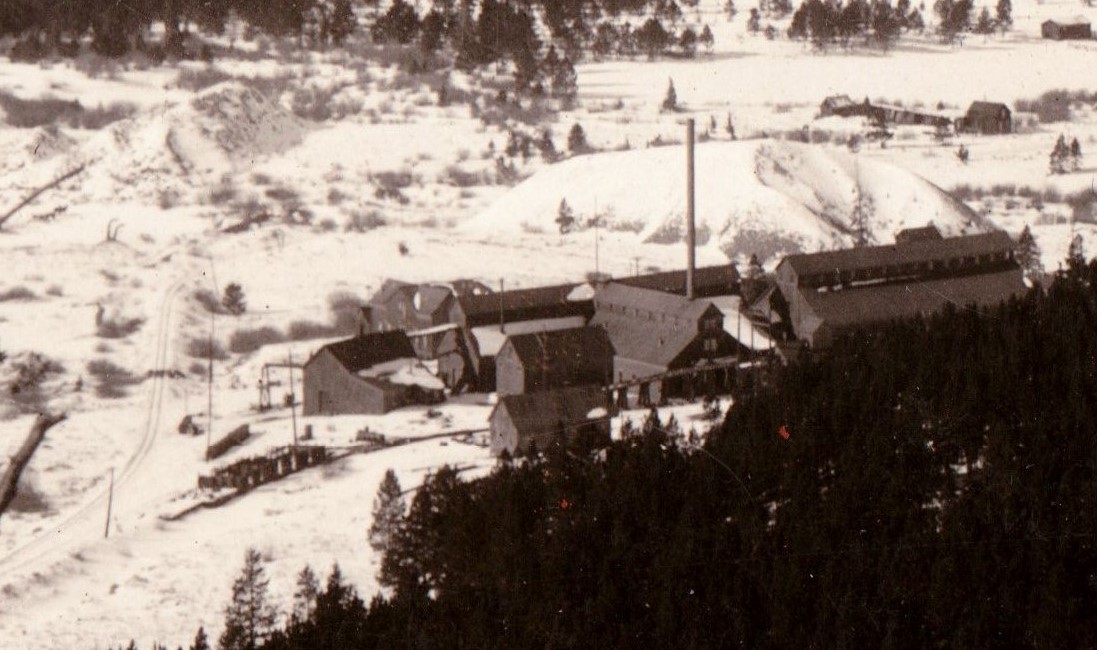 High resolution image courtesy of Jeff Young. I've always thought this odd. The stationary boilers were installed in the shops when constructed so that 5' diameter pipe could be manufactured for the Gold Pan Pipe Line. Once complete, and hydraulic mining at the Gold Pan Pit began, a branch pipe line diverted water directly into the shops as a penstock for hydraulic generation of electricity, to run the shop's machinery. The shops also provided all the electricity for the town of Breckenridge, possibly some of the dredges when they were converted to electric power. So why was there a need for coal delivery track, after say 1902 or so? I've wondered, since the weather is unpredictable (you know, climate change and all), whether the snow pack was inadequate some years, and by late summer or fall there was inadequate water pressure to generate electricity. In such case, the boilers would be fired up to generate electricity to old way. So maybe I could spot coal cars on the trestle in 1924 . . . Makes a good story, but does anyone know if this is true?
Jim Courtney
Poulsbo, WA |
Re: Patience Pays: Sanborn Maps CONX in Leadville
|
Keith wrote:
Also on map 11 there is a Bulk Oil Station just west of the D&RGW Freight House. Could this be where the CONX tanks were loaded to ship petroleum products to Breckenridge and Baileys? The 1919 D&RG station map, corrected to 1927, shows the Conoco bulk plant property to be further north, on the same side of the tracks and beyond the stock yards. The top left corner of map 11 shows the Conoco facility in an insert: 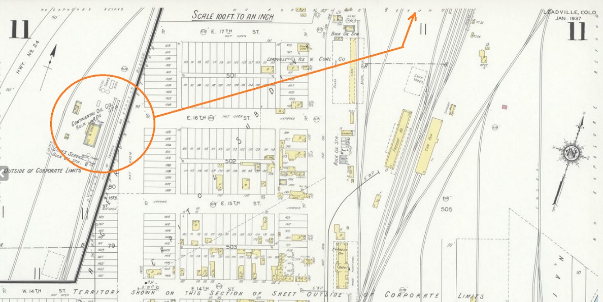 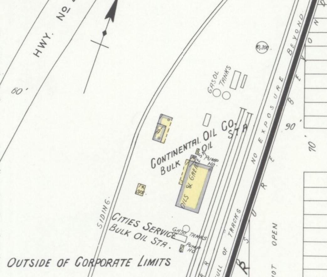 On your Sn3 Leadville it would be at the far left end of the D&RGW trackage, just before the crossing of the C&S mainline, about there: 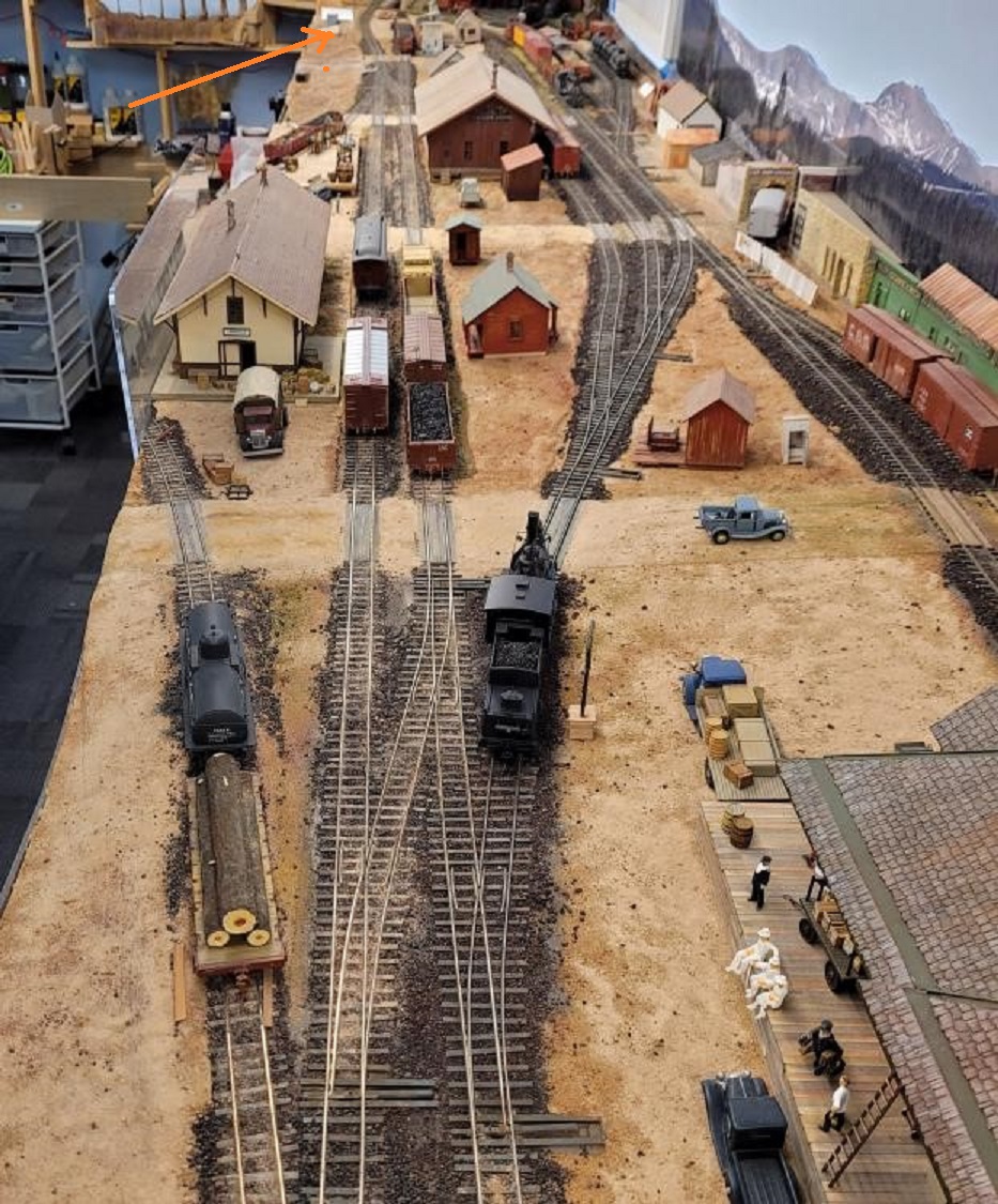 Looks like the track crew needs to put in a new siding, perhaps a long one for all those CONX tank cars . . . 
Jim Courtney
Poulsbo, WA |
|
In reply to this post by Jeff Young
The Leadville Herald Democrat of 1910, viewed in History Colorado Historic Newspapers, runs ads for a Leadville roller skating rink. Roller skating was a BIG deal.
Tom Klinger |
Re: Patience Pays: Sanborn Maps
|
How early did it start?
|
«
Return to C&Sng Discussion Forum
|
1 view|%1 views
| Free forum by Nabble | Edit this page |

