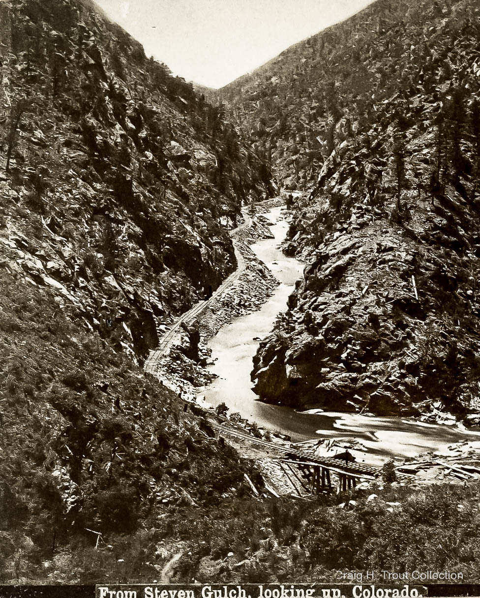
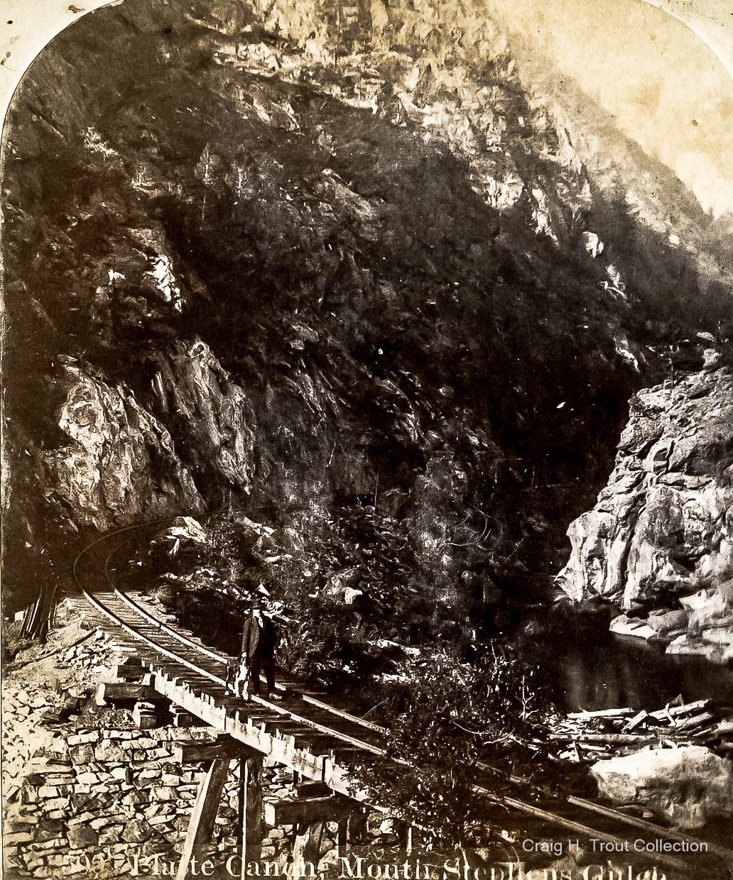
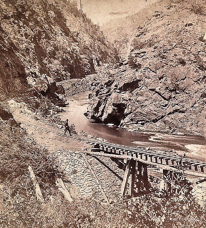
■ I have always believed that the "Stevens Gulch Trestle" would be very interesting to model including its crude footbridge along its left side as well as the careful rock work protecting the earthen slopes beneath the two short wooden abutments.
– Located at milepost 26.00, and as the name indicates, crossing "Stevens Gulch," Bridge #1046, (old #34) consisted of three spans at 3 spans at 16' ea. for a total length 46' [sic], and 12' in height at its center. The trestle was first built in May 1877, replaced in 1883, and replaced again in 1890. It was perhaps high enough above the South Platte River that it escaped serious damage during the catastrophic 3 May 1900 flood. Regardless, I have no additional information on additional rebuilds after 1890.
– In addition to "Deanesbury" (Strontia Springs), Stevens Gulch was perhaps one of the most historic locations in Platte Canyon. In Nov 1860, the "South Platte River Improvement and Lumbering Company" obtained a charter from the newly-formed Jefferson Territory to cut timber along the lower stretches of the South Platte River. The four innovative promoters were C.J. Stevens, J.C. Saunders, J.D. Henderson, and W.A. McFadden. Bolstered with $50,000 for capital outlay, they devised a plan to float logs down to Denver along an "improved" river channel, and they were authorized to "improve the South Platte River from Auraria City to a point 20 miles above the mouth of the Platte Canyon (near later Buffalo) for floating timber, lumber, and so forth down river." It is assumed that Stevens Gulch is named after one of those early lumberman, J.C. Stevens, who perhaps established his timber operations somewhere in Stevens Gulch.
– By about 1865, if not earlier, a series of crude logging roads had been established down Stevens Gulch, and then north across the river at that point, as well as over a sharp ridge line to the upper reaches of Bear Gulch above what later became Deansbury. The Stevens Gulch Road originated from the later location of "Vincent" (opposite Waterton, near the mouth of Platte Canon) and continued nearly due south through Pleasant Park (now Roxborough Park), then turning west over the sharp ridges and then down Stevens Gulch. These crude trails were already portrayed as "old wood roads" when surveyed by Colorado Deputy Surveyor General, Cecil Augustus Deane, in November and December 1872. (Source: BLM). ★ Anyone modeling the South Platte Canyon in those early years should perhaps include sawmills, lumber camps, and logging roads throughout the area. Additionally, floating "cross ties" or logs down the river would be another very interesting modeling detail.
– The other major player in the Platte Canyon quadrant was Cecil Augustus Deane (1844-1925) who as Colorado Deputy Surveyor General, surveyed Platte Canyon in November and December 1872 and noted the various crude logging roads already in existence. Deane noted the abundant timber in the area and soon began purchasing timber cultures as well as lands around Bear Gulch where he soon established his sawmill and lumber camp. He soon erected a small brick office building which also soon became the "Platte Canyon" Post Office with Deane being named as postmaster on 11 Oct 1877. Also in 1877, Deane began expanding his brick office into a hotel, later named Deanesbury, but much more on that later. Track layers did not actually reach "Deane's Ranch" until 24 May 1878. The "Platte Canyon Post Office" was renamed "Deane " on 19 Dec 1879 with Cecil A. Deane remaining as postmaster.
– Back to Steven's Gulch, it was often mentioned in newspaper coverage of the time, primarily regarding the timber cutters, logging operations, and such. Throughout the early years, Stevens Gulch remained a flag stop, just as Mill Gulch nearly 2 miles downriver
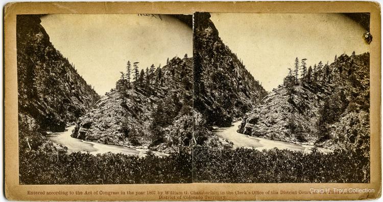
In this interesting photo, we see a classic view of the Steven's Gulch Trestle complete with its companion footbridge running along its side. Source: Craig H. Trout Collection, please credit
.
■ Regardless, I nominate the "Steven's Gulch Trestle" as a very interesting candidate for modeling this stretch of the Denver, South Park & Pacific.
Craig H. Trout