Atlantic & Pacific tunnel

Previous Topic Next Topic
 
classic Classic list List threaded Threaded
7 messages Options
Reply | Threaded
Open this post in threaded view
|

Atlantic & Pacific tunnel

Matt Hutson
Hi guys,
Does anyone know the locations of the east and west portals? I'd love to go check them out this summer, but have been unable to find them on old USGS mapping.

Thanks,
Matt
Reply | Threaded
Open this post in threaded view
|

Re: Atlantic & Pacific tunnel

Jeff Ramsey
Reply | Threaded
Open this post in threaded view
|

Re: Atlantic & Pacific tunnel

Jeff Young
Huh.  I've hiked to the lake at the top of Peru Creek several times; never knew that was the back of Grays Peak behind it.

There's still a cabin (or at least was 20 years ago) on the east side.  It was built in the 1930's by miners attempting to mine from the Eastern bore.

https://www.google.com/maps/place/A%26P+Tunnel+Shelter/@39.671702,-105.8024011,15z/data=!4m14!1m7!3m6!1s0x876a537ad25d62eb:0xee3b27c04410d6ee!2sGrays+Peak!8m2!3d39.6336054!4d-105.817164!16zL20vMDNsdjdn!3m5!1s0x876a5342c610a615:0x61bb8a27e67cbc87!8m2!3d39.6717869!4d-105.7959131!16s%2Fg%2F11ry8y3g38?entry=ttu
Reply | Threaded
Open this post in threaded view
|

Re: Atlantic & Pacific tunnel

Todd Hackett
This is what the cabin looked like 45 years ago. It's along the 4WD trail up Steven's Gulch to the trailhead for hiking Gray's & Torrey's Peaks. There are some photos on Google Maps taken in the last few years showing it's still standing. There was a trail to the right just past the cabin that led to the east portal. I think I was on or near that trail for the photo. I was there again a few years later, but don't seem to have taken any photos on that trip, and only the one shot of the cabin on the first trip. I don't know why I didn't take any photos of the tunnel portal. There was a grate over the portal, but it was easy to climb through and walk all the way to the end of the main bore, which I think was about 1,000 feet in. There was a slight bend near the portal, which made most of the tunnel extremely dark. I had to watch my head most of the way because the top of the bore was typically less than 7' high, and there were plenty of points where it was less than 6'. I'd heard that the portal was more effectively closed after the last time I was there, but I have no idea what's it's like now.

Reply | Threaded
Open this post in threaded view
|

Re: Atlantic & Pacific tunnel

Matt Hutson
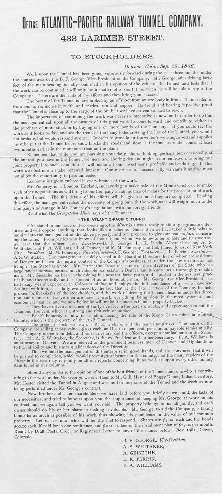
Thank you for the responses! What sparked my interest was a notice I found in an old book last week:


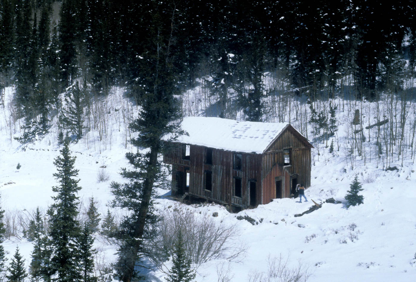
Since my post, I've found this photo of the Pomeroy Tunnel on DPL:

Seems awfully high up on the mountain for a railroad tunnel. I also found this humorous postcard pic:


The tunnel comes out at this location in red on the USGS map, which correlates well with Jeff Young's location:


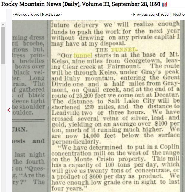
Also discovered this old newspaper story from an interview with Pomeroy himself:


Here's the west end on Google Earth based on the map in Jeff Ramsey's link:

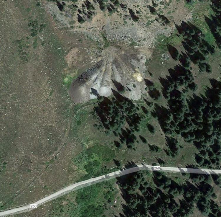
Again, a fair piece up the hill for a supposed railroad tunnel.

Thank you all,
Matt

Reply | Threaded
Open this post in threaded view
|

Re: Atlantic & Pacific tunnel

Mike Trent
Administrator
I believe the letter you posted was written by Bob Rothe in Boulder. Bob may still be active, and if so, try calling that number. Bob was and may still be a member of the Boulder Model RR Club. I'm sure if he's able, he could answer some questions for you. Use my name as having referred you to him.  
Reply | Threaded
Open this post in threaded view
|

Re: Atlantic & Pacific tunnel

Todd Hackett
Yes, that letter was definitely from Bob Rothe. My photo was from one of his hikes in April 1979.

Here's an update on tunnel progress from 1886 which concentrates on ore found rather than railroad use. Standing at the east portal, I couldn't see how they would be able to get the railroad up there, or how it would make the turn to enter the tunnel.