Re: Stanley Mills: Part Two. Salisbury Mill and Donna Juanita Mine.
Posted by Chris Walker on Jul 19, 2016; 2:14am
URL: http://c-sng-discussion-forum.254.s1.nabble.com/Stanley-Mills-Part-Two-Salisbury-Mill-and-Donna-Juanita-Mine-tp3483p5658.html
While revisiting the Donna Juanita some of my interpretations of the dating of these two pictures in the initial post hasn't sat well with me in regards to the existance of the new Hwy6&40 and the C&S prior to abandonment so I have looked back over this.
http://digital.denverlibrary.org/cdm/fullbrowser/collection/p15330coll21/id/11495/rv/singleitem/rec/271
http://digital.denverlibrary.org/cdm/fullbrowser/collection/p15330coll21/id/11494/rv/singleitem/rec/270
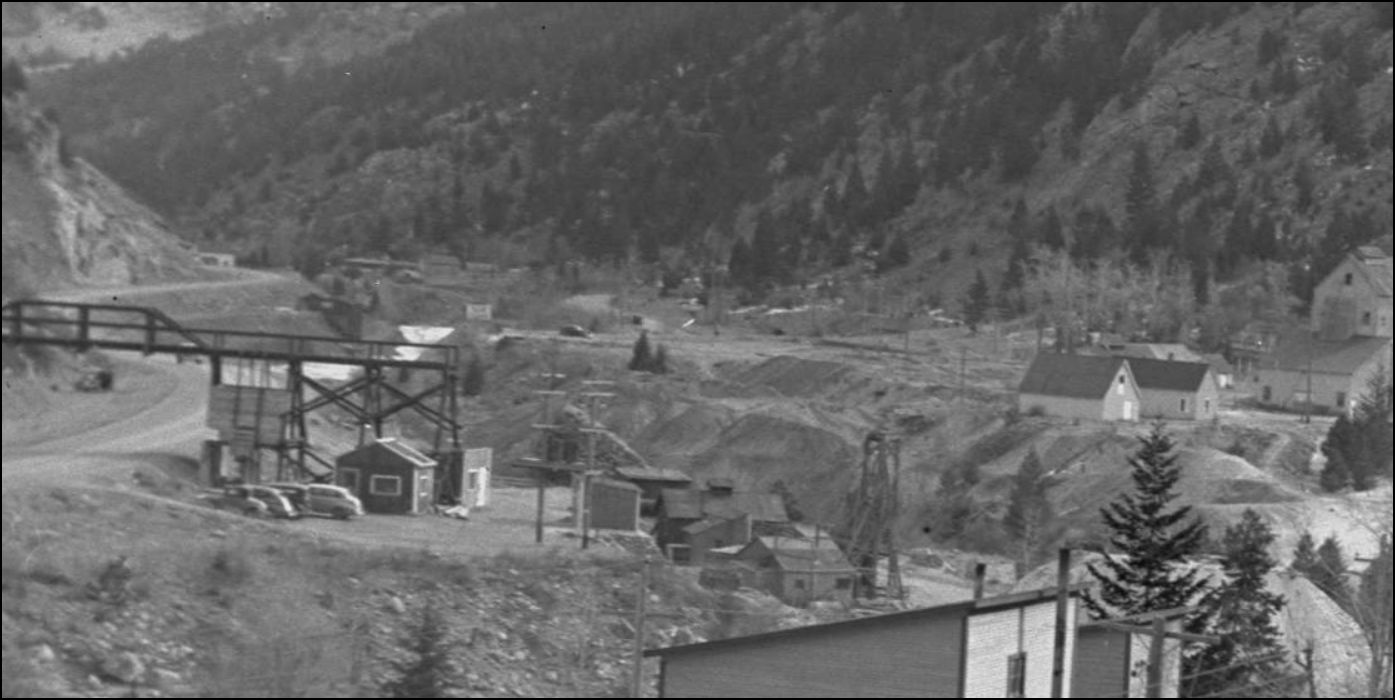
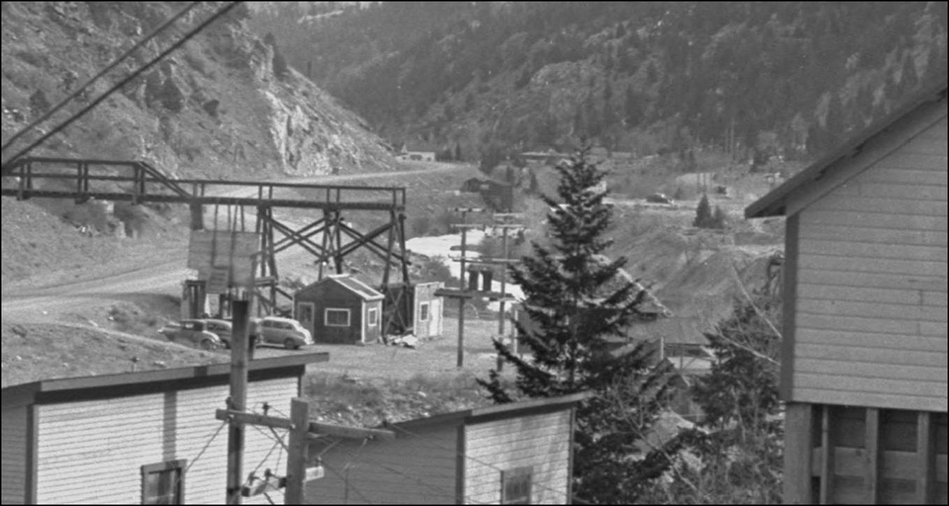
Noting the amount of Tailings that have fouled the mainline here are visible in Alma-Lincoln Mill photos shown in Stanley Mills: Part One, especially when viewed in conjunction with this next R.H. Kindig picture. Those tailings do not appear to be over the tracks at the Bridge #16 shown in the C&S Valuation Survey 1939 photo on pg324 Abbott/McLeod Colorado Central Rail Road, Sundance Publications.
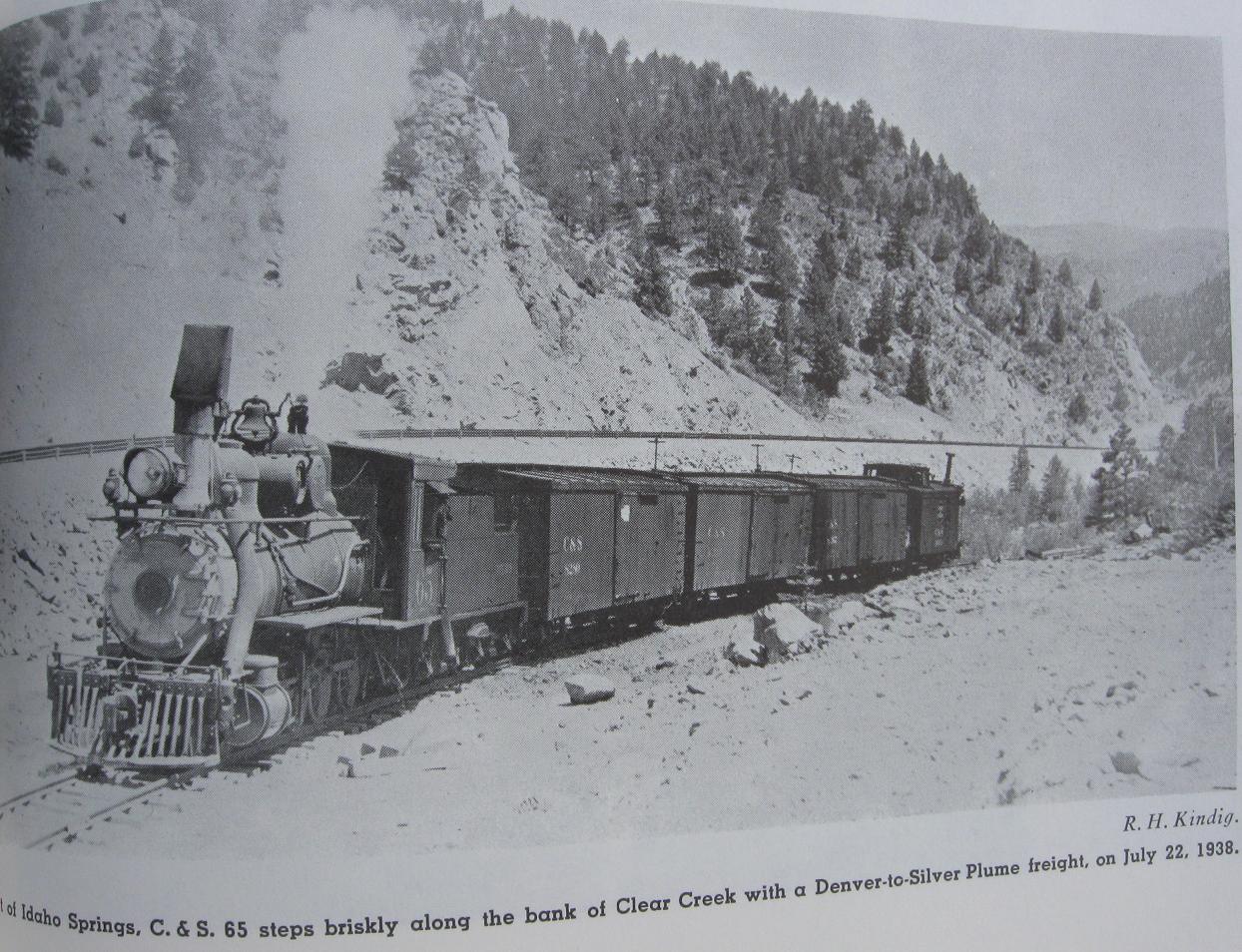
My doubts were raised as in this R.H Kindig Aug 5th, 1938 photo, there clearly are two vehicles on the newly reconstructed highway while the last trains were running.
from pg301 David S. Digerness Mineral Belt Vol-3 Sundance Publications 1982
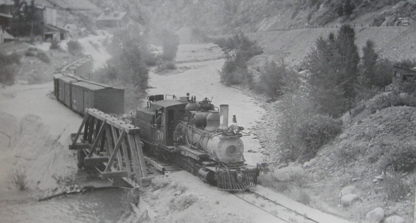
R.H.Kindig photo. Looking East and taken opposite the outlet of Trail Creek, former site of the Plutus Mill: note what looks like fresh asphalt on the Highway.
from Pictorial Supt. to D.S.P.&P.
Cross-checking with CRRA #10 Narrow Gauge to Central and Silver Plume show photos and in Mineral Belt V-3 another, of the new highway and relocated C&S tracks near Blackhawk and Smith Hill prior to abandonment, thus raising the query.
Could the C&S mainline immediately West of Idaho Springs been moved to allow construction of the new highway section and relaid alongside on the same grade as far as the Maude Monroe and Donna Juanita mines? This seems to be a bit of a stretch that the Hwy Dept. would do such but then again public money is easily spent.
There apparently was considerable grade differences between the new Highway and the C&S tracks in this area, in the background of the Maude Monroe trestle there appears a newish constructed Orebin on what I assume to be the edge of the C&S grade with a Shed structure actually on the grade with little clearance between the new Highway fill. So any change of grade between sections especially where the new road bulges into Clear Creek at the former location of the Salisbury and Crockett mines should be apparent in the above enlargements. From that re-affirmation I can't see the C&S being operational at the time of those two DPL picture were taken.

EDIT:UPDATE The shed structure referred to above is the Beauzy Mine. source:USGS 1917.
Perhaps someone-else will have an additional picture taken in this area in their collection or maybe Tom Klingers new book on the Clear Creek will produce something new.
URL: http://c-sng-discussion-forum.254.s1.nabble.com/Stanley-Mills-Part-Two-Salisbury-Mill-and-Donna-Juanita-Mine-tp3483p5658.html
While revisiting the Donna Juanita some of my interpretations of the dating of these two pictures in the initial post hasn't sat well with me in regards to the existance of the new Hwy6&40 and the C&S prior to abandonment so I have looked back over this.
http://digital.denverlibrary.org/cdm/fullbrowser/collection/p15330coll21/id/11495/rv/singleitem/rec/271
http://digital.denverlibrary.org/cdm/fullbrowser/collection/p15330coll21/id/11494/rv/singleitem/rec/270
Noting the amount of Tailings that have fouled the mainline here are visible in Alma-Lincoln Mill photos shown in Stanley Mills: Part One, especially when viewed in conjunction with this next R.H. Kindig picture. Those tailings do not appear to be over the tracks at the Bridge #16 shown in the C&S Valuation Survey 1939 photo on pg324 Abbott/McLeod Colorado Central Rail Road, Sundance Publications.
My doubts were raised as in this R.H Kindig Aug 5th, 1938 photo, there clearly are two vehicles on the newly reconstructed highway while the last trains were running.
from pg301 David S. Digerness Mineral Belt Vol-3 Sundance Publications 1982
R.H.Kindig photo. Looking East and taken opposite the outlet of Trail Creek, former site of the Plutus Mill: note what looks like fresh asphalt on the Highway.
from Pictorial Supt. to D.S.P.&P.
Cross-checking with CRRA #10 Narrow Gauge to Central and Silver Plume show photos and in Mineral Belt V-3 another, of the new highway and relocated C&S tracks near Blackhawk and Smith Hill prior to abandonment, thus raising the query.
Could the C&S mainline immediately West of Idaho Springs been moved to allow construction of the new highway section and relaid alongside on the same grade as far as the Maude Monroe and Donna Juanita mines? This seems to be a bit of a stretch that the Hwy Dept. would do such but then again public money is easily spent.
There apparently was considerable grade differences between the new Highway and the C&S tracks in this area, in the background of the Maude Monroe trestle there appears a newish constructed Orebin on what I assume to be the edge of the C&S grade with a Shed structure actually on the grade with little clearance between the new Highway fill. So any change of grade between sections especially where the new road bulges into Clear Creek at the former location of the Salisbury and Crockett mines should be apparent in the above enlargements. From that re-affirmation I can't see the C&S being operational at the time of those two DPL picture were taken.
EDIT:UPDATE The shed structure referred to above is the Beauzy Mine. source:USGS 1917.
Perhaps someone-else will have an additional picture taken in this area in their collection or maybe Tom Klingers new book on the Clear Creek will produce something new.
UpSideDownC
in New Zealand
in New Zealand
| Free forum by Nabble | Edit this page |