Stanley Mills: Part Three. Stanley Hotel Flagstop. Addendum.
Posted by Chris Walker on Jul 16, 2016; 7:51am
URL: http://c-sng-discussion-forum.254.s1.nabble.com/Stanley-Mills-Part-Three-Two-Smelters-and-the-Consolidated-Stanley-Mines-tp5619p5621.html
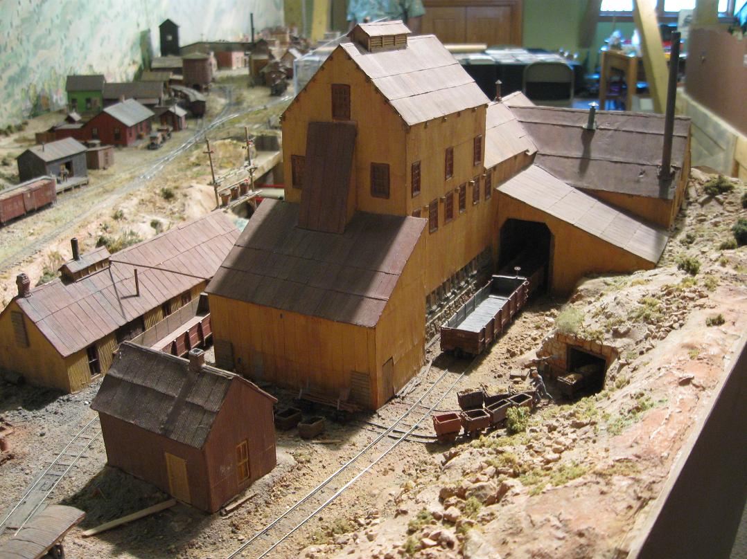
Harry Brunk's model version.
The last and largest Stanley Consolidated Hoisthouse was called the Gehrmann and should not be confused with the German Shaft, which was another Mine at the head of Virginia Canyon above Idaho Springs. Rather than bore you with the details of this new Shafthouse, I will include snippets from the USGS and Trade Journals of the time to give a far better description of the works. Mining details can be boring to modellers or not, I leave it to you. My thanks to Ken Martin for linking me with the answers to some very old questions regarding what had always looked like to me to be an Inclined Shaft structure.
Lachlan McLean photo Idaho Springs Historical Society coll

Lachlan McLean photo Idaho Springs Historical Society coll.

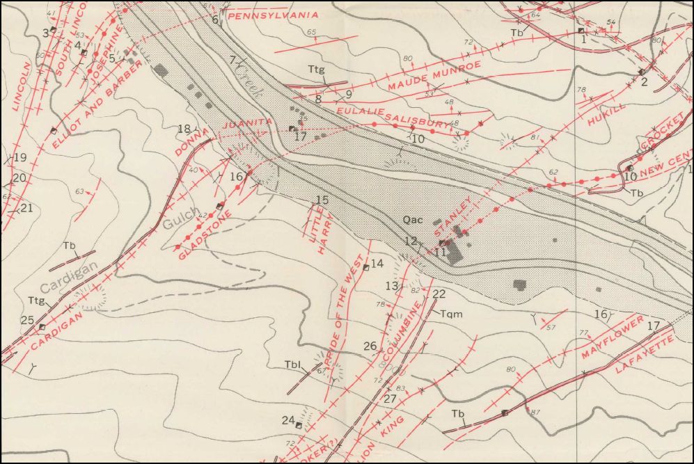
Composite Sanborn Map

CHS-B1486 http://digital.denverlibrary.org/cdm/fullbrowser/collection/p15330coll21/id/4932/rv/singleitem/rec/1626
Looking into the above view, is this the only picture that may show a Locomotive on the Siding?
MCC-368 http://digital.denverlibrary.org/cdm/fullbrowser/collection/p15330coll22/id/77738/rv/singleitem/rec/16
from USGS 1966
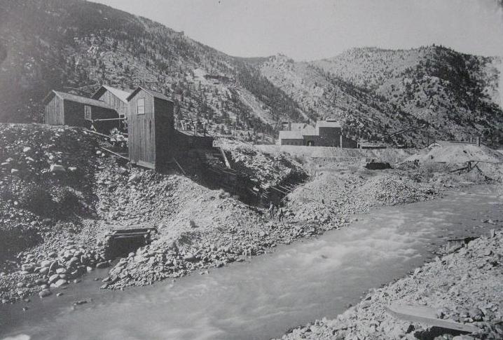
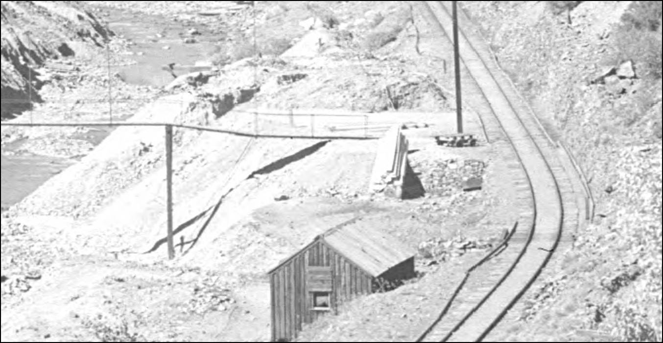
The Road Level Tunnel was across from the Shafthouse as seen in this view.

From A History Of Clear Creek County. 2004. Historical Soc. of I.S.
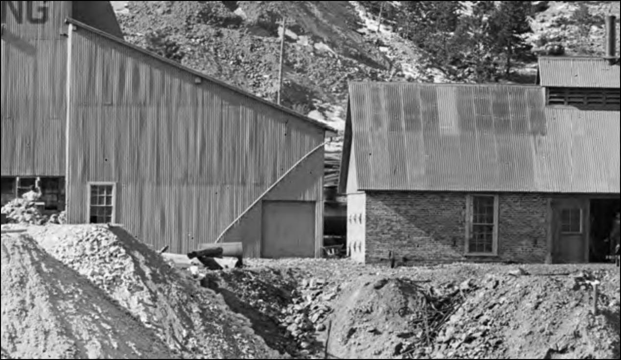
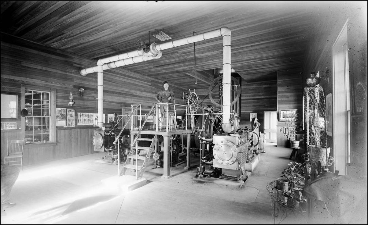
An inside view.
CHS-B337 http://cdm16079.contentdm.oclc.org/cdm/fullbrowser/collection/p15330coll21/id/3790/rv/singleitem/rec/75
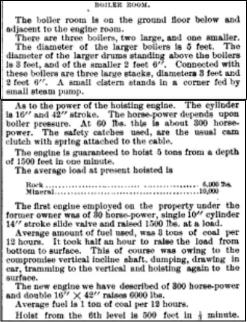

from the Colliery Engineer and Metal Mines 1894, Volumes 14 and 15. (SIC Standley)
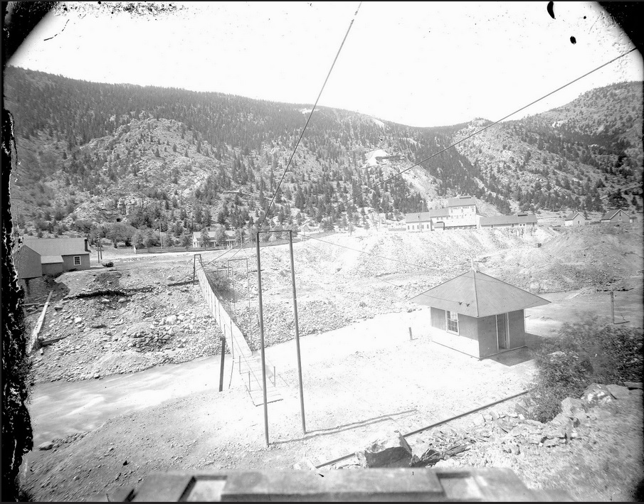
The previously unknown Stanley (Mills?) Flagstop. At the time of the great Yellow paint splurge, which co-incided with the name change from The Stanley Consolidated Mines Co. to The Stanley Mines Co., the ground was prepared for the new Flagstop: note the small trestle Br. No. 14 on the curve, this crossed the 18" gauge minetrack into the Crockett Tunnel. 12lb rail was still in place there at the time of the 1939 valuation survey indicating some reworking during the 1930's. Also of note is the Suspension Footbridge, which is just that, not a "pipe" support structure.
MCC-368 http://digital.denverlibrary.org/cdm/fullbrowser/collection/p15330coll22/id/77738/rv/singleitem/rec/16
Lachlan McLean photo
enlarged to show the details of this little building.
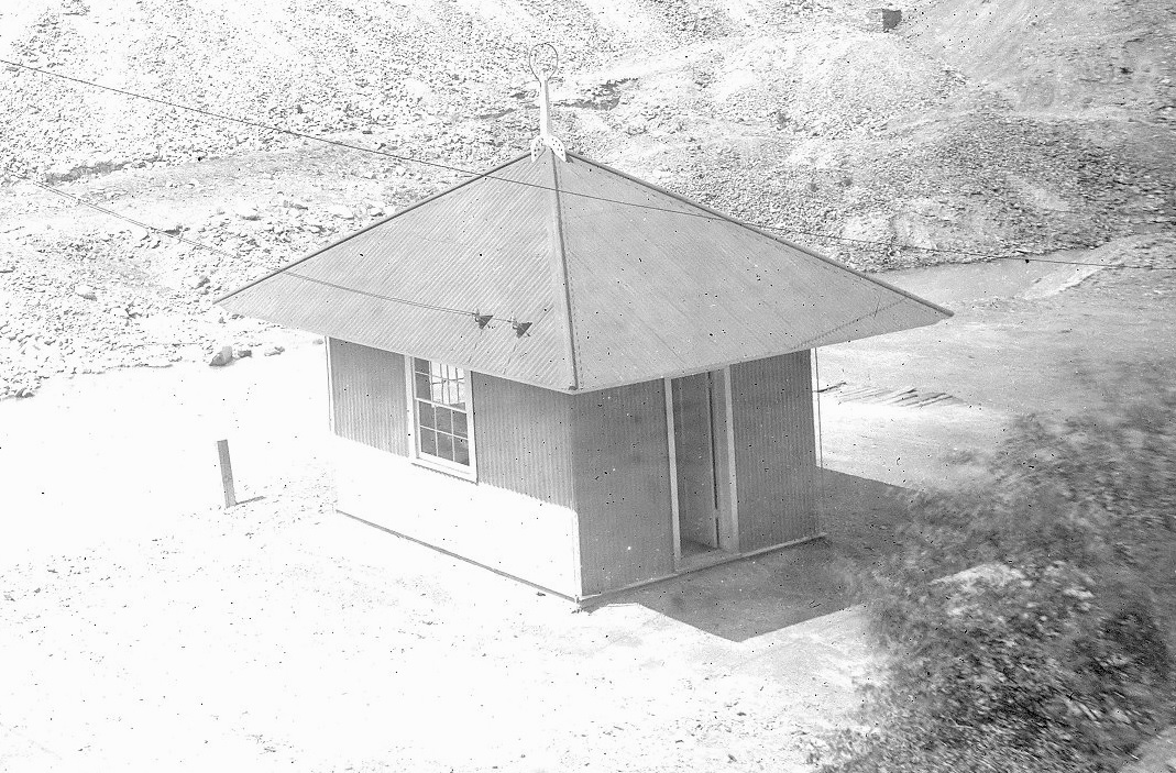
Lachlan McLean photo


X-60762 http://digital.denverlibrary.org/cdm/fullbrowser/collection/p15330coll22/id/36555/rv/singleitem/rec/51
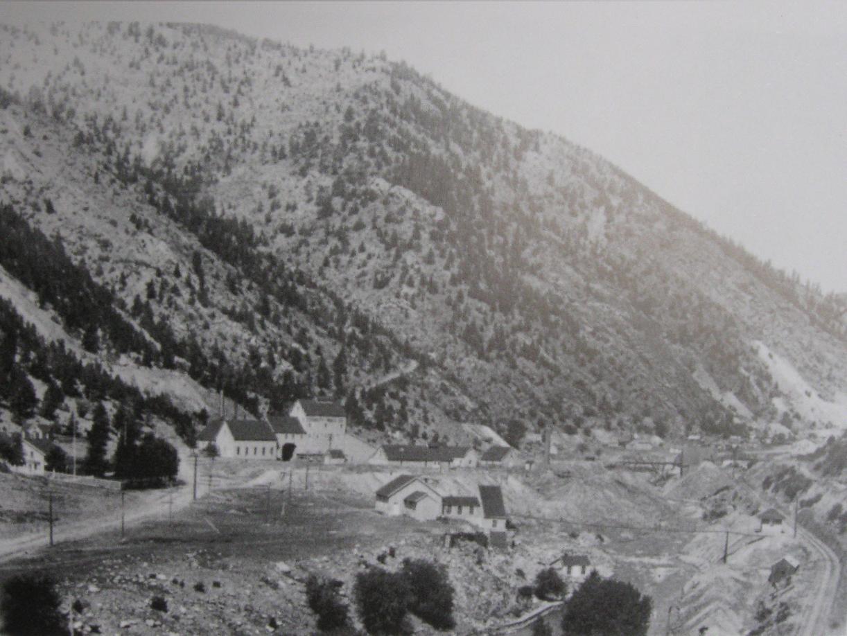
From A History Of Clear Creek County. 2004. Historical Soc. of I.S.

X-60762 http://digital.denverlibrary.org/cdm/fullbrowser/collection/p15330coll22/id/36555/rv/singleitem/rec/51
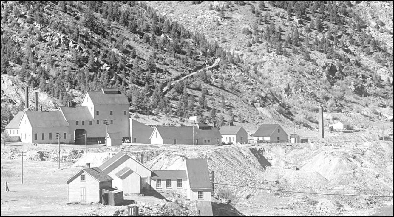
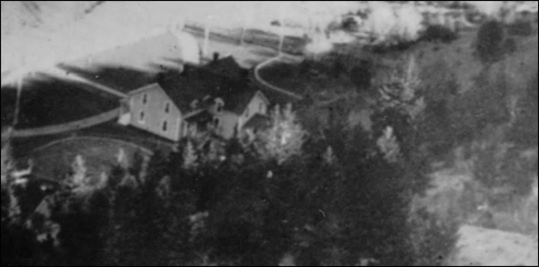
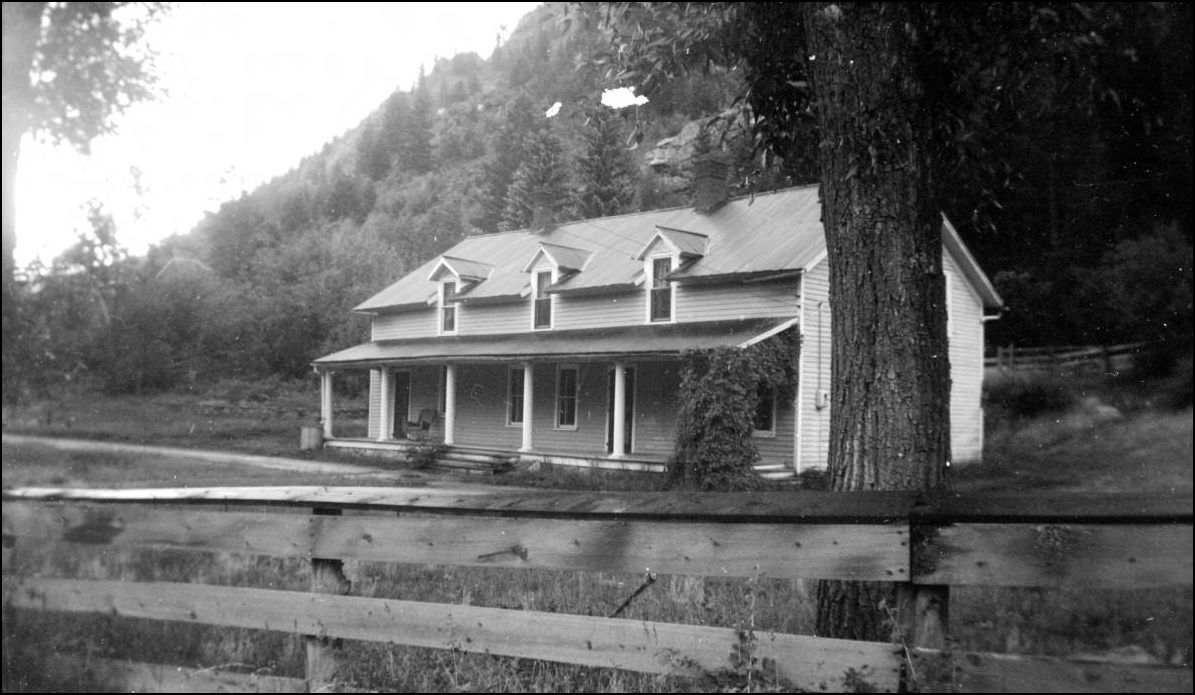
Rounding out this segment of the Clear Creek valley, a last look at the Boarding House from the era of the Whale Smelter. At some point the rearmost addition was truncated or rebuilt.
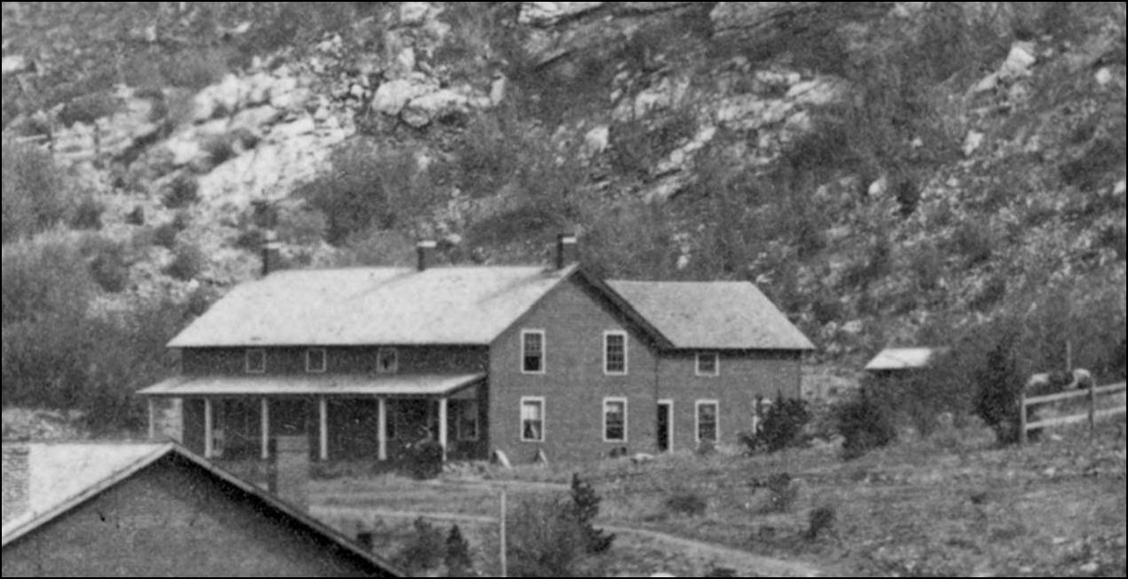
CHS.X4592 http://digital.denverlibrary.org/cdm/fullbrowser/collection/p15330coll21/id/10098/rv/singleitem/rec/63
X-60762 http://digital.denverlibrary.org/cdm/fullbrowser/collection/p15330coll22/id/36555/rv/singleitem/rec/51

MCC-368 http://digital.denverlibrary.org/cdm/fullbrowser/collection/p15330coll22/id/77738/rv/singleitem/rec/16
Lachlan McLean photo enlargement.

X-3328 http://digital.denverlibrary.org/cdm/fullbrowser/collection/p15330coll22/id/2821/rv/singleitem/rec/257
URL: http://c-sng-discussion-forum.254.s1.nabble.com/Stanley-Mills-Part-Three-Two-Smelters-and-the-Consolidated-Stanley-Mines-tp5619p5621.html
Harry Brunk's model version.
The last and largest Stanley Consolidated Hoisthouse was called the Gehrmann and should not be confused with the German Shaft, which was another Mine at the head of Virginia Canyon above Idaho Springs. Rather than bore you with the details of this new Shafthouse, I will include snippets from the USGS and Trade Journals of the time to give a far better description of the works. Mining details can be boring to modellers or not, I leave it to you. My thanks to Ken Martin for linking me with the answers to some very old questions regarding what had always looked like to me to be an Inclined Shaft structure.
Lachlan McLean photo Idaho Springs Historical Society coll
Lachlan McLean photo Idaho Springs Historical Society coll.
Composite Sanborn Map
CHS-B1486 http://digital.denverlibrary.org/cdm/fullbrowser/collection/p15330coll21/id/4932/rv/singleitem/rec/1626
Looking into the above view, is this the only picture that may show a Locomotive on the Siding?
MCC-368 http://digital.denverlibrary.org/cdm/fullbrowser/collection/p15330coll22/id/77738/rv/singleitem/rec/16
from USGS 1966
The Road Level Tunnel was across from the Shafthouse as seen in this view.
From A History Of Clear Creek County. 2004. Historical Soc. of I.S.
An inside view.
CHS-B337 http://cdm16079.contentdm.oclc.org/cdm/fullbrowser/collection/p15330coll21/id/3790/rv/singleitem/rec/75
from the Colliery Engineer and Metal Mines 1894, Volumes 14 and 15. (SIC Standley)
The previously unknown Stanley (Mills?) Flagstop. At the time of the great Yellow paint splurge, which co-incided with the name change from The Stanley Consolidated Mines Co. to The Stanley Mines Co., the ground was prepared for the new Flagstop: note the small trestle Br. No. 14 on the curve, this crossed the 18" gauge minetrack into the Crockett Tunnel. 12lb rail was still in place there at the time of the 1939 valuation survey indicating some reworking during the 1930's. Also of note is the Suspension Footbridge, which is just that, not a "pipe" support structure.
MCC-368 http://digital.denverlibrary.org/cdm/fullbrowser/collection/p15330coll22/id/77738/rv/singleitem/rec/16
Lachlan McLean photo
enlarged to show the details of this little building.
Lachlan McLean photo
X-60762 http://digital.denverlibrary.org/cdm/fullbrowser/collection/p15330coll22/id/36555/rv/singleitem/rec/51
From A History Of Clear Creek County. 2004. Historical Soc. of I.S.
X-60762 http://digital.denverlibrary.org/cdm/fullbrowser/collection/p15330coll22/id/36555/rv/singleitem/rec/51
Rounding out this segment of the Clear Creek valley, a last look at the Boarding House from the era of the Whale Smelter. At some point the rearmost addition was truncated or rebuilt.
CHS.X4592 http://digital.denverlibrary.org/cdm/fullbrowser/collection/p15330coll21/id/10098/rv/singleitem/rec/63
X-60762 http://digital.denverlibrary.org/cdm/fullbrowser/collection/p15330coll22/id/36555/rv/singleitem/rec/51
MCC-368 http://digital.denverlibrary.org/cdm/fullbrowser/collection/p15330coll22/id/77738/rv/singleitem/rec/16
Lachlan McLean photo enlargement.
X-3328 http://digital.denverlibrary.org/cdm/fullbrowser/collection/p15330coll22/id/2821/rv/singleitem/rec/257
UpSideDownC
in New Zealand
in New Zealand
| Free forum by Nabble | Edit this page |