Stanley Mills: Part One....The Lincoln and Alma-Lincoln Mills.
Posted by Chris Walker on
URL: http://c-sng-discussion-forum.254.s1.nabble.com/Stanley-Mills-Part-One-The-Lincoln-and-Alma-Lincoln-Mills-tp3389.html
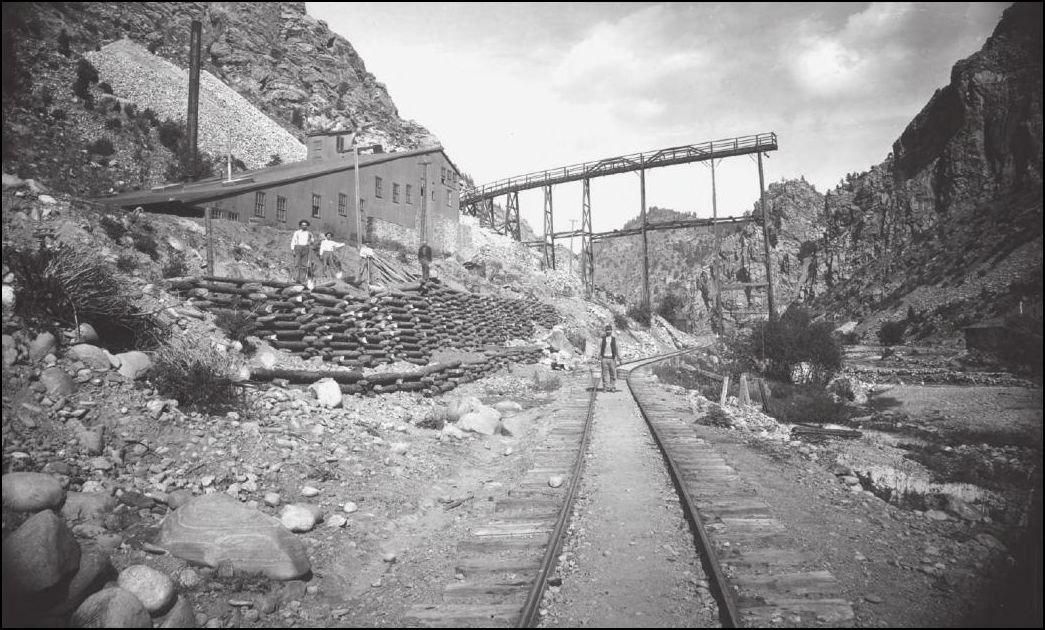
Lachlan McLean Photo: Idaho Springs Historical Society Coll.
This outstanding view of the Lincoln Mill taken by Lachlan may have been part of a series that was produced in 1894-95 showing the progression of the Wooden Stave Conduit for the Consolidated Stanley Powerhouse that had its intake upstream of the Fall River Sectionhouse.
The second picture I presented here: http://c-sn3-discussion-forum.41377.n7.nabble.com/Mills-of-Fall-River-tp2576p2809.html appears to be taken just about upstream of the dump Trestle over the Railway.
Lincoln Mill first on Sanborn Maps in 1895
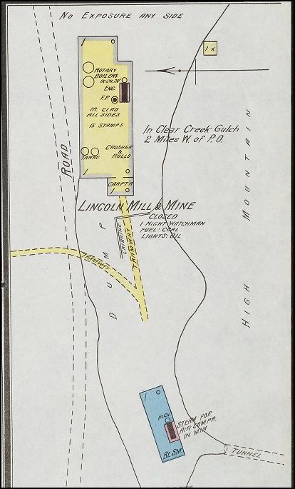
Sanborn Map of 1900
From a greatly enlarged Lachlan McLean photo of the Clear Creek valley taken high above the Stanley Properties, is the Lincoln Mill and further on the Plutus Mill. This is the only view I've seen to date that has clearly captured the two Mills.
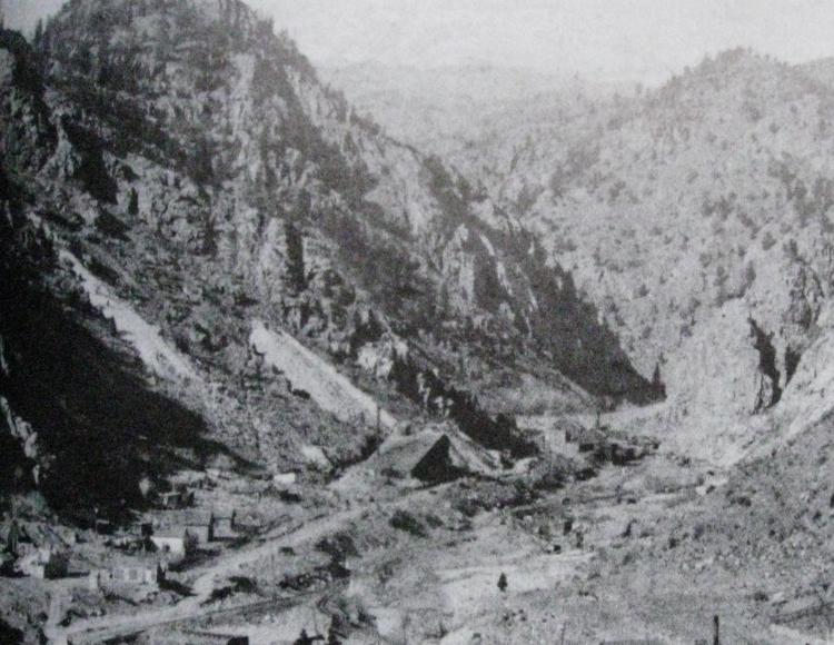
Lachlan McLean Photo: Idaho Springs Historical Society Coll.
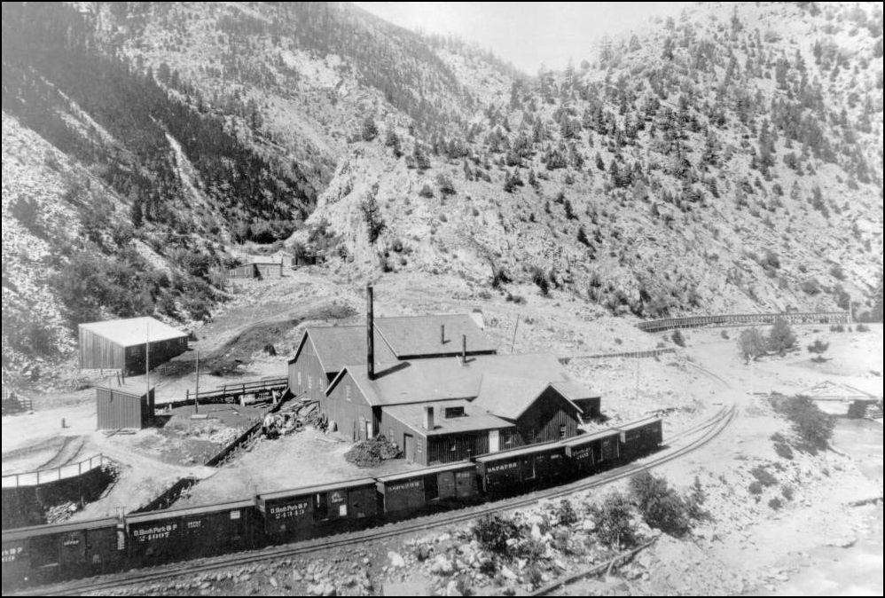
A refresher look at the Plutus Mill at the outlet of Trail Creek
http://digital.denverlibrary.org/cdm/fullbrowser/collection/p15330coll22/id/38845/rv/singleitem
Quite a small community has sprung up at this location. The Switchstand for the short branch to the Plutus Mine and Smelter, later the Consolidated Stanley Mines is visible alongside the C&S Mainline here.
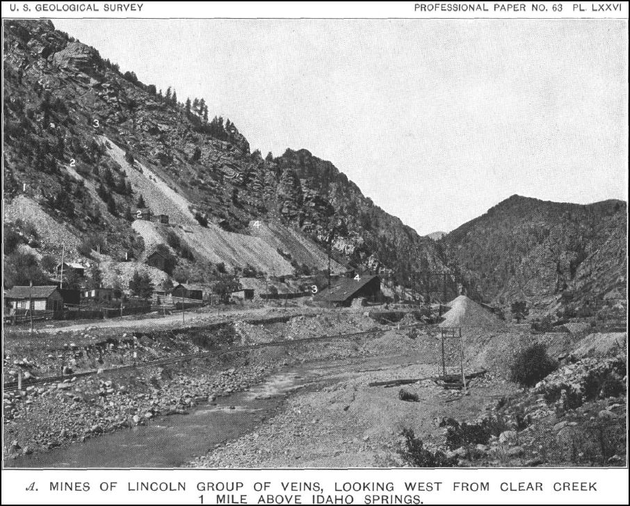
USGS Professional Paper NO. 63. Economic Geology of the Georgetown Quadrangle.
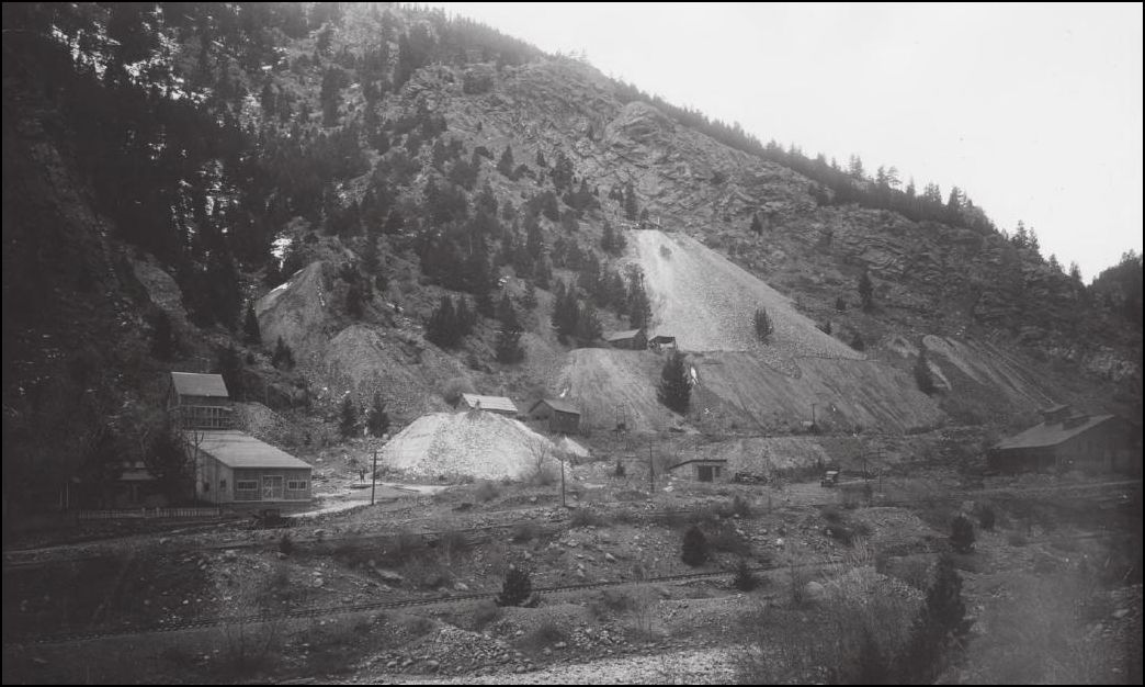
Here is the earliest view of the new Alma-Lincoln Mill with the now-truncated Lincoln to the right. The infant wasterock dumps indicate some activity underground with a number of openings on multiple levels.
Lachlan McLean Photo: Idaho Springs Historical Society Coll.
Stanley Mills Location sign C&S Railway Milepost 39.06 By this time the sign has weathered much like the Mining industry here in Clear Creek. Note in the background a new Orebin under construction and Incline to an upper level being worked.
http://cdm16079.contentdm.oclc.org/cdm/fullbrowser/collection/p15330coll22/id/14316/rv/singleitem
A wider view of the Stanley Mills sign shows the abutment construction of C&S Bridge #39 formerly numbered 716. This crossing of Clear Creek was the site of several replacement bridges over the years since the Colorado Central first built Bridge #16, a 54ft span.
http://cdm16079.contentdm.oclc.org/cdm/fullbrowser/collection/p15330coll22/id/14316/rv/singleitem
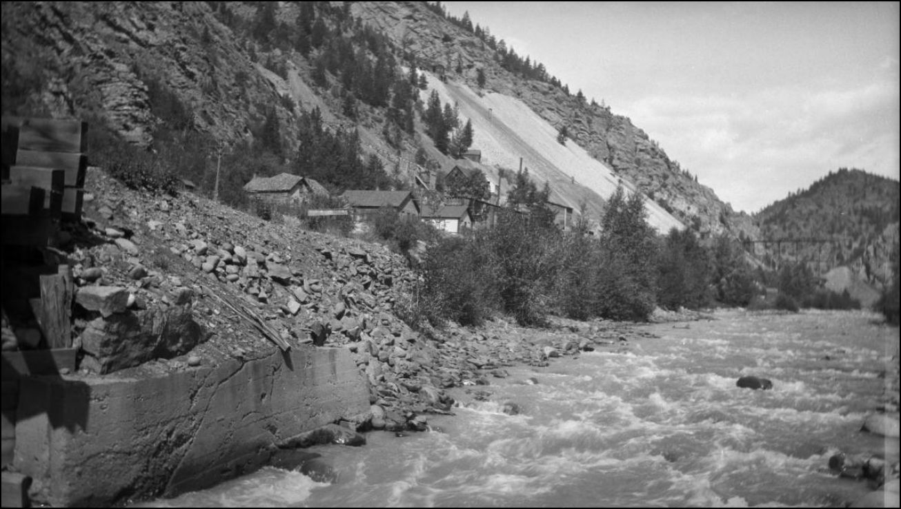
Another progressive pictorial comparison, this photo shot at the same time as the creeklevel Picture. The loading bay has not yet been built nor the 2nd West Elevator. The old Lincoln Mill and dumptrestle over the roadway and the C&S mainline is prominent in this view.
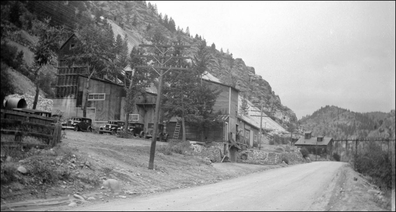
http://cdm16079.contentdm.oclc.org/cdm/fullbrowser/collection/p15330coll22/id/14313/rv/singleitem
http://cdm16079.contentdm.oclc.org/cdm/fullbrowser/collection/p15330coll22/id/14317/rv/singleitem/rec/812
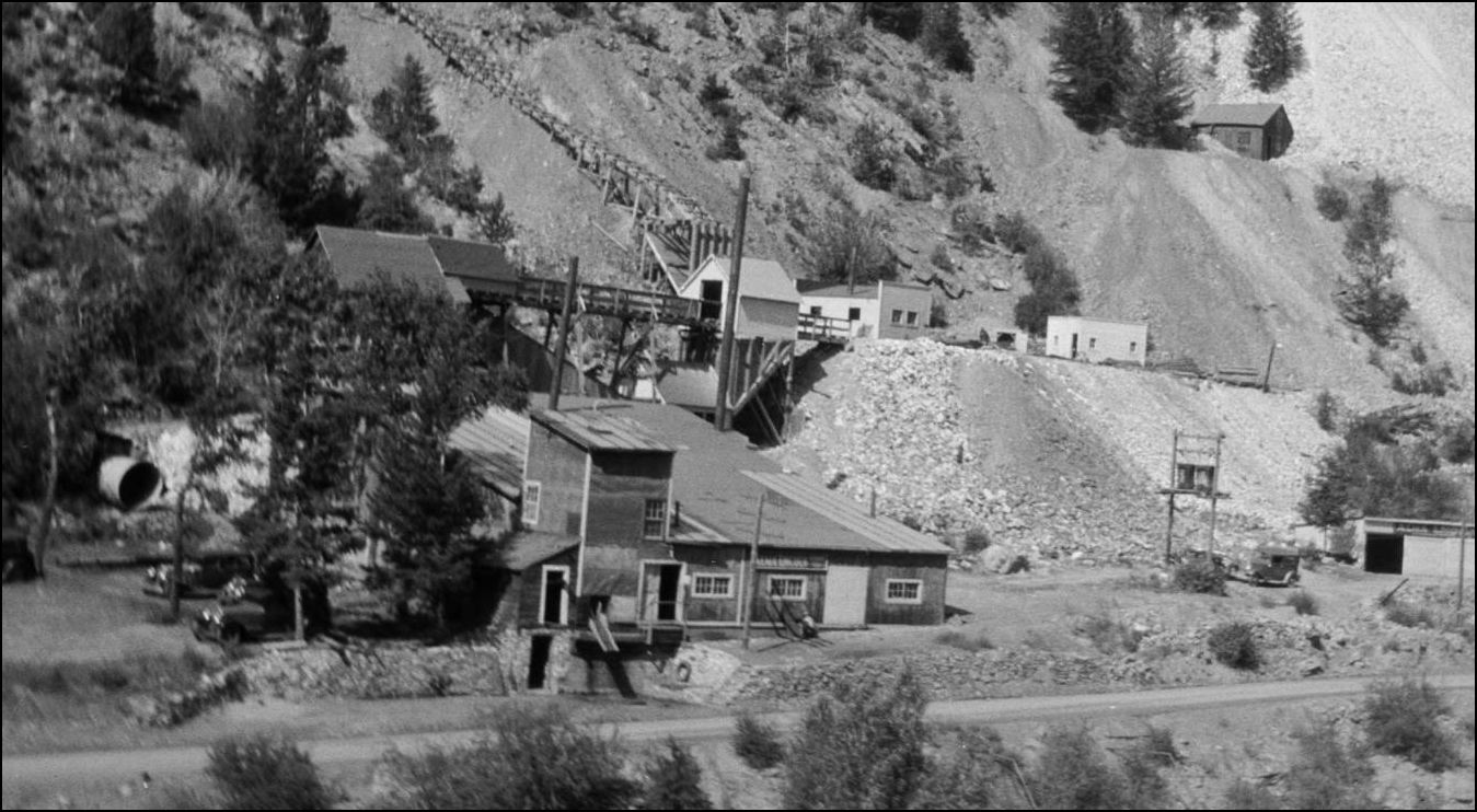
Here we see that the new Alma-Lincoln Mill has had the first covered loading dock added on and the outbuildings higher to the right at the Adit have been completed along with the new Orebin at the foot of the Inclined Tram. The Alma Management kept up a spiffy image to project to the passing public here.
More to come on this section of the Lincoln Mine.
http://digital.denverlibrary.org/cdm/fullbrowser/collection/p15330coll22/id/38887/rv/singleitem
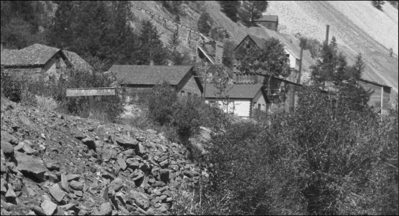
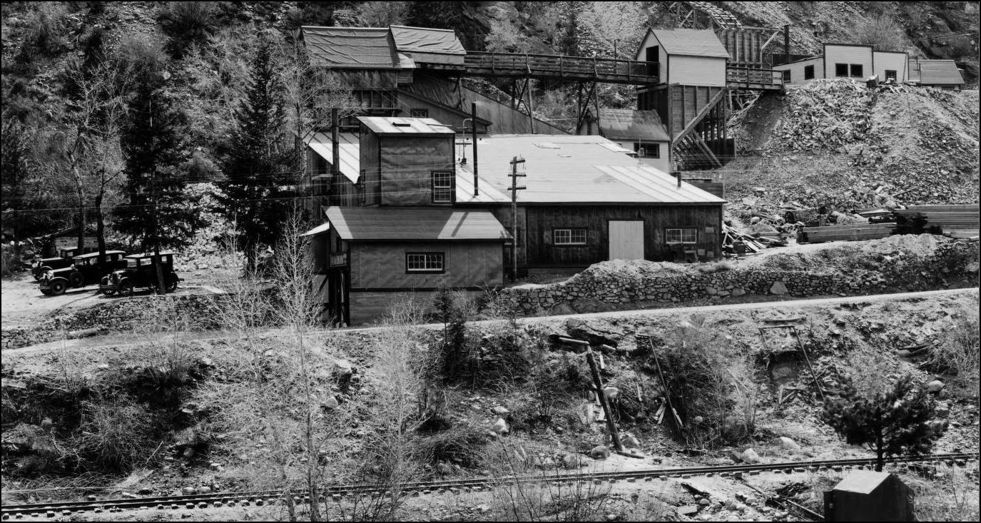
This later picture shows the New Alma-Lincoln with a second Elevator Tower and the carpark now on the Western side of the Mill since the stockpile took over the whole downstream parking area. The tramway trestle at the upper rear is now hidden behind a snowshed added in front to connect to another third Orebin. This has to be one of the most interesting Mills with documented improvements available for comparison.
http://digital.denverlibrary.org/cdm/fullbrowser/collection/p15330coll22/id/16567/rv/singleitem
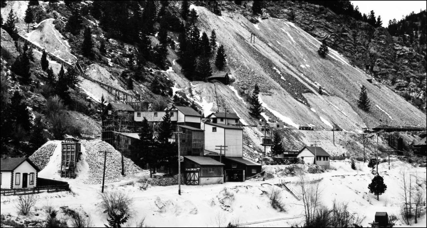
And in this somewhat later image; note the carpark Dump(stockpile) has now been removed and the Orebin (extreme left) has shifted back alongside the Mill. The dry-stacked rockwall has been modernised at the left of the mill.
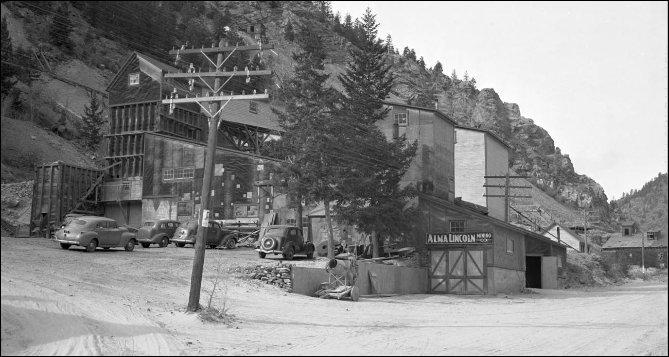
http://digital.denverlibrary.org/cdm/fullbrowser/collection/p15330coll21/id/11496/rv/singleitem
And here we are in 1950: End of the road. RIP Alma Lincoln.
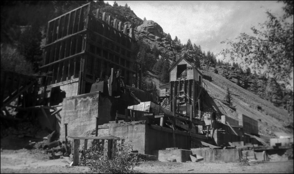
http://cdm16079.contentdm.oclc.org/cdm/fullbrowser/collection/p15330coll22/id/6199/rv/singleitem/rec/15
URL: http://c-sng-discussion-forum.254.s1.nabble.com/Stanley-Mills-Part-One-The-Lincoln-and-Alma-Lincoln-Mills-tp3389.html
Lachlan McLean Photo: Idaho Springs Historical Society Coll.
This outstanding view of the Lincoln Mill taken by Lachlan may have been part of a series that was produced in 1894-95 showing the progression of the Wooden Stave Conduit for the Consolidated Stanley Powerhouse that had its intake upstream of the Fall River Sectionhouse.
The second picture I presented here: http://c-sn3-discussion-forum.41377.n7.nabble.com/Mills-of-Fall-River-tp2576p2809.html appears to be taken just about upstream of the dump Trestle over the Railway.
Lincoln Mill first on Sanborn Maps in 1895
Sanborn Map of 1900
From a greatly enlarged Lachlan McLean photo of the Clear Creek valley taken high above the Stanley Properties, is the Lincoln Mill and further on the Plutus Mill. This is the only view I've seen to date that has clearly captured the two Mills.
Lachlan McLean Photo: Idaho Springs Historical Society Coll.
A refresher look at the Plutus Mill at the outlet of Trail Creek
http://digital.denverlibrary.org/cdm/fullbrowser/collection/p15330coll22/id/38845/rv/singleitem
Quite a small community has sprung up at this location. The Switchstand for the short branch to the Plutus Mine and Smelter, later the Consolidated Stanley Mines is visible alongside the C&S Mainline here.
USGS Professional Paper NO. 63. Economic Geology of the Georgetown Quadrangle.
Here is the earliest view of the new Alma-Lincoln Mill with the now-truncated Lincoln to the right. The infant wasterock dumps indicate some activity underground with a number of openings on multiple levels.
Lachlan McLean Photo: Idaho Springs Historical Society Coll.
Stanley Mills Location sign C&S Railway Milepost 39.06 By this time the sign has weathered much like the Mining industry here in Clear Creek. Note in the background a new Orebin under construction and Incline to an upper level being worked.
http://cdm16079.contentdm.oclc.org/cdm/fullbrowser/collection/p15330coll22/id/14316/rv/singleitem
A wider view of the Stanley Mills sign shows the abutment construction of C&S Bridge #39 formerly numbered 716. This crossing of Clear Creek was the site of several replacement bridges over the years since the Colorado Central first built Bridge #16, a 54ft span.
http://cdm16079.contentdm.oclc.org/cdm/fullbrowser/collection/p15330coll22/id/14316/rv/singleitem
Another progressive pictorial comparison, this photo shot at the same time as the creeklevel Picture. The loading bay has not yet been built nor the 2nd West Elevator. The old Lincoln Mill and dumptrestle over the roadway and the C&S mainline is prominent in this view.
http://cdm16079.contentdm.oclc.org/cdm/fullbrowser/collection/p15330coll22/id/14313/rv/singleitem
http://cdm16079.contentdm.oclc.org/cdm/fullbrowser/collection/p15330coll22/id/14317/rv/singleitem/rec/812
Here we see that the new Alma-Lincoln Mill has had the first covered loading dock added on and the outbuildings higher to the right at the Adit have been completed along with the new Orebin at the foot of the Inclined Tram. The Alma Management kept up a spiffy image to project to the passing public here.
More to come on this section of the Lincoln Mine.
http://digital.denverlibrary.org/cdm/fullbrowser/collection/p15330coll22/id/38887/rv/singleitem
This later picture shows the New Alma-Lincoln with a second Elevator Tower and the carpark now on the Western side of the Mill since the stockpile took over the whole downstream parking area. The tramway trestle at the upper rear is now hidden behind a snowshed added in front to connect to another third Orebin. This has to be one of the most interesting Mills with documented improvements available for comparison.
http://digital.denverlibrary.org/cdm/fullbrowser/collection/p15330coll22/id/16567/rv/singleitem
And in this somewhat later image; note the carpark Dump(stockpile) has now been removed and the Orebin (extreme left) has shifted back alongside the Mill. The dry-stacked rockwall has been modernised at the left of the mill.
http://digital.denverlibrary.org/cdm/fullbrowser/collection/p15330coll21/id/11496/rv/singleitem
And here we are in 1950: End of the road. RIP Alma Lincoln.
http://cdm16079.contentdm.oclc.org/cdm/fullbrowser/collection/p15330coll22/id/6199/rv/singleitem/rec/15
UpSideDownC
in New Zealand
in New Zealand
| Free forum by Nabble | Edit this page |