Re: Dealing with compression...
Posted by Jeff Young on Jun 21, 2015; 7:14pm
URL: http://c-sng-discussion-forum.254.s1.nabble.com/Dealing-with-compression-tp2535p2582.html
John,
Well, it's undergone some changes and I never bothered to update the overall plan. However, here's what I have:
This is the original plan:
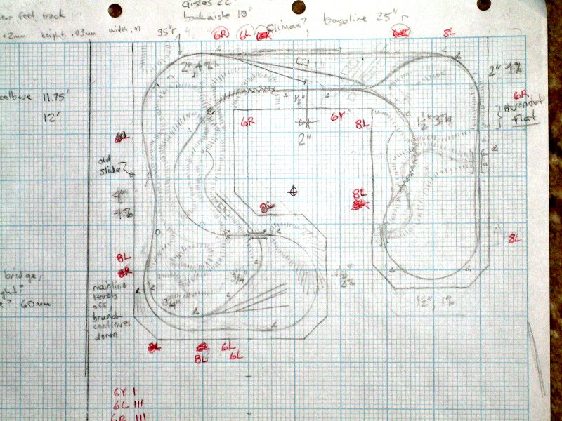
The center of the upside-down 'U' is Tenmile canyon (originally represented by Climax, but now Kokomo).
The left leg is the Saguache range (Marshall Pass down the left side with Sargent at the bottom; Alpine Tunnel down the right).
The right leg is South Park (the Silica branch on the left; Jefferson siding on the right).
Here's an updated sketch of Kokomo:
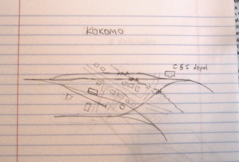
The D&RGW tracks enter from the top-left (coming off Marshall Pass) and goes diagonally to the bottom-right, passing the depot and then water tank. The real D&RGW tracks crossed over to the other side of the valley after the tank; on my layout this is represented by a track which is also the C&S "downtown spur". The Kokomo school house is at right angles below the depot (between the freight spur and the Alpine Tunnel track).
The C&S mainline enters from the top-right. The downtown spur switches off right before the depot. (The spur also connects to the Alpine Tunnel track to allow it to act as a reverse loop.)
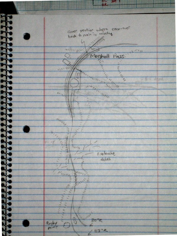
Here's an update of the Marshall Pass section:
and an update of Sargent:
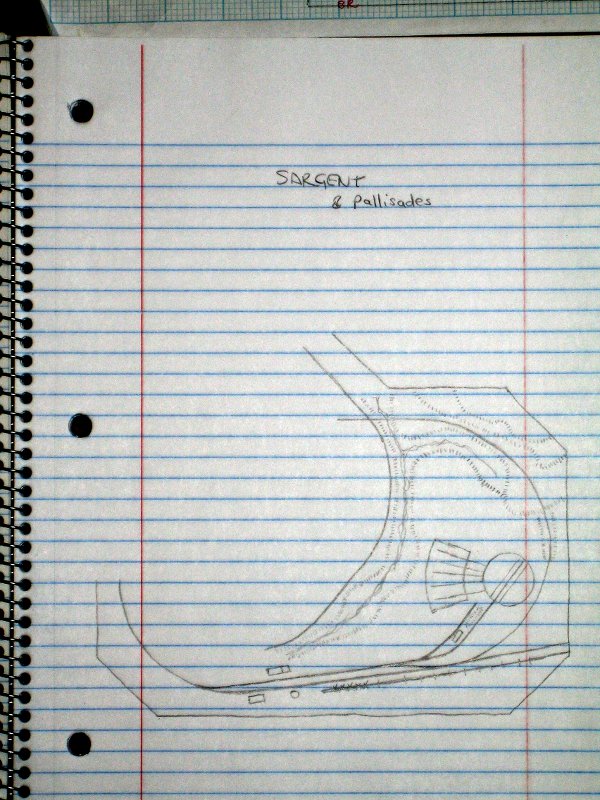
The coaling trestle is at the bottom. It's not operational as the feeder track to it goes off the layout.
Water tank and depot off the end of the trestle; eating house across the mainline and siding from the depot.
The spur on the other side of the creek from Sargent is the C&S Pitkin branch (now being run by the D&RGW). It goes under the Alpine Tunnel track and on to the Mary Murphy mine and tram house.
All that may be pretty difficult to piece together; I realize there's a whole lot internalized in my head. ;)
Cheers,
Jeff.
URL: http://c-sng-discussion-forum.254.s1.nabble.com/Dealing-with-compression-tp2535p2582.html
John,
Well, it's undergone some changes and I never bothered to update the overall plan. However, here's what I have:
This is the original plan:
The center of the upside-down 'U' is Tenmile canyon (originally represented by Climax, but now Kokomo).
The left leg is the Saguache range (Marshall Pass down the left side with Sargent at the bottom; Alpine Tunnel down the right).
The right leg is South Park (the Silica branch on the left; Jefferson siding on the right).
Here's an updated sketch of Kokomo:
The D&RGW tracks enter from the top-left (coming off Marshall Pass) and goes diagonally to the bottom-right, passing the depot and then water tank. The real D&RGW tracks crossed over to the other side of the valley after the tank; on my layout this is represented by a track which is also the C&S "downtown spur". The Kokomo school house is at right angles below the depot (between the freight spur and the Alpine Tunnel track).
The C&S mainline enters from the top-right. The downtown spur switches off right before the depot. (The spur also connects to the Alpine Tunnel track to allow it to act as a reverse loop.)
Here's an update of the Marshall Pass section:
and an update of Sargent:
The coaling trestle is at the bottom. It's not operational as the feeder track to it goes off the layout.
Water tank and depot off the end of the trestle; eating house across the mainline and siding from the depot.
The spur on the other side of the creek from Sargent is the C&S Pitkin branch (now being run by the D&RGW). It goes under the Alpine Tunnel track and on to the Mary Murphy mine and tram house.
All that may be pretty difficult to piece together; I realize there's a whole lot internalized in my head. ;)
Cheers,
Jeff.
| Free forum by Nabble | Edit this page |