Re: Along The Gilpin Tramway - A Closer Look
Posted by Keith Pashina on Jan 20, 2025; 5:47pm
URL: http://c-sng-discussion-forum.254.s1.nabble.com/Along-The-Gilpin-Tramway-A-Closer-Look-tp20380p20446.html
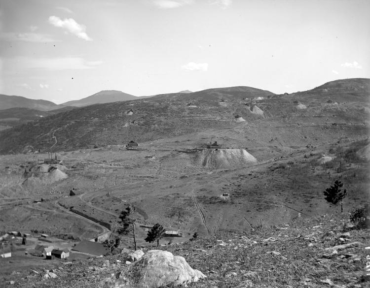
This image was taken by H. H. Lake, and a part of the Denver Public Library, Western History Collection. The view is looking southward towards Gunnell Hill and in the background, Quartz Hill. Most of the mine waste rock dumps that can be seen were served by Gilpin Tram trackage. We will be taking a closer look at these locations in future posts.
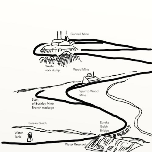
This sketch explains what is shown in the preceding photo. Although at the edge of the glass plate negative, the slightly blurred first Gilpin Tram water tank can be seen at lower left, along with the reservoir, and gulch bridge crossing.

This image is an enlargement of the preceding HH Lake photo, and shows the first water tank. The reservoir can be seen at the right edge.
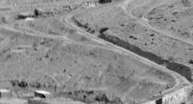
From the same preceding H H Lake photo, we seen the main line as it crossing Eureka Gulch (at lower right corner) and the junction switch where the Buckley Mine Branch diverges to the right. This is a preview of where we are going nest – looking at the four mines along this branch.
So, the next stop is... the Buckley Mine Branch. Stay tuned,
URL: http://c-sng-discussion-forum.254.s1.nabble.com/Along-The-Gilpin-Tramway-A-Closer-Look-tp20380p20446.html
This image was taken by H. H. Lake, and a part of the Denver Public Library, Western History Collection. The view is looking southward towards Gunnell Hill and in the background, Quartz Hill. Most of the mine waste rock dumps that can be seen were served by Gilpin Tram trackage. We will be taking a closer look at these locations in future posts.
This sketch explains what is shown in the preceding photo. Although at the edge of the glass plate negative, the slightly blurred first Gilpin Tram water tank can be seen at lower left, along with the reservoir, and gulch bridge crossing.
This image is an enlargement of the preceding HH Lake photo, and shows the first water tank. The reservoir can be seen at the right edge.
From the same preceding H H Lake photo, we seen the main line as it crossing Eureka Gulch (at lower right corner) and the junction switch where the Buckley Mine Branch diverges to the right. This is a preview of where we are going nest – looking at the four mines along this branch.
So, the next stop is... the Buckley Mine Branch. Stay tuned,
Keith Pashina
Narrow-minded in Arizona
Narrow-minded in Arizona
| Free forum by Nabble | Edit this page |