Re: Along The Gilpin Tramway - A Closer Look
Posted by Keith Pashina on Dec 30, 2024; 5:16am
URL: http://c-sng-discussion-forum.254.s1.nabble.com/Along-The-Gilpin-Tramway-A-Closer-Look-tp20380p20401.html
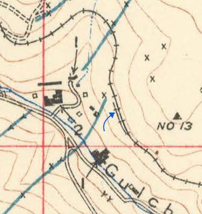
At about 750’ further west of the Smith Road Crossing, a spur was laid to serve one of the stamp mills located down in the bottom of the gulch. There was at least a 75’ drop down to the mill, so perhaps the ore was slide down a wooden chute – I have found no record of how the ore was moved.
The mill spur was used by the Colorado-Tellurium Gold Mining Company for processing gold ore taken from the Freedom Mine (located on Winnebago Hill, about 2/3 mile further southwest of the mill). The company purchased the former Oliver Mill, renaming it the Freedom Mill.
The Mining News reported on November 17, 1904: “This company has purchased the Olive (usually referred to as the Oliver Mill, so, a typo in the account) stamp mill near Chage gulch….For delivering ore to the mill, a switch has been built from the tracks of the Gilpin Tramway Company…From the 500-foot west level daily shipments amounting to three cars are made to the company’s Freedom mill in Chase gulch.”
Interesting – for a while, the tramway had short daily haul of three ore cars between the mine and mill.
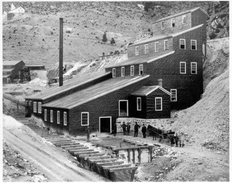
This is the Oliver, later Freedom Mill in Chase Gulch. The main line ran high above the mill and can be seen just below the top of the smoke stack. The tram built a short spur here in 1904, for unloading ore from the Freedom Mine. The mill in the left background is the Bonanza Mine and Mill – I have seen no record that this was a customer of the Gilpin Tram. This image is from the Denver Public Library, Western History collection, image X-61769.
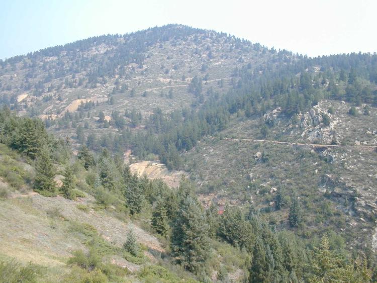
A contemporary view, looking north. The Gilpin Tram grade can be seen along the south slope of Maryland Mountain. The waste dump from the Oliver/Freedom, and Bonanza Mills can be seen at center.

Now we’re looking west, towards the head of Chase Gulch. The arrows point out the grade. The waste rock dumps at center are the Queen of the West and Virginia Mines, which are actually on the east slope of Winnebago Hill.
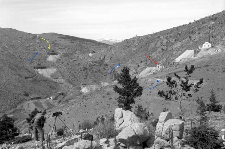
Here’s a similar historic view (the photographer can be seen in the foreground). The blue arrows point out the Gilpin Tram grade, the red arrow the Robbert Emmet Mine, and the yellow arrow the Queen of the West Mine.
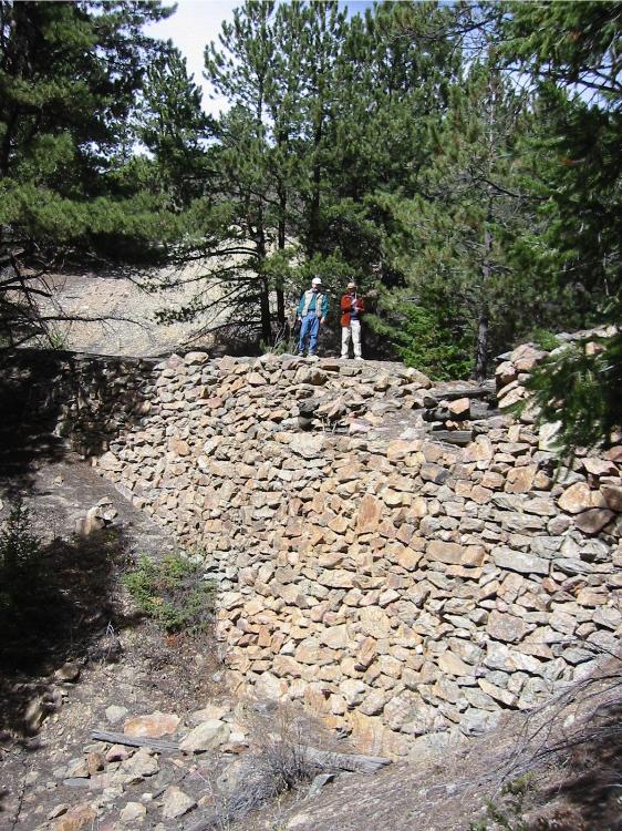
Here is a sizeable dry laid stone retaining wall with Joe Crea and Dan Abbott standing on top, for scale.
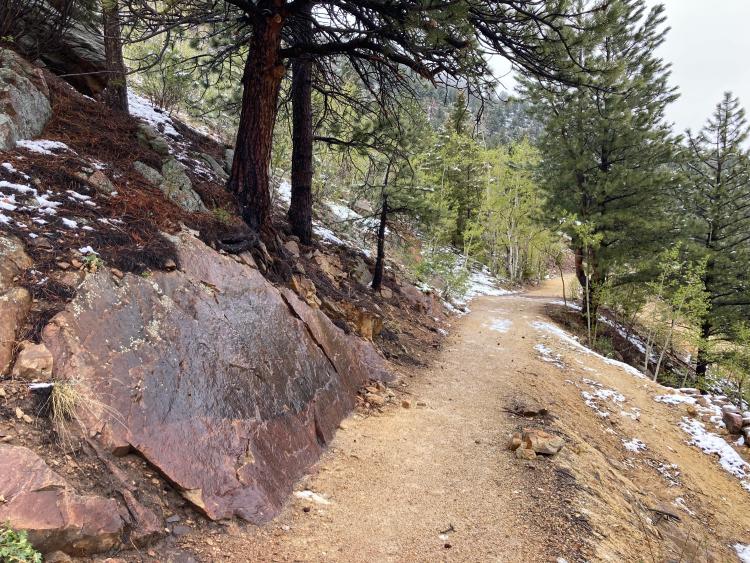
A view of the grade looking east, as we near Castle Rock. The combination of the rock outcropping, trees, and dirt grade could make an appealing model scene.
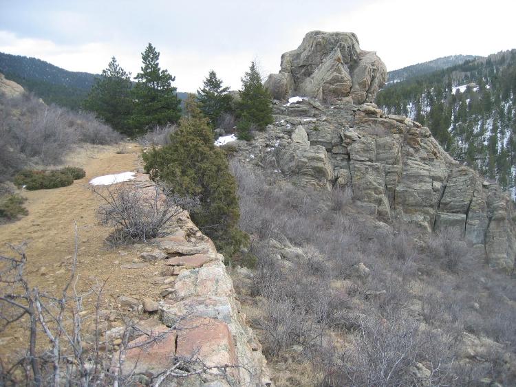
Here, the Gilpin Tram main line squeezes past a rock outcropping, building up the grade on yet another stone retaining wall.
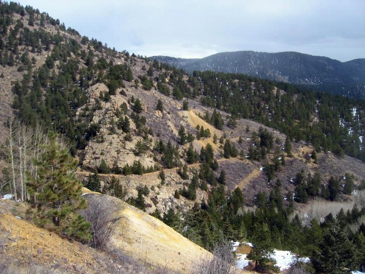
The Gilpin Tram grade is easily seen here. The waste rock dump in the foreground is from the Queen of the West Mine, and the mine dump on the far hillside at center is the Robert Emmet Mine. We’re looking east in this photo. Nothing remains of either mine today, except for the waste dump.
URL: http://c-sng-discussion-forum.254.s1.nabble.com/Along-The-Gilpin-Tramway-A-Closer-Look-tp20380p20401.html

At about 750’ further west of the Smith Road Crossing, a spur was laid to serve one of the stamp mills located down in the bottom of the gulch. There was at least a 75’ drop down to the mill, so perhaps the ore was slide down a wooden chute – I have found no record of how the ore was moved.
The mill spur was used by the Colorado-Tellurium Gold Mining Company for processing gold ore taken from the Freedom Mine (located on Winnebago Hill, about 2/3 mile further southwest of the mill). The company purchased the former Oliver Mill, renaming it the Freedom Mill.
The Mining News reported on November 17, 1904: “This company has purchased the Olive (usually referred to as the Oliver Mill, so, a typo in the account) stamp mill near Chage gulch….For delivering ore to the mill, a switch has been built from the tracks of the Gilpin Tramway Company…From the 500-foot west level daily shipments amounting to three cars are made to the company’s Freedom mill in Chase gulch.”
Interesting – for a while, the tramway had short daily haul of three ore cars between the mine and mill.

This is the Oliver, later Freedom Mill in Chase Gulch. The main line ran high above the mill and can be seen just below the top of the smoke stack. The tram built a short spur here in 1904, for unloading ore from the Freedom Mine. The mill in the left background is the Bonanza Mine and Mill – I have seen no record that this was a customer of the Gilpin Tram. This image is from the Denver Public Library, Western History collection, image X-61769.

A contemporary view, looking north. The Gilpin Tram grade can be seen along the south slope of Maryland Mountain. The waste dump from the Oliver/Freedom, and Bonanza Mills can be seen at center.

Now we’re looking west, towards the head of Chase Gulch. The arrows point out the grade. The waste rock dumps at center are the Queen of the West and Virginia Mines, which are actually on the east slope of Winnebago Hill.

Here’s a similar historic view (the photographer can be seen in the foreground). The blue arrows point out the Gilpin Tram grade, the red arrow the Robbert Emmet Mine, and the yellow arrow the Queen of the West Mine.

Here is a sizeable dry laid stone retaining wall with Joe Crea and Dan Abbott standing on top, for scale.

A view of the grade looking east, as we near Castle Rock. The combination of the rock outcropping, trees, and dirt grade could make an appealing model scene.

Here, the Gilpin Tram main line squeezes past a rock outcropping, building up the grade on yet another stone retaining wall.

The Gilpin Tram grade is easily seen here. The waste rock dump in the foreground is from the Queen of the West Mine, and the mine dump on the far hillside at center is the Robert Emmet Mine. We’re looking east in this photo. Nothing remains of either mine today, except for the waste dump.
Keith Pashina
Narrow-minded in Arizona
Narrow-minded in Arizona
| Free forum by Nabble | Edit this page |