Re: C&S Photos on eBay: That Location: Mis-located.
Posted by Chris Walker on
URL: http://c-sng-discussion-forum.254.s1.nabble.com/C-S-Photos-on-eBay-tp8859p10569.html
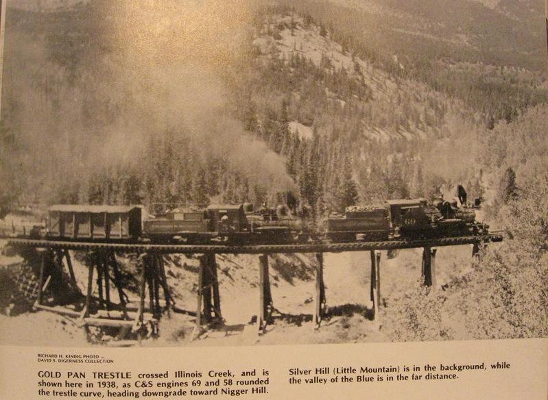
Thanks Jim, I have since found the EBay pic, Mineral Belt V-II pg96 sepia toned which also added to my confusion as to where I thought I had seen it.
the photo referenced with the chalking is one of several scattered over several books at that area, of which I'm now certain the EBay photo will belong to....which now begs the question would the locality be known as Bacon, since the line had to hook around Nigger Hill and Rocky Point first.
Looking at the #58 headed upgrade with that peak behind, only the curve above Gold Pan trestle fits since the intervening ridge behind Hookeye isn't high enough.
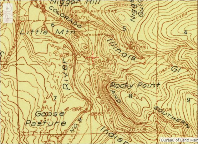
USGS 1938 Mt Lincoln
See Digerness got the grade and direction wrong, pg131 Min Belt 2.
By the way, New Years Day is bright sunshine and a light Easterly cooling breeze at 83f
URL: http://c-sng-discussion-forum.254.s1.nabble.com/C-S-Photos-on-eBay-tp8859p10569.html
Thanks Jim, I have since found the EBay pic, Mineral Belt V-II pg96 sepia toned
which also added to my confusion as to where I thought I had seen it.
the photo referenced with the chalking is one of several scattered over several books at that area, of which I'm now certain the EBay photo will belong to....which now begs the question would the locality be known as Bacon, since the line had to hook around Nigger Hill and Rocky Point first.
Looking at the #58 headed upgrade with that peak behind, only the curve above Gold Pan trestle fits since the intervening ridge behind Hookeye isn't high enough.
USGS 1938 Mt Lincoln
See Digerness got the grade and direction wrong, pg131 Min Belt 2.
By the way, New Years Day is bright sunshine and a light Easterly cooling breeze at 83f
UpSideDownC
in New Zealand
in New Zealand
| Free forum by Nabble | Edit this page |