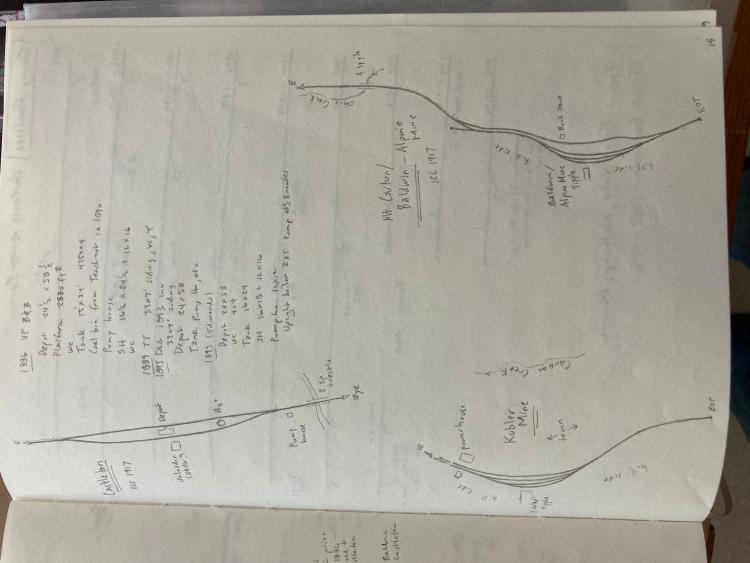
I was looking at images last year trying to figure out a better idea of the mine's trackage. Gunnison to Baldwin seemed an interesting model railroad idea. Here are my notes, based on the 1918 ICC survey and photos in books and in the Dorman collection in the C&TS archives. North for all three locations is towards the bottom of the page (right edge given this photo wants to rotate). Not a final word on this, just something that might help understand the operation of this highly-optimized industry.
These are my interpretations based on the sources, open to interpretation. Heavily leaning towards the D&RGW era of the line but I will go out on a limb and theorize the sidings were similar (or slightly simpler) in the C&S (1899-1910) era. Earlier periods were likely simplified down more. The basic gist of several double-ended sidings under the coal chutes, with a long spur to feed in empties, and a track to service the town and machinery, would capture it in all but the earliest years I bet.
I don't think there's any map of the original "old" Baldwin seen in the 1880s photos in Poor's books. That was the first mine opened. Then came the Mt. Carbon/Baldwin/Alpine. Then finally Kubler.

Dave Eggleston
Seattle, WA