The Floyd Hill Overpass
|
This post was updated on .
By 1939-1940, when it was obvious the Clear Creek line was headed toward abandonment, major improvements were made to US highway 6 & 40 between Denver and Idaho Springs and beyond. The highway, still gravel, descended Floyd Hill to reach the Clear Creek canyon where it finally broadened out, just to the east of Idaho Springs. The highway crossed over the C&S narrow gauge tracks and Clear Creek itself, on a poured concrete overpass.
Up until last week, I had only seen one photo of the overpass during C&S days: 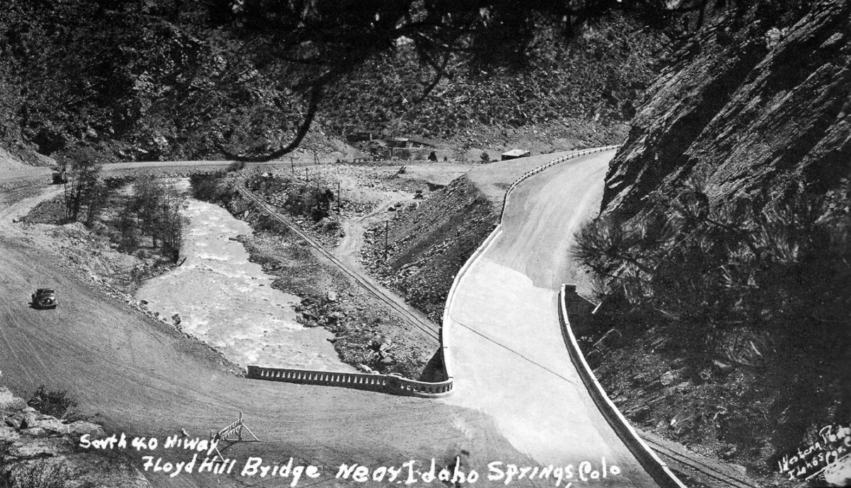 In Digerness, The Mineral Belt, Volume III, page 322 This is last weeks eBay photo purchase: 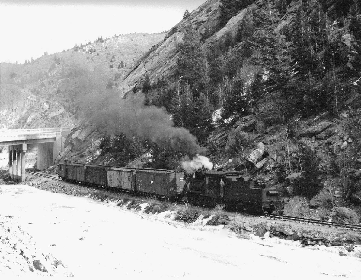 I'm not sure of the photographer, I'm guessing Richard Kindig. Since number 68 is running westbound in reverse, this must be sometime after January, 1939, when train service west of Idaho Springs ceased. This is the only photo that I've ever seen of a C&S train at the overpass, and it allows one to better judge the scale of the concrete structure. I suspect that Otto Perry stood on top of the overpass to take this wonderful photograph of an east bound freight: http://digital.denverlibrary.org/cdm/fullbrowser/collection/p15330coll22/id/42724/rv/singleitem/rec/43 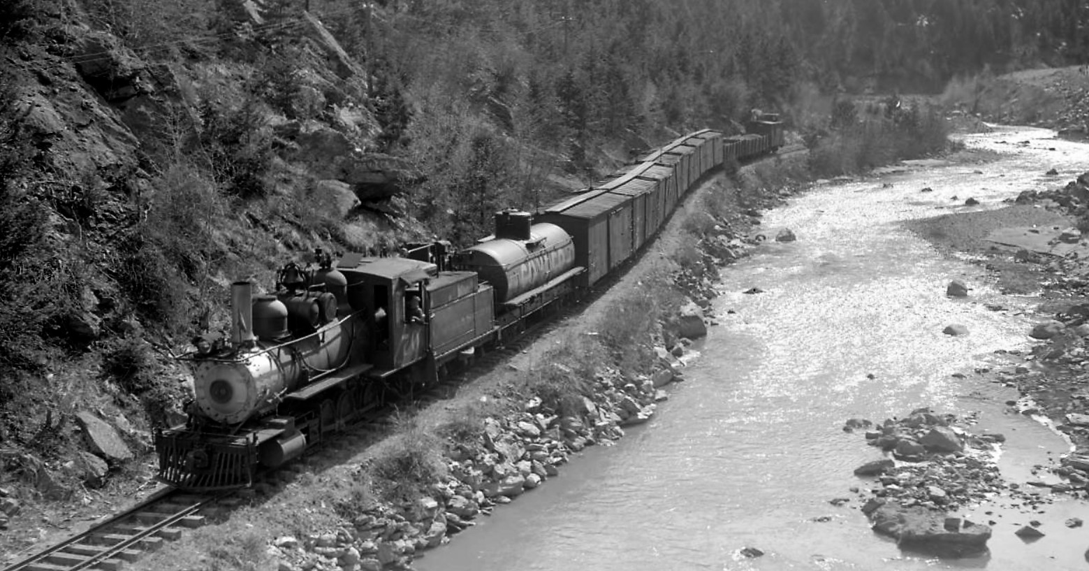 For the C&S model railroader, this might be the only prototype (outside of Denver) where a concrete overpass could be used as a scenic divider, to conceal track penetrating a backdrop! Does anyone know when the overpass was actually built?? Any other photos available for this location??
Jim Courtney
Poulsbo, WA |
|
This post was updated on .
Some days Jim I swear you have spyware installed on my lappy
 Only just this week I've been looking at the Clear Creek Highways in various sources trying to nail down the opening date near the Donna Juanita Mine. Several Overpass construction photos, although rather small and one flopped are on pg113 in A History of Clear Creek County by the Idaho Springs Historical Society. Dates are "circa 1938 or 1938". The large Eastern abutment of this bridge remains today. Another just downstream from the overpass. Rather late in the timeline but note the use of the large diameter steel pipe for a placer operation. OP-6305 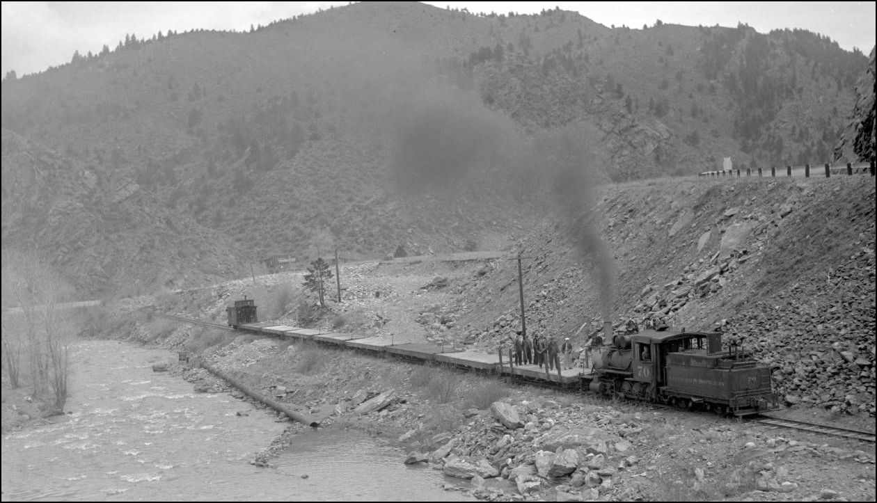 http://cdm16079.contentdm.oclc.org/cdm/fullbrowser/collection/p15330coll22/id/42810/rv/singleitem/rec/4  http://www.route40.net/images/postcards/co-floyd-hill-bridge-3-c1950.jpg
UpSideDownC
in New Zealand |
|
Some days Jim I swear you have spyware installed on my lappy
No spyware, just proves great minds think alike, even over great distances!  Thanks for the full view of the concrete overpass. Those large arched piers look like something out of Gotham City, transplanted to the Colorado mountains. Jim
Jim Courtney
Poulsbo, WA |
|
This post was updated on .
Designed and built at the height of Art Deco culture, that influence being brought out in the wonderful arched supports.
UpSideDownC
in New Zealand |
|
Chris,
There is an inherent problem with the human logic that we can go on forever with an ever-expanding population. In 1938, the U.S. population was massively smaller than it is today. And everyone keeps having kids, and those kids all grow up to expect jobs and cars and homes in which to repeat the process in. We 19th century dreamers loathe the trampling of all that old stuff we think is cool, but everyone wants to ignore the elephant in the room of why the hills are paved over in housing developments and freeways glut the modern landscape. Can you imagine what would happen if one could wave their magic wand and today's I-70 traffic is funneled through a 1938 Clear Creek Cañon !!! Heard in the clear today: "California doesn't have enough water." Untrue. California had all the water it needed in 1845, 1885, and 1925. But when the population overwhelms the resources, what exactly is the problem ??? Methinks too many people ! 
"Duty above all else except Honor"
|
|
In reply to this post by Jim Courtney
Here are a couple of other views of the highway bridge at the base of Floyd Hill...
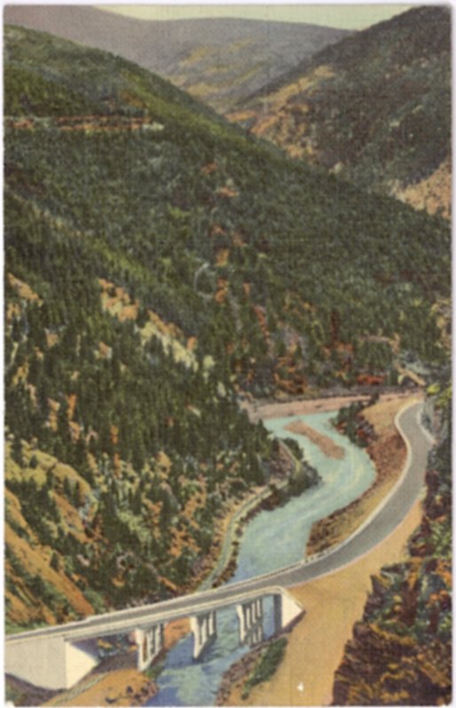 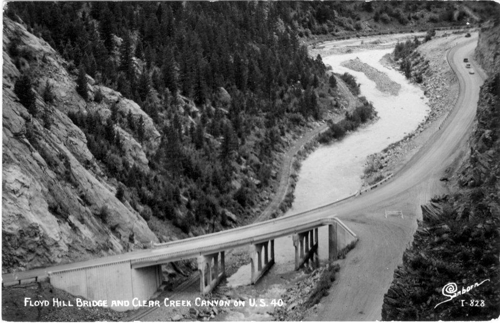 ...and one of another road bridge toward the end of C&S operation. This one taken on the way to Black Hawk. 
|
|
In reply to this post by South Park
CONTENTS DELETED
The author has deleted this message.
|
|
Right-on, Mr. Schapekahm. And no shout-outsuch to that filthy Artist Deco trend, either!😎
Keith Hayes
Leadville in Sn3 |
Re: The "Hwy-119" Sanborn Postcard.
|
This post was updated on .
In reply to this post by Todd Hackett
Todd,
your inclusion of the wonderful Sanborn Postcard view of the "119 to Blackhawk" is much appreciated to this Clear Creek Pilgram. This location is West of the US6 road tunnel past Forks Creek. 39.743544, -105.406492 or 39°44'36.8"N 105°24'23.4"W depending on your preference. 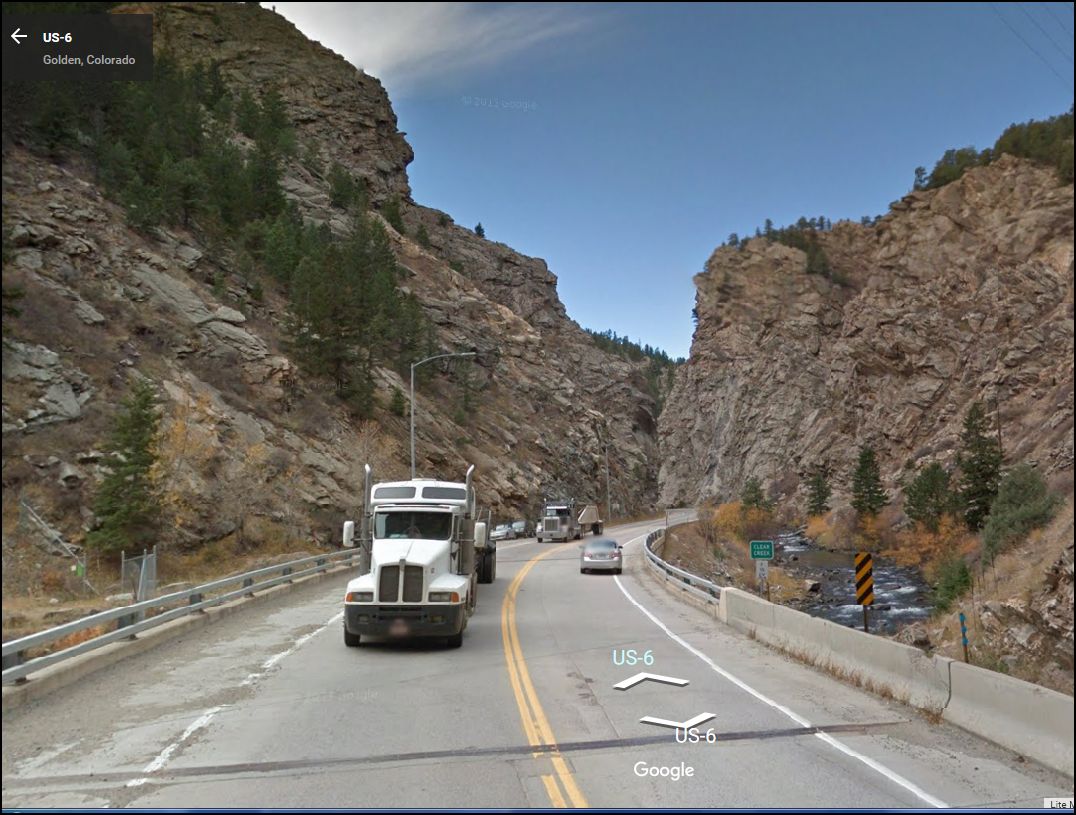 
UpSideDownC
in New Zealand |
|
In reply to this post by Jim Courtney
CONTENTS DELETED
The author has deleted this message.
|
|
Thanks John for pointing out that the road from Floyd Hill via Forks to Blackhawk was constructed first and that would be why the Sanborn Postcard view says Hwy-119 as opposed to the later US 6 designation.
One more piece in the jigsaw puzzle added.
UpSideDownC
in New Zealand |
|
RIP C&S
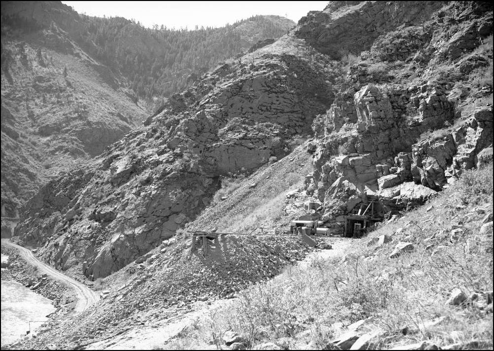 http://cdm16079.contentdm.oclc.org/cdm/fullbrowser/collection/p15330coll21/id/12065/rv/singleitem/rec/40
UpSideDownC
in New Zealand |
«
Return to C&Sng Discussion Forum
|
1 view|%1 views
| Free forum by Nabble | Edit this page |

