I put together a short video of some photos and video near and at Sherrod Curve from our trip this past July. You can
see it here.
The first stretch of the video was shot with a GoPro mounted on our ATV as we travel from the site of Woodstock to the start of Sherrod Loop. I wish I could have gotten aerial shots of the location with the drone I brought, but time limitations with our rental made this unfeasible. Instead I took screen videos of Google Earth traversing the loop's terrain. At the end, I walk the relaid track. Pardon the bounce as I was using a traditional camera. Should've used the GoPro! Hindsight :)
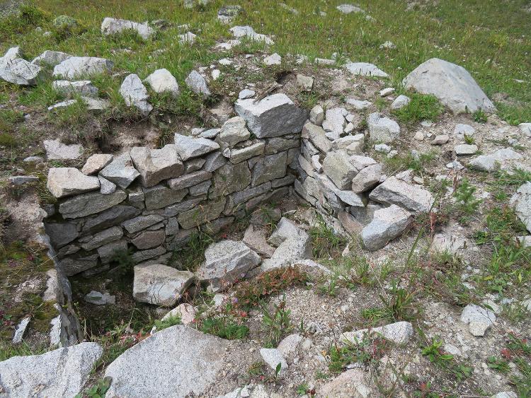
I was not aware that there was a water tank at Sherrod, but on the narrow gauge discussion forum it was pointed out that Colorado Rail Annual #31 says:
Sherrod MP 163.8
A wooden tank, 16' x 12', was constructed in 1898. Water was gravity-fed from a spring higher up the mountain.
One person posted this photo of what he surmised to be the base of this tank:

You can see the location of this on one of the Google Earth portions of the video.
Enjoy,
Kurt