Garos

Previous Topic Next Topic
 
classic Classic list List threaded Threaded
21 messages Options
12
Reply | Threaded
Open this post in threaded view
|

Garos

Jeff Young
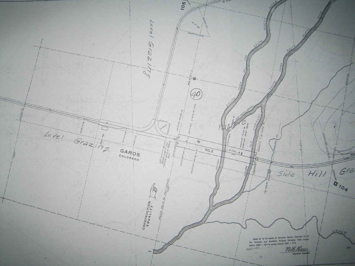
Is this perhaps the frost-box of one of the Garos tanks (or foundation of the pumphouse):


It appears highway 9 clobbered anything that may have remained of the section house foundations, but the wye for the Alma branch can still be seen directly behind the Garos general store:


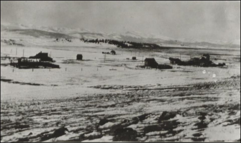
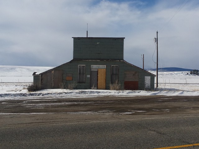
Speaking of which, ~1900 from the Park County Archives:


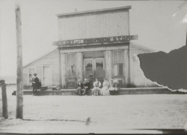
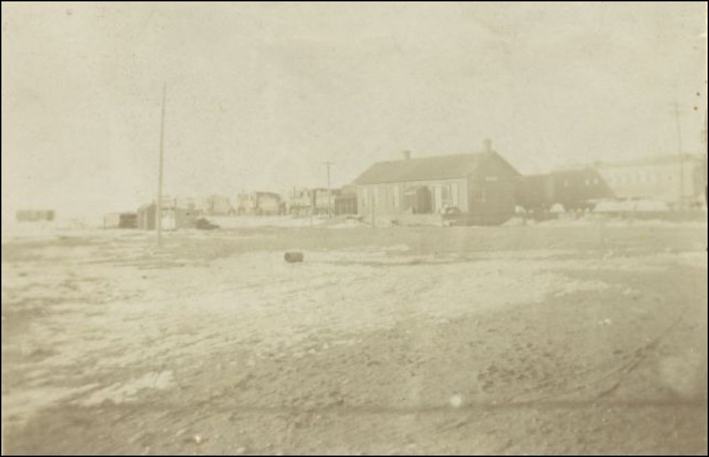
... and, remarkably, as of 2012:


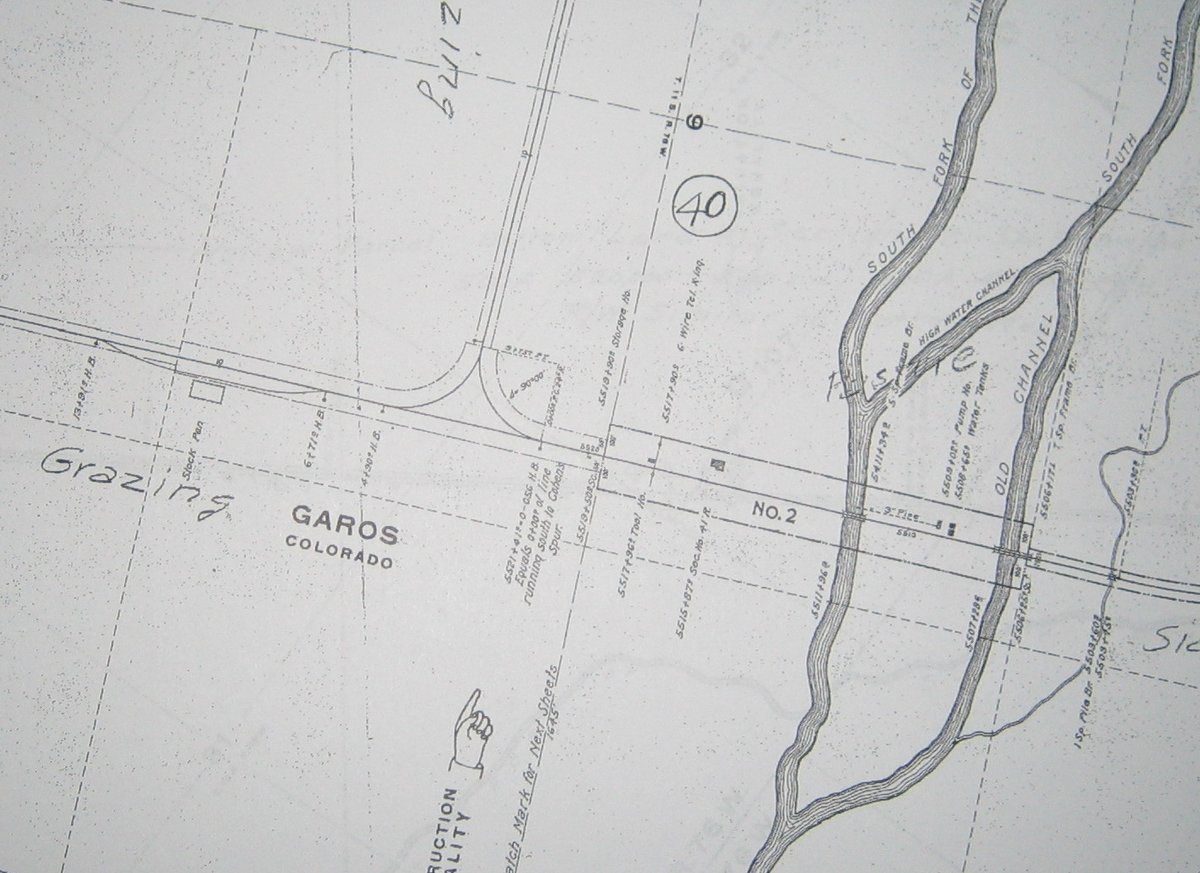
Further South there appears to be another wye with a forked tail:


A bit further south again is another water tank foundation (and if you pan this map yet again south, you'll find a third wye). Based on Mac Poor's map, I believe these last two are "Platte River".


Mac Poor has the salt works even farther south, so that doesn't fit with the middle (forked tail) wye. Anyone know what it is?

Cheers,
Jeff.
Reply | Threaded
Open this post in threaded view
|

Re: Garos

Jeff Young
Some of the roadbed in this area is in a remarkable state of preservation:


And a bit of the Colorado Midland, heading for its rendezvous with the C&S atop Trout Creek Pass:
Reply | Threaded
Open this post in threaded view
|

Re: Garos

Robert McFarland
In reply to this post by Jeff Young
The store is still there as of August of this year when I saw it last.The wye with the forked tail is the location of  Weston.
Reply | Threaded
Open this post in threaded view
|

Re: Garos

Jeff Young
Ahh... Weston.  Thanks Robert.

(Apologies to those who read this thread via email.  It appears you have to go to the forum website to see the embedded Google maps and pictures.)
Reply | Threaded
Open this post in threaded view
|

Re: Garos

Don Pacetti
Jeff, thanks so much for posting this information. I think I would like to model Garos on my layout. Please let me know if you have any copies of the ICC Valuation Maps for this town, or any other information that would assist me in laying out the buildings. I just love C&S water tanks so Garos gives me an opportunity to add two more to the layout, in a very interesting configuration - awesome!
Reply | Threaded
Open this post in threaded view
|

Re: Garos

Robert McFarland
Where was the Garos depot located?
Reply | Threaded
Open this post in threaded view
|

Re: Garos

Chris Walker
This post was updated on .
Looking towards Como


from Park County Local History Archives. http://www.parkcoarchives.org/


from Park County Local History Archives.
http://www.parkcoarchives.org/photo_inventory/inventory_0596to0697/655.jpg


from Park County Local History Archives.
http://www.parkcoarchives.org/photo_inventory/inventory_1504to1603/1551.jpg
UpSideDownC
in New Zealand
Reply | Threaded
Open this post in threaded view
|

Re: Garos

Jeff Young
In reply to this post by Don Pacetti
Don, the ICC maps don't usually show non-railroad buildings, so the photos Chris posted are more likely to help for that.  

Robert, I don't see a depot on the ICC maps.  Usually there's at least a "Sta. Sign" in the absence of a depot, but I don't see that either, so I'm not sure what that all means.  

Anyway, here's what they do show:


Reply | Threaded
Open this post in threaded view
|

Re: Garos

Jeff Young
That last picture Chris posted sure looks like a depot.  I wonder why it's not on the ICC maps?
Reply | Threaded
Open this post in threaded view
|

Re: Garos

Robert McFarland
It isthe depot.It was moved to Fairplay in Sept 1912 to replace the depot that burned.It still  exists but has been remodeled.Its about a couple of blocks from the Fairplay high scool.
Reply | Threaded
Open this post in threaded view
|

Re: Garos

Robert McFarland
My guess is that was somewhere near the stock pens.
Reply | Threaded
Open this post in threaded view
|

Re: Garos

Jeff Young
In reply to this post by Robert McFarland
> It was moved to Fairplay in Sept 1912

Makes sense.  I imagine after the Trout Creek flood when Garos became nothing more than a way-stop on the Alma branch local traffic probably evaporated.

The picture of the twin water tanks shows a bunch of buildings on the north side of the river too, although the siding was on the south side with the stock pens.  (Where depots usually co-located with sidings, or what that a non-issue since the passenger trains usually stopped right on the mainline anyway?)

Cheers,
Jeff.

Reply | Threaded
Open this post in threaded view
|

Re: Garos

Robert McFarland
The buildings in the background of the twin tanks photo are what is known as the Buffalo Peaks Ranch-the location of the  Rocky Mountain Land Library.
Reply | Threaded
Open this post in threaded view
|

Re: Garos

Norm Acker
In reply to this post by Robert McFarland
Still standing in frigid temperatures last week (-14 degrees F).
Norm in Littleton, CO
 - on the C&S Silica Branch
Reply | Threaded
Open this post in threaded view
|

Re: Garos

Southpark
In reply to this post by Jeff Young
Good to see the interest in Garos.  If one goes to google maps earth view and enlarge to the max the segment of the grade to right of highway 9 to the brush next to the river you "may" be able to note a spur on the right.  This short spur, between the dirt road and the river was discovered when I was working on our Gunnison Division book.  Fairplay Flume reported spurs between Fairplay for loading "lime rock".  If you are in Garos and beat the bushes and bugs you can follow the grade to the historic signs on that dirt road.   This would have been tonnage going to Leadville by way of Trout Creek Pass before Boreas was built.
Tom Klinger
Reply | Threaded
Open this post in threaded view
|

Re: Garos

Robert McFarland
On Google Maps at the southern end of the heavy green vegetation there seems to be a spot where a siding splits off from the main line-would it be possible for you to post a picture of he location you're referring to?Poors Memorial mentions a place called Lime Rock Tank/Track,but from the mile numbers it appears to be way up by Fairplay.
Reply | Threaded
Open this post in threaded view
|

Re: Garos

Chris Walker
Simply by clicking Google maps in the location you're talking about, will reveal the lat/lon Co-ords, and posting such so then we could all see where you're referring to.
UpSideDownC
in New Zealand
Reply | Threaded
Open this post in threaded view
|

Re: Garos

Robert McFarland
In reply to this post by Jeff Young
Looking at the top of the Garos valuation map near the number 105,the Alma branch curves toward the right-nearing the river .Does the map show much more ROW north of there? Its kind of hard to follow the branch on Google maps from the Garos wye.
Reply | Threaded
Open this post in threaded view
|

Re: Garos

Robert McFarland
In reply to this post by Chris Walker
39.109102--105.890157
Reply | Threaded
Open this post in threaded view
|

Re: Garos

ComoDepot
I know Bob has walked the Weston wye, I think he said it did not show on any of the maps.
12