Buffalo
|
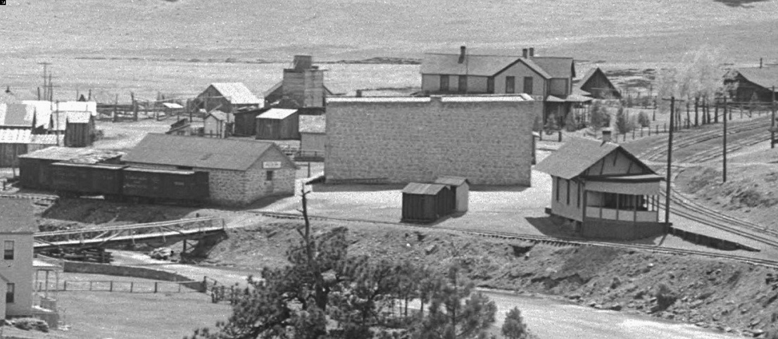
Back in an old MR magazine there was a drawing for a tale tell I don't recall seeing any photos of this. Any ideas when it was removed and why. Don't say it was after the depot was moved to Como. It would indicate that at some point tall items were moved through the canyon. Secondly was the warehouse used as a storage area and distribution area for local merchants and ranch supplies that's the only thing I can think of. Lastly the stock pens does any one know if there was ever much activity here and was it for dropping off for summer grazing which would indicate some stock car activity at one time or during the year
|
|
John,
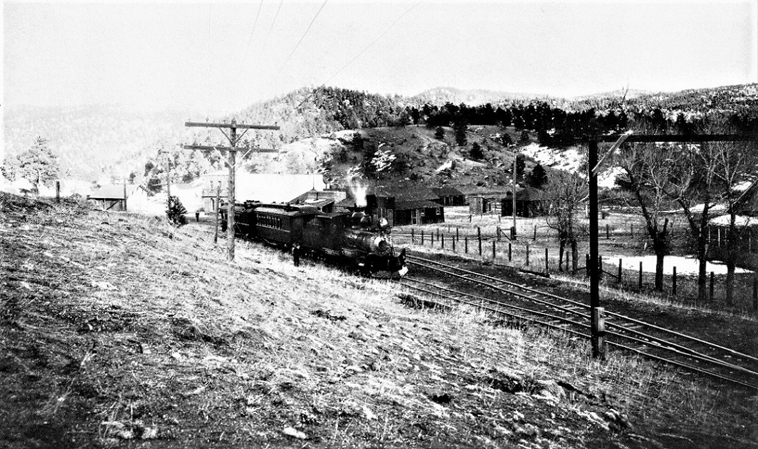
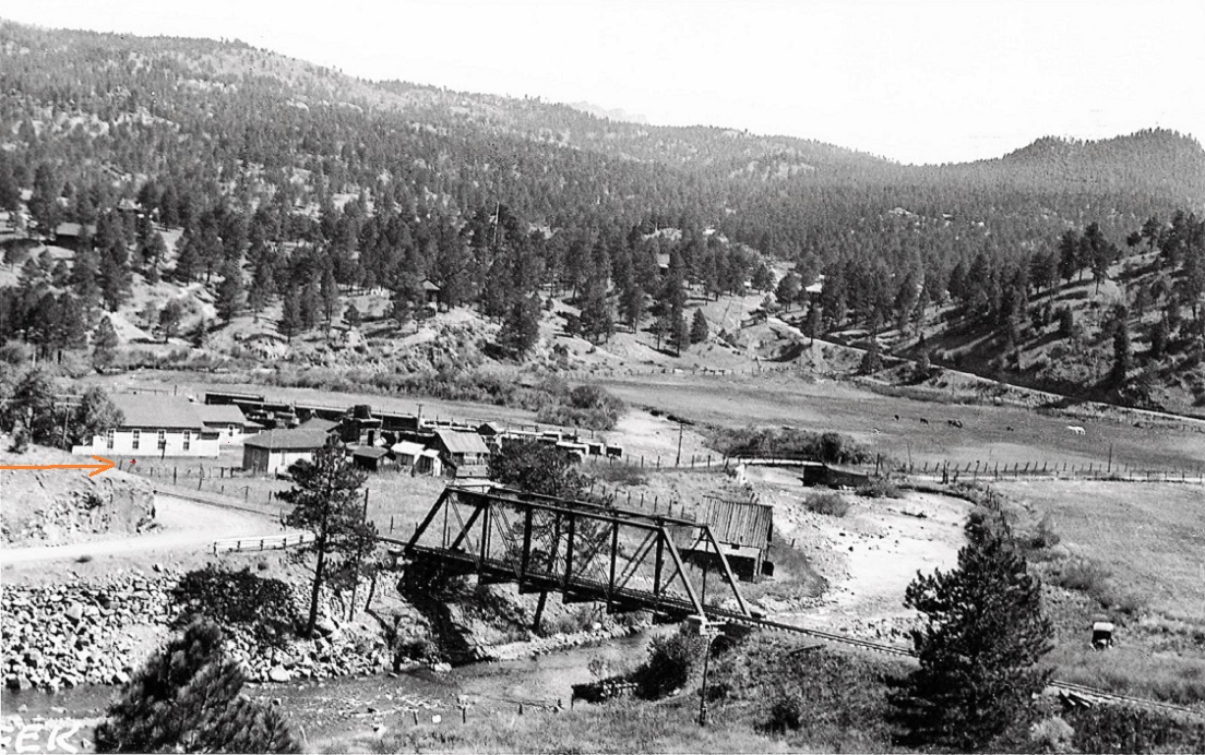
The tell-tale was located over the track switch at the west end of the siding at Buffalo. Its purpose was to alert brakemen atop boxcars, during switching moves, that they were approaching the through truss bridge over the South Platte, so their noggin' didn't get bumped.  Denver Water Board Special, 1929. Tell-tale at right frame.  In the Klingers' Platte Canon Memories . . . The tell-tale at the west switch is just out of frame to the left; the target of the switch stand for the west siding switch in noted by the arrow. Notice the proximity of the South Platte bridge . . . and why is there a horizontal component on the left end (on which to hit your head) but not on the right??
Jim Courtney
Poulsbo, WA |
|
Thanks Jim I now remember those photos from Tom's book. Do you remember what year that drawing was in MR
|
|
In the photo with the telltale showing, where is the road that we
see in the high shot, showing the bridge ??? Was that put in AFTER the first photo ? Where did the road lead as it went up the far hill in the background ?
"Duty above all else except Honor"
|
|
Hey John and S.P,
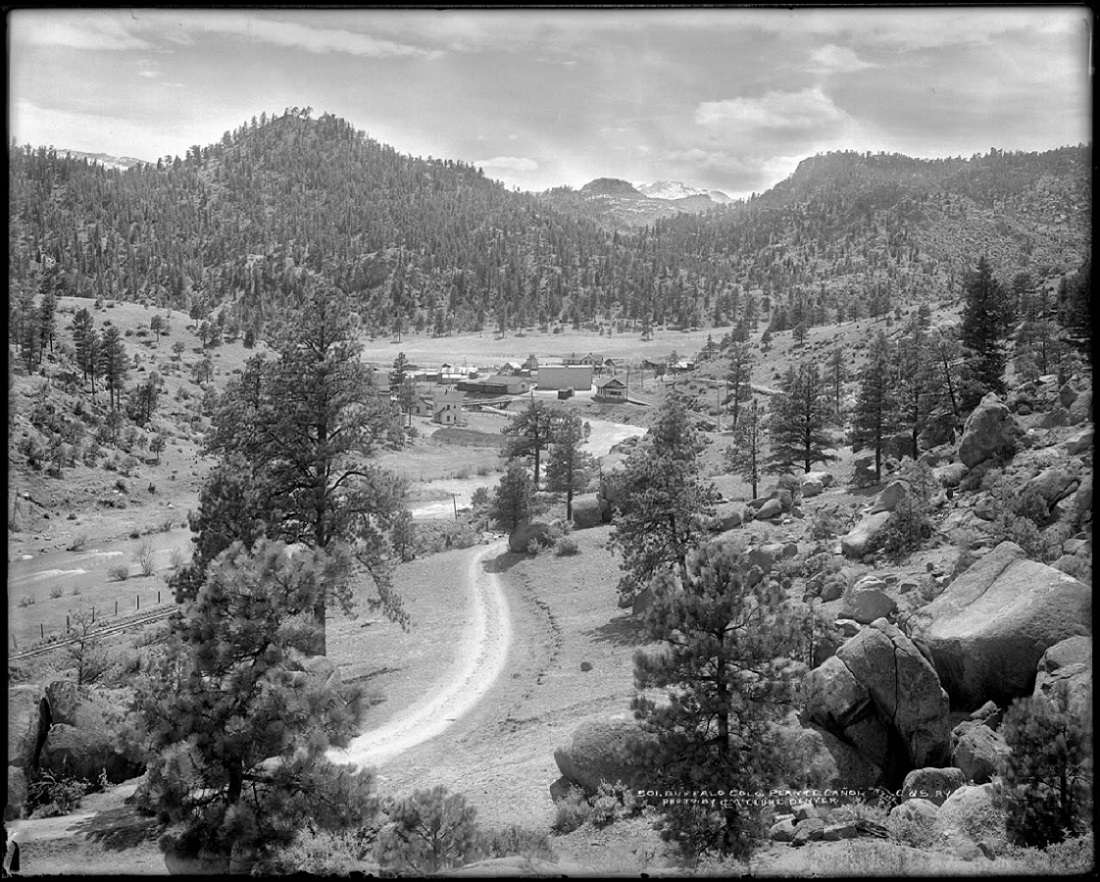
The drawing of the Tell Tale wasn't in MR -- it was in Bob Brown's old Slim Gauge News, predecessor of the Gazette. If you'd like a copy, contact me off line, and I'll send it as a PDF. The stone warehouse was built by the Greens as additional storage for their large stone store; I suspect bulk items were stored there, like bagged flour and beans, building materials, paint, etc. http://digital.denverlibrary.org/cdm/singleitem/collection/p15330coll22/id/78093/rec/483  The stock pens were on one of two spurs, at the end of the long spur running past the stone warehouse. They are visible in the c1910 McClure photo above, and were present at abandonment. The Klingers' book has several photos in which they can be seen. So, yes, they saw seasonal activity with stock shipments over the years. As to the roads, S.P., the road leading to the left of the bridge is likely an improvement to connect the road to Pine Grove (lower left frame) with the wagon road that paralleled the railroad east toward Riverview and Dome Rock: http://digital.denverlibrary.org/cdm/singleitem/collection/p15330coll22/id/78093/rec/483  It must be new construction, after the 1929 DWB photo. It is dated in the Klingers' book as "about 1930". I may be imagining things when I pointed out the "switch stand" in the 2nd photo in my post above, with the South Platte bridge -- the Buffalo siding was removed sometime in the 1930s. Perhaps the new road connection followed the grade of the siding until it intersecting the much older wagon road. The road disappearing in the distance is today known as South Buffalo Creek road. I think it ran up to serve a shingle mill. At least current maps refer to a "Shingle Mill Creek", a tributary of Buffalo Creek, near where the road ends.
Jim Courtney
Poulsbo, WA |
|
Is that a small grain elevator behind the ware house and store?Looks like that "hotel" behind the store would make a good model.BTW whatever became of Darrel Poole's plan to model Buffalo a nearby areas?
|
I always wondered just who was Anonymous , now I know.   It was considered to be an Icehouse for the Hotel/Store for local storage.
UpSideDownC
in New Zealand |
|
At least I got an answer,Chris.
|
«
Return to C&Sng Discussion Forum
|
1 view|%1 views
| Free forum by Nabble | Edit this page |

